Blakeshall Common

Wood, Forest in Worcestershire Wyre Forest

England

Blakeshall Common

Footpath across a field, near Cookley There is a public footpath across this field, although it isn't immediately obvious quite where the footpath is. It leads to the popular Kingsford Forest Park, which is a nice place for walking, riding and other outdoor pursuits. In the distance can be seen some industrial buildings, which are on the edge of the village of Cookley.

<a href="https://www.geograph.org.uk/photo/2340802">SO8480 : Signpost by Debdale Bridge, Staffs & Worcs Canal, near Cookley</a>.
Footpath across a field, near Cookley Credit: P L Chadwick

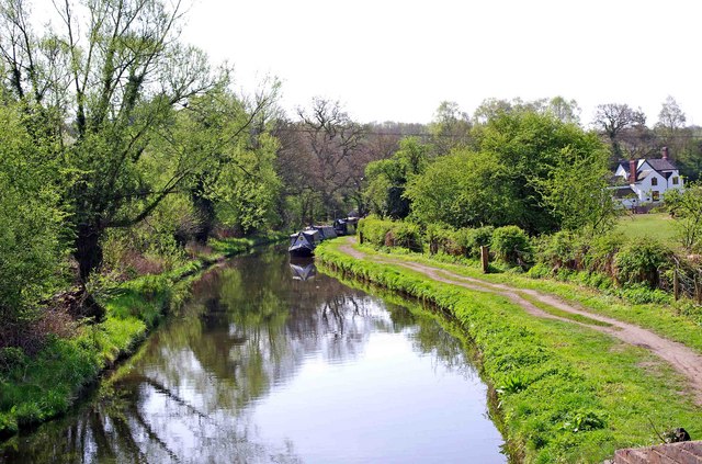
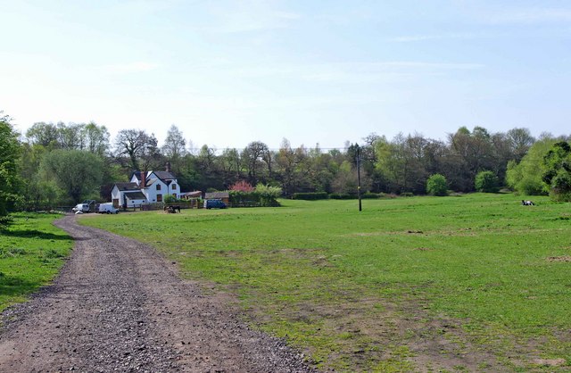
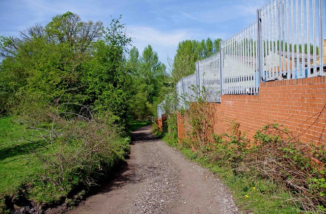
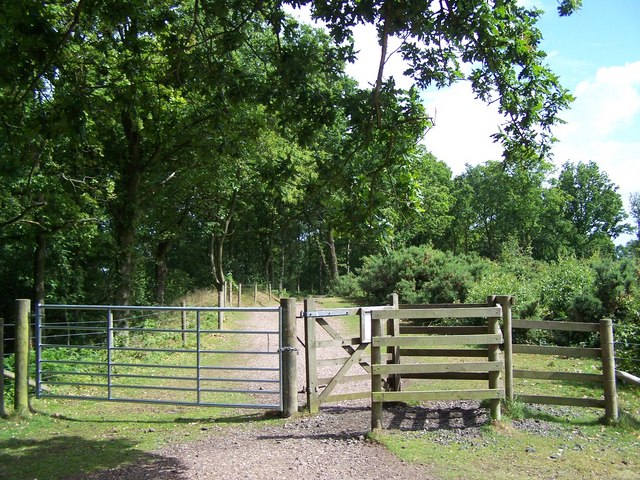
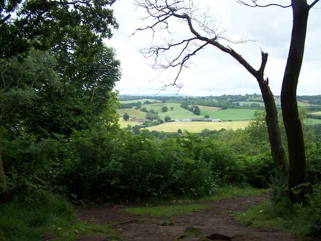
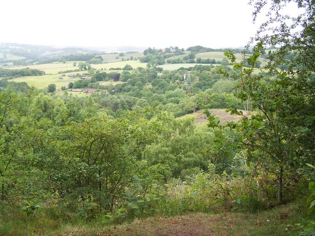
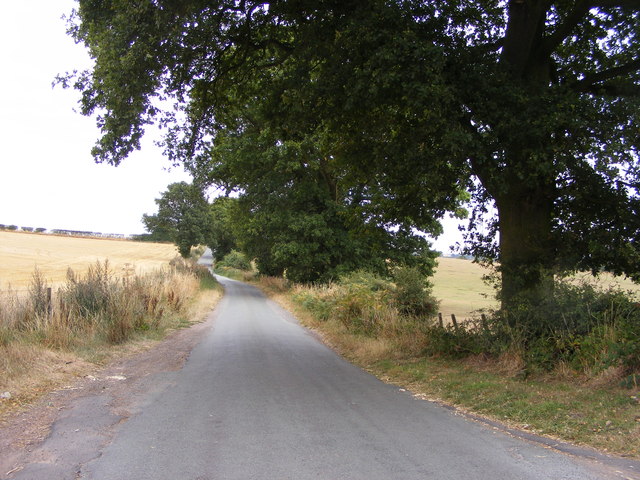
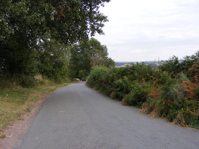
Blakeshall Common is a picturesque woodland area located in Worcestershire, England. Covering approximately 200 acres, it is a part of the larger Blakeshall Forest and is known for its natural beauty and diverse wildlife.

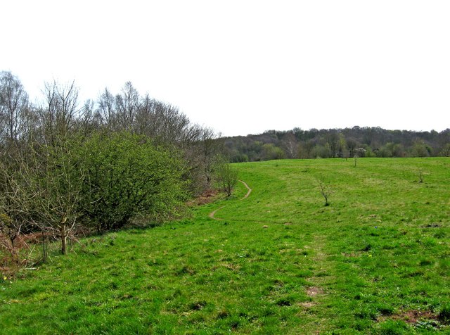
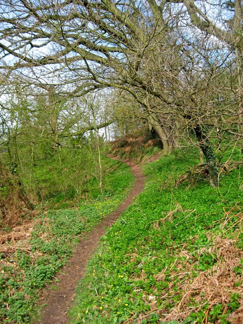
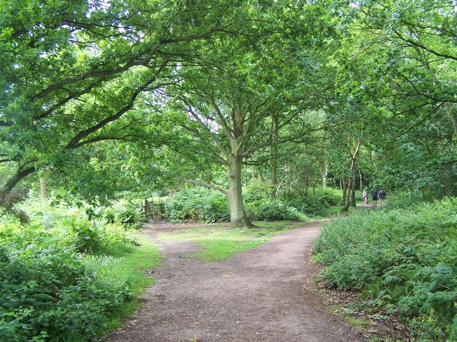
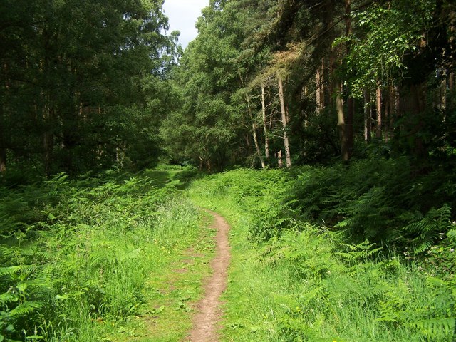
The common is primarily composed of ancient woodland, with a variety of tree species such as oak, birch, and ash dominating the landscape. The dense canopy provides a haven for numerous bird species, including woodpeckers, owls, and various songbirds. The forest floor is adorned with a rich carpet of wildflowers, ferns, and mosses, creating a vibrant and enchanting atmosphere.

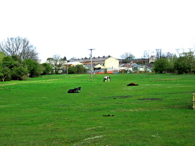
Blakeshall Common is also home to a number of animal species. Roe deer are often spotted wandering through the woods, while badgers, foxes, and rabbits can be seen going about their daily activities. The area is particularly known for its population of red squirrels, which are a rare sight in many parts of the country.

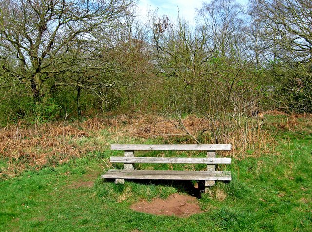
The common is crisscrossed by a network of footpaths and trails, making it a popular destination for walkers, nature enthusiasts, and photographers. Visitors can explore the woodlands at their leisure, soaking in the tranquility and beauty of the surroundings. In addition, there are several picnic areas and benches scattered throughout the common, providing the perfect opportunity to sit back, relax, and appreciate the natural wonders on display.

Blakeshall Common is a true haven for nature lovers, offering a peaceful retreat from the hustle and bustle of everyday life. Its diverse flora and fauna, combined with its idyllic setting, make it a must-visit destination for anyone seeking solace in nature.

If you have any feedback on the listing, please let us know in the comments section below.

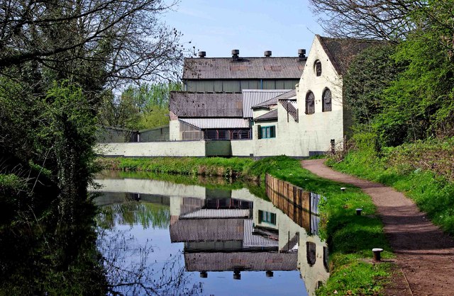
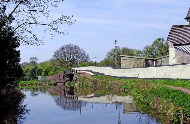
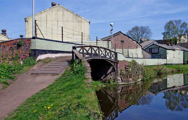
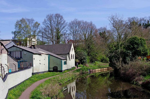
Blakeshall Common Images

Images are sourced within 2km of 52.431546/-2.2586543 or Grid Reference SO8281. Thanks to Geograph Open Source API. All images are credited.

Footpath across a field, near Cookley There is a public footpath across this field, although it isn't immediately obvious quite where the footpath is. It leads to the popular Kingsford Forest Park, which is a nice place for walking, riding and other outdoor pursuits. In the distance can be seen some industrial buildings, which are on the edge of the village of Cookley.

<a href="https://www.geograph.org.uk/photo/2340802">SO8480 : Signpost by Debdale Bridge, Staffs & Worcs Canal, near Cookley</a>.
Footpath across a field, near Cookley
There is a public footpath across this field, although it isn't immediately obvious quite where the footpath is. It leads to the popular Kingsford Forest Park, which is a nice place for walking, riding and other outdoor pursuits. In the distance can be seen some industrial buildings, which are on the edge of the village of Cookley. SO8480 : Signpost by Debdale Bridge, Staffs & Worcs Canal, near Cookley.
Seat in Horseshoe Meadow, near Cookley Horseshoe Meadow is part of Cookley Playing Fields, which is an area open to the public to enjoy. There is a path from near the seat, which leads down to a path by the Staffs & Worcs Canal, on the opposite side to the towpath.
Seat in Horseshoe Meadow, near Cookley
Horseshoe Meadow is part of Cookley Playing Fields, which is an area open to the public to enjoy. There is a path from near the seat, which leads down to a path by the Staffs & Worcs Canal, on the opposite side to the towpath.
Footpath across Horseshoe Meadow, near Cookley The footpath goes to the Village Hall and car park, with a branch leading off and descending to Debdale Lock, on the nearby Staffs & Worcs Canal. The meadow, which is part of Cookley Playing Fields, is not treated with chemicals or artificial fertilisers. It supports more than fifty species of wildflowers, grasses and associated wildlife.
Footpath across Horseshoe Meadow, near Cookley
The footpath goes to the Village Hall and car park, with a branch leading off and descending to Debdale Lock, on the nearby Staffs & Worcs Canal. The meadow, which is part of Cookley Playing Fields, is not treated with chemicals or artificial fertilisers. It supports more than fifty species of wildflowers, grasses and associated wildlife.
Footpath near Staffs & Worcs Canal, near Cookley The footpath climbs here, with the canal below and to its left.

<a href="https://www.geograph.org.uk/photo/2342309">SO8380 : Public footpath up to Cookley Playing Fields, near Cookley</a>.
Footpath near Staffs & Worcs Canal, near Cookley
The footpath climbs here, with the canal below and to its left. SO8380 : Public footpath up to Cookley Playing Fields, near Cookley.
Factory buildings by the Staffs & Worcs Canal, Cookley There have been industrial buildings here since an ironworks was built on this site, as early as about 1650, by John Knight. That has long gone, but other industrial buildings followed in the 19th century, but most of what is here now dates from 1935. The buildings are still in use today.

<a href="https://www.geograph.org.uk/photo/2352088">SO8480 : Looking towards a factory arm of the Staffs & Worcs Canal near Cookley</a>.
<a href="https://www.geograph.org.uk/photo/2352108">SO8480 : Entrance to a factory arm of the Staffs & Worcs Canal near Cookley</a>.
Factory buildings by the Staffs & Worcs Canal, Cookley
There have been industrial buildings here since an ironworks was built on this site, as early as about 1650, by John Knight. That has long gone, but other industrial buildings followed in the 19th century, but most of what is here now dates from 1935. The buildings are still in use today. SO8480 : Looking towards a factory arm of the Staffs & Worcs Canal near Cookley. SO8480 : Entrance to a factory arm of the Staffs & Worcs Canal near Cookley.
Looking towards a factory arm of the Staffs & Worcs Canal near Cookley The canal towpath goes over the hump back bridge in the distance. This crossed the start of a short factory arm, which no longer exists. It served an old ironworks, which closed in 1887.  The site has had various industrial uses since then, and most of the existing buildings date from 1935. Some of these can be seen in this view.

<a href="https://www.geograph.org.uk/photo/2352061">SO8480 : Factory buildings by the Staffs & Worcs Canal, Cookley</a>.
<a href="https://www.geograph.org.uk/photo/2352108">SO8480 : Entrance to a factory arm of the Staffs & Worcs Canal near Cookley</a>.
Looking towards a factory arm of the Staffs & Worcs Canal near Cookley
The canal towpath goes over the hump back bridge in the distance. This crossed the start of a short factory arm, which no longer exists. It served an old ironworks, which closed in 1887. The site has had various industrial uses since then, and most of the existing buildings date from 1935. Some of these can be seen in this view. SO8480 : Factory buildings by the Staffs & Worcs Canal, Cookley. SO8480 : Entrance to a factory arm of the Staffs & Worcs Canal near Cookley.
Entrance to a factory arm of the Staffs & Worcs Canal near Cookley On the left was the entrance to a factory arm, which used to allow barges to pass into the ironworks which once stood here. Now the arm is blocked off immediately under the bridge, and on the other side is a factory yard with no visible trace of the former arm of the canal. The ironworks closed in 1887. The current buildings on the site are still in industrial use.

<a href="https://www.geograph.org.uk/photo/2352088">SO8480 : Looking towards a factory arm of the Staffs & Worcs Canal near Cookley</a>.
<a href="https://www.geograph.org.uk/photo/2352061">SO8480 : Factory buildings by the Staffs & Worcs Canal, Cookley</a>.
Entrance to a factory arm of the Staffs & Worcs Canal near Cookley
On the left was the entrance to a factory arm, which used to allow barges to pass into the ironworks which once stood here. Now the arm is blocked off immediately under the bridge, and on the other side is a factory yard with no visible trace of the former arm of the canal. The ironworks closed in 1887. The current buildings on the site are still in industrial use. SO8480 : Looking towards a factory arm of the Staffs & Worcs Canal near Cookley. SO8480 : Factory buildings by the Staffs & Worcs Canal, Cookley.
Factory buildings by the Staffs & Worcs Canal, Cookley Just around the corner, is the western entrance to Cookley Tunnel.

<a href="https://www.geograph.org.uk/photo/2352061">SO8480 : Factory buildings by the Staffs & Worcs Canal, Cookley</a>.
Factory buildings by the Staffs & Worcs Canal, Cookley
Just around the corner, is the western entrance to Cookley Tunnel. SO8480 : Factory buildings by the Staffs & Worcs Canal, Cookley.
Staffs & Worcs Canal near Cookley The white building in the distance is the former lock keeper's cottage at Debdale Lock.
Staffs & Worcs Canal near Cookley
The white building in the distance is the former lock keeper's cottage at Debdale Lock.
Debdale lock meadow near Cookley The white building is the former lock keeper's cottage at Debdale Lock, on the adjacent Staffs & Worcs Canal. There is a public footpath across this field to the lock, with access there to the towpath, and a path up to Cookley Playing Fields and the Village Hall.
Debdale lock meadow near Cookley
The white building is the former lock keeper's cottage at Debdale Lock, on the adjacent Staffs & Worcs Canal. There is a public footpath across this field to the lock, with access there to the towpath, and a path up to Cookley Playing Fields and the Village Hall.
Track by factory wall, near Cookley The track appears to be part of the vehicular access to the former lock keeper's cottage at Debdale Lock. On the right is a wall of a factory yard.
Track by factory wall, near Cookley
The track appears to be part of the vehicular access to the former lock keeper's cottage at Debdale Lock. On the right is a wall of a factory yard.
Staffordshire Way Nearing Kinver
Staffordshire Way On Kinver Edge
View From Kinver Edge
Footpath In Kingsford Forest Park
View From Kingsford Forest Park
Gipsy Lane The lane runs from Kinver Edge to Cookley Lane.
Gipsy Lane
The lane runs from Kinver Edge to Cookley Lane.
Gipsy Lane The lane runs from Kinver Edge towards Cookley Lane.
Gipsy Lane
The lane runs from Kinver Edge towards Cookley Lane.
Show me another place!

Blakeshall Common is located at Grid Ref: SO8281 (Lat: 52.431546, Lng: -2.2586543)

Administrative County: Worcestershire

District: Wyre Forest

Police Authority: West Mercia

What 3 Words

///closets.headrest.stewing. Near Kinvere, Staffordshire

Nearby Locations

Blakeshall Common

Related Wikis

Kingsford, Worcestershire

Kingsford is a large hamlet in Worcestershire, England. == Location == Kingsford is located one mile (1.6 km) north of the village of Wolverley, Worcestershire...

Drakelow Tunnels

Drakelow Tunnels are a former underground military complex beneath the Blakeshall Estate north of Kidderminster, Worcestershire, covering 285,000 sq ft...

Drakelow Hillfort

Drakelow Hillfort, is a small multivallate Iron Age hillfort, located on a promontory (known as Drakelow Hill) at Drakelow at the southern end of Kinver...

Blakeshall

Blakeshall is a hamlet in Worcestershire, England. It is one of the ancient townships of the manor of Wolverley, whose extent was similar to that of the...

Kingsford Country Park

Kingsford Country Park, officially Kingsford Forest Park, was in Worcestershire, England, U.K. and managed by Worcestershire County Council. It adjoined...

Castle Hill, Wolverley

Castle Hill or Baron Hill is about a mile from the hamlet of Kingsford in the civil parish of Wolverley and Cookley, Worcestershire. In 1912 the site consisted...

Wolverley Church of England Secondary School

Wolverley CofE Secondary School is located in the village of Wolverley, near Kidderminster in Worcestershire, England. The mixed gender school has approximately...

Kinver Edge Hillfort

Kinver Edge Hillfort, is a univallate Iron Age hillfort with a massive rampart and outer ditch along the south-west and south-east sides, with natural...

Nearby Amenities

Located within 500m of 52.431546,-2.2586543
The data included in this document is from www.openstreetmap.org. The data is made available under ODbL.

Have you been to Blakeshall Common?

Leave your review of Blakeshall Common below (or comments, questions and feedback).