Bath Coppice

Wood, Forest in Staffordshire South Staffordshire

England

Bath Coppice

Enville Hall Grade II listed 16C&17C hall built by the Grey family, Earls of Stamford and Warrington. The extensive estate comprises 6500acres at Enville.
Enville Hall Credit: John M

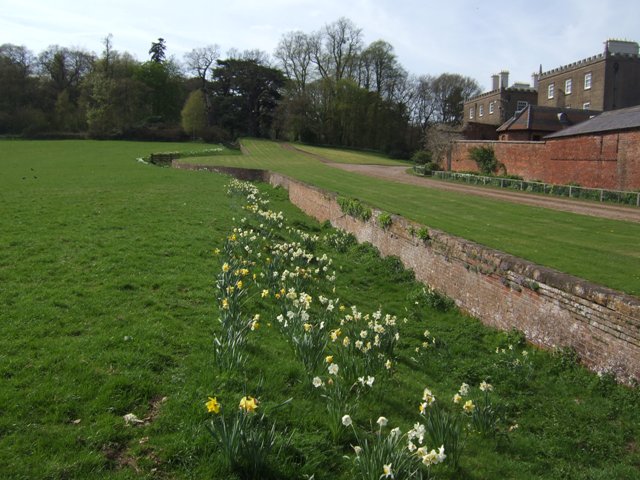
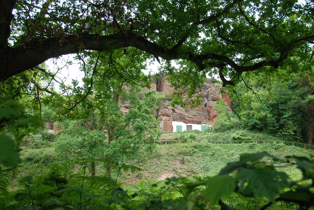
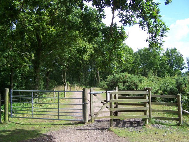
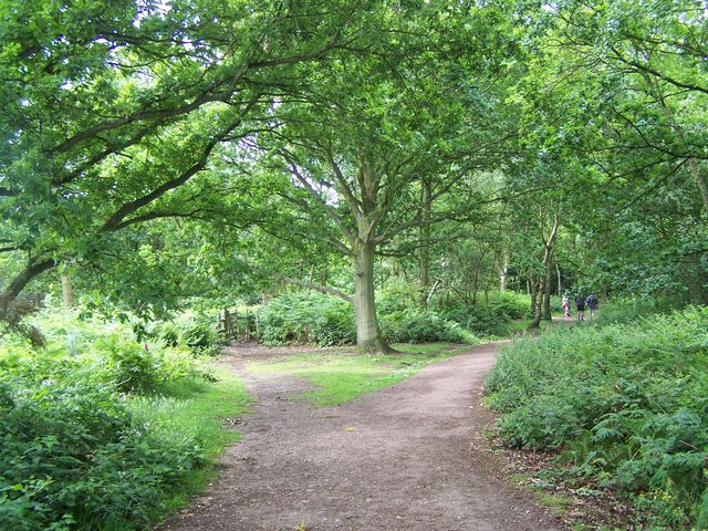
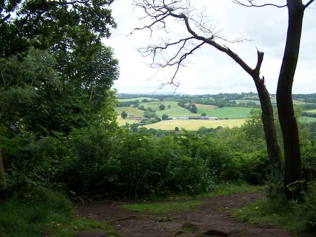
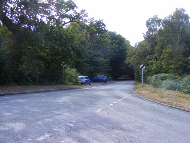
Bath Coppice is a picturesque woodland located in Staffordshire, England. Spanning over several acres, it is known for its abundant wildlife and natural beauty. The coppice is situated in a rural area, surrounded by rolling hills and fields, providing a serene and peaceful environment for visitors.

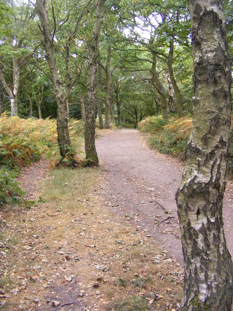
The woodland is predominantly made up of broadleaf trees such as oak, beech, and ash, creating a diverse and vibrant ecosystem. These trees are carefully managed through traditional coppicing techniques, which involves cutting the trees at ground level to stimulate new growth. This practice not only provides a sustainable source of timber but also promotes biodiversity by allowing sunlight to reach the forest floor, encouraging the growth of wildflowers, ferns, and other plant species.

Bath Coppice is a haven for wildlife enthusiasts, as it is home to a variety of animals, including deer, squirrels, badgers, and a wide array of bird species. The tranquil atmosphere and abundance of food sources attract these creatures, making it an excellent spot for birdwatching and animal tracking.

In addition to its natural beauty, Bath Coppice offers a range of recreational activities for visitors. There are well-maintained walking trails that meander through the woodland, allowing visitors to explore the area at their own pace. These paths are suitable for all ages and fitness levels, ensuring that everyone can enjoy the beauty of the forest.

Overall, Bath Coppice is a stunning woodland retreat in Staffordshire, offering a unique opportunity to connect with nature and experience the wonders of a thriving forest ecosystem.

If you have any feedback on the listing, please let us know in the comments section below.

Bath Coppice Images

Images are sourced within 2km of 52.457349/-2.2620579 or Grid Reference SO8284. Thanks to Geograph Open Source API. All images are credited.

Enville Hall Grade II listed 16C&17C hall built by the Grey family, Earls of Stamford and Warrington. The extensive estate comprises 6500acres at Enville.
Enville Hall
Grade II listed 16C&17C hall built by the Grey family, Earls of Stamford and Warrington. The extensive estate comprises 6500acres at Enville.
Gateway at Enville Hall The gate in the brick wall surrounding the hall leads into the landscaped gardens.
Gateway at Enville Hall
The gate in the brick wall surrounding the hall leads into the landscaped gardens.
Enville Cricket Club In the grounds of Enville Hall.
Enville Cricket Club
In the grounds of Enville Hall.
Scoreboard at Enville Cricket Club Built onto the wall surrounding Enville Hall.
Scoreboard at Enville Cricket Club
Built onto the wall surrounding Enville Hall.
Ha-ha at Enville Hall The Ha-ha or sunken wall feature separates the house and gardens from the grazing in the landscaped parkland.
Ha-ha at Enville Hall
The Ha-ha or sunken wall feature separates the house and gardens from the grazing in the landscaped parkland.
Gamekeepers Cottages. These Cottages are on the Enville Road, Compton Road crossroads. Just outside Kinver.
Gamekeepers Cottages.
These Cottages are on the Enville Road, Compton Road crossroads. Just outside Kinver.
House On The Outskirts Of Kinver. This house replaced an old Cottage, around 1990
House On The Outskirts Of Kinver.
This house replaced an old Cottage, around 1990
Crossroads Near Holy Austin Rock, Kinver. These Crossroads are at the Kinver end of Kingsford Lane.
Crossroads Near Holy Austin Rock, Kinver.
These Crossroads are at the Kinver end of Kingsford Lane.
Holy Austin Rock, Kinver. One of the Rock houses has been restored, and is open to the public at certain times.The others have been closed off, as is evident from the Photo, for Health & Safety reasons.
Holy Austin Rock, Kinver.
One of the Rock houses has been restored, and is open to the public at certain times.The others have been closed off, as is evident from the Photo, for Health & Safety reasons.
Entrance To Huntsmans Drive, Kinver
Falcon Farm, Enville. Falcon Farm is part of the Enville Estate.
Falcon Farm, Enville.
Falcon Farm is part of the Enville Estate.
Brindley Hall, Compton, Kinver This house was once owned by James Brindley, the man who played such a big part in the building of the Canals. Up until recent years it was owned by the Enville Estate and fell into disrepair, squatters moved in for a while, then it was sold to Developers, but when they came to renovate it, Bats were found in the roof and work had to stop. If anyone lives in it now I don't know, but with iron fence and Doberman dogs I will leave that to someone else to find out. The farm nextdoor is Union Hall Farm named after The Grand Union Canal.
Brindley Hall, Compton, Kinver
This house was once owned by James Brindley, the man who played such a big part in the building of the Canals. Up until recent years it was owned by the Enville Estate and fell into disrepair, squatters moved in for a while, then it was sold to Developers, but when they came to renovate it, Bats were found in the roof and work had to stop. If anyone lives in it now I don't know, but with iron fence and Doberman dogs I will leave that to someone else to find out. The farm nextdoor is Union Hall Farm named after The Grand Union Canal.
Gate House, Brindley Hall, Compton, Kinver High security, note one of the dogs in right hand corner.
Gate House, Brindley Hall, Compton, Kinver
High security, note one of the dogs in right hand corner.
Staffordshire Way Nearing Kinver
Staffordshire Way On Kinver Edge
View From Kinver Edge
Kinver Ridge Path The footpath runs along the ridge of Kinver Edge.
Kinver Ridge Path
The footpath runs along the ridge of Kinver Edge.
Kinver Lane Junction The view along Compton Road from Meddings Lane, next to Kinver Edge National Trust woodland.
Kinver Lane Junction
The view along Compton Road from Meddings Lane, next to Kinver Edge National Trust woodland.
Show me another place!

Bath Coppice is located at Grid Ref: SO8284 (Lat: 52.457349, Lng: -2.2620579)

Administrative County: Staffordshire

District: South Staffordshire

Police Authority: Staffordshire

What 3 Words

///refrain.obstinate.noises. Near Kinvere, Staffordshire

Nearby Locations

Compton Bath Coppice

Related Wikis

Kinver Edge

Kinver Edge is a high heath and woodland escarpment just west of Kinver, about four miles west of Stourbridge, and four miles north of Kidderminster, and...

Kinver Edge Hillfort

Kinver Edge Hillfort, is a univallate Iron Age hillfort with a massive rampart and outer ditch along the south-west and south-east sides, with natural...
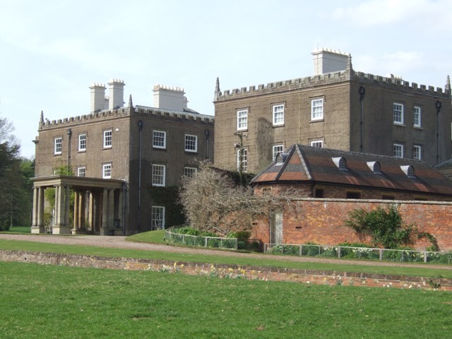
Enville Hall

Enville Hall is an English Tudor country house in the village of Enville, Staffordshire. It is a Grade II listed building.The house has a 16th and 17th...

Great Fountain, Enville

The Great Fountain, Enville, was a fountain created in the mid-19th century by the Earl of Stamford in the middle of a lake on his Enville Hall estate...

Kinver High School

Kinver High School (formerly Edgecliff High School) is a mixed secondary school and sixth form located in Kinver in the English county of Staffordshire...

Kingsford Country Park

Kingsford Country Park, officially Kingsford Forest Park, was in Worcestershire, England, U.K. and managed by Worcestershire County Council. It adjoined...

Enville, Staffordshire

Enville is a village and civil parish in rural Staffordshire, England, on the A458 road between Stourbridge and Bridgnorth. Enville is in the South Staffordshire...

West Midlands (region)

The West Midlands is one of nine official regions of England at the first level of International Territorial Level for statistical purposes. It covers...

Nearby Amenities

Located within 500m of 52.457349,-2.2620579
Compton
Created By: Potlatch 0.10f
Place: hamlet
Lat/Long: 52.460903/-2.2639154
Power: tower
Lat/Long: 52.4531767/-2.2624009
Power: tower
Lat/Long: 52.4535054/-2.261655
Power: tower
Lat/Long: 52.4550576/-2.2597339
Power: tower
Lat/Long: 52.4567376/-2.2576596
Power: tower
Lat/Long: 52.4581781/-2.2559016
Power: pole
Lat/Long: 52.4603767/-2.2572974
Power: pole
Lat/Long: 52.4603473/-2.2581744
Power: pole
Lat/Long: 52.4602765/-2.2637833
Power: pole
Lat/Long: 52.460277/-2.259993
Power: pole
Lat/Long: 52.4602474/-2.2609552
Power: pole
Lat/Long: 52.4602701/-2.2631038
Power: pole
Lat/Long: 52.46021/-2.2619188
Power: pole
Lat/Long: 52.4603138/-2.2590409
Barrier: stile
Material: wood
Stile: stepover
Lat/Long: 52.4604932/-2.2628968
Barrier: stile
Material: wood
Stile: stepover
Lat/Long: 52.4573175/-2.2549921
Barrier: stile
Material: wood
Stile: stepover
Lat/Long: 52.4577086/-2.2553362
The data included in this document is from www.openstreetmap.org. The data is made available under ODbL.

Have you been to Bath Coppice?

Leave your review of Bath Coppice below (or comments, questions and feedback).