Cullimer's Wood

Wood, Forest in Wiltshire

England

Cullimer's Wood

Lane in West Kington Wick Looking south west up the hill towards North Wraxall from West Kington Wick crossroads.
Lane in West Kington Wick Credit: Kevin Pearson

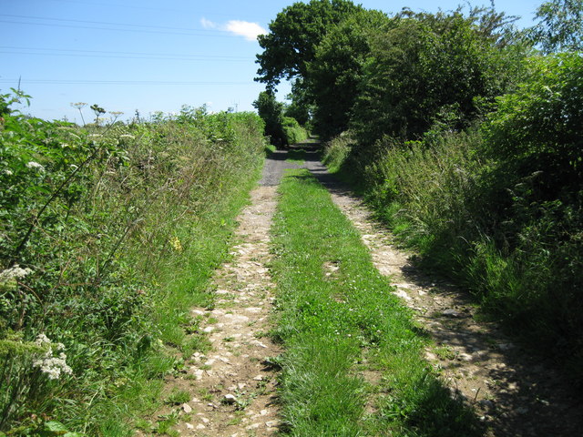
Cullimer's Wood is a picturesque woodland located in the county of Wiltshire, England. Extending over an area of approximately 500 acres, this enchanting forest is nestled within the scenic landscape of the South West of England. The wood is named after the Cullimer family, who were the original owners of the land.

The woodland is predominantly composed of native tree species such as oak, beech, and ash, creating a diverse and vibrant ecosystem. The trees form a dense canopy, casting dappled sunlight on the forest floor, which is carpeted with an array of wildflowers and ferns. Cullimer's Wood boasts an extensive network of walking trails, allowing visitors to explore and immerse themselves in the natural beauty of the area.

The wood is not only a haven for nature enthusiasts but also provides a habitat for a variety of wildlife. Birdwatchers can spot numerous species, including woodpeckers, owls, and various songbirds. Mammals such as deer, foxes, and rabbits also call Cullimer's Wood their home.

The wood has a rich history, with evidence of human activity dating back centuries. Archaeological finds in the area suggest that the wood was once used for charcoal production and as a source of timber. Today, it is managed by a local conservation organization, ensuring the preservation of its natural heritage.

Cullimer's Wood offers a peaceful retreat for those seeking solace in nature, with its tranquil atmosphere and stunning scenery. It is a true gem of Wiltshire, inviting visitors to reconnect with the great outdoors and appreciate the wonders of the woodland ecosystem.

If you have any feedback on the listing, please let us know in the comments section below.

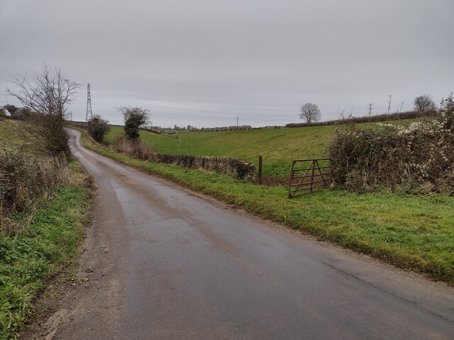
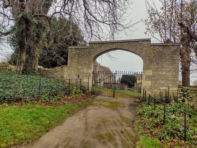
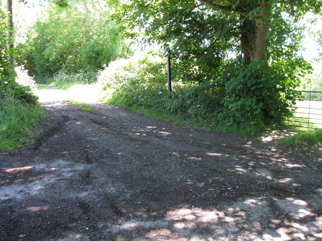
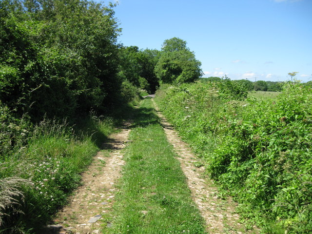
Cullimer's Wood Images

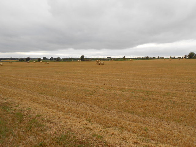
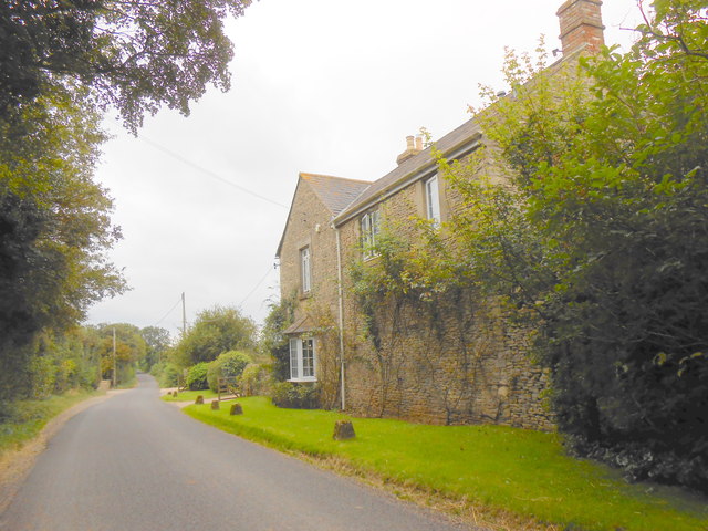
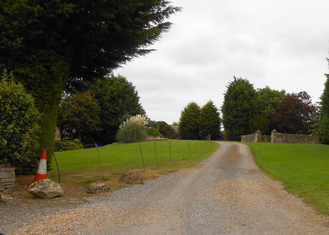
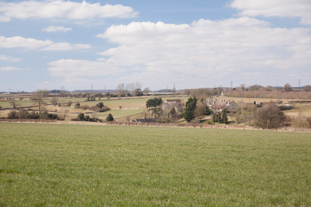
Images are sourced within 2km of 51.472701/-2.2567463 or Grid Reference ST8274. Thanks to Geograph Open Source API. All images are credited.

Lane in West Kington Wick Looking south west up the hill towards North Wraxall from West Kington Wick crossroads.
Lane in West Kington Wick
Looking south west up the hill towards North Wraxall from West Kington Wick crossroads.
Crossroads on the Fosse Way at West Kington Wick The crossroads at West Kington Wick on the Fosseway, looking north west back towards the village.
Crossroads on the Fosse Way at West Kington Wick
The crossroads at West Kington Wick on the Fosseway, looking north west back towards the village.
Gates to St. James' Church, North Wraxall The gateway to the church of St. James in North Wraxall.
Gates to St. James' Church, North Wraxall
The gateway to the church of St. James in North Wraxall.
Fosse Farm northerly aspect The front of the farm faces onto the Fosse Way and ancient Roman Trackway.
Fosse Farm northerly aspect
The front of the farm faces onto the Fosse Way and ancient Roman Trackway.
Broadmead Brook south of Nettleton Shrub The Romans built several structures around Nettleton and here the small stream, which may have attracted them, runs down from Wick Wood to flow under The Fosse Way.
Broadmead Brook south of Nettleton Shrub
The Romans built several structures around Nettleton and here the small stream, which may have attracted them, runs down from Wick Wood to flow under The Fosse Way.
The Old Coach Road The Old Coach Road is now a byway.  It leaves the tarmac lane between North Wraxall and the A420 at this point and continues roughly eastwards for a little over 2km to Ford village on the A420.
The Old Coach Road
The Old Coach Road is now a byway. It leaves the tarmac lane between North Wraxall and the A420 at this point and continues roughly eastwards for a little over 2km to Ford village on the A420.
Looking west along The Old Coach Road The byway has a good stone surface at this point.
Looking west along The Old Coach Road
The byway has a good stone surface at this point.
Looking east along The Old Coach Road
Aerials on the byway The Old Coach Road provides access to new aerial masts for mobile phones
Aerials on the byway
The Old Coach Road provides access to new aerial masts for mobile phones
View to the south east The view from The Old Coach Road towards Ford
View to the south east
The view from The Old Coach Road towards Ford
The Old Coach Road Byway
Fields at Upper Wraxall All that was left in this large wheat field after harvesting was a few round bales of straw and some stubble.It is just off the Fosse Way
Fields at Upper Wraxall
All that was left in this large wheat field after harvesting was a few round bales of straw and some stubble.It is just off the Fosse Way
Halls Barn Farm Situated right on the Fosse Way just west of North Wraxall this is a large working farm with a considerable number of buildings on both sides of the old Roman road.
Halls Barn Farm
Situated right on the Fosse Way just west of North Wraxall this is a large working farm with a considerable number of buildings on both sides of the old Roman road.
Powerlines near Fosse Farm This powerline runs straight across the Fosse Way east of Mountain Bower and north of North Wraxall. The fields in this area are a mix of pasture and arable. A footpath to West Kington runs on the other side of the fence on the right.
Powerlines near Fosse Farm
This powerline runs straight across the Fosse Way east of Mountain Bower and north of North Wraxall. The fields in this area are a mix of pasture and arable. A footpath to West Kington runs on the other side of the fence on the right.
Fosse Way near West Kington Wick At this point the old Roman road on its route south towards Bath is halfway up the ascent out of the valley of the By Brook towards the elevated ground near North Wraxall. It is showing the typical Roman road "straightness". This is a very quiet stretch of the Fosse way compared with some very busy sections in Warwickshire.
Fosse Way near West Kington Wick
At this point the old Roman road on its route south towards Bath is halfway up the ascent out of the valley of the By Brook towards the elevated ground near North Wraxall. It is showing the typical Roman road "straightness". This is a very quiet stretch of the Fosse way compared with some very busy sections in Warwickshire.
Entrance to Fosse Barn Fosse Barn was an old working farm that has been split into two large residences neither of which is a working farm any longer. This is the drive to the northernmost of the two properties.
Entrance to Fosse Barn
Fosse Barn was an old working farm that has been split into two large residences neither of which is a working farm any longer. This is the drive to the northernmost of the two properties.
View towards West Kington Wick The image is taken from the road which follows the line of the old Roman Road The Fosse Way.  Given the proximity to the major Roman thoroughfare I would presume that the "Wick" in the name is derived from the old Roman "Vicus" and that there was a settlement here in Roman times.
View towards West Kington Wick
The image is taken from the road which follows the line of the old Roman Road The Fosse Way. Given the proximity to the major Roman thoroughfare I would presume that the "Wick" in the name is derived from the old Roman "Vicus" and that there was a settlement here in Roman times.
Fields beside the Fosse Way The hedgerow to the right of this image separates these fields from the minor road that follows the line of the Roman road The Fosse Way.
Fields beside the Fosse Way
The hedgerow to the right of this image separates these fields from the minor road that follows the line of the Roman road The Fosse Way.
Show me another place!

Cullimer's Wood is located at Grid Ref: ST8274 (Lat: 51.472701, Lng: -2.2567463)

Unitary Authority: Wiltshire

Police Authority: Wiltshire

What 3 Words

///impact.buying.lobbed. Near North Wraxall, Wiltshire

Related Wikis

North Wraxall

North Wraxall is a village and civil parish in Wiltshire, England. The village is about 6 miles (10 km) west of Chippenham, just north of the A420 road...

Bury Camp

Bury Camp is the site of an Iron Age multivallate hillfort in north-west Wiltshire, England. It occupies a triangular promontory of Colerne Down, in the...

Danks Down and Truckle Hill

Danks Down and Truckle Hill (grid reference ST834758) is a 13.1 hectare biological Site of Special Scientific Interest in Wiltshire, notified in 1990....

The Shoe

The Shoe is a hamlet in the parish of North Wraxall, in the north-west of Wiltshire in England. It lies at the junction of the Fosse Way (the old Roman...

Out Woods

Out Woods (grid reference ST833763) is a 14.3 hectare biological Site of Special Scientific Interest in Wiltshire, notified in 1975. It is an ancient Ash...

Ford, North Wiltshire

Ford is a small village in the north-west of Wiltshire, England. The village is on the A420 road, 4 miles west of Chippenham and 11 miles east of Bristol...

Lucknam Park

Lucknam Park is a luxury hotel, spa and restaurant in west Wiltshire, England, about 3 miles (5 km) north-west of Corsham and 7 miles (11 km) north-east...

Slaughterford

Slaughterford is a small village in the civil parish of Biddestone and Slaughterford, about 5 miles (8 km) west of Chippenham, in Wiltshire, England. The...

Nearby Amenities

Located within 500m of 51.472701,-2.2567463
Power: tower
Source: Bing
Lat/Long: 51.476148/-2.2572195
Power: tower
Source: Bing
Lat/Long: 51.4741489/-2.2521067
North Wraxall
Place: village
Wikidata: Q2722373
Wikipedia: en:North Wraxall
Lat/Long: 51.4738285/-2.2626902
Grit Bin
Colour: yellow
Material: plastic
Lat/Long: 51.4733034/-2.2631156
Advertising: board
Lat/Long: 51.4738777/-2.2631843
Power: pole
Lat/Long: 51.4748528/-2.2615542
Power: pole
Lat/Long: 51.4744098/-2.2605294
Power: pole
Lat/Long: 51.473851/-2.2592416
Power: pole
Lat/Long: 51.4733755/-2.2581577
Power: pole
Lat/Long: 51.4725899/-2.2563654
Power: pole
Lat/Long: 51.4713603/-2.2524521
Power: pole
Lat/Long: 51.4719392/-2.253018
Power: pole
Lat/Long: 51.4721255/-2.2532286
Power: pole
Lat/Long: 51.4728846/-2.2546347
Power: pole
Lat/Long: 51.4725007/-2.2539064
The data included in this document is from www.openstreetmap.org. The data is made available under ODbL.

Have you been to Cullimer's Wood?

Leave your review of Cullimer's Wood below (or comments, questions and feedback).