Richard's Wood

Wood, Forest in Gloucestershire Gloucester

England

Richard's Wood

1-4 Westfield Terrace, Gloucester Mid C19th semi-detached villas.
1-4 Westfield Terrace, Gloucester Credit: Stephen Richards

Richard's Wood is a picturesque forest located in Gloucestershire, England. Covering an area of approximately 500 acres, this woodland is known for its stunning natural beauty and diverse ecosystem. The wood is situated just a few miles away from the quaint village of Richard's Hill, making it easily accessible to both locals and tourists.

The forest is characterized by its dense canopy of towering oak, beech, and birch trees, which provide shelter and habitat for a wide variety of wildlife. Visitors to Richard's Wood can expect to see an array of bird species, including woodpeckers, owls, and various songbirds. Additionally, the forest is home to numerous small mammals such as squirrels, foxes, and badgers.

Several well-maintained trails wind their way through the wood, allowing visitors to explore its natural wonders at their own pace. These pathways provide opportunities for hiking, jogging, and wildlife observation. The forest also features a designated picnic area, where visitors can relax and enjoy a meal amidst the tranquil surroundings.

Richard's Wood is not only a haven for nature enthusiasts but also a valuable resource for conservation and education. Efforts have been made to preserve the wood's biodiversity, ensuring its long-term sustainability. Local organizations often host educational programs and guided walks to raise awareness about the importance of preserving this natural habitat.

Overall, Richard's Wood in Gloucestershire offers a serene and enchanting escape into nature, where visitors can immerse themselves in the beauty of the forest and experience the wonders of wildlife firsthand.

If you have any feedback on the listing, please let us know in the comments section below.

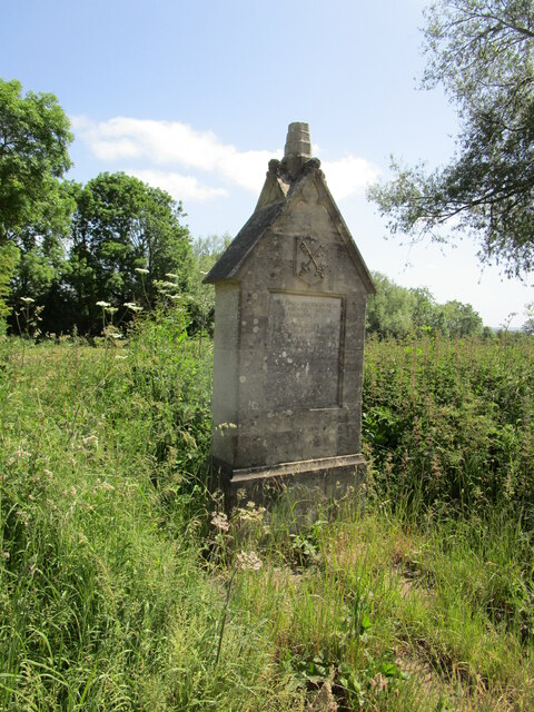
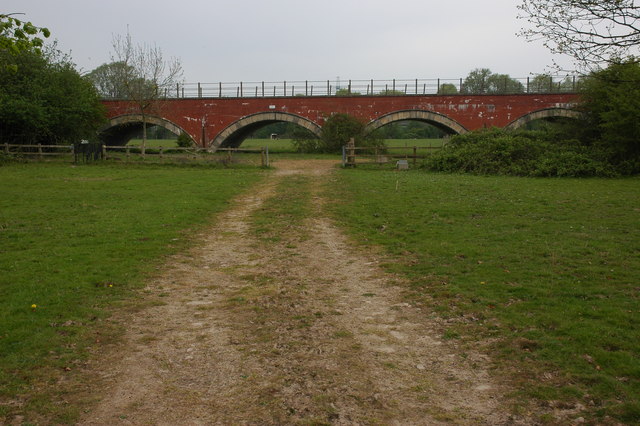
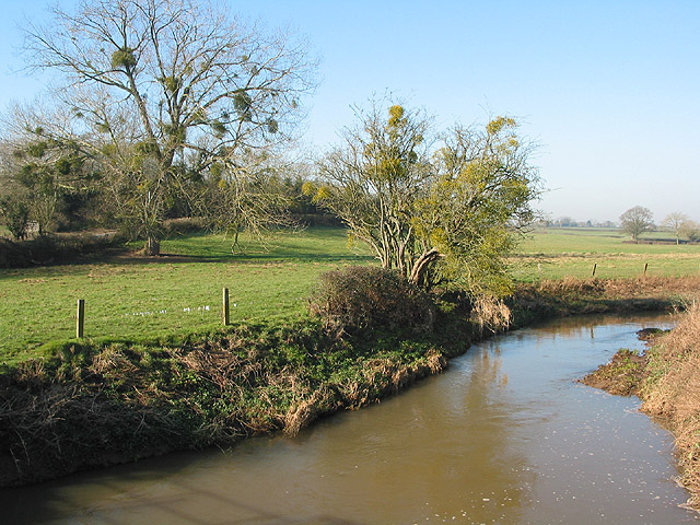
Richard's Wood Images

Images are sourced within 2km of 51.870946/-2.2621038 or Grid Reference SO8219. Thanks to Geograph Open Source API. All images are credited.

1-4 Westfield Terrace, Gloucester Mid C19th semi-detached villas.
1-4 Westfield Terrace, Gloucester
Mid C19th semi-detached villas.
Old Boundary Post, Sandhurst On the Western side of Sandhurst Lane, near Bridge House which is 10.3 m Above Sea Level. Just South of the bridge over Broadboard Brook, GHD would stand for Gloucester Hundred Division. Longford, since at least 1950, has not used the Sᵀ Catherine appendage. See Wiki <span class="nowrap"><a title="https://en.wikipedia.org/wiki/Longford,_Gloucestershire" rel="nofollow ugc noopener" href="https://en.wikipedia.org/wiki/Longford,_Gloucestershire">Link</a><img style="margin-left:2px;" alt="External link" title="External link - shift click to open in new window" src="https://s1.geograph.org.uk/img/external.png" width="10" height="10"/></span>. And for Sandhurst see <span class="nowrap"><a title="https://en.wikipedia.org/wiki/Sandhurst,_Gloucestershire" rel="nofollow ugc noopener" href="https://en.wikipedia.org/wiki/Sandhurst,_Gloucestershire">Link</a><img style="margin-left:2px;" alt="External link" title="External link - shift click to open in new window" src="https://s1.geograph.org.uk/img/external.png" width="10" height="10"/></span>

Inscription: G H / D // Longford Sᵀ Catherine // Sandhurst

Milestone Society National ID: GL_LONSAN01pb
Old Boundary Post, Sandhurst
On the Western side of Sandhurst Lane, near Bridge House which is 10.3 m Above Sea Level. Just South of the bridge over Broadboard Brook, GHD would stand for Gloucester Hundred Division. Longford, since at least 1950, has not used the Sᵀ Catherine appendage. See Wiki LinkExternal link. And for Sandhurst see LinkExternal link Inscription: G H / D // Longford Sᵀ Catherine // Sandhurst Milestone Society National ID: GL_LONSAN01pb
Footpath along a field edge, Maisemore Ham
Footpath and wheat field, Maisemore Ham
Cross by Maisemore Bridge Originally erected in 1851 <span class="nowrap"><a title="https://historicengland.org.uk/listing/the-list/list-entry/1091378?section=official-list-entry" rel="nofollow ugc noopener" href="https://historicengland.org.uk/listing/the-list/list-entry/1091378?section=official-list-entry">Link</a><img style="margin-left:2px;" alt="External link" title="External link - shift click to open in new window" src="https://s1.geograph.org.uk/img/external.png" width="10" height="10"/></span>
Cross by Maisemore Bridge
Originally erected in 1851 LinkExternal link
Three Choirs Way on Maisemore Ham A farm track which is also a public bridleway.
Three Choirs Way on Maisemore Ham
A farm track which is also a public bridleway.
Grass field and Three Choirs Way, Maisemore Ham
Disc harrowing on Maisemore Ham
Cycle path 45 alongside the River Severn
Cycle path 45 near Maisemore Bridge
The River Severn (West Channel) below Maisemore Bridge
The White Horse A Chinese Restaurant.
The White Horse
A Chinese Restaurant.
The Longford Beefeater Inn, Longford Sign: <a title="https://www.geograph.org.uk/photo/4974466" href="https://www.geograph.org.uk/photo/4974466">Link</a>
The Longford Beefeater Inn, Longford
Sign: Link
The Longford Beefeater Inn, Longford <a title="https://www.geograph.org.uk/photo/4974462" href="https://www.geograph.org.uk/photo/4974462">Link</a>
The Longford Beefeater Inn, Longford
The A40 goes over Sandhurst Road, Longford
The White Horse Chinese Restaurant, Longford <a title="https://www.geograph.org.uk/photo/4974511" href="https://www.geograph.org.uk/photo/4974511">Link</a>
The White Horse Chinese Restaurant, Longford
The White Horse Chinese Restaurant, Longford <a title="https://www.geograph.org.uk/photo/4974508" href="https://www.geograph.org.uk/photo/4974508">Link</a>
The White Horse Chinese Restaurant, Longford
Horsbere Brook Taken from Sandhurst Lane.
Horsbere Brook
Taken from Sandhurst Lane.
Show me another place!

Richard's Wood is located at Grid Ref: SO8219 (Lat: 51.870946, Lng: -2.2621038)

Administrative County: Gloucestershire

District: Gloucester

Police Authority: Gloucestershire

What 3 Words

///store.caring.cowboy. Near Gloucester, Gloucestershire

Related Wikis

Castle Meads Power Station

Castle Meads Power Station was a coal-fired power station situated on Alney Island in the River Severn at Gloucester. == History == Construction of the...
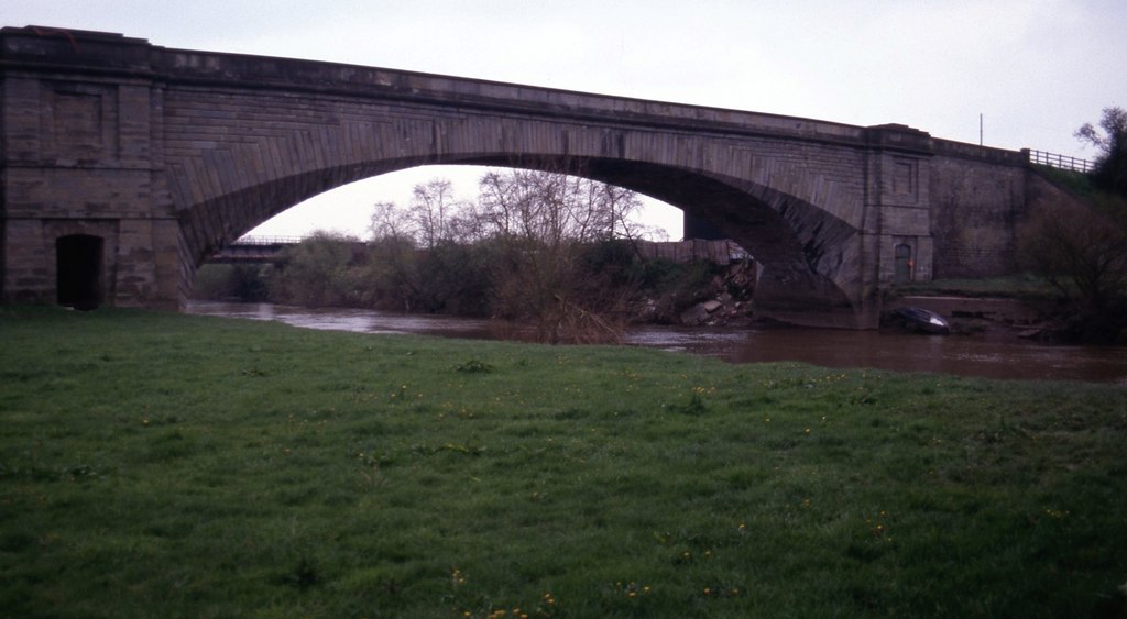
Over Bridge

Over Bridge, also known as Telford's Bridge, is a single span stone arch bridge spanning the canalised West Channel of the River Severn near Gloucester...

Westgate Galleria

The Westgate Galleria are grade II listed almshouses in Westgate Street, Gloucester, now used as a small shopping centre. The building dates from 1787...

Herefordshire and Gloucestershire Canal Trust

The Herefordshire and Gloucestershire Canal Trust is a British organisation whose main aim is the restoration of the Herefordshire and Gloucestershire...

Over, Tewkesbury

Over is a village in Gloucestershire, England, 2 mi (3.2 km) west of Gloucester. It lies on the A40 road in the parish of Highnam, on the west bank of...
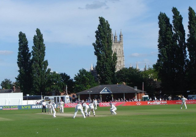
Archdeacon Meadow

Archdeacon Meadow is a cricket ground in Gloucester, England. The land is owned by The King's School. The ground was first used by the Gloucestershire...

Alney Island

Alney Island is an island in the River Severn near Gloucester, Gloucestershire, England. The Severn splits into two channels (known as East Channel and...
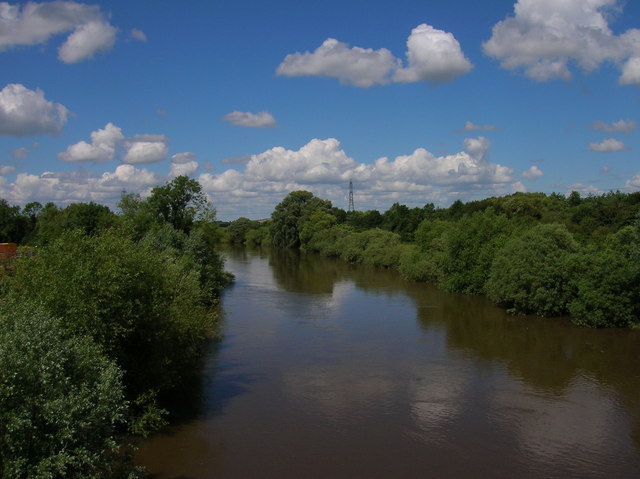
River Leadon

The River Leadon () is a river in Herefordshire and Gloucestershire, England, a tributary of the River Severn. It rises just south of the village of Acton...

Nearby Amenities

Located within 500m of 51.870946,-2.2621038
Traffic Signals
Lat/Long: 51.8707111/-2.2596079
Traffic Signals
Lat/Long: 51.8704715/-2.2595278
Barrier: stile
Lat/Long: 51.8682248/-2.2628315
Port Ham
Is In: Gloucestershire, England, UK
Is In City: Gloucester
Place: hamlet
Source: local_knowledge
Lat/Long: 51.8706733/-2.2688256
Oxleaze
Is In: Gloucestershire, England, UK
Is In City: Gloucester
Place: hamlet
Source: local_knowledge
Lat/Long: 51.867573/-2.2629462
Power: tower
Source: Bing
Lat/Long: 51.8675493/-2.2580547
Bus Stop
West End Parade
Bus: yes
Naptan AtcoCode: 1600GLB511
Naptan Bearing: NW
Naptan CommonName: West End Parade
Naptan Indicator: opp
Naptan NaptanCode: gloawjpd
Naptan Street: Westgate Street
Naptan Verified: no
Public Transport: platform
Source: naptan_import
Lat/Long: 51.8700652/-2.2584711
Bus Stop
West End Parade
Bus: yes
Naptan AtcoCode: 1600GLB512
Naptan Bearing: SE
Naptan CommonName: West End Parade
Naptan Indicator: by
Naptan NaptanCode: gloawjpw
Naptan Street: Westgate Street
Naptan Verified: no
Public Transport: platform
Source: naptan_import
Lat/Long: 51.8705328/-2.258777
Westend Terrace
Source: OS Opendata Streetview
Lat/Long: 51.8703846/-2.2579422
Line Management: transition
Location Transition: yes
Power: tower
Source: Bing
Lat/Long: 51.8711637/-2.2667635
Line Management: transition
Location Transition: yes
Power: tower
Source: Bing
Lat/Long: 51.8705624/-2.2664454
Line Management: transition
Location Transition: yes
Power: tower
Source: Bing
Lat/Long: 51.8699065/-2.2660331
Power: tower
Source: Bing
Lat/Long: 51.8680146/-2.26655
Power: pole
Source: Bing
Lat/Long: 51.8668032/-2.2592684
Power: pole
Source: Bing
Lat/Long: 51.8676474/-2.2584073
Power: pole
Source: Bing
Lat/Long: 51.8677123/-2.2585366
Power: pole
Source: Bing
Lat/Long: 51.8668613/-2.2594146
Barrier: kissing_gate
Lat/Long: 51.8716488/-2.2603207
Barrier: kissing_gate
Lat/Long: 51.8734797/-2.2611267
Barrier: kissing_gate
Lat/Long: 51.8734986/-2.2612786
Barrier: kissing_gate
Lat/Long: 51.8740818/-2.2633567
Barrier: kissing_gate
Lat/Long: 51.874552/-2.2603606
Power: pole
Source: Bing
Lat/Long: 51.8683516/-2.2606436
Power: tower
Source: Bing
Lat/Long: 51.8682838/-2.2611373
Power: pole
Source: Bing
Lat/Long: 51.8680099/-2.2583607
Power: tower
Source: Bing
Lat/Long: 51.8676774/-2.2575009
Power: pole
Source: Bing
Lat/Long: 51.8681893/-2.2595333
Line Management: transition
Location Transition: yes
Power: tower
Source: Bing
Lat/Long: 51.8701276/-2.2644278
Power: pole
Source: Bing
Lat/Long: 51.8685748/-2.262033
Shop: car_repair
Lat/Long: 51.8687983/-2.2561298
Docks Branch Junction
Railway: junction
Lat/Long: 51.8737953/-2.2670827
Crossing
Crossing: traffic_signals
Source: DigitalGlobe-Premium
Lat/Long: 51.87042/-2.2597291
Source: DigitalGlobe-Premium
Tactile Paving: yes
Lat/Long: 51.8704226/-2.2596471
Crossing
Crossing: traffic_signals
Source: DigitalGlobe-Premium
Lat/Long: 51.8703116/-2.2594089
Source: DigitalGlobe-Premium
Tactile Paving: yes
Lat/Long: 51.8702868/-2.2593889
Traffic Signals
Source: DigitalGlobe-Premium
Lat/Long: 51.8703116/-2.2593534
Source: DigitalGlobe-Premium
Tactile Paving: yes
Lat/Long: 51.8685136/-2.257942
Source: DigitalGlobe-Premium
Tactile Paving: yes
Lat/Long: 51.8703468/-2.259437
Source: DigitalGlobe-Premium
Tactile Paving: yes
Lat/Long: 51.8679607/-2.2567906
Crossing
Crossing: traffic_signals
Source: DigitalGlobe-Premium
Lat/Long: 51.8703963/-2.2595789
Traffic Signals
Source: DigitalGlobe-Premium
Lat/Long: 51.8703966/-2.2597483
Source: DigitalGlobe-Premium
Tactile Paving: yes
Lat/Long: 51.8684604/-2.2578131
Crossing
Crossing: traffic_signals
Source: DigitalGlobe-Premium
Tactile Paving: yes
Lat/Long: 51.8704847/-2.259961
Source: DigitalGlobe-Premium
Tactile Paving: yes
Lat/Long: 51.8703555/-2.2594726
Traffic Signals
Source: DigitalGlobe-Premium
Lat/Long: 51.8704554/-2.2599512
Power: pole
Source: Bing
Lat/Long: 51.8715197/-2.2636167
Power: pole
Source: Bing
Lat/Long: 51.8704383/-2.2630267
Power: pole
Source: Bing
Lat/Long: 51.8693932/-2.2624688
Generator Method: photovoltaic
Generator Output Electricity: yes
Generator Source: solar
Generator Type: solar_photovoltaic_panel
Location: roof
Power: generator
Lat/Long: 51.8704979/-2.2577521
Generator Method: photovoltaic
Generator Output Electricity: yes
Generator Source: solar
Generator Type: solar_photovoltaic_panel
Location: roof
Power: generator
Lat/Long: 51.8707364/-2.2573122
Generator Method: photovoltaic
Generator Output Electricity: yes
Generator Source: solar
Generator Type: solar_photovoltaic_panel
Location: roof
Power: generator
Lat/Long: 51.8707364/-2.2572559
Generator Method: photovoltaic
Generator Output Electricity: yes
Generator Source: solar
Generator Type: solar_photovoltaic_panel
Location: roof
Power: generator
Lat/Long: 51.8712332/-2.2576126
Crossing
Lat/Long: 51.8700205/-2.2583573
Barrier: stile
Lat/Long: 51.868403/-2.2629187
Marker: aerial
Operator: CLH
Operator Old: GPSS
Ref GPSS: 18300
Source: survey
Utility: oil
Lat/Long: 51.8678034/-2.258428
Marker: aerial
Operator: CLH
Operator Old: GPSS
Ref GPSS: 19430
Source: survey
Utility: oil
Lat/Long: 51.8683747/-2.2583529
Marker: aerial
Operator: CLH
Operator Old: GPSS
Source: survey
Utility: oil
Lat/Long: 51.8680468/-2.2582282
Marker: aerial
Operator: CLH
Operator Old: GPSS
Ref GPSS: 19430
Source: survey
Utility: oil
Lat/Long: 51.8685785/-2.2585675
Marker: aerial
Operator: CLH
Operator Old: GPSS
Ref GPSS: 19431
Source: survey
Utility: oil
Lat/Long: 51.8688733/-2.2582135
Marker: pedestal
Operator: CLH
Operator Old: GPSS
Ref: CP 1735
Source: survey
Utility: oil
Lat/Long: 51.8694355/-2.2575215
Marker: aerial
Operator: CLH
Operator Old: GPSS
Ref: MP 2826
Ref GPSS: 18288
Source: survey
Utility: oil
Lat/Long: 51.8694057/-2.2574463
Marker: post
Operator: CLH
Operator Old: GPSS
Source: survey
Utility: oil
Lat/Long: 51.8699506/-2.2575791
Marker: aerial
Operator: CLH
Operator Old: GPSS
Ref: MP 1925
Source: survey
Utility: oil
Lat/Long: 51.8699605/-2.2574805
Marker: aerial
Operator: CLH
Operator Old: GPSS
Ref: MP 6224
Source: survey
Utility: oil
Lat/Long: 51.8695962/-2.2560717
Marker: pedestal
Operator: CLH
Operator Old: GPSS
Ref: MP 6225
Source: survey
Utility: oil
Lat/Long: 51.8695966/-2.2559711
Marker: pedestal
Operator: CLH
Operator Old: GPSS
Ref: MP 6226
Source: survey
Utility: oil
Lat/Long: 51.8697274/-2.2558176
Marker: post
Operator: CLH
Operator Old: GPSS
Ref: MP 4117
Source: survey
Utility: oil
Lat/Long: 51.8700955/-2.2557767
Post Box
Collection Times: Mo-Fr 09:00; Sa 07:00
Post Box Type: wall
Ref: GL1 52
Royal Cypher: GR
Royal Cypher Wikidata: Q33102273
Lat/Long: 51.8705672/-2.2580039
Barrier: kissing_gate
Fixme: from aerial imagery confirm with survey
Lat/Long: 51.8687527/-2.2588469
Barrier: kissing_gate
Fixme: from aerial imagery confirm with survey
Lat/Long: 51.8687597/-2.2587977
Crossing
Crossing: unmarked
Tactile Paving: yes
Lat/Long: 51.8679344/-2.2567383
The data included in this document is from www.openstreetmap.org. The data is made available under ODbL.

Have you been to Richard's Wood?

Leave your review of Richard's Wood below (or comments, questions and feedback).