Cranoe

Settlement in Leicestershire Harborough

England

Cranoe

Welham Road dropping down to the Welland valley
Welham Road dropping down to the Welland valley Credit: Tim Heaton

Cranoe is a small village located in the Harborough district of Leicestershire, England. Situated approximately 7 miles east of the town of Market Harborough, Cranoe is a rural community with a population of around 100 residents.

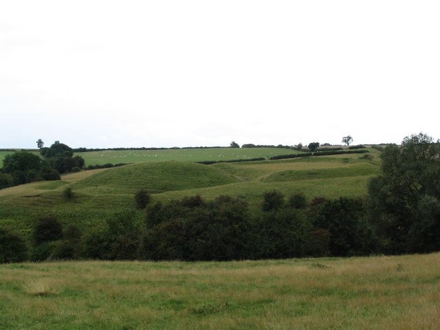
The village is known for its picturesque countryside and charming stone cottages, which contribute to its quintessentially English character. Surrounded by rolling hills and farmland, Cranoe offers a tranquil and idyllic setting for its inhabitants.

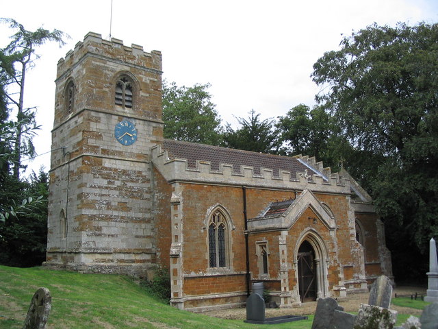
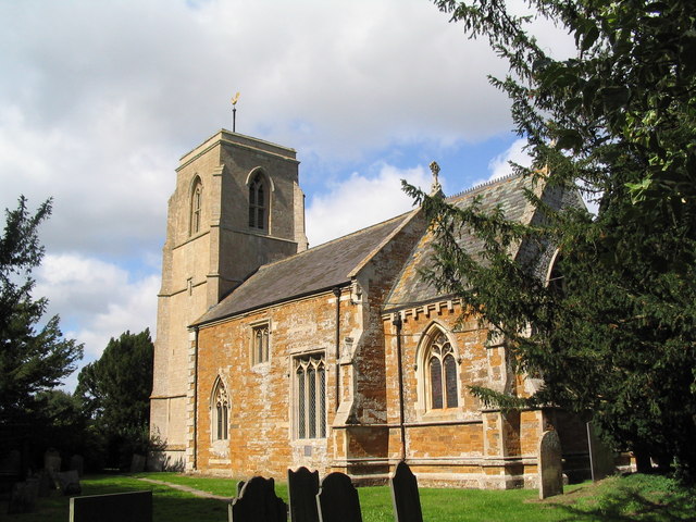
Despite its small size, Cranoe has a rich history that can be traced back to medieval times. The village is mentioned in the Domesday Book of 1086, indicating its long-standing presence in the region. Today, remnants of its past can be seen in the form of historic buildings, including the Grade II listed St. Michael and All Angels Church, which dates back to the 12th century.

Cranoe is primarily a residential area, with limited amenities within its boundaries. However, the village benefits from its proximity to nearby Market Harborough, where residents can access a wider range of services, including shops, schools, and healthcare facilities.

The village also offers easy access to the surrounding countryside, making it an attractive location for outdoor enthusiasts. The nearby Welland Valley provides opportunities for hiking, cycling, and horse riding, allowing residents to enjoy the natural beauty of the area.

Overall, Cranoe is a charming village with a rich history and a scenic environment, offering a peaceful and close-knit community for its residents.

If you have any feedback on the listing, please let us know in the comments section below.
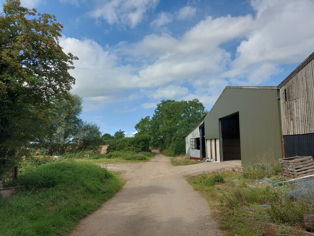
Cranoe Images

Images are sourced within 2km of 52.548087/-0.879399 or Grid Reference SP7695. Thanks to Geograph Open Source API. All images are credited.

Welham Road dropping down to the Welland valley
Fields south-west of Slawston Looking along the supposed route of Via Devana on the north slope of the Welland valley
Fields south-west of Slawston
Looking along the supposed route of Via Devana on the north slope of the Welland valley
View towards Romans Farm The supposed route of the Roman road, Via Devana, runs across the view next to the farm. But it is not clear to me when the farm was built, or when it acquired its 'Roman' name. I can only find it on modern OS maps, not on late 19th or early 20th OS maps
View towards Romans Farm
The supposed route of the Roman road, Via Devana, runs across the view next to the farm. But it is not clear to me when the farm was built, or when it acquired its 'Roman' name. I can only find it on modern OS maps, not on late 19th or early 20th OS maps
Cycle Route 64 crossing Langton Lane, Cranoe A most enjoyable cycle route from Market Harborough (left) to Lincoln. Mostly gentle gradients, though a steep climb up the hill to the right.
Cycle Route 64 crossing Langton Lane, Cranoe
A most enjoyable cycle route from Market Harborough (left) to Lincoln. Mostly gentle gradients, though a steep climb up the hill to the right.
Fields south of Cranoe Looking along the supposed route of Via Devana on the north side of the Welland valley
Fields south of Cranoe
Looking along the supposed route of Via Devana on the north side of the Welland valley
Cranoe Road. View north-west towards Glooston On Cycle Route 64 after the climb up Church Hill, Cranoe
Cranoe Road. View north-west towards Glooston
On Cycle Route 64 after the climb up Church Hill, Cranoe
Andrew's Lane leaving the west side of Glooston
Andrew's Lane leading to Glooston
Leicestershire Round footpath looking down Langton Caudle
Fields to the west of Welham Lane
Welham Lane towards Cranoe The Midshires Way long distance footpath follow this road at this point.
Welham Lane towards Cranoe
The Midshires Way long distance footpath follow this road at this point.
Welham Lane towards Welham The Midshires Way long distance footpath follow this road at this point.
Welham Lane towards Welham
The Midshires Way long distance footpath follow this road at this point.
Welham Lane south from Cranoe
Welham Lane towards Welham The Midshires Way long distance footpath follow this road at this point.
Welham Lane towards Welham
The Midshires Way long distance footpath follow this road at this point.
Gate into a field east of Welham Lane
Into the centre of Cranoe
Show me another place!

Cranoe is located at Grid Ref: SP7695 (Lat: 52.548087, Lng: -0.879399)

Administrative County: Leicestershire

District: Harborough

Police Authority: Leicestershire

What 3 Words

///thread.squeaks.gossip. Near Kibworth Harcourt, Leicestershire

Nearby Locations

Church Hill Cranoe

Related Wikis

Cranoe

Cranoe is a small village and civil parish in the Harborough district of Leicestershire, England. The parish had a population of 35 in 2001. The population...

Glooston

Glooston is a small village and civil parish in the Harborough district of Leicestershire, England. According to the 2001 census the parish had a population...

Slawston

Slawston is a village and civil parish in the Harborough district of Leicestershire, England, north-east of Market Harborough. According to the 2001 census...

Hallaton Treasure

The Hallaton Treasure, the largest hoard of British Iron Age coins, was discovered in 2000 near Hallaton in southeast Leicestershire, England, by volunteers...

Stonton Wyville

Stonton Wyville is a small village and civil parish in the Harborough district of Leicestershire, England. According to the 2001 census the parish had...

Hallaton Castle

Hallaton Castle was situated to the west of the village of Hallaton, which lies some 20 km to the south-east of the city of Leicester (grid reference SP780967...

Knave Hill

Knave Hill is an archaeological site near the village of Stonton Wyville, Leicestershire, in the English East Midlands. It was excavated by Channel 4's...

Welham, Leicestershire

Welham is a small village and civil parish in the Harborough district of Leicestershire, England. Welham lies 4 miles (6 km) north-east of Market Harborough...

Nearby Amenities

Located within 500m of 52.548087,-0.879399
Bus Stop
Crossroads
Bus: yes
Naptan AtcoCode: 260018800
Naptan Bearing: E
Naptan BusStopType: CUS
Naptan CommonName: Crossroads
Naptan Indicator: outside
Naptan Landmark: Crossroads
Naptan NaptanCode: leijmdta
Naptan Notes: Non-Hourly - County
Naptan Street: Langton Road
Naptan Verified: no
Public Transport: platform
Source: naptan_import
Lat/Long: 52.5481593/-0.8789053
Bus Stop
Crossroads
Bus: yes
Naptan AtcoCode: 260018801
Naptan Bearing: W
Naptan BusStopType: CUS
Naptan CommonName: Crossroads
Naptan Indicator: opposite
Naptan Landmark: Crossroads
Naptan NaptanCode: leijmdtd
Naptan Notes: Non-Hourly - County
Naptan Street: Langton Road
Naptan Verified: no
Public Transport: platform
Source: naptan_import
Lat/Long: 52.5480268/-0.8791594
Bench
Lat/Long: 52.5500229/-0.8785388
The data included in this document is from www.openstreetmap.org. The data is made available under ODbL.

Have you been to Cranoe?

Leave your review of Cranoe below (or comments, questions and feedback).