Bernard's Green Belt

Wood, Forest in Worcestershire Malvern Hills

England

Bernard's Green Belt

Footbridges at the junction of footpaths near Blackmore End
Footbridges at the junction of footpaths near Blackmore End Credit: peter robinson

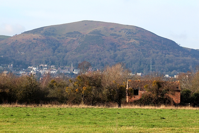
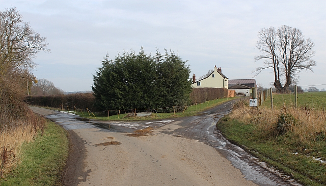
Bernard's Green Belt is a picturesque woodland area located in Worcestershire, England. Situated in the heart of the county, this green belt is renowned for its lush greenery, tranquil atmosphere, and diverse range of flora and fauna.

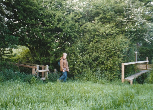
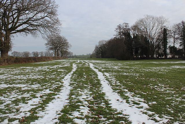
Covering an extensive area, Bernard's Green Belt is primarily composed of dense forests and woodlands, offering a haven for nature enthusiasts and outdoor adventurers. The towering trees, including oak, beech, and birch, create a majestic canopy that provides shade and shelter for an array of wildlife.

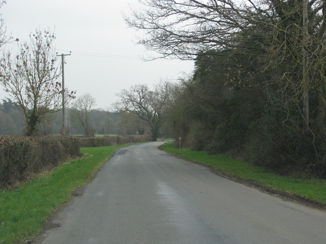
The green belt is intersected by several walking trails and footpaths, allowing visitors to explore its natural wonders. These paths wind through the forest, offering breathtaking views of the surrounding landscape and glimpses of wildlife such as deer, foxes, and a wide variety of bird species.

Bernard's Green Belt also features a network of streams and ponds that add to its scenic beauty. These water bodies not only contribute to the aesthetic appeal of the area but also provide essential habitats for amphibians, fish, and aquatic plants.

Valued for its ecological significance, this green belt serves as a vital corridor for wildlife movement and biodiversity conservation. It plays a crucial role in maintaining the ecological balance of the region and acts as a buffer between urban development and the natural environment.

Bernard's Green Belt is a cherished natural gem that offers a serene escape from the hustle and bustle of daily life. Its abundant beauty and rich biodiversity make it a must-visit destination for nature lovers and a valuable asset to the Worcestershire region.

If you have any feedback on the listing, please let us know in the comments section below.

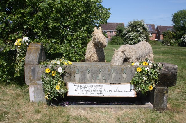
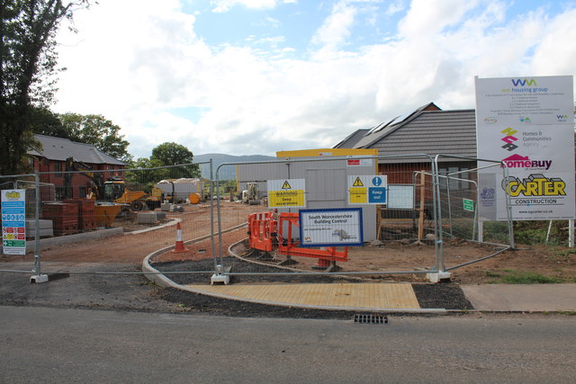
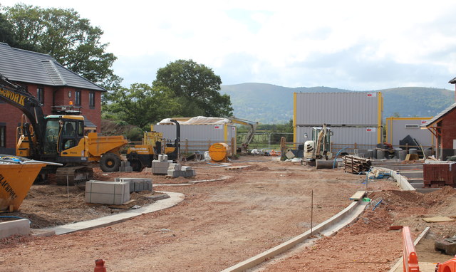
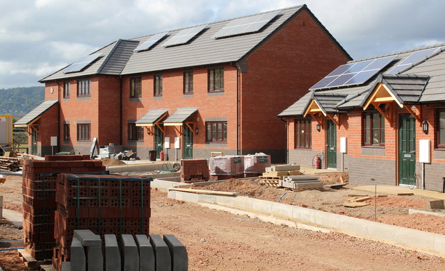
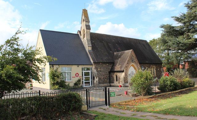
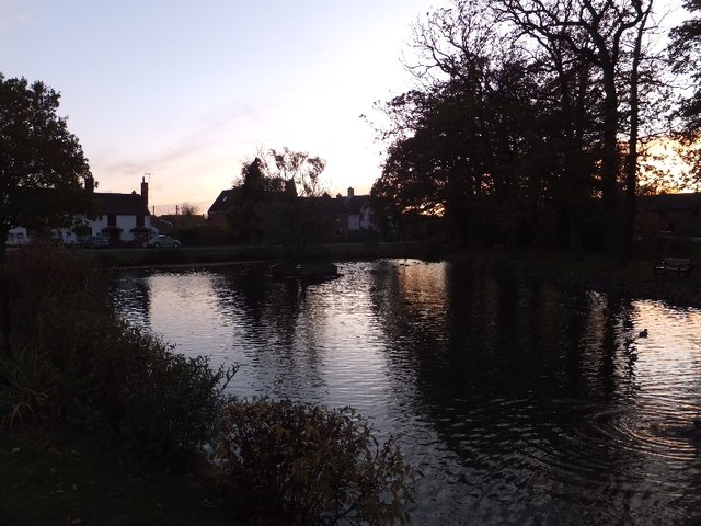
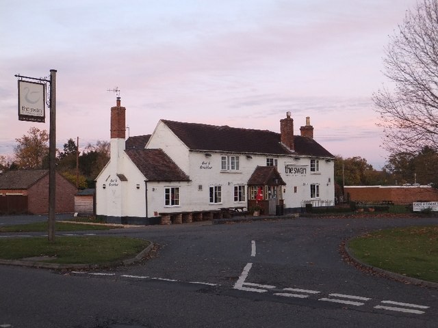
Bernard's Green Belt Images

Images are sourced within 2km of 52.095741/-2.2743976 or Grid Reference SO8144. Thanks to Geograph Open Source API. All images are credited.

Footbridges at the junction of footpaths near Blackmore End
Minor road on the northern edge of Guarlford
Pylons cross the road near White House Farm
MSPCA trough - Well Dressing 2011 - Togetherness The trough, erected at the beginning of the 20th century by the Malvern Society for the Prevention of Cruelty to Animals as a memorial to the horses who suffered in the Boer War, has been decorated by a team led by Stephanie Underwood-Webb. 
Begun as a solo venture it soon became a community project and has been rewarded with a Gold Award.
"You aren't a proper couple until you understand everything the other hasn't said." 
The trough used to be located on the large oddly shaped traffic island in Barnards Green shopping area, but has been at this position, by the Guarlford straight for many decades.
Worcestershire Beacon is in the distance.
<a href="https://www.geograph.org.uk/photo/2395889">SO7945 : MSPCA trough - Well Dressing 2011 - Togetherness</a>
MSPCA trough - Well Dressing 2011 - Togetherness
The trough, erected at the beginning of the 20th century by the Malvern Society for the Prevention of Cruelty to Animals as a memorial to the horses who suffered in the Boer War, has been decorated by a team led by Stephanie Underwood-Webb. Begun as a solo venture it soon became a community project and has been rewarded with a Gold Award. "You aren't a proper couple until you understand everything the other hasn't said." The trough used to be located on the large oddly shaped traffic island in Barnards Green shopping area, but has been at this position, by the Guarlford straight for many decades. Worcestershire Beacon is in the distance. SO7945 : MSPCA trough - Well Dressing 2011 - Togetherness
MSPCA trough - Well Dressing 2011 - Togetherness The trough, erected at the beginning of the 20th century by the Malvern Society for the Prevention of Cruelty to Animals as a memorial to the horses who suffered in the Boer War, has been decorated by a team led by Stephanie Underwood-Webb. 
Begun as a solo venture it soon became a community project and has been rewarded with a Gold Award.

"And so we stand together,
The horses, thee and me,
As the beasts take sips from the old stone trough
The world turns, quietly."

<a href="https://www.geograph.org.uk/photo/2395867">SO7945 : MSPCA trough - Well Dressing 2011 - Togetherness</a>
MSPCA trough - Well Dressing 2011 - Togetherness
The trough, erected at the beginning of the 20th century by the Malvern Society for the Prevention of Cruelty to Animals as a memorial to the horses who suffered in the Boer War, has been decorated by a team led by Stephanie Underwood-Webb. Begun as a solo venture it soon became a community project and has been rewarded with a Gold Award. "And so we stand together, The horses, thee and me, As the beasts take sips from the old stone trough The world turns, quietly." SO7945 : MSPCA trough - Well Dressing 2011 - Togetherness
Housing development, Hanley Swan On the Welland road on what was a meadow between the school and the limit of residential land.
There will be 11 new homes for rent or "HomeBuy": 
4 three bedroomed houses, 3 two bedroomed houses, 
2 two bedroomed bungalows and 2 two bedroomed apartments.

Under the "HomeBuy" scheme the occupier initially buys between 25% and 75% of the house with the option of buying more shares in the house later.

<span class="nowrap"><a title="http://www.homebuy.org.uk/homebuy_schemes.html" rel="nofollow ugc noopener" href="http://www.homebuy.org.uk/homebuy_schemes.html">Link</a><img style="margin-left:2px;" alt="External link" title="External link - shift click to open in new window" src="https://s1.geograph.org.uk/img/external.png" width="10" height="10"/></span>

How the meadow looked in 2007:
<a href="https://www.geograph.org.uk/photo/446149">SO8142 : Horse Jumps in Meadow</a>
<a href="https://www.geograph.org.uk/photo/2595342">SO8142 : Building site (right), Hanley Swan</a>
<a href="https://www.geograph.org.uk/photo/2595324">SO8142 : Building site (left), Hanley Swan</a>
<a href="https://www.geograph.org.uk/photo/2595317">SO8142 : Building site (centre), Hanley Swan</a>
Housing development, Hanley Swan
On the Welland road on what was a meadow between the school and the limit of residential land. There will be 11 new homes for rent or "HomeBuy": 4 three bedroomed houses, 3 two bedroomed houses, 2 two bedroomed bungalows and 2 two bedroomed apartments. Under the "HomeBuy" scheme the occupier initially buys between 25% and 75% of the house with the option of buying more shares in the house later. LinkExternal link How the meadow looked in 2007: SO8142 : Horse Jumps in Meadow SO8142 : Building site (right), Hanley Swan SO8142 : Building site (left), Hanley Swan SO8142 : Building site (centre), Hanley Swan
Building site (centre), Hanley Swan On the Welland road on what was a meadow between the school and the limit of residential land.
How the meadow looked in 2007:
<a href="https://www.geograph.org.uk/photo/446149">SO8142 : Horse Jumps in Meadow</a>
<a href="https://www.geograph.org.uk/photo/2595342">SO8142 : Building site (right), Hanley Swan</a>
<a href="https://www.geograph.org.uk/photo/2595324">SO8142 : Building site (left), Hanley Swan</a>
<a href="https://www.geograph.org.uk/photo/2595302">SO8142 : Housing development, Hanley Swan</a>
Building site (centre), Hanley Swan
On the Welland road on what was a meadow between the school and the limit of residential land. How the meadow looked in 2007: SO8142 : Horse Jumps in Meadow SO8142 : Building site (right), Hanley Swan SO8142 : Building site (left), Hanley Swan SO8142 : Housing development, Hanley Swan
Building site (left), Hanley Swan On the Welland road on what was a meadow between the school and the limit of residential land.
<a href="https://www.geograph.org.uk/photo/2595342">SO8142 : Building site (right), Hanley Swan</a>
<a href="https://www.geograph.org.uk/photo/2595317">SO8142 : Building site (centre), Hanley Swan</a>
<a href="https://www.geograph.org.uk/photo/2595302">SO8142 : Housing development, Hanley Swan</a>
Building site (left), Hanley Swan
On the Welland road on what was a meadow between the school and the limit of residential land. SO8142 : Building site (right), Hanley Swan SO8142 : Building site (centre), Hanley Swan SO8142 : Housing development, Hanley Swan
Building site (right), Hanley Swan On the Welland road on what was a meadow between the school and the limit of residential land.
Note the photo-voltaic solar panels already fitted to the south facing roofs.
<a href="https://www.geograph.org.uk/photo/2595324">SO8142 : Building site (left), Hanley Swan</a>
<a href="https://www.geograph.org.uk/photo/2595317">SO8142 : Building site (centre), Hanley Swan</a>
<a href="https://www.geograph.org.uk/photo/2595302">SO8142 : Housing development, Hanley Swan</a>
Building site (right), Hanley Swan
On the Welland road on what was a meadow between the school and the limit of residential land. Note the photo-voltaic solar panels already fitted to the south facing roofs. SO8142 : Building site (left), Hanley Swan SO8142 : Building site (centre), Hanley Swan SO8142 : Housing development, Hanley Swan
Hanley Swan C of E primary school A Church of England "controlled" school on the Welland Road next to the village hall.
It was built around 1861 as a "school for the education of children and adults or children only of the Labouring, Manufacturing or other poorer classes."
In 1947 it became solely a primary school.
Notice how the older part of the school, with Malvern granite walls, looks just like a chapel - for indeed it was also used as a chapel of ease for the inhabitants of the Swan Green area (now called Hanley Swan) until St Gabriel's church was built.
Hanley Swan C of E primary school
A Church of England "controlled" school on the Welland Road next to the village hall. It was built around 1861 as a "school for the education of children and adults or children only of the Labouring, Manufacturing or other poorer classes." In 1947 it became solely a primary school. Notice how the older part of the school, with Malvern granite walls, looks just like a chapel - for indeed it was also used as a chapel of ease for the inhabitants of the Swan Green area (now called Hanley Swan) until St Gabriel's church was built.
Annual Honey Show, Hanley Swan Village Hall An annual event in September for members of the Upton & Malvern Beekeepers.
Many classes of honey, mead, beeswax, full frames of unextracted honey, cakes, biscuits and "interesting bee keeping-related exhibits".
After the judges have made their decisions the show is open to the members and public for free.
The hire of the hall is paid for by the car boot sale outside the hall, a raffle and the sale of refreshments inside.
The show ends with the raffle draw and presentation of the many prize cups, shields, etc.
It is good preparation for the Worcestershire County competition a few weeks later at the Autumn Show held at the Three Counties Showground.
Annual Honey Show, Hanley Swan Village Hall
An annual event in September for members of the Upton & Malvern Beekeepers. Many classes of honey, mead, beeswax, full frames of unextracted honey, cakes, biscuits and "interesting bee keeping-related exhibits". After the judges have made their decisions the show is open to the members and public for free. The hire of the hall is paid for by the car boot sale outside the hall, a raffle and the sale of refreshments inside. The show ends with the raffle draw and presentation of the many prize cups, shields, etc. It is good preparation for the Worcestershire County competition a few weeks later at the Autumn Show held at the Three Counties Showground.
The Swan Pool (village pond) at sunset
The Swan Inn at Hanley Swan Perhaps the title should be "the swan" as the signs use lower case only.  Hanley Swan has the traditional English village centre: a cross roads with a village green, overlooked by an inn in one corner; a village pond in the next corner; the post office and shop next, and houses in the fourth.  When I grew up here, I almost believed that every village should have this layout.
The Swan Inn at Hanley Swan
Perhaps the title should be "the swan" as the signs use lower case only. Hanley Swan has the traditional English village centre: a cross roads with a village green, overlooked by an inn in one corner; a village pond in the next corner; the post office and shop next, and houses in the fourth. When I grew up here, I almost believed that every village should have this layout.
A second oak tree on the village green The centre of the green is site for an oak planted in the 19th century.
A second oak tree on the village green
The centre of the green is site for an oak planted in the 19th century.
Old Barn, Guarlford A derelict building amongst an apple orchard with a good crop of mistletoe.
In the background is North Hill at the end of the granite Malvern Hills range with Great Malvern beneath.
The church spire to the left of centre is Holly Mount United Reformed Church.
The infill television transmitter is to the right of the picture.
This also transmits local radio and the structure is adorned with a plethora of aerials and microwave dishes.
Old Barn, Guarlford
A derelict building amongst an apple orchard with a good crop of mistletoe. In the background is North Hill at the end of the granite Malvern Hills range with Great Malvern beneath. The church spire to the left of centre is Holly Mount United Reformed Church. The infill television transmitter is to the right of the picture. This also transmits local radio and the structure is adorned with a plethora of aerials and microwave dishes.
Hangman's Lane - Green Lane junction Hangmans Lane forks to the left while the lane to the right becomes an unmetalled "green lane" after Broadacres Farm.
Hangman's Lane - Green Lane junction
Hangmans Lane forks to the left while the lane to the right becomes an unmetalled "green lane" after Broadacres Farm.
Snow field, Hanley Swan An interesting long narrow field with a stream on the right hand boundary.
Snow field, Hanley Swan
An interesting long narrow field with a stream on the right hand boundary.
Snow field, Hanley Swan An interesting long narrow field with a stream bordering its southern edge.
The Malvern Hills can be seen in the distance.
Snow field, Hanley Swan
An interesting long narrow field with a stream bordering its southern edge. The Malvern Hills can be seen in the distance.
Show me another place!

Bernard's Green Belt is located at Grid Ref: SO8144 (Lat: 52.095741, Lng: -2.2743976)

Administrative County: Worcestershire

District: Malvern Hills

Police Authority: West Mercia

What 3 Words

///dial.thus.jumbo. Near Great Malvern, Worcestershire

Related Wikis

Guarlford

Guarlford is a village and civil parish in the Malvern Hills district in the county of Worcestershire, England. The parish population was 261 in 2021.It...

British National Fencing Museum

The British National Fencing Museum is the national museum for Great Britain for the sport and martial art of fencing.The museum opened during the year...

Hanley Swan

Hanley Swan is a small village in the English county of Worcestershire. It lies in the Malvern Hills district, between the towns of Malvern (two miles...

Poolbrook

Poolbrook is a village and a suburb of Malvern, Worcestershire, England, situated approximately 1.5 miles (2.4 km) southeast of Great Malvern, the town...

The Rhydd

The Rhydd (formerly Rhydd Court) is an English country house alongside the River Severn, near the village of Hanley Castle, Worcestershire, about halfway...

The Chase School

The Chase School is a secondary school (ages 11–18) in Malvern, Worcestershire, England. The school opened as a Secondary Modern in 1953 under headteacher...

Malvern Hills Science Park

Malvern Hills Science Park is located on a 10 acre (4 Hectare) site in the Barnards Green suburb of Malvern, Worcestershire, England. It is a partnership...

Sherrard's Green

Sherrard's Green is a village and a suburb of Malvern, Worcestershire, England, situated approximately 1.5 miles (2.4 km) southeast of Great Malvern, the...

Nearby Amenities

Located within 500m of 52.095741,-2.2743976
Access: no
Barrier: lift_gate
Bicycle: private
Foot: yes
Motor Vehicle: private
Lat/Long: 52.0957765/-2.2753754
Blackmore Camp Site
Naptan AtcoCode: 2000G058220
Naptan Bearing: SW
Naptan BusStopType: CUS
Naptan CommonName: Blackmore Camp Site
Naptan Indicator: opp
Naptan Landmark: Blackmore Camp Site
Naptan NaptanCode: wocdjgma
Naptan Street: Hanley Road
Naptan Verified: no
Source: naptan_import
Lat/Long: 52.0947114/-2.274529
Blackmore Camp Site
Naptan AtcoCode: 2000G582201
Naptan Bearing: NE
Naptan BusStopType: CUS
Naptan CommonName: Blackmore Camp Site
Naptan Indicator: adj
Naptan Landmark: Blackmore Camp Site
Naptan NaptanCode: wocdgajd
Naptan Street: Hanley Road
Naptan Verified: no
Source: naptan_import
Lat/Long: 52.0948868/-2.2744458
Barrier: stile
Lat/Long: 52.0982816/-2.2747153
Barrier: stile
Lat/Long: 52.095151/-2.273963
Post Box
Collection Times: Mo-Fr 16:30; Sa 09:30
Post Box Type: lamp
Ref: WR8 151
Royal Cypher: EIIR
Royal Cypher Wikidata: Q33102113
Source: GPS Survey
Lat/Long: 52.0946656/-2.274878
Bench
Lat/Long: 52.0986603/-2.275175
Power: pole
Lat/Long: 52.0926459/-2.2733411
Tickeridge
Power: pole
Transformer: distribution
Voltage Primary: 11000
Lat/Long: 52.0925858/-2.274068
Power: pole
Lat/Long: 52.0952092/-2.2737354
Location Transition: yes
Power: pole
Lat/Long: 52.0961946/-2.2739232
Power: pole
Lat/Long: 52.0917091/-2.2732446
Blackmore Grange
Power: pole
Transformer: distribution
Lat/Long: 52.0949554/-2.2737139
Power: pole
Lat/Long: 52.0943226/-2.273604
Power: pole
Lat/Long: 52.093708/-2.2735128
Power: pole
Lat/Long: 52.0929129/-2.2733532
Power: pole
Lat/Long: 52.0931213/-2.2733948
Power: pole
Lat/Long: 52.0931939/-2.2723648
Power: pole
Lat/Long: 52.0932581/-2.2713751
Tickeridge Farm
Power: pole
Transformer: distribution
Voltage Primary: 11000
Lat/Long: 52.0933306/-2.2703934
Power: pole
Lat/Long: 52.0934839/-2.2690389
Power: pole
Lat/Long: 52.0936075/-2.2679767
Power: pole
Lat/Long: 52.0951556/-2.2679298
Blackmore End Farm
Power: pole
Transformer: distribution
Voltage Primary: 11000
Lat/Long: 52.095388/-2.2684629
Blackmore Park No. 2
Power: transformer
Transformer: distribution
Voltage Primary: 11000
Lat/Long: 52.0964384/-2.2776615
Caravan Club Blackmore End
Power: transformer
Transformer: distribution
Voltage Primary: 11000
Lat/Long: 52.0963659/-2.2785124
Power: pole
Lat/Long: 52.0970489/-2.2740747
Power: pole
Lat/Long: 52.0977187/-2.2743402
Power: pole
Lat/Long: 52.0983465/-2.2746018
Power: pole
Lat/Long: 52.099027/-2.2752294
Power: pole
Lat/Long: 52.0996828/-2.2758329
The data included in this document is from www.openstreetmap.org. The data is made available under ODbL.

Have you been to Bernard's Green Belt?

Leave your review of Bernard's Green Belt below (or comments, questions and feedback).