Jubilee Plantation

Wood, Forest in Worcestershire Malvern Hills

England

Jubilee Plantation

Poolbrook in Malvern Mid-December and the trees at Poolbrook in Malvern are now bare.
Poolbrook in Malvern Credit: Philip Halling

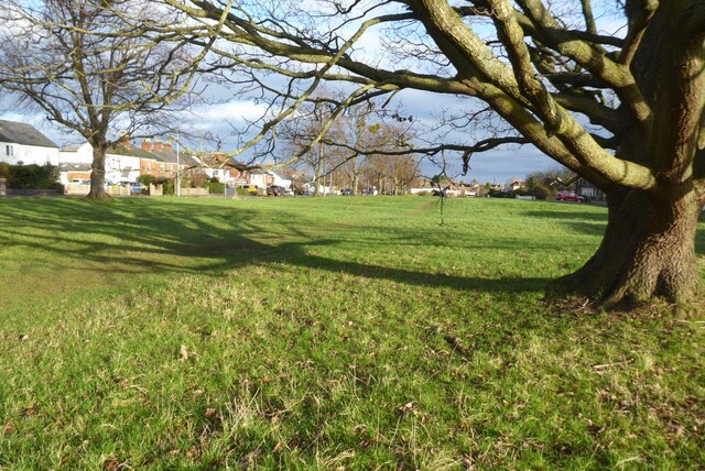
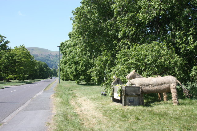
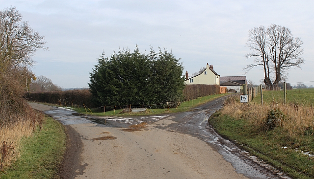
Jubilee Plantation is a picturesque woodland located in Worcestershire, England. Covering an area of approximately 100 hectares, it is situated within the wider Forest of Worcestershire. The plantation is named after the Jubilee of Queen Victoria in 1887, as it was established to commemorate this historic event.

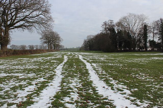
The woodland consists mainly of broadleaf trees such as oak, beech, and ash, creating a diverse and vibrant ecosystem. These tall, majestic trees provide a dense canopy that allows only dappled sunlight to filter through to the forest floor, creating a tranquil and shaded environment.

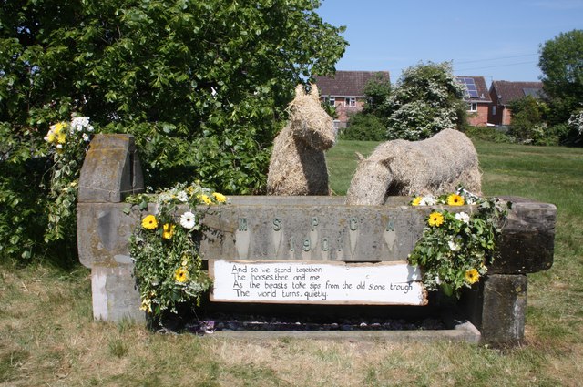
Jubilee Plantation is known for its rich biodiversity, hosting a wide range of wildlife species. Visitors may encounter various bird species, including woodpeckers, owls, and thrushes, as well as small mammals like squirrels and badgers. The woodland also supports a diverse array of plant life, with carpets of bluebells in the spring and ferns adorning the forest floor.

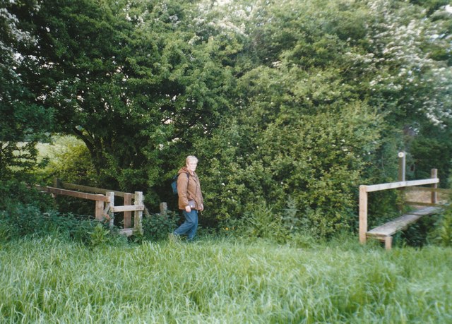
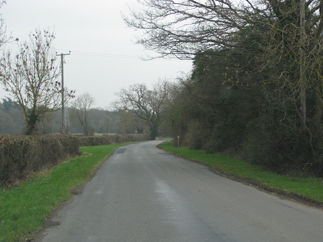
The plantation offers numerous walking trails, making it a popular destination for nature enthusiasts and hikers. These paths wind through the woodland, allowing visitors to immerse themselves in the natural beauty of the area. The peaceful atmosphere, coupled with the soothing sounds of chirping birds and rustling leaves, provides a serene escape from the hustle and bustle of everyday life.

Jubilee Plantation, Worcestershire, is not only a place of natural beauty but also serves as a vital habitat for wildlife, making it an essential part of the local ecosystem. Whether for a leisurely stroll or a deeper connection with nature, this woodland offers a captivating experience for all who visit.

If you have any feedback on the listing, please let us know in the comments section below.

Jubilee Plantation Images

Images are sourced within 2km of 52.097651/-2.2802923 or Grid Reference SO8044. Thanks to Geograph Open Source API. All images are credited.

Poolbrook in Malvern Mid-December and the trees at Poolbrook in Malvern are now bare.
Poolbrook in Malvern
Mid-December and the trees at Poolbrook in Malvern are now bare.
Footbridges at the junction of footpaths near Blackmore End
Minor road on the northern edge of Guarlford
Pylons cross the road near White House Farm
MSPCA trough - Well Dressing 2011 - Togetherness The trough, erected at the beginning of the 20th century by the Malvern Society for the Prevention of Cruelty to Animals as a memorial to the horses who suffered in the Boer War, has been decorated by a team led by Stephanie Underwood-Webb. 
Begun as a solo venture it soon became a community project and has been rewarded with a Gold Award.
"You aren't a proper couple until you understand everything the other hasn't said." 
The trough used to be located on the large oddly shaped traffic island in Barnards Green shopping area, but has been at this position, by the Guarlford straight for many decades.
Worcestershire Beacon is in the distance.
<a href="https://www.geograph.org.uk/photo/2395889">SO7945 : MSPCA trough - Well Dressing 2011 - Togetherness</a>
MSPCA trough - Well Dressing 2011 - Togetherness
The trough, erected at the beginning of the 20th century by the Malvern Society for the Prevention of Cruelty to Animals as a memorial to the horses who suffered in the Boer War, has been decorated by a team led by Stephanie Underwood-Webb. Begun as a solo venture it soon became a community project and has been rewarded with a Gold Award. "You aren't a proper couple until you understand everything the other hasn't said." The trough used to be located on the large oddly shaped traffic island in Barnards Green shopping area, but has been at this position, by the Guarlford straight for many decades. Worcestershire Beacon is in the distance. SO7945 : MSPCA trough - Well Dressing 2011 - Togetherness
MSPCA trough - Well Dressing 2011 - Togetherness The trough, erected at the beginning of the 20th century by the Malvern Society for the Prevention of Cruelty to Animals as a memorial to the horses who suffered in the Boer War, has been decorated by a team led by Stephanie Underwood-Webb. 
Begun as a solo venture it soon became a community project and has been rewarded with a Gold Award.

"And so we stand together,
The horses, thee and me,
As the beasts take sips from the old stone trough
The world turns, quietly."

<a href="https://www.geograph.org.uk/photo/2395867">SO7945 : MSPCA trough - Well Dressing 2011 - Togetherness</a>
MSPCA trough - Well Dressing 2011 - Togetherness
The trough, erected at the beginning of the 20th century by the Malvern Society for the Prevention of Cruelty to Animals as a memorial to the horses who suffered in the Boer War, has been decorated by a team led by Stephanie Underwood-Webb. Begun as a solo venture it soon became a community project and has been rewarded with a Gold Award. "And so we stand together, The horses, thee and me, As the beasts take sips from the old stone trough The world turns, quietly." SO7945 : MSPCA trough - Well Dressing 2011 - Togetherness
Housing development, Hanley Swan On the Welland road on what was a meadow between the school and the limit of residential land.
There will be 11 new homes for rent or "HomeBuy": 
4 three bedroomed houses, 3 two bedroomed houses, 
2 two bedroomed bungalows and 2 two bedroomed apartments.

Under the "HomeBuy" scheme the occupier initially buys between 25% and 75% of the house with the option of buying more shares in the house later.

<span class="nowrap"><a title="http://www.homebuy.org.uk/homebuy_schemes.html" rel="nofollow ugc noopener" href="http://www.homebuy.org.uk/homebuy_schemes.html">Link</a><img style="margin-left:2px;" alt="External link" title="External link - shift click to open in new window" src="https://s1.geograph.org.uk/img/external.png" width="10" height="10"/></span>

How the meadow looked in 2007:
<a href="https://www.geograph.org.uk/photo/446149">SO8142 : Horse Jumps in Meadow</a>
<a href="https://www.geograph.org.uk/photo/2595342">SO8142 : Building site (right), Hanley Swan</a>
<a href="https://www.geograph.org.uk/photo/2595324">SO8142 : Building site (left), Hanley Swan</a>
<a href="https://www.geograph.org.uk/photo/2595317">SO8142 : Building site (centre), Hanley Swan</a>
Housing development, Hanley Swan
On the Welland road on what was a meadow between the school and the limit of residential land. There will be 11 new homes for rent or "HomeBuy": 4 three bedroomed houses, 3 two bedroomed houses, 2 two bedroomed bungalows and 2 two bedroomed apartments. Under the "HomeBuy" scheme the occupier initially buys between 25% and 75% of the house with the option of buying more shares in the house later. LinkExternal link How the meadow looked in 2007: SO8142 : Horse Jumps in Meadow SO8142 : Building site (right), Hanley Swan SO8142 : Building site (left), Hanley Swan SO8142 : Building site (centre), Hanley Swan
Building site (centre), Hanley Swan On the Welland road on what was a meadow between the school and the limit of residential land.
How the meadow looked in 2007:
<a href="https://www.geograph.org.uk/photo/446149">SO8142 : Horse Jumps in Meadow</a>
<a href="https://www.geograph.org.uk/photo/2595342">SO8142 : Building site (right), Hanley Swan</a>
<a href="https://www.geograph.org.uk/photo/2595324">SO8142 : Building site (left), Hanley Swan</a>
<a href="https://www.geograph.org.uk/photo/2595302">SO8142 : Housing development, Hanley Swan</a>
Building site (centre), Hanley Swan
On the Welland road on what was a meadow between the school and the limit of residential land. How the meadow looked in 2007: SO8142 : Horse Jumps in Meadow SO8142 : Building site (right), Hanley Swan SO8142 : Building site (left), Hanley Swan SO8142 : Housing development, Hanley Swan
Building site (left), Hanley Swan On the Welland road on what was a meadow between the school and the limit of residential land.
<a href="https://www.geograph.org.uk/photo/2595342">SO8142 : Building site (right), Hanley Swan</a>
<a href="https://www.geograph.org.uk/photo/2595317">SO8142 : Building site (centre), Hanley Swan</a>
<a href="https://www.geograph.org.uk/photo/2595302">SO8142 : Housing development, Hanley Swan</a>
Building site (left), Hanley Swan
On the Welland road on what was a meadow between the school and the limit of residential land. SO8142 : Building site (right), Hanley Swan SO8142 : Building site (centre), Hanley Swan SO8142 : Housing development, Hanley Swan
Building site (right), Hanley Swan On the Welland road on what was a meadow between the school and the limit of residential land.
Note the photo-voltaic solar panels already fitted to the south facing roofs.
<a href="https://www.geograph.org.uk/photo/2595324">SO8142 : Building site (left), Hanley Swan</a>
<a href="https://www.geograph.org.uk/photo/2595317">SO8142 : Building site (centre), Hanley Swan</a>
<a href="https://www.geograph.org.uk/photo/2595302">SO8142 : Housing development, Hanley Swan</a>
Building site (right), Hanley Swan
On the Welland road on what was a meadow between the school and the limit of residential land. Note the photo-voltaic solar panels already fitted to the south facing roofs. SO8142 : Building site (left), Hanley Swan SO8142 : Building site (centre), Hanley Swan SO8142 : Housing development, Hanley Swan
Hanley Swan C of E primary school A Church of England "controlled" school on the Welland Road next to the village hall.
It was built around 1861 as a "school for the education of children and adults or children only of the Labouring, Manufacturing or other poorer classes."
In 1947 it became solely a primary school.
Notice how the older part of the school, with Malvern granite walls, looks just like a chapel - for indeed it was also used as a chapel of ease for the inhabitants of the Swan Green area (now called Hanley Swan) until St Gabriel's church was built.
Hanley Swan C of E primary school
A Church of England "controlled" school on the Welland Road next to the village hall. It was built around 1861 as a "school for the education of children and adults or children only of the Labouring, Manufacturing or other poorer classes." In 1947 it became solely a primary school. Notice how the older part of the school, with Malvern granite walls, looks just like a chapel - for indeed it was also used as a chapel of ease for the inhabitants of the Swan Green area (now called Hanley Swan) until St Gabriel's church was built.
The Swan Pool (village pond) at sunset
The Swan Inn at Hanley Swan Perhaps the title should be "the swan" as the signs use lower case only.  Hanley Swan has the traditional English village centre: a cross roads with a village green, overlooked by an inn in one corner; a village pond in the next corner; the post office and shop next, and houses in the fourth.  When I grew up here, I almost believed that every village should have this layout.
The Swan Inn at Hanley Swan
Perhaps the title should be "the swan" as the signs use lower case only. Hanley Swan has the traditional English village centre: a cross roads with a village green, overlooked by an inn in one corner; a village pond in the next corner; the post office and shop next, and houses in the fourth. When I grew up here, I almost believed that every village should have this layout.
A second oak tree on the village green The centre of the green is site for an oak planted in the 19th century.
A second oak tree on the village green
The centre of the green is site for an oak planted in the 19th century.
Old Barn, Guarlford A derelict building amongst an apple orchard with a good crop of mistletoe.
In the background is North Hill at the end of the granite Malvern Hills range with Great Malvern beneath.
The church spire to the left of centre is Holly Mount United Reformed Church.
The infill television transmitter is to the right of the picture.
This also transmits local radio and the structure is adorned with a plethora of aerials and microwave dishes.
Old Barn, Guarlford
A derelict building amongst an apple orchard with a good crop of mistletoe. In the background is North Hill at the end of the granite Malvern Hills range with Great Malvern beneath. The church spire to the left of centre is Holly Mount United Reformed Church. The infill television transmitter is to the right of the picture. This also transmits local radio and the structure is adorned with a plethora of aerials and microwave dishes.
Hangman's Lane - Green Lane junction Hangmans Lane forks to the left while the lane to the right becomes an unmetalled "green lane" after Broadacres Farm.
Hangman's Lane - Green Lane junction
Hangmans Lane forks to the left while the lane to the right becomes an unmetalled "green lane" after Broadacres Farm.
Snow field, Hanley Swan An interesting long narrow field with a stream on the right hand boundary.
Snow field, Hanley Swan
An interesting long narrow field with a stream on the right hand boundary.
Snow field, Hanley Swan An interesting long narrow field with a stream bordering its southern edge.
The Malvern Hills can be seen in the distance.
Snow field, Hanley Swan
An interesting long narrow field with a stream bordering its southern edge. The Malvern Hills can be seen in the distance.
Show me another place!

Jubilee Plantation is located at Grid Ref: SO8044 (Lat: 52.097651, Lng: -2.2802923)

Administrative County: Worcestershire

District: Malvern Hills

Police Authority: West Mercia

What 3 Words

///wand.fraction.pyramid. Near Great Malvern, Worcestershire

Related Wikis

Guarlford

Guarlford is a village and civil parish in the Malvern Hills district in the county of Worcestershire, England. The parish population was 261 in 2021.It...

British National Fencing Museum

The British National Fencing Museum is the national museum for Great Britain for the sport and martial art of fencing.The museum opened during the year...

Hanley Swan

Hanley Swan is a small village in the English county of Worcestershire. It lies in the Malvern Hills district, between the towns of Malvern (two miles...

Poolbrook

Poolbrook is a village and a suburb of Malvern, Worcestershire, England, situated approximately 1.5 miles (2.4 km) southeast of Great Malvern, the town...

The Chase School

The Chase School is a secondary school (ages 11–18) in Malvern, Worcestershire, England. The school opened as a Secondary Modern in 1953 under headteacher...

Malvern Hills Science Park

Malvern Hills Science Park is located on a 10 acre (4 Hectare) site in the Barnards Green suburb of Malvern, Worcestershire, England. It is a partnership...

Sherrard's Green

Sherrard's Green is a village and a suburb of Malvern, Worcestershire, England, situated approximately 1.5 miles (2.4 km) southeast of Great Malvern, the...

Barnards Green

Barnards Green is one of the main population areas of Malvern, Worcestershire, England, situated approximately 1 mile (1.6 km) east and downhill from Great...

Nearby Amenities

Located within 500m of 52.097651,-2.2802923
Access: no
Barrier: lift_gate
Bicycle: private
Foot: yes
Motor Vehicle: private
Lat/Long: 52.0957765/-2.2753754
Barrier: stile
Lat/Long: 52.1009814/-2.2771008
Barrier: stile
Lat/Long: 52.1000955/-2.2763277
Barrier: stile
Lat/Long: 52.0982816/-2.2747153
Post Box
Collection Times: Mo-Fr 16:30; Sa 09:30
Post Box Type: lamp
Ref: WR8 151
Royal Cypher: EIIR
Royal Cypher Wikidata: Q33102113
Source: GPS Survey
Lat/Long: 52.0946656/-2.274878
Bench
Lat/Long: 52.0986603/-2.275175
Location Transition: yes
Power: pole
Lat/Long: 52.0961946/-2.2739232
Power: pole
Lat/Long: 52.1014168/-2.2764292
Power: pole
Lat/Long: 52.1010215/-2.2770701
Blackmore Park No. 2
Power: transformer
Transformer: distribution
Voltage Primary: 11000
Lat/Long: 52.0964384/-2.2776615
Caravan Club Blackmore End
Power: transformer
Transformer: distribution
Voltage Primary: 11000
Lat/Long: 52.0963659/-2.2785124
Power: pole
Lat/Long: 52.0970489/-2.2740747
Power: pole
Lat/Long: 52.0977187/-2.2743402
Power: pole
Lat/Long: 52.0983465/-2.2746018
Power: pole
Lat/Long: 52.099027/-2.2752294
Power: pole
Lat/Long: 52.0996828/-2.2758329
Highfield Organic Farm - Trans
Power: pole
Transformer: distribution
Voltage Primary: 11000
Lat/Long: 52.1006219/-2.2802988
Power: pole
Lat/Long: 52.1005206/-2.279022
Power: pole
Lat/Long: 52.10043/-2.2777239
Power: pole
Lat/Long: 52.1003385/-2.2764297
Power: pole
Lat/Long: 52.1017201/-2.2778043
Power: pole
Lat/Long: 52.0947198/-2.2838607
Power: pole
Lat/Long: 52.0945884/-2.2832928
Blackmore House
Power: pole
Transformer: distribution
Voltage Primary: 11000
Lat/Long: 52.0944747/-2.2823647
Power: pole
Lat/Long: 52.0954765/-2.28407
Power: pole
Lat/Long: 52.0949002/-2.2847325
Power: pole
Lat/Long: 52.0963758/-2.2818987
Power: pole
Lat/Long: 52.0958461/-2.2836683
Power: pole
Lat/Long: 52.0961258/-2.282751
Power: pole
Lat/Long: 52.0972796/-2.2824077
Blackmore Cottages
Power: pole
Transformer: distribution
Voltage Primary: 11000
Lat/Long: 52.0973307/-2.2824472
The data included in this document is from www.openstreetmap.org. The data is made available under ODbL.

Have you been to Jubilee Plantation?

Leave your review of Jubilee Plantation below (or comments, questions and feedback).