Fairbroad Coppice

Wood, Forest in Wiltshire

England

Fairbroad Coppice

Old Milestone by Lodge Road, Horningsham Metal plate attached to stone post by the UC road, in parish of HORNINGSHAM (WEST WILTSHIRE District), Lodge Road; 150m South of Bath Arms, 50m South of bus shelter, by the road, on West side of road. Longleat iron plate erected by a private estate in the 18th century. 

Inscription reads:-
Longleat
Houſe
1 Mile

Grade II listed.
List Entry Number: 1364360 <span class="nowrap"><a title="https://historicengland.org.uk/listing/the-list/list-entry/1364360" rel="nofollow ugc noopener" href="https://historicengland.org.uk/listing/the-list/list-entry/1364360">Link</a><img style="margin-left:2px;" alt="External link" title="External link - shift click to open in new window" src="https://s1.geograph.org.uk/img/external.png" width="10" height="10"/></span>

Milestone Society National ID: WI_LL01S
Old Milestone by Lodge Road, Horningsham Credit: Spike Johnson

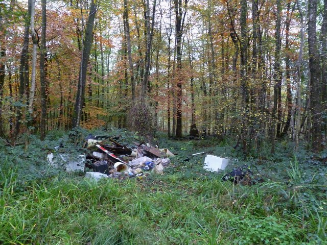
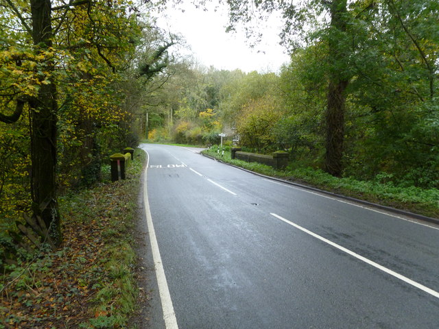
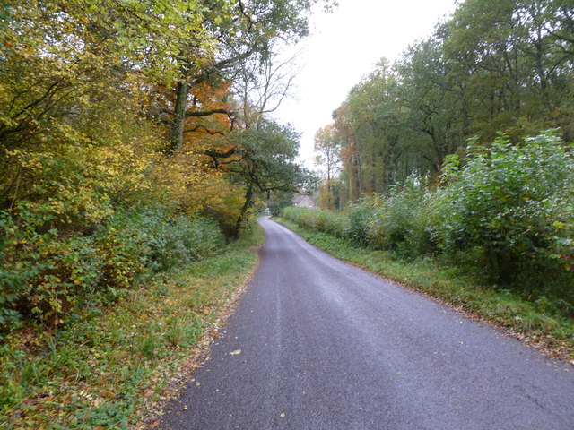
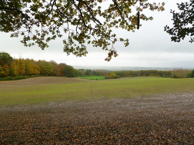
Fairbroad Coppice is a picturesque woodland located in the county of Wiltshire, England. Spanning over an area of approximately 500 acres, it is an enchanting retreat for nature enthusiasts and those seeking solace in the midst of a serene environment. The coppice is situated near the village of Fairbroad, which adds to its charm and accessibility.

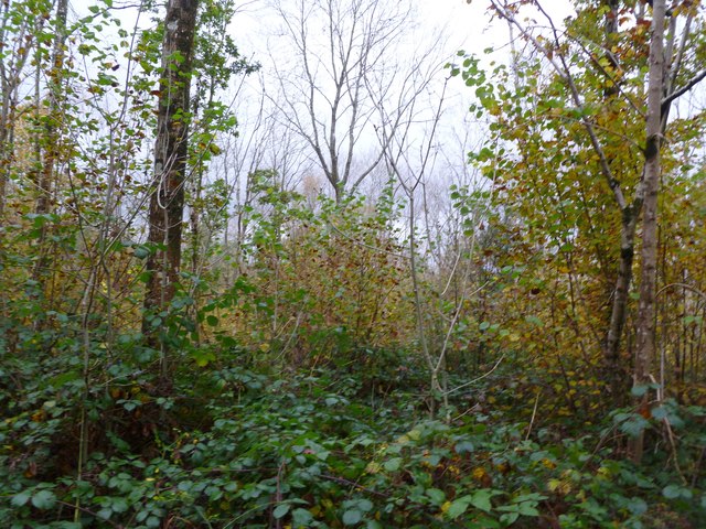
The woodland is predominantly composed of a mixture of deciduous trees, including oak, beech, and ash, forming a dense canopy that provides ample shade and shelter for a diverse range of flora and fauna. The forest floor is carpeted with a rich variety of wildflowers and ferns, creating a vibrant tapestry of colors during the spring and summer months.

Fairbroad Coppice is home to an abundance of wildlife, making it a haven for birdwatchers and animal enthusiasts. Visitors may spot various bird species, such as woodpeckers, owls, and thrushes, along with small mammals like squirrels, rabbits, and foxes. The woodland also supports a diverse insect population, including butterflies, bees, and beetles.

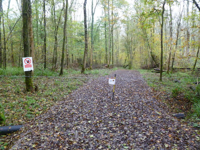
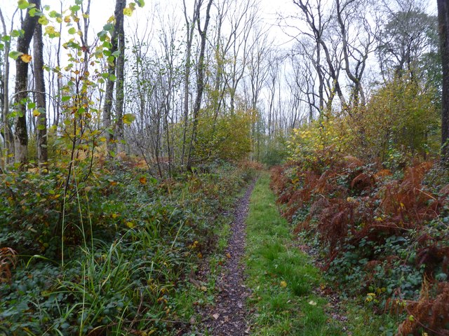
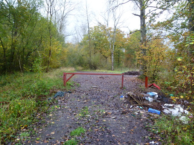
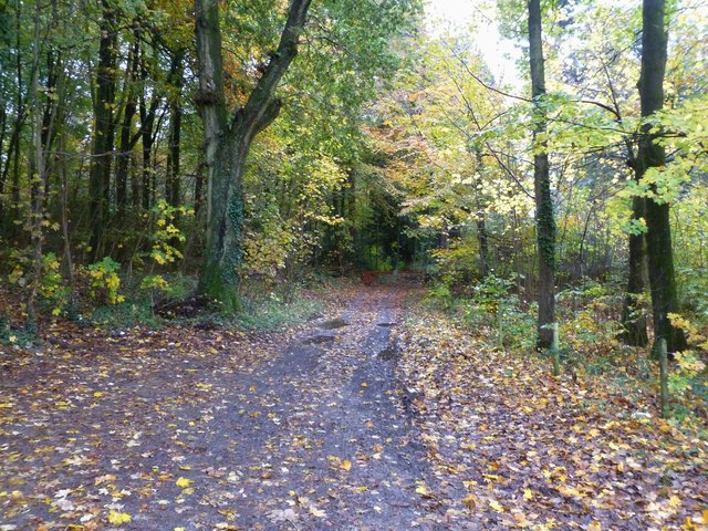
The coppice offers a network of well-maintained footpaths and trails, allowing visitors to explore its natural beauty at their own pace. These paths wind through ancient trees, alongside babbling brooks, and past peaceful ponds, providing a tranquil setting for leisurely walks or more energetic hikes.

Whether one seeks solitude, a connection with nature, or simply a break from the hustle and bustle of everyday life, Fairbroad Coppice offers a sanctuary of tranquility and natural beauty that is sure to captivate all who visit.

If you have any feedback on the listing, please let us know in the comments section below.

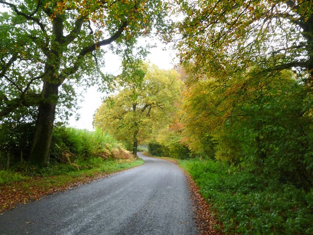
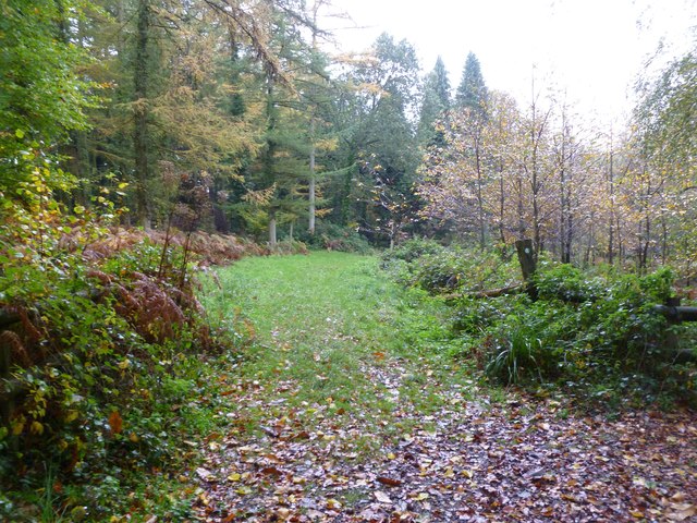
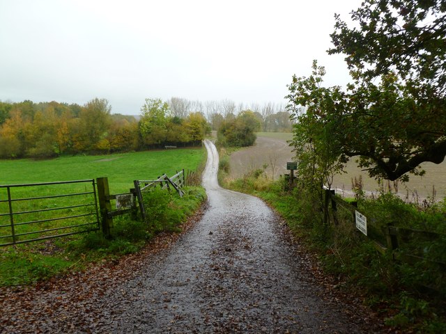
Fairbroad Coppice Images

Images are sourced within 2km of 51.176987/-2.2922353 or Grid Reference ST7942. Thanks to Geograph Open Source API. All images are credited.

Old Milestone by Lodge Road, Horningsham Metal plate attached to stone post by the UC road, in parish of HORNINGSHAM (WEST WILTSHIRE District), Lodge Road; 150m South of Bath Arms, 50m South of bus shelter, by the road, on West side of road. Longleat iron plate erected by a private estate in the 18th century. 

Inscription reads:-
Longleat
Houſe
1 Mile

Grade II listed.
List Entry Number: 1364360 <span class="nowrap"><a title="https://historicengland.org.uk/listing/the-list/list-entry/1364360" rel="nofollow ugc noopener" href="https://historicengland.org.uk/listing/the-list/list-entry/1364360">Link</a><img style="margin-left:2px;" alt="External link" title="External link - shift click to open in new window" src="https://s1.geograph.org.uk/img/external.png" width="10" height="10"/></span>

Milestone Society National ID: WI_LL01S
Old Milestone by Lodge Road, Horningsham
Metal plate attached to stone post by the UC road, in parish of HORNINGSHAM (WEST WILTSHIRE District), Lodge Road; 150m South of Bath Arms, 50m South of bus shelter, by the road, on West side of road. Longleat iron plate erected by a private estate in the 18th century. Inscription reads:- Longleat Houſe 1 Mile Grade II listed. List Entry Number: 1364360 LinkExternal link Milestone Society National ID: WI_LL01S
Gardens between Orangery and Longleat House
Longleat House and gardens The view of the house from the Orangery , now a tea and coffee shop.
Longleat House and gardens
The view of the house from the Orangery , now a tea and coffee shop.
Longleat House Looking down the drive at Longleat with fresh cut hay along the drive.
Longleat House
Looking down the drive at Longleat with fresh cut hay along the drive.
Gare Hill, woodland Beech trees in Marston Wood, showing good autumn colour.
Gare Hill, woodland
Beech trees in Marston Wood, showing good autumn colour.
Gare Hill, fly-tipping A sad sight amongst the beech trees of Marston Wood.
Gare Hill, fly-tipping
A sad sight amongst the beech trees of Marston Wood.
Gare Hill, forestry track With Marston Wood, left, and Ridge Copse, right.
Gare Hill, forestry track
With Marston Wood, left, and Ridge Copse, right.
Gare Hill, Honey Pot Lane Restricted byway from Gare Hill to County Bridge, with young ash trees to the left. The lane also forms the boundary between Somerset, left, and Wiltshire, right.
Gare Hill, Honey Pot Lane
Restricted byway from Gare Hill to County Bridge, with young ash trees to the left. The lane also forms the boundary between Somerset, left, and Wiltshire, right.
Gare Hill, woodland Bare young ash, with autumn-coloured hazel in the under-storey.
Gare Hill, woodland
Bare young ash, with autumn-coloured hazel in the under-storey.
Maiden Bradley, gate At the northern end of Honey Pot Lane. The lane forms the boundary between Wiltshire, left, and Somerset, right. Note the fly-tipping.
Maiden Bradley, gate
At the northern end of Honey Pot Lane. The lane forms the boundary between Wiltshire, left, and Somerset, right. Note the fly-tipping.
Maiden Bradley, County Bridge Across a stream on Frome Road (B3092); on the far side, Somerset, on this, Wiltshire. The boundary is marked mid-bridge by an iron post.
Maiden Bradley, County Bridge
Across a stream on Frome Road (B3092); on the far side, Somerset, on this, Wiltshire. The boundary is marked mid-bridge by an iron post.
Maiden Bradley, Forest Road From Horningsham to County Bridge (B3092); Little Bradley Wood to the left, Gully Copse, right.
Maiden Bradley, Forest Road
From Horningsham to County Bridge (B3092); Little Bradley Wood to the left, Gully Copse, right.
Horningsham, autumn colours Provided by beech trees on Forest Road.
Horningsham, autumn colours
Provided by beech trees on Forest Road.
Horningsham, permissive footpath Through Little Bradley Wood, on the Duke of Somerset's Estate.
Horningsham, permissive footpath
Through Little Bradley Wood, on the Duke of Somerset's Estate.
Horningsham, farm entrance To Woodhead Farm, off Forest Road.
Horningsham, farm entrance
To Woodhead Farm, off Forest Road.
Horningsham, forestry track Into Little Bradley Wood.
Horningsham, forestry track
Into Little Bradley Wood.
Horningsham, arable land A young crop off Forest Road.  The field is full of countless pheasants, some of which can be seen as light spots.
Horningsham, arable land
A young crop off Forest Road. The field is full of countless pheasants, some of which can be seen as light spots.
Horningsham, Cock Road Approaching the village from County Bridge.
Horningsham, Cock Road
Approaching the village from County Bridge.
Show me another place!

Fairbroad Coppice is located at Grid Ref: ST7942 (Lat: 51.176987, Lng: -2.2922353)

Unitary Authority: Wiltshire

Police Authority: Wiltshire

What 3 Words

///yards.intervene.strategy. Near Corsley, Wiltshire

Related Wikis

Bradley Woods

Bradley Woods (grid reference ST789410) is an area of woodland in Wiltshire, south of Longleat Woods and north of Gare Hill. A 48.7 hectare area within...

Horningsham

Horningsham is a small village and civil parish in Wiltshire, England, on the county border with Somerset. The village lies about 4 miles (6 km) southwest...

Longleat Woods

Longleat Woods (grid reference ST795435) is a 249.9 hectare (617.4 acre) biological Site of Special Scientific Interest south of Frome in Somerset, notified...
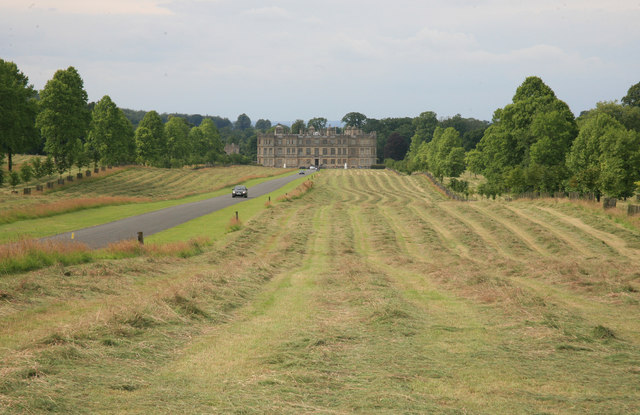
Longleat

Longleat is a stately home about 4 miles (7 km) west of Warminster in Wiltshire, England. A leading and early example of the Elizabethan prodigy house...

Nearby Amenities

Located within 500m of 51.176987,-2.2922353
The data included in this document is from www.openstreetmap.org. The data is made available under ODbL.

Have you been to Fairbroad Coppice?

Leave your review of Fairbroad Coppice below (or comments, questions and feedback).