Ardingly

Settlement in Sussex Mid Sussex

England

Ardingly

Bridleway 42 Ar This, together with its continuation 33Ba, follows the east side of Ardingly Reservoir.
Bridleway 42 Ar Credit: Robin Webster

Ardingly is a village located in the county of West Sussex, England. Situated approximately 12 miles north of the city of Brighton and Hove, Ardingly is a picturesque and quintessentially English village set in the beautiful countryside of the High Weald Area of Outstanding Natural Beauty.

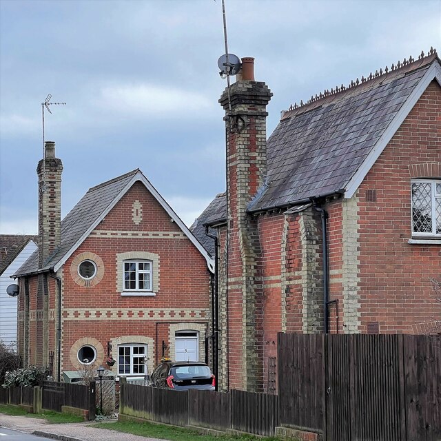
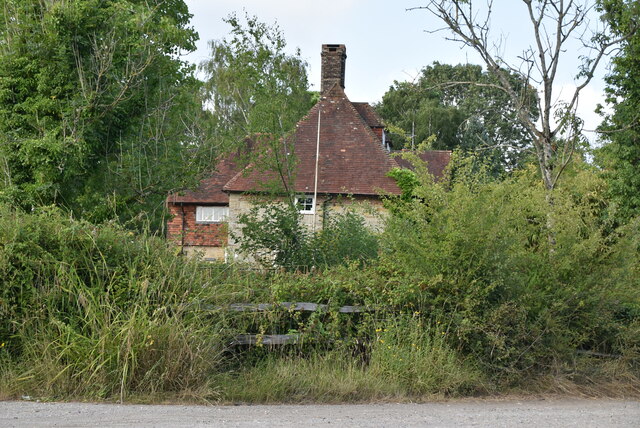
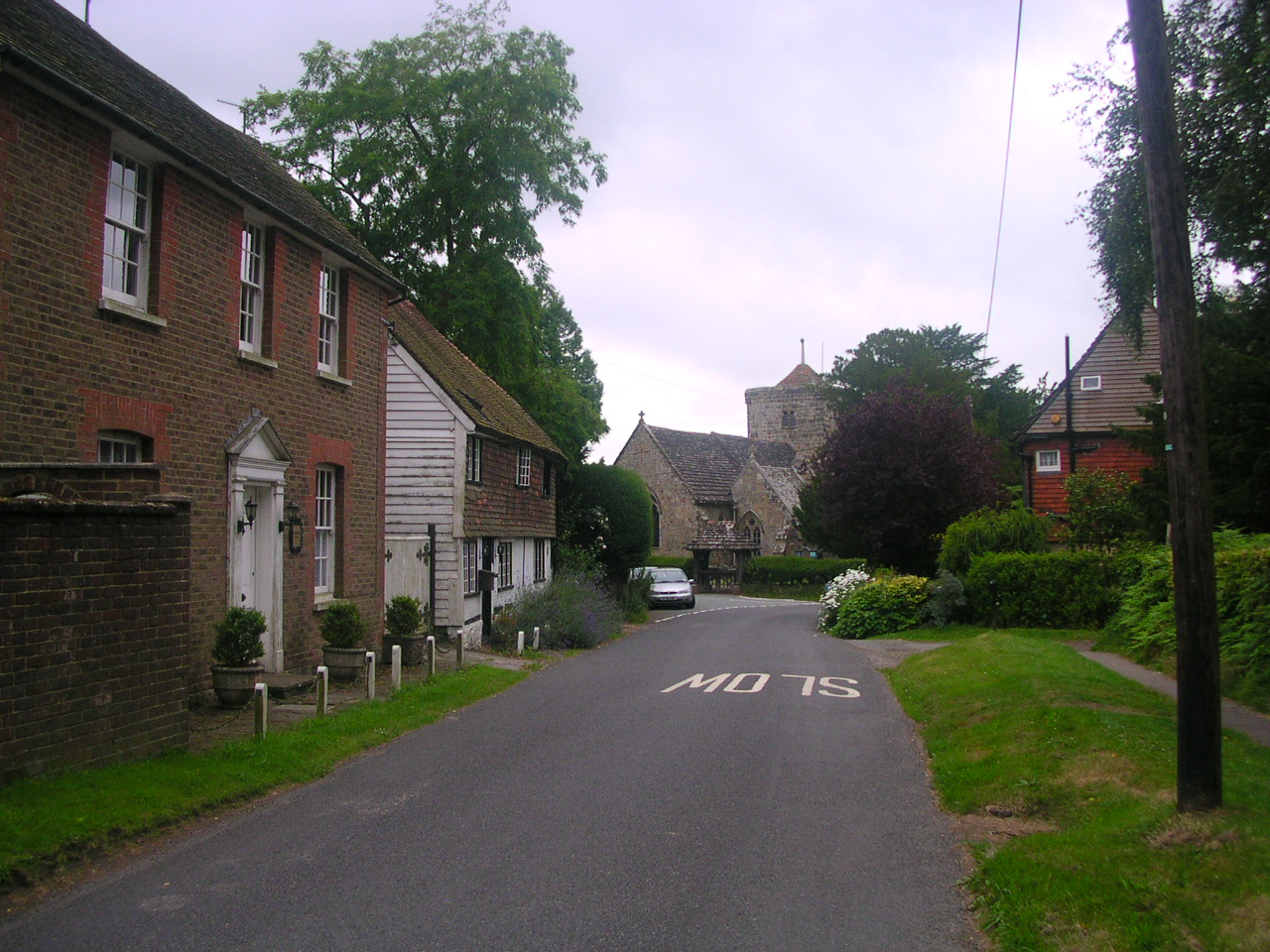
The village is known for its historic charm, with many of its buildings dating back to the 16th and 17th centuries. The centerpiece of Ardingly is its village square, which is surrounded by traditional cottages, a historic church, and a quaint village pub serving local ales and hearty British cuisine.

Ardingly is perhaps most famous for being home to Ardingly College, a prestigious co-educational boarding and day school founded in 1858. The college boasts stunning grounds and a rich architectural heritage, adding to the village's overall charm.

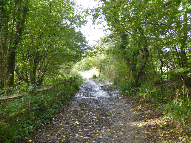
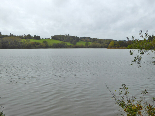
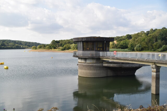
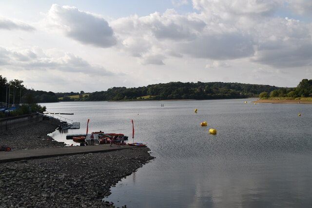
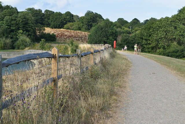
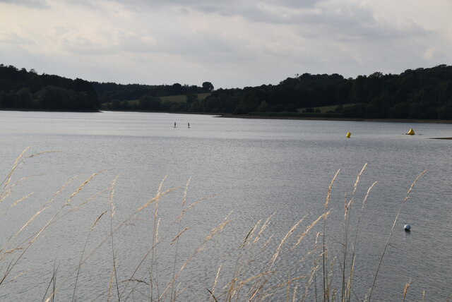
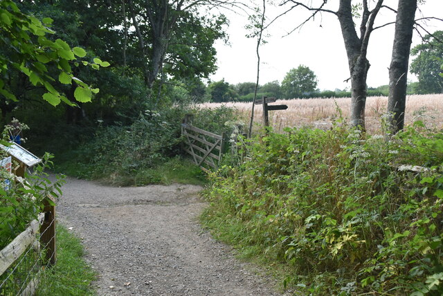
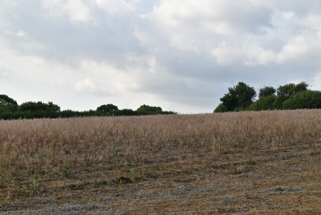
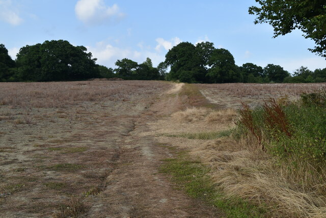
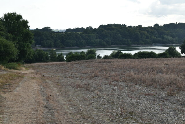
Nature lovers will be delighted to explore the nearby Ardingly Reservoir, a large body of water surrounded by woodlands and meadows, which offers a variety of outdoor activities such as fishing, sailing, and birdwatching. The reservoir is also a popular spot for picnics and leisurely walks.

The village hosts various events throughout the year, including the Ardingly Arts and Crafts Festival, showcasing local artists and craftsmen, and the Ardingly Agricultural Show, a traditional agricultural fair that attracts visitors from far and wide.

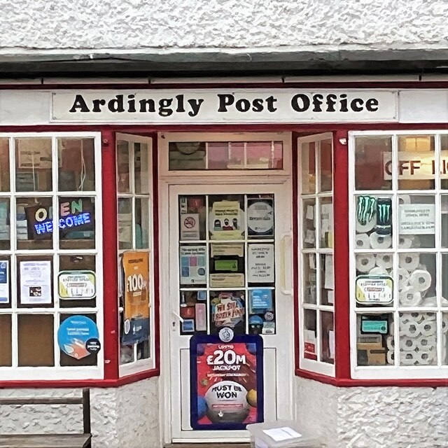
Overall, Ardingly is a delightful village that combines history, natural beauty, and a sense of community, making it a charming place to visit or call home in the heart of Sussex.

If you have any feedback on the listing, please let us know in the comments section below.

Ardingly Images

Images are sourced within 2km of 51.048433/-0.078074 or Grid Reference TQ3429. Thanks to Geograph Open Source API. All images are credited.

Bridleway 42 Ar This, together with its continuation 33Ba, follows the east side of Ardingly Reservoir.
Bridleway 42 Ar
This, together with its continuation 33Ba, follows the east side of Ardingly Reservoir.
Ardingly Reservoir
Ardingly Reservoir
Field near Townhouse Farm Looking up from the path by Ardingly Reservoir.
Field near Townhouse Farm
Looking up from the path by Ardingly Reservoir.
Ardingly Reservoir - from the dam
Houses on High Street
Ardingly Post Office
Saucelands Pond Ardingly College is beyond.
Saucelands Pond
Ardingly College is beyond.
Ardingly Reservoir overflow tower Ardingly Reservoir is a 198-acre (0.80 km2) reservoir that feeds the River Ouse in West Sussex, 5 miles (8 km) north of Haywards Heath. The villages of Ardingly and Balcombe are immediately to the east and north of the reservoir respectively. The reservoir was created in 1978 by damming Shell Brook, a tributary of the River Ouse which flows into the Ouse about 500m south of the Reservoir.

The Ardingly Activity Centre provides watersports for the public including wind surfing, canoeing, powerboating and dinghy sailing.

The reservoir is a popular fishing venue offering 3 miles (5 km) of freshwater fishing for carp, tench, pike, roach, rudd, eel, gudgeon, European perch and bream.

The west bank of the reservoir is private property of the Balcombe Estate but the north, south and east shores offer public rights of way and bridleways. Ornithologists are catered for with two bird hides situated on the east bank.

The site is a local Nature Reserve <span class="nowrap"><a title="http://en.wikipedia.org/wiki/Ardingly_Reservoir" rel="nofollow ugc noopener" href="http://en.wikipedia.org/wiki/Ardingly_Reservoir">Link</a><img style="margin-left:2px;" alt="External link" title="External link - shift click to open in new window" src="https://s1.geograph.org.uk/img/external.png" width="10" height="10"/></span>
Ardingly Reservoir overflow tower
Ardingly Reservoir is a 198-acre (0.80 km2) reservoir that feeds the River Ouse in West Sussex, 5 miles (8 km) north of Haywards Heath. The villages of Ardingly and Balcombe are immediately to the east and north of the reservoir respectively. The reservoir was created in 1978 by damming Shell Brook, a tributary of the River Ouse which flows into the Ouse about 500m south of the Reservoir. The Ardingly Activity Centre provides watersports for the public including wind surfing, canoeing, powerboating and dinghy sailing. The reservoir is a popular fishing venue offering 3 miles (5 km) of freshwater fishing for carp, tench, pike, roach, rudd, eel, gudgeon, European perch and bream. The west bank of the reservoir is private property of the Balcombe Estate but the north, south and east shores offer public rights of way and bridleways. Ornithologists are catered for with two bird hides situated on the east bank. The site is a local Nature Reserve LinkExternal link
Ardingly Reservoir Ardingly Reservoir is a 198-acre (0.80 km2) reservoir that feeds the River Ouse in West Sussex, 5 miles (8 km) north of Haywards Heath. The villages of Ardingly and Balcombe are immediately to the east and north of the reservoir respectively. The reservoir was created in 1978 by damming Shell Brook, a tributary of the River Ouse which flows into the Ouse about 500m south of the Reservoir.

The Ardingly Activity Centre provides watersports for the public including wind surfing, canoeing, powerboating and dinghy sailing.

The reservoir is a popular fishing venue offering 3 miles (5 km) of freshwater fishing for carp, tench, pike, roach, rudd, eel, gudgeon, European perch and bream.

The west bank of the reservoir is private property of the Balcombe Estate but the north, south and east shores offer public rights of way and bridleways. Ornithologists are catered for with two bird hides situated on the east bank.

The site is a local Nature Reserve <span class="nowrap"><a title="http://en.wikipedia.org/wiki/Ardingly_Reservoir" rel="nofollow ugc noopener" href="http://en.wikipedia.org/wiki/Ardingly_Reservoir">Link</a><img style="margin-left:2px;" alt="External link" title="External link - shift click to open in new window" src="https://s1.geograph.org.uk/img/external.png" width="10" height="10"/></span>
Ardingly Reservoir
Ardingly Reservoir is a 198-acre (0.80 km2) reservoir that feeds the River Ouse in West Sussex, 5 miles (8 km) north of Haywards Heath. The villages of Ardingly and Balcombe are immediately to the east and north of the reservoir respectively. The reservoir was created in 1978 by damming Shell Brook, a tributary of the River Ouse which flows into the Ouse about 500m south of the Reservoir. The Ardingly Activity Centre provides watersports for the public including wind surfing, canoeing, powerboating and dinghy sailing. The reservoir is a popular fishing venue offering 3 miles (5 km) of freshwater fishing for carp, tench, pike, roach, rudd, eel, gudgeon, European perch and bream. The west bank of the reservoir is private property of the Balcombe Estate but the north, south and east shores offer public rights of way and bridleways. Ornithologists are catered for with two bird hides situated on the east bank. The site is a local Nature Reserve LinkExternal link
Ardingly Reservoir Dam
Ardingly Reservoir Ardingly Reservoir is a 198-acre (0.80 km2) reservoir that feeds the River Ouse in West Sussex, 5 miles (8 km) north of Haywards Heath. The villages of Ardingly and Balcombe are immediately to the east and north of the reservoir respectively. The reservoir was created in 1978 by damming Shell Brook, a tributary of the River Ouse which flows into the Ouse about 500m south of the Reservoir.

The Ardingly Activity Centre provides watersports for the public including wind surfing, canoeing, powerboating and dinghy sailing.

The reservoir is a popular fishing venue offering 3 miles (5 km) of freshwater fishing for carp, tench, pike, roach, rudd, eel, gudgeon, European perch and bream.

The west bank of the reservoir is private property of the Balcombe Estate but the north, south and east shores offer public rights of way and bridleways. Ornithologists are catered for with two bird hides situated on the east bank.

The site is a local Nature Reserve <span class="nowrap"><a title="http://en.wikipedia.org/wiki/Ardingly_Reservoir" rel="nofollow ugc noopener" href="http://en.wikipedia.org/wiki/Ardingly_Reservoir">Link</a><img style="margin-left:2px;" alt="External link" title="External link - shift click to open in new window" src="https://s1.geograph.org.uk/img/external.png" width="10" height="10"/></span>
Ardingly Reservoir
Ardingly Reservoir is a 198-acre (0.80 km2) reservoir that feeds the River Ouse in West Sussex, 5 miles (8 km) north of Haywards Heath. The villages of Ardingly and Balcombe are immediately to the east and north of the reservoir respectively. The reservoir was created in 1978 by damming Shell Brook, a tributary of the River Ouse which flows into the Ouse about 500m south of the Reservoir. The Ardingly Activity Centre provides watersports for the public including wind surfing, canoeing, powerboating and dinghy sailing. The reservoir is a popular fishing venue offering 3 miles (5 km) of freshwater fishing for carp, tench, pike, roach, rudd, eel, gudgeon, European perch and bream. The west bank of the reservoir is private property of the Balcombe Estate but the north, south and east shores offer public rights of way and bridleways. Ornithologists are catered for with two bird hides situated on the east bank. The site is a local Nature Reserve LinkExternal link
Footpath, Ardingly Reservoir
Footpath waymarker
Footpath waymarker
Field by Ardingly Reservoir
Footpath to Ardingly
Ardingly Reservoir Ardingly Reservoir is a 198-acre (0.80 km2) reservoir that feeds the River Ouse in West Sussex, 5 miles (8 km) north of Haywards Heath. The villages of Ardingly and Balcombe are immediately to the east and north of the reservoir respectively. The reservoir was created in 1978 by damming Shell Brook, a tributary of the River Ouse which flows into the Ouse about 500m south of the Reservoir.

The Ardingly Activity Centre provides watersports for the public including wind surfing, canoeing, powerboating and dinghy sailing.

The reservoir is a popular fishing venue offering 3 miles (5 km) of freshwater fishing for carp, tench, pike, roach, rudd, eel, gudgeon, European perch and bream.

The west bank of the reservoir is private property of the Balcombe Estate but the north, south and east shores offer public rights of way and bridleways. Ornithologists are catered for with two bird hides situated on the east bank.

The site is a local Nature Reserve <span class="nowrap"><a title="http://en.wikipedia.org/wiki/Ardingly_Reservoir" rel="nofollow ugc noopener" href="http://en.wikipedia.org/wiki/Ardingly_Reservoir">Link</a><img style="margin-left:2px;" alt="External link" title="External link - shift click to open in new window" src="https://s1.geograph.org.uk/img/external.png" width="10" height="10"/></span>
Ardingly Reservoir
Ardingly Reservoir is a 198-acre (0.80 km2) reservoir that feeds the River Ouse in West Sussex, 5 miles (8 km) north of Haywards Heath. The villages of Ardingly and Balcombe are immediately to the east and north of the reservoir respectively. The reservoir was created in 1978 by damming Shell Brook, a tributary of the River Ouse which flows into the Ouse about 500m south of the Reservoir. The Ardingly Activity Centre provides watersports for the public including wind surfing, canoeing, powerboating and dinghy sailing. The reservoir is a popular fishing venue offering 3 miles (5 km) of freshwater fishing for carp, tench, pike, roach, rudd, eel, gudgeon, European perch and bream. The west bank of the reservoir is private property of the Balcombe Estate but the north, south and east shores offer public rights of way and bridleways. Ornithologists are catered for with two bird hides situated on the east bank. The site is a local Nature Reserve LinkExternal link
Townhouse Farmhouse
Townhouse Farmhouse
Track to Ardingly
Track to Ardingly
Show me another place!

Ardingly is located at Grid Ref: TQ3429 (Lat: 51.048433, Lng: -0.078074)

Administrative County: West Sussex

District: Mid Sussex

Police Authority: Sussex

What 3 Words

///blunders.doses.episode. Near Ardingly, West Sussex

Related Wikis

Ardingly

Ardingly ( AR-ding-lye) is an English village and civil parish in the Mid Sussex district of West Sussex, England. The village is in the High Weald Area...

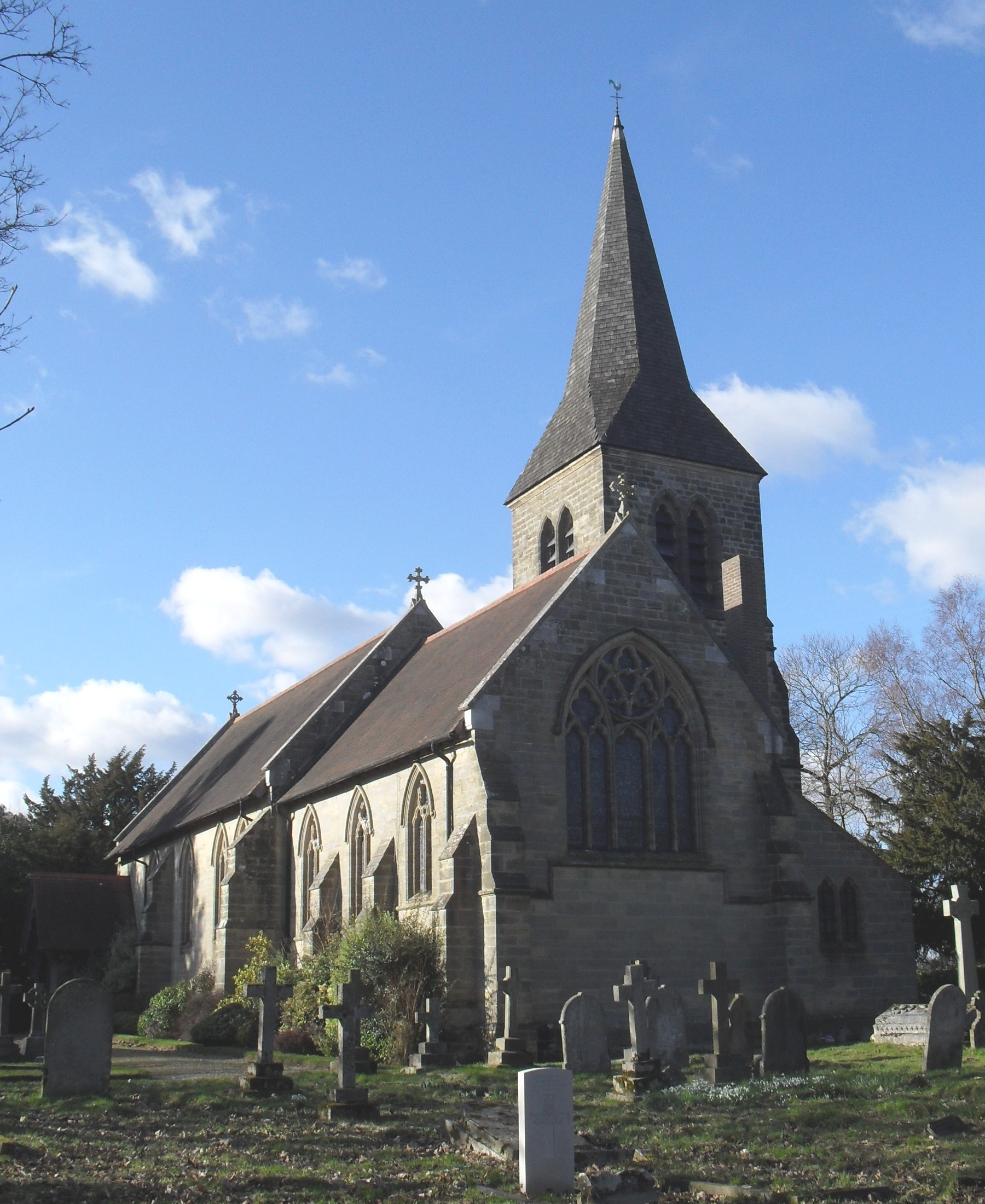
St Peter's Church, Ardingly

St Peter's Church is the Church of England parish church of the parish of Ardingly in Mid Sussex, one of seven local government districts in the English...

South of England Show

The South of England Show is a county show held annually at its own showground in Ardingly, Sussex during June.The show was founded in 1967 and is organised...

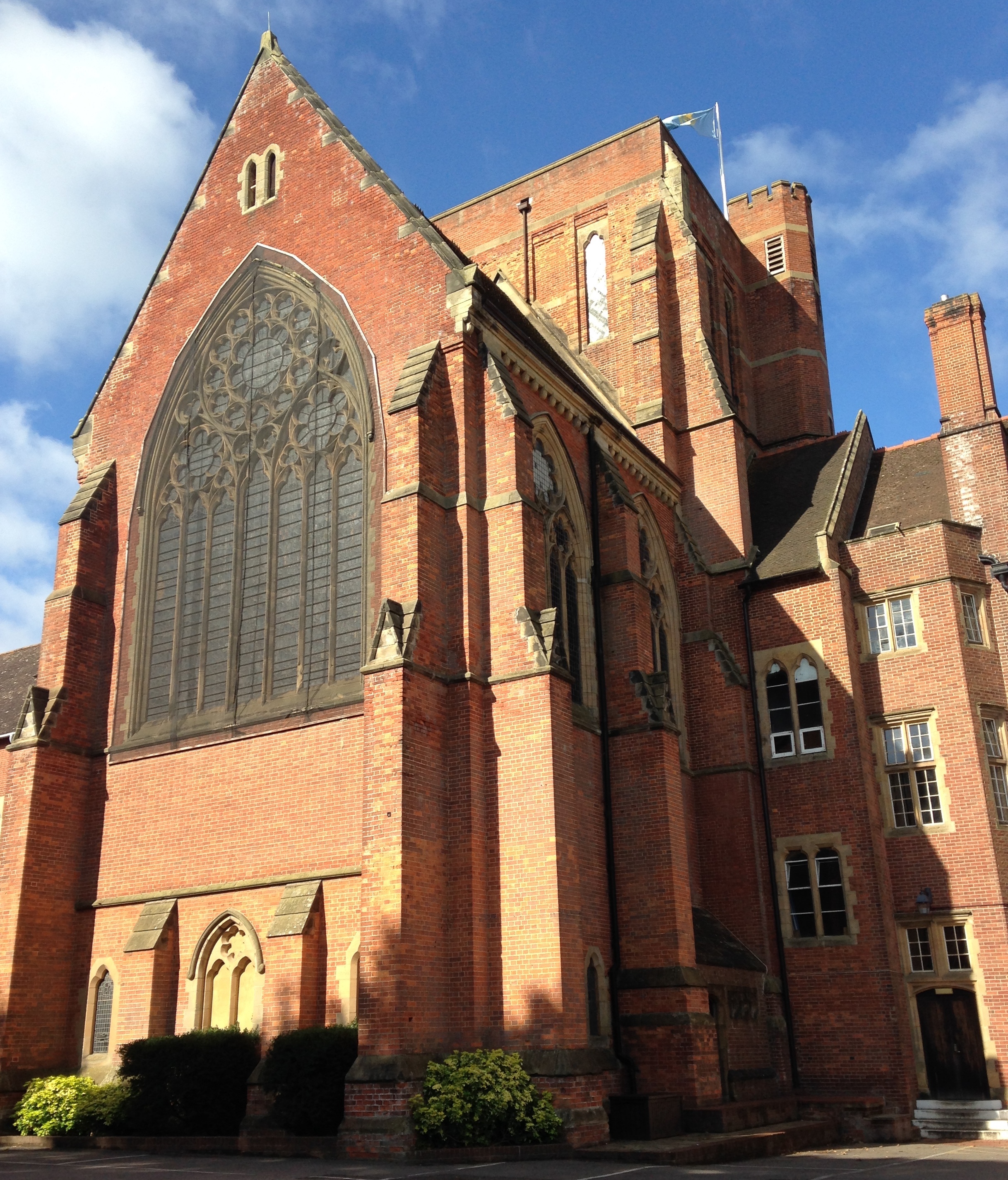
Ardingly College Chapel

The Chapel of S. Saviour is the chapel to Ardingly College in West Sussex, England, and is considered an example of Gothic Revival architecture. The chapel...

Ardingly College

Ardingly College () is a fee-charging boarding and day school in the English public school tradition located near Ardingly, West Sussex, England. The school...

All Saints Church, Highbrook

All Saints Church is an Anglican church in the hamlet of Highbrook in Mid Sussex, one of seven local government districts in the English county of West...
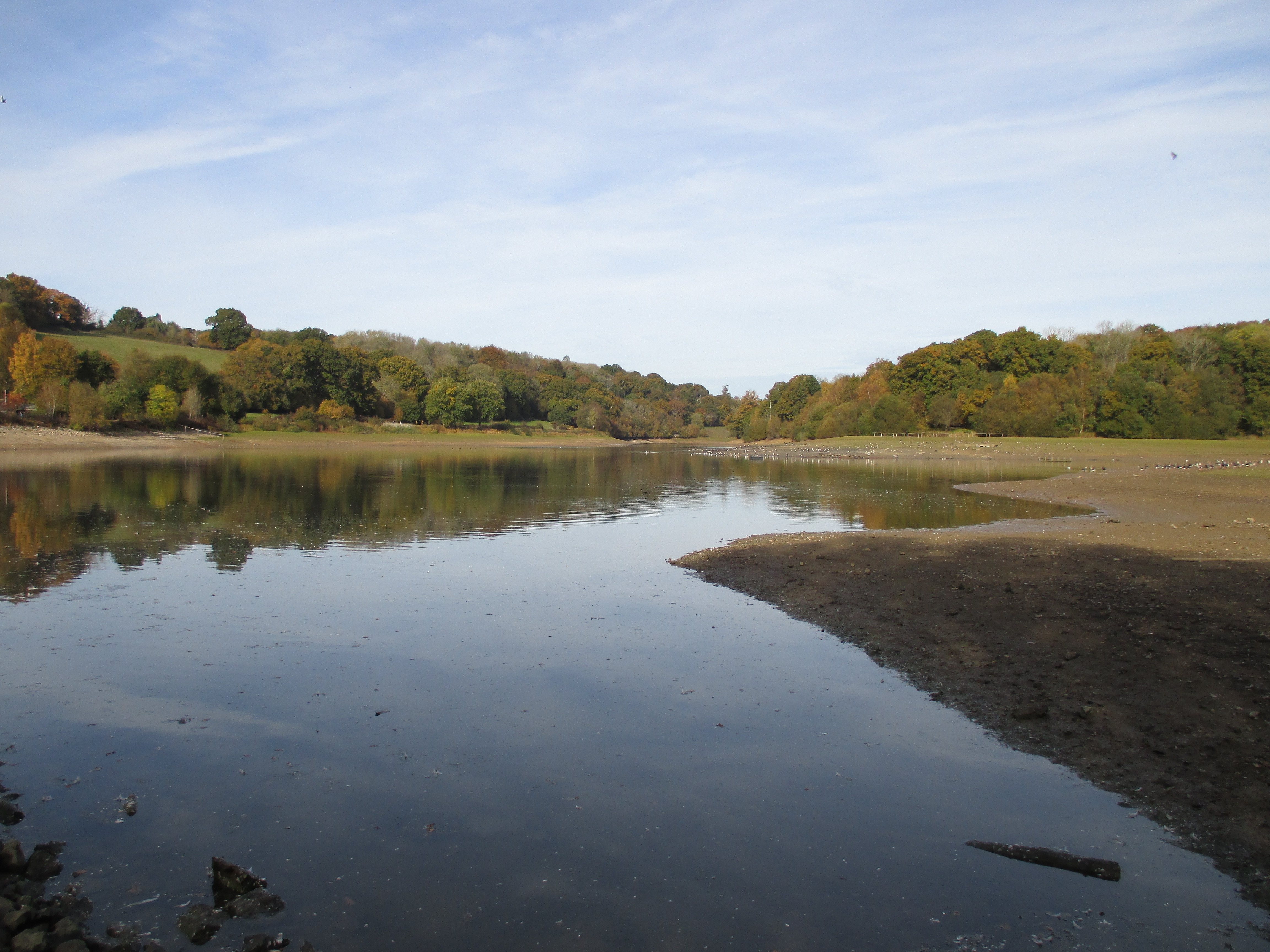
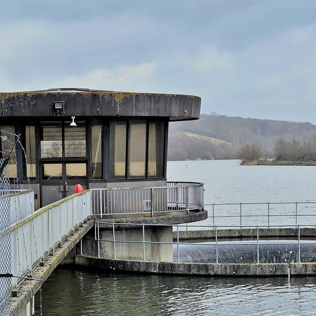
Ardingly Reservoir

Ardingly Reservoir is west of Ardingly in West Sussex. The southern end is a 74.5-hectare (184-acre) Local Nature Reserve owned and managed by South East...

Ardingly railway station

Ardingly was a railway station which served the West Sussex village of Ardingly in England. It was opened on 3 September 1883 by the London, Brighton and...

Nearby Amenities

Located within 500m of 51.048433,-0.078074
Mini Roundabout
Direction: clockwise
Lat/Long: 51.0500928/-0.0798495
Post Box
Collection Times: Mo-Fr 09:00; Sa 07:00
Operator: Royal Mail
Post Box Type: wall
Ref: RH17 83D
Royal Cypher: EIIR
Royal Cypher Wikidata: Q33102113
Lat/Long: 51.0447009/-0.0815083
Barrier: stile
Lat/Long: 51.0509526/-0.0745402
Bus Stop
Hapstead Hall
Bus: yes
Naptan AtcoCode: 4400EG0148
Naptan Bearing: SE
Naptan CommonName: Hapstead Hall
Naptan Indicator: opp Swinbrook House
Naptan Landmark: The Street
Naptan NaptanCode: wsxamwtm
Naptan Street: Lindfield Road
Naptan Verified: no
Public Transport: platform
Source: naptan_import
Lat/Long: 51.048325/-0.0777622
Bus Stop
Hapstead Hall
Bench: no
Bus: yes
Naptan AtcoCode: 4400EG0165
Naptan Bearing: N
Naptan BusStopType: CUS
Naptan CommonName: Hapstead Hall
Naptan Indicator: outside Hapstead Hall
Naptan Landmark: Street Lane
Naptan NaptanCode: wsxapaja
Naptan Street: High Street
Naptan Verified: yes
Public Transport: platform
Shelter: no
Source: naptan_import
Lat/Long: 51.0489184/-0.0783897
Selsfield Road B2028
Naptan AtcoCode: 4400EG0399
Naptan Bearing: S
Naptan BusStopType: CUS
Naptan CommonName: Selsfield Road B2028
Naptan Indicator: HAR
Naptan Landmark: Hail & Ride
Naptan NaptanCode: wsxdwtdw
Naptan Street: Selsfield Road B2028
Naptan Verified: no
Source: naptan_import
Lat/Long: 51.052493/-0.0798068
Selsfield Road B2028
Naptan AtcoCode: 4400EG0400
Naptan Bearing: N
Naptan BusStopType: CUS
Naptan CommonName: Selsfield Road B2028
Naptan Indicator: HAR
Naptan Landmark: Hail & Ride
Naptan NaptanCode: wsxdwtga
Naptan Street: Selsfield Road B2028
Naptan Verified: no
Source: naptan_import
Lat/Long: 51.0524698/-0.0800361
Bus Stop
Hett Close
Bus: yes
Naptan AtcoCode: 4400EG0460
Naptan Bearing: N
Naptan CommonName: Hett Close
Naptan Indicator: opp
Naptan Landmark: Hett Close
Naptan Street: High Street
Naptan Verified: yes
Public Transport: platform
Source: naptan_import
Lat/Long: 51.0514867/-0.0794785
Bus Stop
Hett Close
Bench: no
Bus: yes
Naptan AtcoCode: 4400EG0461
Naptan Bearing: S
Naptan CommonName: Hett Close
Naptan Indicator: Adj
Naptan Landmark: Hett Close
Naptan Street: High Street
Naptan Verified: yes
Public Transport: platform
Shelter: no
Source: naptan_import
Lat/Long: 51.0513565/-0.0792384
Barrier: stile
Lat/Long: 51.0461005/-0.0775609
Post Office
Ardingly Post Office
Source: OS_OpenData_StreetView
Lat/Long: 51.0498925/-0.0787762
Barrier: stile
Lat/Long: 51.0501913/-0.0766374
Barrier: stile
Lat/Long: 51.0508899/-0.0733242
Bench
Backrest: yes
Seats: 2
Lat/Long: 51.0488334/-0.078472
Post Box
Brand: Royal Mail
Brand Wikidata: Q638098
Brand Wikipedia: en:Royal Mail
Collection Times: Mo-Fr 17:00; Sa 09:15
Operator: Royal Mail
Operator Wikidata: Q638098
Post Box Type: pillar
Ref: RH17 107
Royal Cypher: GR
Royal Cypher Wikidata: Q33102273
Lat/Long: 51.0498582/-0.0786362
Defibrillator
Emergency: defibrillator
Lat/Long: 51.0488747/-0.0784344
Barrier: kissing_gate
Foot: permissive
Lat/Long: 51.0523477/-0.0800372
Bench
Backrest: yes
Lat/Long: 51.0465676/-0.0771015
Bench
Lat/Long: 51.0483291/-0.0780082
Cafe
Ardingly Cafe
Lat/Long: 51.048449/-0.0784238
Give Way
Direction: backward
Lat/Long: 51.0486579/-0.0785529
Bench
Backrest: yes
Lat/Long: 51.0473376/-0.0788737
Bench
Lat/Long: 51.0506725/-0.0842338
Bench
Lat/Long: 51.0488662/-0.0792083
Power: pole
Lat/Long: 51.0476644/-0.0843422
Power: pole
Lat/Long: 51.0469975/-0.0843417
Power: pole
Lat/Long: 51.0464227/-0.0834489
Grit Bin
Lat/Long: 51.0511895/-0.0794913
Give Way
Direction: backward
Lat/Long: 51.0484276/-0.0780322
Give Way
Direction: backward
Lat/Long: 51.0483905/-0.0781944
Give Way
Direction: forward
Lat/Long: 51.0488846/-0.0783232
Grit Bin
Lat/Long: 51.0488445/-0.079044
Bicycle Parking
Street Lane
Bicycle Parking: stands
Capacity: 4
Fee: no
Smoothness: excellent
Surface: asphalt
Lat/Long: 51.0488559/-0.07904
Motorcycle Parking
Street Lane
Fee: no
Operator: Mid Sussex CC
Smoothness: excellent
Surface: asphalt
Lat/Long: 51.0490144/-0.0789555
Bench
Backrest: yes
Seats: 3
Source: survey
Lat/Long: 51.0513227/-0.0816491
Bench
Backrest: yes
Source: survey
Lat/Long: 51.0515158/-0.0795825
Bench
Backrest: yes
Source: survey
Lat/Long: 51.0516456/-0.0796469
Bench
Backrest: yes
Source: survey
Lat/Long: 51.0517881/-0.0797005
Bench
Backrest: yes
Source: survey
Lat/Long: 51.0519474/-0.0797702
Power: pole
Lat/Long: 51.0451368/-0.0740556
Power: pole
Lat/Long: 51.0474179/-0.0751115
Power: pole
Lat/Long: 51.0482139/-0.0751036
Power: pole
Lat/Long: 51.0479507/-0.0742124
Power: pole
Lat/Long: 51.0477903/-0.0732591
Power: pole
Lat/Long: 51.0476779/-0.0726829
Power: pole
Lat/Long: 51.0485115/-0.0761682
The data included in this document is from www.openstreetmap.org. The data is made available under ODbL.

Have you been to Ardingly?

Leave your review of Ardingly below (or comments, questions and feedback).