Ardindrean

Settlement in Ross-shire

Scotland

Ardindrean

Looking south along the A835 towards the Fannichs
Looking south along the A835 towards the Fannichs Credit: Peter Moore

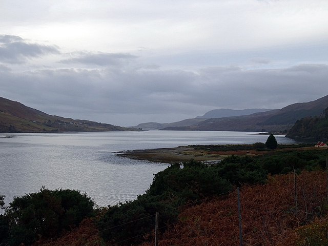
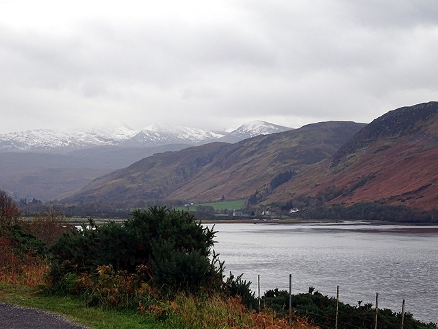
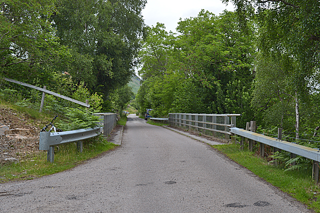
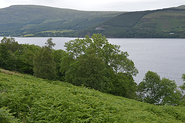
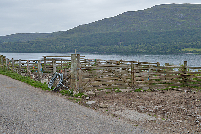
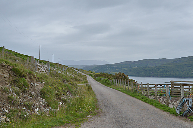
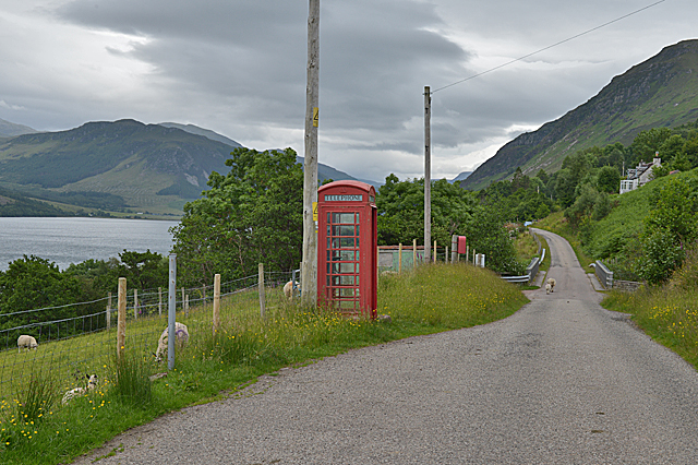
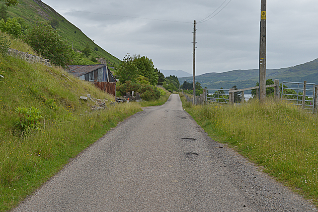
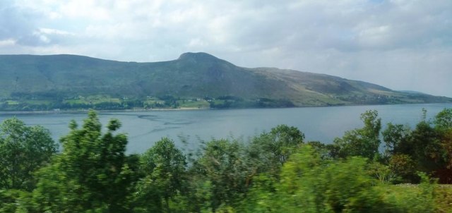
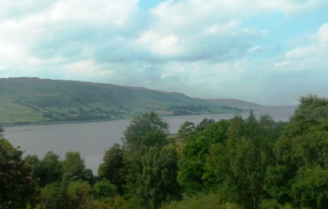
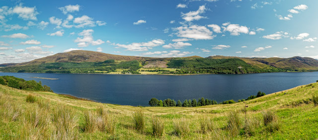
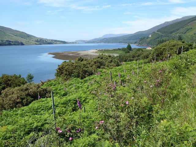
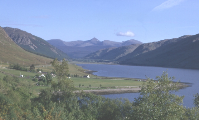
Ardindrean is a picturesque village located in the Ross-shire region of the Scottish Highlands. Situated on the northern banks of Loch Broom, it is surrounded by stunning natural landscapes and offers a tranquil escape in the heart of Scotland.

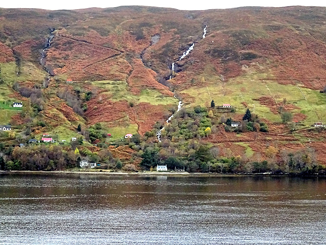
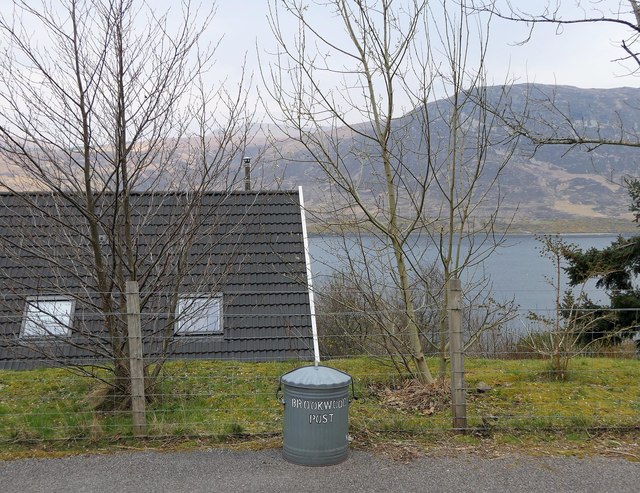
The village is characterized by its traditional stone houses and idyllic setting, providing residents and visitors with breathtaking views of the loch and the surrounding rolling hills. Ardindrean is known for its close-knit community, with friendly locals who take great pride in their village.

Despite its small size, Ardindrean offers a range of amenities to cater to residents' needs. The village boasts a well-stocked local shop, providing essentials and locally sourced produce. Additionally, there are a few cozy pubs and restaurants where visitors can enjoy traditional Scottish cuisine and experience the warm Highland hospitality.

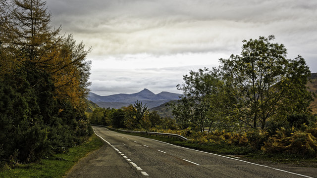
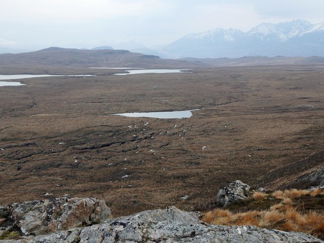
Outdoor enthusiasts will find Ardindrean to be a paradise. The region offers a multitude of activities, including hiking, fishing, and boating on Loch Broom. The village serves as a great base for exploring the surrounding mountains, such as An Teallach and Beinn Dearg, which attract avid climbers and hillwalkers from near and far.

For those interested in history, Ardindrean is home to several notable sites. The nearby Ardvreck Castle, a ruined 16th-century fortress, stands as a testament to the area's rich past. Visitors can immerse themselves in the history and heritage of the Highlands by exploring this iconic landmark.

In summary, Ardindrean is a charming village nestled in the scenic beauty of Ross-shire. With its breathtaking landscapes, welcoming community, and abundance of outdoor activities, it offers an ideal retreat for nature lovers and those seeking a peaceful Scottish getaway.

If you have any feedback on the listing, please let us know in the comments section below.

Ardindrean Images

Images are sourced within 2km of 57.843486/-5.101731 or Grid Reference NH1587. Thanks to Geograph Open Source API. All images are credited.

Looking south along the A835 towards the Fannichs
Beside Loch Broom Viewed from the A 835 road to Ullapool.
Beside Loch Broom
Viewed from the A 835 road to Ullapool.
Looking up Loch Broom From the A835 road to Ullapool.
Looking up Loch Broom
From the A835 road to Ullapool.
Looking across Loch Broom towards Letters
Bridge over the Allt Corrach in Letters
Steep slopes below the road Dropping to trees and Loch Broom.
Steep slopes below the road
Dropping to trees and Loch Broom.
Sheep pens north of Ardindrean
The Logie road north of Ardindrean
Ardindrean phone box and post box
The Loggie road passing through Ardindrean
Loch Broom at Ardcharnich Taken from the A835.
Loch Broom at Ardcharnich
Taken from the A835.
Loch Broom Viewed from the A835.
Loch Broom
Viewed from the A835.
Loch Broom Looking across Loch Broom to Leckmelm from Rhiroy
Loch Broom
Looking across Loch Broom to Leckmelm from Rhiroy
Bracken-covered slopes of Loch Broom From the car park on the A835, looking towards Ullapool in the distance.
Bracken-covered slopes of Loch Broom
From the car park on the A835, looking towards Ullapool in the distance.
Lochan below Cnoc an Droighinn, Ross and Cromarty The lochan is the source of the Allt Mòr Aird an Droighinn which flows into Loch Broom at Ardindrean to the east.
Lochan below Cnoc an Droighinn, Ross and Cromarty
The lochan is the source of the Allt Mòr Aird an Droighinn which flows into Loch Broom at Ardindrean to the east.
Outflow from Loch a' Chàirn Beag, Ross and Cromarty The outflow is the source of the Allt Chaluim which flows into Loch Broom at Letters.
Outflow from Loch a' Chàirn Beag, Ross and Cromarty
The outflow is the source of the Allt Chaluim which flows into Loch Broom at Letters.
Loch a' Chàirn Beag, Ross and Cromarty The name of the loch means 'Loch of the Cairn The Less'.  The larger <a href="https://www.geograph.org.uk/photo/1937691">NH1486 : Loch a' Chàirn Mòr</a>, 'Loch of the Cairn The Greater', lies to the south-west.
Loch a' Chàirn Beag, Ross and Cromarty
The name of the loch means 'Loch of the Cairn The Less'. The larger NH1486 : Loch a' Chàirn Mòr, 'Loch of the Cairn The Greater', lies to the south-west.
Letter box at Letters, Ross and Cromarty Looking across Loch Broom towards the north western slopes of Reidh Chreagan.

A postie's dream letter box: plenty of room for parcels!
Letter box at Letters, Ross and Cromarty
Looking across Loch Broom towards the north western slopes of Reidh Chreagan. A postie's dream letter box: plenty of room for parcels!
Show me another place!

Ardindrean is located at Grid Ref: NH1587 (Lat: 57.843486, Lng: -5.101731)

Unitary Authority: Highland

Police Authority: Highlands and Islands

What 3 Words

///expired.swordfish.special. Near Ullapool, Highland

Nearby Locations

Eas Chaluim Ardindrean

Related Wikis

Letters, Wester Ross

Letters (Scottish Gaelic: An Leitir) is a village on the south west shore of Loch Broom, in Garve, Ross-shire, Scottish Highlands and is in the Scottish...

Ardindrean

Ardindrean (Scottish Gaelic: Àird an Dreaghainn) is a small hamlet, located on the west shore of Loch Broom in Garve, Ross-shire and is within the Highland...

Ardcharnich

Ardcharnich (; Scottish Gaelic: Àird Cheatharnaich) is a crofting township in the parish of Loch Broom, Wester Ross in the Highland, within the Scottish...

Blarnalearoch

Blarnalearoch is a remote crofting township situated on the west shore of Loch Broom in Garve, Ross-shire, Scottish Highlands and is in the Scottish council...

Nearby Amenities

Located within 500m of 57.843486,-5.101731
Source: PGS
Lat/Long: 57.8404122/-5.0967995
Created By: almien_coastlines
Source: PGS
Lat/Long: 57.84053/-5.09689
Created By: almien_coastlines
Source: PGS
Lat/Long: 57.841289/-5.097414
Source: PGS
Lat/Long: 57.8417777/-5.0980095
Source: PGS
Lat/Long: 57.8422791/-5.0985243
Source: PGS
Lat/Long: 57.8427847/-5.0989997
Source: PGS
Lat/Long: 57.8434294/-5.0993415
Source: PGS
Lat/Long: 57.8437596/-5.0995535
Source: PGS
Lat/Long: 57.8445084/-5.1001602
Source: PGS
Lat/Long: 57.8447366/-5.1002186
Source: PGS
Lat/Long: 57.846358/-5.1013157
Source: PGS
Lat/Long: 57.8468132/-5.1019645
Source: PGS
Lat/Long: 57.8469575/-5.1021279
Created By: almien_coastlines
Source: PGS
Lat/Long: 57.847098/-5.102313
Telephone
Booth: K6
Covered: booth
Lat/Long: 57.8454877/-5.1034881
Post Box
Collection Times: Mo-Fr 12:45
Post Box Mounting: wooden_post
Post Box Type: lamp
Ref: IV 217
Royal Cypher: scottish_crown
Source: survey
Lat/Long: 57.8453652/-5.103403
Ardindrean
Traffic Sign: city_limit
Lat/Long: 57.8432464/-5.101577
Power: pole
Lat/Long: 57.8392914/-5.0992587
Power: pole
Lat/Long: 57.8399027/-5.0999274
Power: pole
Lat/Long: 57.8409597/-5.1008413
Power: pole
Lat/Long: 57.8412643/-5.1010642
Power: pole
Lat/Long: 57.8422668/-5.1017563
Power: pole
Lat/Long: 57.8428678/-5.1022615
Power: pole
Lat/Long: 57.8434433/-5.1026907
Power: pole
Lat/Long: 57.8440463/-5.103157
Power: pole
Lat/Long: 57.8444722/-5.103486
Power: pole
Lat/Long: 57.8449938/-5.1039016
Power: pole
Lat/Long: 57.8456124/-5.1044029
Power: pole
Lat/Long: 57.8462433/-5.1049159
Power: pole
Lat/Long: 57.8467914/-5.1053694
Power: pole
Lat/Long: 57.8473384/-5.1058016
Passing Place
Lat/Long: 57.8455557/-5.1035946
Passing Place
Lat/Long: 57.8439605/-5.1022849
The data included in this document is from www.openstreetmap.org. The data is made available under ODbL.

Have you been to Ardindrean?

Leave your review of Ardindrean below (or comments, questions and feedback).