Aldersey's Rough

Wood, Forest in Staffordshire Newcastle-under-Lyme

England

Aldersey's Rough

View from the M6 Northbound  Yet another standstill on the M6
View from the M6 Northbound Credit: jeff collins

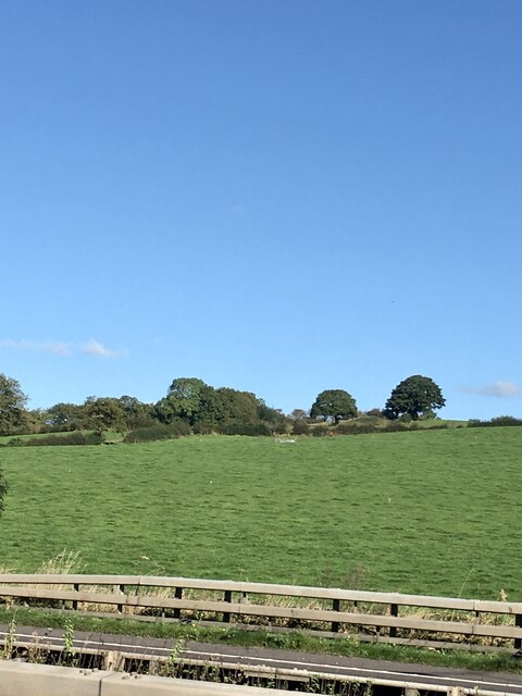
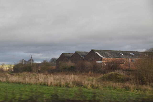
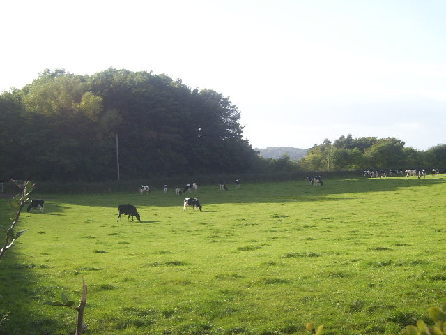
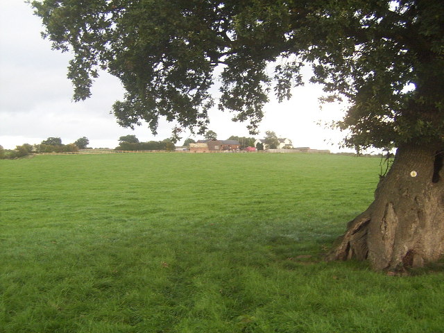
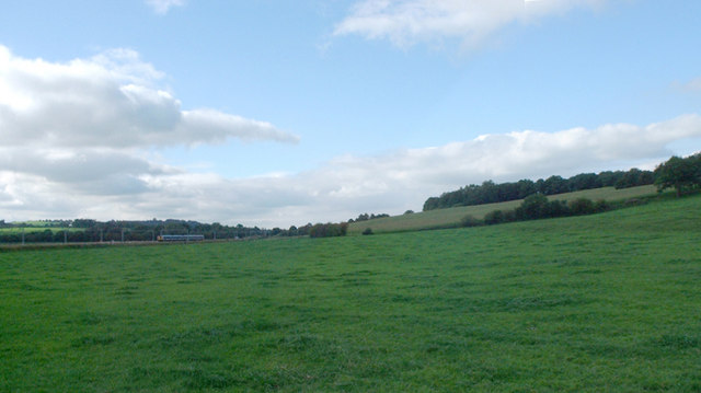
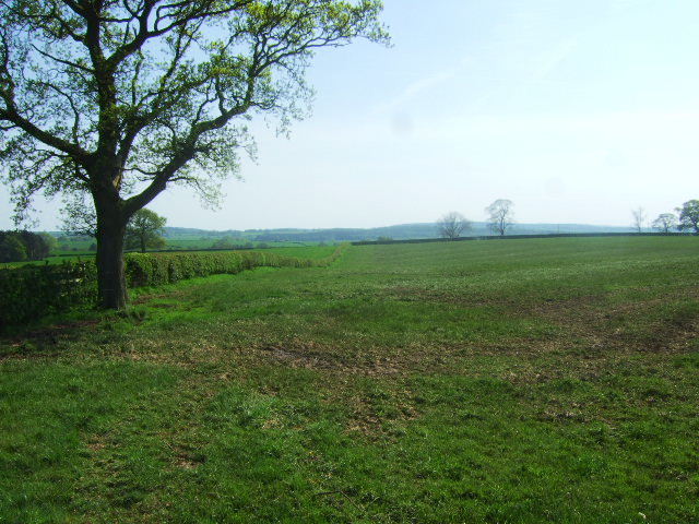
Aldersey's Rough is a picturesque woodland located in the county of Staffordshire, England. Covering an area of approximately 50 acres, this charming forest is a beloved natural attraction for locals and visitors alike.

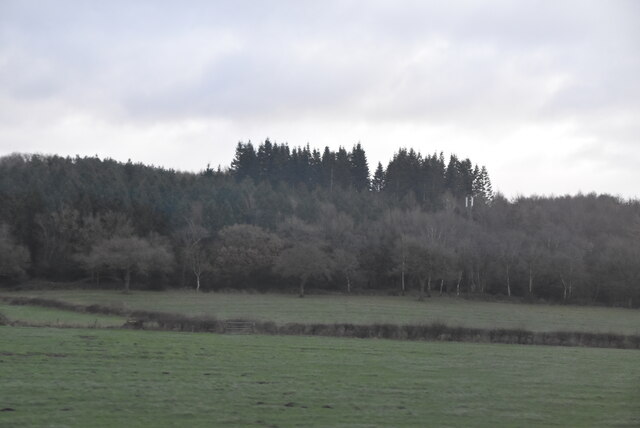
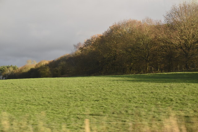
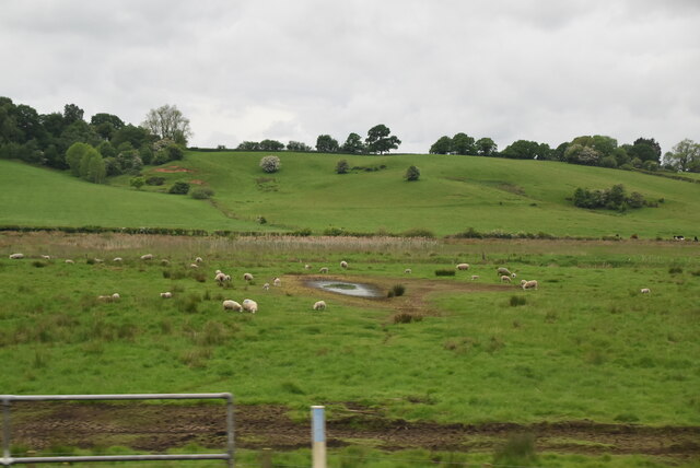
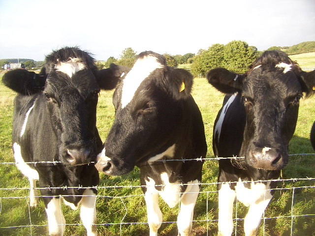
The woodland is characterized by its dense canopy of towering alder trees, which give the area its name. These majestic trees provide a habitat for a diverse range of wildlife, including various bird species, mammals, and insects. It is not uncommon to spot squirrels darting between the branches or hear the songs of birds echoing through the forest.

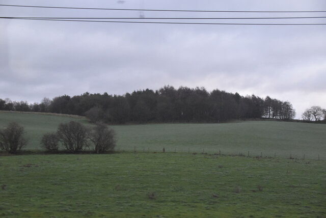
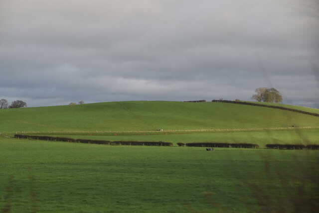
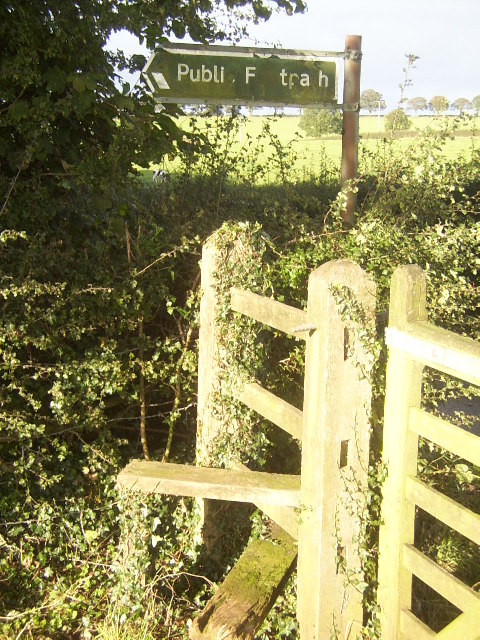
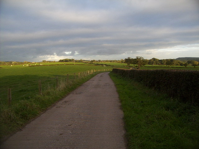
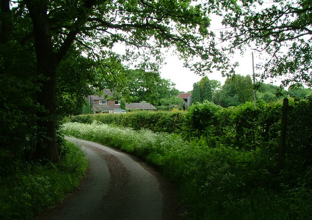
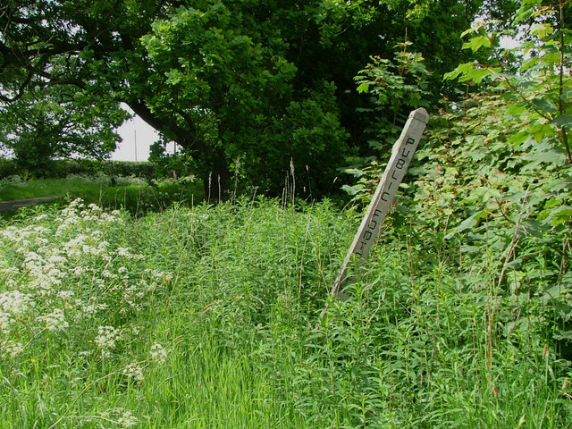
Aldersey's Rough offers a network of well-maintained paths and trails, making it an ideal destination for walkers, hikers, and nature enthusiasts. The pathways wind through the forest, allowing visitors to explore the beauty of the woodlands at their own pace. Along the way, one can find secluded clearings, peaceful streams, and even a small pond, adding to the tranquility and charm of the area.

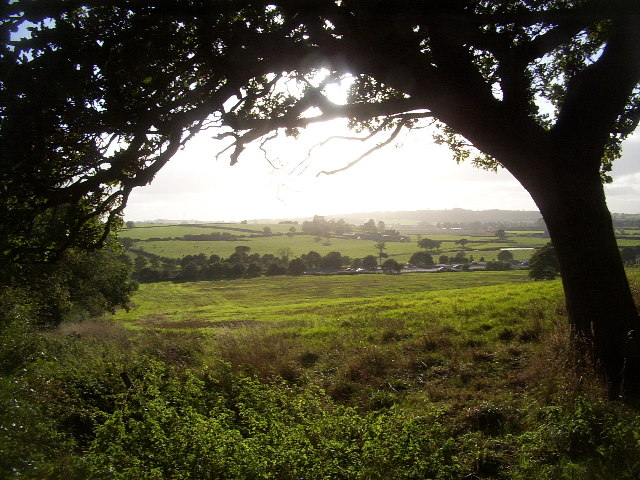
The forest is also popular among photographers, as it offers breathtaking scenery and ample opportunities to capture the beauty of nature. Whether it is the vibrant colors of autumn leaves, the delicate spring blossoms, or the ethereal fog that blankets the trees in winter, Aldersey's Rough is a photographer's paradise.

Overall, Aldersey's Rough is a hidden gem in Staffordshire, offering a serene escape from the hustle and bustle of everyday life. With its lush greenery, diverse wildlife, and well-maintained trails, this woodland provides an enchanting experience for all who venture into its depths.

If you have any feedback on the listing, please let us know in the comments section below.

Aldersey's Rough Images

Images are sourced within 2km of 52.987721/-2.3096504 or Grid Reference SJ7943. Thanks to Geograph Open Source API. All images are credited.

View from the M6 Northbound  Yet another standstill on the M6
View from the M6 Northbound
Yet another standstill on the M6
Whitmore Wood
Whitmore Wood
Hey Sprink
Hey Sprink
Trent Polysacks Ltd
Trent Polysacks Ltd
Works units
Works units
Pasture in the Lea Valley
Hey Sprink
Hey Sprink
Sheep grazing around a boggy hollow
Merrily Munching Cows A lot of the region around this area is devoted to cattle, mostly dairy cattle. Here is a herd of calves, apparently all male (I didn't check!), presumably being fattened up to make beefburgers. Curiously enough, the map charts a railway not far behind the woodland at the rear of the image, which continues down into <a href="https://www.geograph.org.uk/gridref/SJ7944">SJ7944</a>, yet no evidence of it is visible, save some abandoned cuttings.
Merrily Munching Cows
A lot of the region around this area is devoted to cattle, mostly dairy cattle. Here is a herd of calves, apparently all male (I didn't check!), presumably being fattened up to make beefburgers. Curiously enough, the map charts a railway not far behind the woodland at the rear of the image, which continues down into SJ7944, yet no evidence of it is visible, save some abandoned cuttings.
Stile near Highway Farm Any more iconic and this would be on a shortbread tin... at least up in Scotland! This square also contains the North Staffordshire Railway, which, despite being closed down as part of the Beeching plan, is still shown as being very much alive on maps today.
Stile near Highway Farm
Any more iconic and this would be on a shortbread tin... at least up in Scotland! This square also contains the North Staffordshire Railway, which, despite being closed down as part of the Beeching plan, is still shown as being very much alive on maps today.
Motorway and Fields Rural Staffordshire. Quiet, peaceful, idyllic. And cut in two by the roaring inferno of the M6. Oh well, I guess folks have got to travel.
Motorway and Fields
Rural Staffordshire. Quiet, peaceful, idyllic. And cut in two by the roaring inferno of the M6. Oh well, I guess folks have got to travel.
Cows A bunch of rather inquisitive cows at Hungerford House Farm. There is a large cattle presence in this part of the world, with a large proportion, if not the majority of agricultural land given over to cattle farming.
Cows
A bunch of rather inquisitive cows at Hungerford House Farm. There is a large cattle presence in this part of the world, with a large proportion, if not the majority of agricultural land given over to cattle farming.
Lower Stoneylow Farm Taken from the footpath that approaches the farm buildings, this shows one of the typical pastures that are present for miles around, along with a rather gnarled old oak tree.
Lower Stoneylow Farm
Taken from the footpath that approaches the farm buildings, this shows one of the typical pastures that are present for miles around, along with a rather gnarled old oak tree.
Track near Stoney Low A pleasant walk on an autumn afternoon, this track forms part of a path that leads from the village of Madeley to Keele Service Station on the M6.
Track near Stoney Low
A pleasant walk on an autumn afternoon, this track forms part of a path that leads from the village of Madeley to Keele Service Station on the M6.
Dab Green Farm note the fingerpost  with no path on the right.
Dab Green Farm
note the fingerpost with no path on the right.
Another fingerpost with no apparent path.
Another fingerpost
with no apparent path.
Rail line to Crewe The main line to Crewe with local train,Hey Sprink to right.
Rail line to Crewe
The main line to Crewe with local train,Hey Sprink to right.
Fields near Highway Farm The farmland near Highway farm.
Fields near Highway Farm
The farmland near Highway farm.
Show me another place!

Aldersey's Rough is located at Grid Ref: SJ7943 (Lat: 52.987721, Lng: -2.3096504)

Administrative County: Staffordshire

District: Newcastle-under-Lyme

Police Authority: Staffordshire

What 3 Words

///beams.strongman.pheasants. Near Madeley, Staffordshire

Nearby Locations

Aldersey's Rough

Related Wikis

Keele services

Keele services is a motorway service station, between junctions 15 and 16 of the M6 motorway near Keele in England. Operated by Welcome Break, it was built...

Hollywood Music Festival

The Hollywood Music Festival was held at Leycett in an area called Hollywood on the grounds of Ted Askey's Lower (pig) Farm at Finney Green, between Silverdale...

Loggerheads and Whitmore (ward)

Loggerheads and Whitmore ward was a ward in the Borough of Newcastle-under-Lyme, in the county of Staffordshire, England. It covered, amongst others, the...

Madeley railway station (Staffordshire)

Madeley railway station is a disused railway station in Staffordshire, England. The station was opened by the Grand Junction Railway in 1837.: 43  It...

Madeley Road railway station

Madeley Road railway station is a disused railway station in Staffordshire, England. The Stoke to Market Drayton Line was opened by the North Staffordshire...

All Saints' Church, Madeley

All Saints' Church is an Anglican church in Madeley, Staffordshire, England, and in the Diocese of Lichfield. The building dates mostly from the 14th and...

Madeley Old Hall

Madeley Old Hall is a black and white Elizabethan house, now a small hotel, in the village of Madeley in Staffordshire, England. It stands in 2 acres of...

Keele

Keele is a village and civil parish in the Borough of Newcastle-under-Lyme in Staffordshire, England. It is approximately 3 miles (4.8 km) west of Newcastle...

Nearby Amenities

Located within 500m of 52.987721,-2.3096504
Stony Low
Place: locality
Lat/Long: 52.9908478/-2.3148099
Power: tower
Source: Bing
Lat/Long: 52.9878593/-2.3148268
Power: tower
Source: Bing
Lat/Long: 52.9855356/-2.3075596
Power: tower
Source: Bing
Lat/Long: 52.986718/-2.3113199
Keele Park
Historic Railway: halt
Railway: site
Wikidata: Q18708286
Wikipedia: en:List of North Staffordshire Railway halts
Lat/Long: 52.991447/-2.3103775
The data included in this document is from www.openstreetmap.org. The data is made available under ODbL.

Have you been to Aldersey's Rough?

Leave your review of Aldersey's Rough below (or comments, questions and feedback).