Bonnyleigh Wood

Wood, Forest in Somerset Mendip

England

Bonnyleigh Wood

Old Milestone, (Former A361) Frome Road, South West of Beckington The milestone is located between Oldford and Beckington in the roadside hedge on the west side of the road. Parish of Beckington (Mendip District). Cast iron post, C&M Classical iron casting design, erected by the Black Dog turnpike trust in the 19th century.

Inscription reads:-
BATH
11
MILES
FROME
2

Somerset HER number: 19330 <span class="nowrap"><a title="https://www.heritagegateway.org.uk/Gateway/Results_Single.aspx?uid=19330&resourceID=100" rel="nofollow ugc noopener" href="https://www.heritagegateway.org.uk/Gateway/Results_Single.aspx?uid=19330&resourceID=100">Link</a><img style="margin-left:2px;" alt="External link" title="External link - shift click to open in new window" src="https://s1.geograph.org.uk/img/external.png" width="10" height="10"/></span>

Milestone Society National ID: SO_BAFR11
Old Milestone, (Former A361) Frome Road, South West of Beckington Credit: Janet Dowding

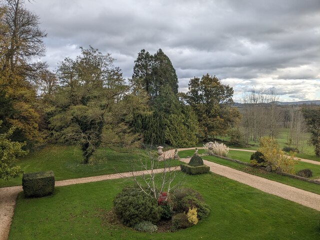
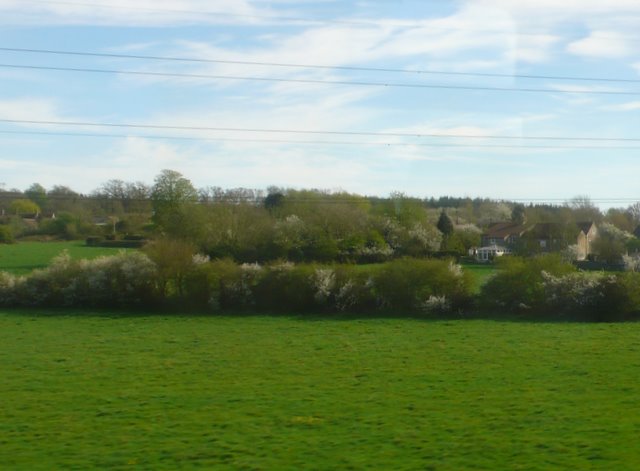
Bonnyleigh Wood, located in Somerset, is a picturesque forest known for its natural beauty and diverse range of flora and fauna. Spanning over a vast area, the wood offers visitors a tranquil and serene environment to immerse themselves in nature.

The woodland is characterized by its dense canopy of tall, ancient trees, primarily consisting of oak, beech, and ash species. These majestic trees provide a haven for a variety of wildlife, including various bird species, deer, foxes, and squirrels.

Bonnyleigh Wood boasts a well-maintained network of walking trails, allowing visitors to explore the area at their own pace. The trails offer scenic views of the forest, with occasional glimpses of meandering streams and small ponds. Nature enthusiasts and photographers often visit the wood to capture the stunning sights and capture the essence of the natural surroundings.

The forest is well-preserved and managed by local authorities, ensuring the protection of the ecosystem and promoting sustainable practices. It serves as an important habitat for numerous rare and endangered species, contributing to the overall biodiversity of the region.

In addition to its natural beauty, Bonnyleigh Wood also holds cultural significance. It has been a popular destination for local folklore and storytelling, with tales of mythical creatures and magical encounters being passed down through generations.

Overall, Bonnyleigh Wood is a haven for nature lovers, offering a peaceful retreat from the hustle and bustle of everyday life. Its diverse range of flora and fauna, coupled with its tranquil atmosphere, make it a must-visit destination for those seeking solace in the embrace of nature.

If you have any feedback on the listing, please let us know in the comments section below.

Bonnyleigh Wood Images

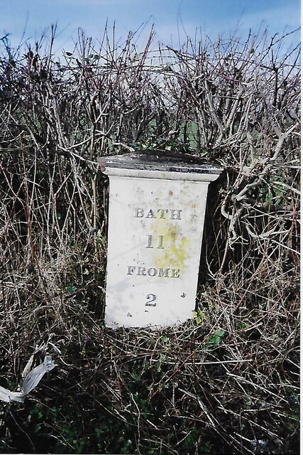
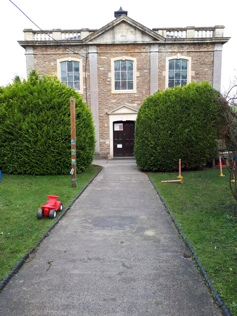
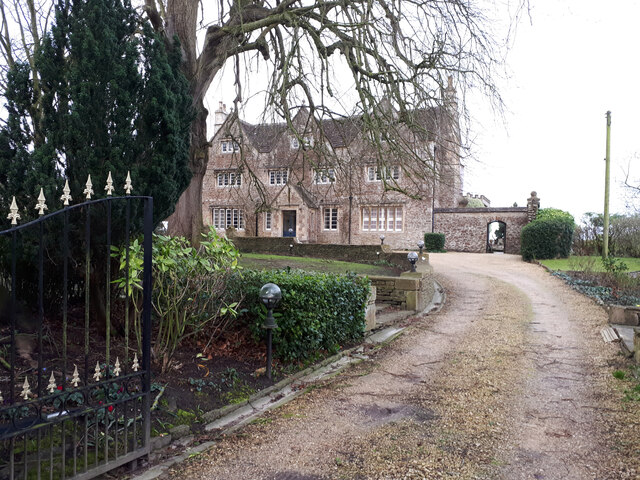
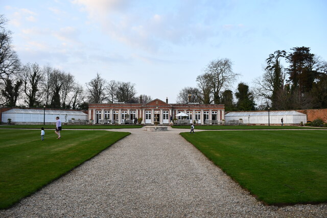
Images are sourced within 2km of 51.254034/-2.3012354 or Grid Reference ST7950. Thanks to Geograph Open Source API. All images are credited.

Old Milestone, (Former A361) Frome Road, South West of Beckington The milestone is located between Oldford and Beckington in the roadside hedge on the west side of the road. Parish of Beckington (Mendip District). Cast iron post, C&M Classical iron casting design, erected by the Black Dog turnpike trust in the 19th century.

Inscription reads:-
BATH
11
MILES
FROME
2

Somerset HER number: 19330 <span class="nowrap"><a title="https://www.heritagegateway.org.uk/Gateway/Results_Single.aspx?uid=19330&resourceID=100" rel="nofollow ugc noopener" href="https://www.heritagegateway.org.uk/Gateway/Results_Single.aspx?uid=19330&resourceID=100">Link</a><img style="margin-left:2px;" alt="External link" title="External link - shift click to open in new window" src="https://s1.geograph.org.uk/img/external.png" width="10" height="10"/></span>

Milestone Society National ID: SO_BAFR11
Old Milestone, (Former A361) Frome Road, South West of Beckington
The milestone is located between Oldford and Beckington in the roadside hedge on the west side of the road. Parish of Beckington (Mendip District). Cast iron post, C&M Classical iron casting design, erected by the Black Dog turnpike trust in the 19th century. Inscription reads:- BATH 11 MILES FROME 2 Somerset HER number: 19330 LinkExternal link Milestone Society National ID: SO_BAFR11
Beckington Baptist Chapel Grade II listed former Baptist Chapel, now a day nursery. <span class="nowrap"><a title="https://britishlistedbuildings.co.uk/101296104-baptist-chapel-forecourt-wall-gate-piers-and-gates-beckington#.Yhp0djjP2Uk" rel="nofollow ugc noopener" href="https://britishlistedbuildings.co.uk/101296104-baptist-chapel-forecourt-wall-gate-piers-and-gates-beckington#.Yhp0djjP2Uk">Link</a><img style="margin-left:2px;" alt="External link" title="External link - shift click to open in new window" src="https://s1.geograph.org.uk/img/external.png" width="10" height="10"/></span>
Beckington Baptist Chapel
Grade II listed former Baptist Chapel, now a day nursery. LinkExternal link
Beckington House Grade II listed former 17th century manor house, restored mid-19th century. <span class="nowrap"><a title="https://britishlistedbuildings.co.uk/101345321-beckington-manor-attached-garden-wall-gate-and-piers-beckington#.Yhp2DTjP2Uk" rel="nofollow ugc noopener" href="https://britishlistedbuildings.co.uk/101345321-beckington-manor-attached-garden-wall-gate-and-piers-beckington#.Yhp2DTjP2Uk">Link</a><img style="margin-left:2px;" alt="External link" title="External link - shift click to open in new window" src="https://s1.geograph.org.uk/img/external.png" width="10" height="10"/></span>
Beckington House
Grade II listed former 17th century manor house, restored mid-19th century. LinkExternal link
Elmhay Park A wedding venue. There is a golf course in the grounds.
Elmhay Park
A wedding venue. There is a golf course in the grounds.
View from Orchardleigh House
Iron Mill Lane heading east
Layby on Frome Road, heading towards Beckington
Pile of rubbish opposite the layby on Frome Road
Gloucester Lodge and old road sign, Lullington Hoprfully the road sign is now considered to be equivalent to a finger post, as it is at the junction. It points to Oldford and Frome.
Gloucester Lodge and old road sign, Lullington
Hoprfully the road sign is now considered to be equivalent to a finger post, as it is at the junction. It points to Oldford and Frome.
Old road sign at Gloucester Lodge This is hopefully now regarded as a finger post, It points to Woolverton and Bath.
Old road sign at Gloucester Lodge
This is hopefully now regarded as a finger post, It points to Woolverton and Bath.
Lullington: old signpost to Woolverton and Bath One of two old road signs surviving at this junction, the other pointing eastward towards Oldford and Frome. They date from before 1963 when the Worboys Report led to the road signage that is practically universal today. 

The other sign is here: <a href="https://www.geograph.org.uk/photo/4059012">ST7851 : Lullington: old signpost to Oldford and Frome</a>.
Lullington: old signpost to Woolverton and Bath
One of two old road signs surviving at this junction, the other pointing eastward towards Oldford and Frome. They date from before 1963 when the Worboys Report led to the road signage that is practically universal today. The other sign is here: ST7851 : Lullington: old signpost to Oldford and Frome.
Lullington: old signpost to Oldford and Frome One of two old road signs surviving at this junction, the other pointing northward towards Woolverton and Bath. They date from before 1963 when the Worboys Report led to the road signage that is practically universal today. 

The other sign is here: <a href="https://www.geograph.org.uk/photo/4059008">ST7851 : Lullington: old signpost to Woolverton and Bath</a>.
Lullington: old signpost to Oldford and Frome
One of two old road signs surviving at this junction, the other pointing northward towards Woolverton and Bath. They date from before 1963 when the Worboys Report led to the road signage that is practically universal today. The other sign is here: ST7851 : Lullington: old signpost to Woolverton and Bath.
Lullington: postbox № BA11 45 Lullington's postbox is set into a wall alongside Gloucester Lodge, at the road junction somewhat to the east of the village itself.
Lullington: postbox № BA11 45
Lullington's postbox is set into a wall alongside Gloucester Lodge, at the road junction somewhat to the east of the village itself.
Oldford: postbox № BA11 27 An Elizabeth II-reign postbox of a design very common in rural areas, poking out of the hedgerow.

It is located only a couple of yards from the site of the telephone box (<a href="https://www.geograph.org.uk/photo/1311238">ST7850 : Telephone box and road next to The Ship</a>) which is no longer there.
Oldford: postbox № BA11 27
An Elizabeth II-reign postbox of a design very common in rural areas, poking out of the hedgerow. It is located only a couple of yards from the site of the telephone box (ST7850 : Telephone box and road next to The Ship) which is no longer there.
Down Milk empties at Clink Road, near Frome View NE, towards Westbury, Reading and London; ex-GWR London - Reading - Westbury - Taunton etc. main line. (Just ahead of the train the Frome-avoiding line to Blatchbridge Junction commences). This is probably the very important Kensington - Plymouth Milk empties, returning tank-wagons to various Milk Depots in the West Country which supplied a large proportion of the capital's needs - before the age of Motorways. The locomotive is 4-6-0 No. 4941 'Llangedwyn Hall' (built 7/29, withdrawn 10/62).
Down Milk empties at Clink Road, near Frome
View NE, towards Westbury, Reading and London; ex-GWR London - Reading - Westbury - Taunton etc. main line. (Just ahead of the train the Frome-avoiding line to Blatchbridge Junction commences). This is probably the very important Kensington - Plymouth Milk empties, returning tank-wagons to various Milk Depots in the West Country which supplied a large proportion of the capital's needs - before the age of Motorways. The locomotive is 4-6-0 No. 4941 'Llangedwyn Hall' (built 7/29, withdrawn 10/62).
Bristol - Weymouth express approaching Clink Road Junction, Frome View NE, towards Westbury (and Bristol, via Bath), Newbury, Reading and London, etc.; ex-GWR Paddington - Reading - Westbury - Taunton - Exeter - Plymouth - Penzance, also Wilts., Somerset and Weymouth (Swindon/Bath - Westbury - Yeovil - Weymouth, main lines. (At Clink Road the Frome cut-off line ran to Blacksbridge Junction). The 09.43 Bristol Temple Meads to Weymouth is headed by 4-6-0 No. 5924 'Dinton Hall' (built 5/33, withdrawn 12/63) and will call in at Frome. (See also <a href="https://www.geograph.org.uk/photo/2468446">ST7948 : Down Milk empties at Clink Road, near Frome</a>).
Bristol - Weymouth express approaching Clink Road Junction, Frome
View NE, towards Westbury (and Bristol, via Bath), Newbury, Reading and London, etc.; ex-GWR Paddington - Reading - Westbury - Taunton - Exeter - Plymouth - Penzance, also Wilts., Somerset and Weymouth (Swindon/Bath - Westbury - Yeovil - Weymouth, main lines. (At Clink Road the Frome cut-off line ran to Blacksbridge Junction). The 09.43 Bristol Temple Meads to Weymouth is headed by 4-6-0 No. 5924 'Dinton Hall' (built 5/33, withdrawn 12/63) and will call in at Frome. (See also ST7948 : Down Milk empties at Clink Road, near Frome).
Art Deco School: Frome Community College, Bath Road, Frome, Somerset According to <span class="nowrap"><a title="www.schoolsnet.com" rel="nofollow ugc noopener" href="http://www.schoolsnet.com">Link</a><img style="margin-left:2px;" alt="External link" title="External link - shift click to open in new window" src="https://s1.geograph.org.uk/img/external.png" width="10" height="10"/></span> the college was founded as a secondary school in 1921 which fits in with the Art Deco style. Either side of the central entrance are two long wings and the google satellite shows they extend around the building to form a central quadrangle.  In 1945 it became a grammar school and in 1974 the three-tier system which was established in the Frome area.
Art Deco School: Frome Community College, Bath Road, Frome, Somerset
According to LinkExternal link the college was founded as a secondary school in 1921 which fits in with the Art Deco style. Either side of the central entrance are two long wings and the google satellite shows they extend around the building to form a central quadrangle. In 1945 it became a grammar school and in 1974 the three-tier system which was established in the Frome area.
Edge of Frome At one time none of the town was east of the River From but now nearly half of it is. This is the back of one of the large housing estates on the north eastern edge of the town, viewed from a Yeovil to Bristol train.
Edge of Frome
At one time none of the town was east of the River From but now nearly half of it is. This is the back of one of the large housing estates on the north eastern edge of the town, viewed from a Yeovil to Bristol train.
Show me another place!

Bonnyleigh Wood is located at Grid Ref: ST7950 (Lat: 51.254034, Lng: -2.3012354)

Administrative County: Somerset

District: Mendip

Police Authority: Avon and Somerset

What 3 Words

///still.airship.flocking. Near Frome, Somerset

Related Wikis

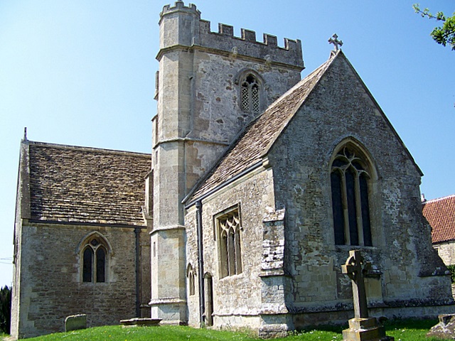
Lullington, Somerset

Lullington is a village and civil parish just across the Mells River from Beckington and 2.5 miles (4.0 km) north east of Frome, in the Mendip district...
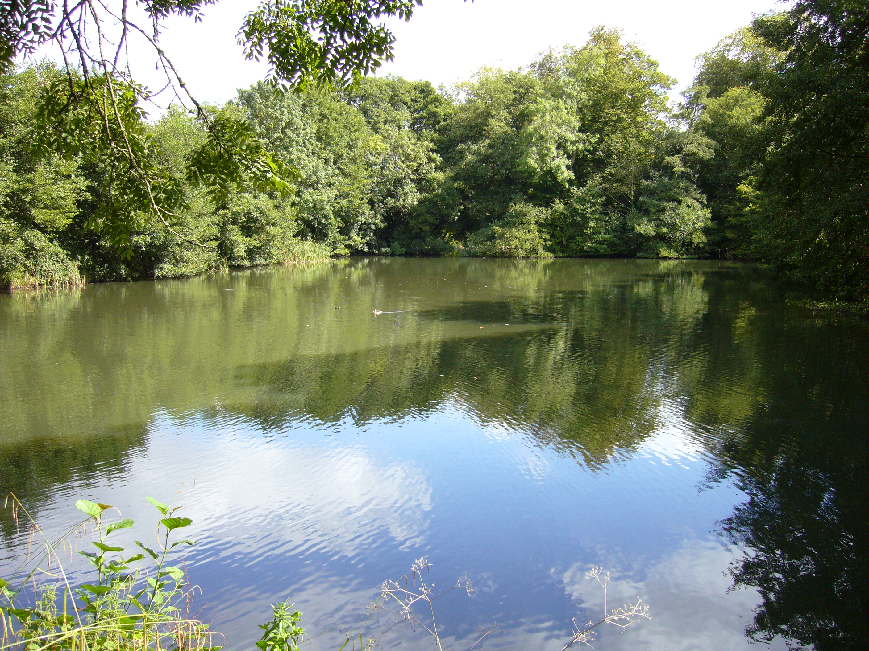
Orchardleigh Lake

Orchardleigh Lake (also spelt Orchardlea) (grid reference ST779508) is an 11.23-hectare artificial lake in the grounds of the Orchardleigh Estate, just...

Beckington Castle

Beckington Castle is a historic house in the village of Beckington, Somerset, England. It is a Grade II* listed building.It was built in the early 17th...

The Wool Hall

The Wool Hall is a recording studio in the village of Beckington, near Frome, Somerset, England. It was originally a residential studio set up by Tears...

Nearby Amenities

Located within 500m of 51.254034,-2.3012354
Oldford
Place: hamlet
Lat/Long: 51.2520919/-2.3050261
Barrier: block
Lat/Long: 51.2503026/-2.2989855
Barrier: stile
Lat/Long: 51.2511515/-2.3066193
Barrier: stile
Lat/Long: 51.2570418/-2.3037397
Barrier: stile
Lat/Long: 51.2570182/-2.3038449
Barrier: kissing_gate
Lat/Long: 51.252469/-2.3065838
Barrier: kissing_gate
Lat/Long: 51.2525277/-2.3066574
Barrier: stile
Lat/Long: 51.2531205/-2.3062386
Bus Stop
The Bay Leaf
Bus: yes
Naptan AtcoCode: 3600SOB21735
Naptan Bearing: SW
Naptan CommonName: The Bay Leaf
Naptan Indicator: SW-bound
Naptan NaptanCode: sotdmamp
Naptan Street: B3090
Naptan Verified: no
Public Transport: platform
Lat/Long: 51.251351/-2.305122
Bus Stop
The Bay Leaf
Bus: yes
Naptan AtcoCode: 3600SOB21736
Naptan Bearing: NE
Naptan CommonName: The Bay Leaf
Naptan Indicator: NE-bound
Naptan NaptanCode: sotdmamt
Naptan Street: B3090
Naptan Verified: no
Public Transport: platform
Lat/Long: 51.2515276/-2.3049362
The data included in this document is from www.openstreetmap.org. The data is made available under ODbL.

Have you been to Bonnyleigh Wood?

Leave your review of Bonnyleigh Wood below (or comments, questions and feedback).