Ribbesford Woods

Wood, Forest in Worcestershire Wyre Forest

England

Ribbesford Woods

St David's Close, Lickhill
St David's Close, Lickhill Credit: Alex McGregor

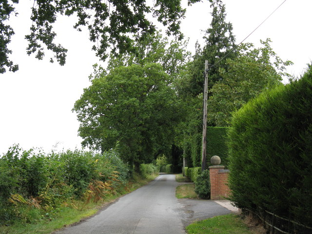
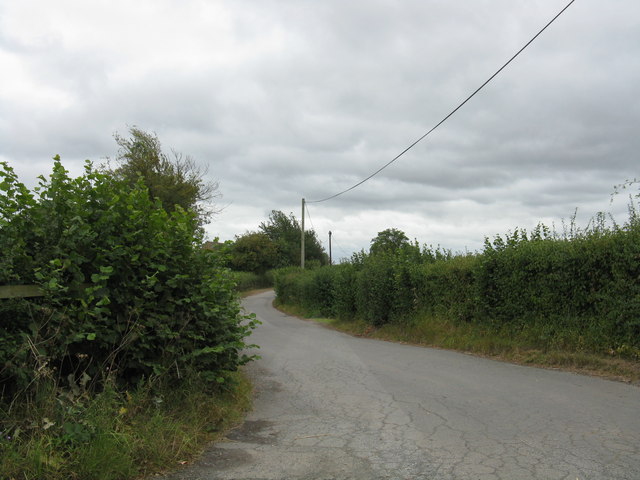
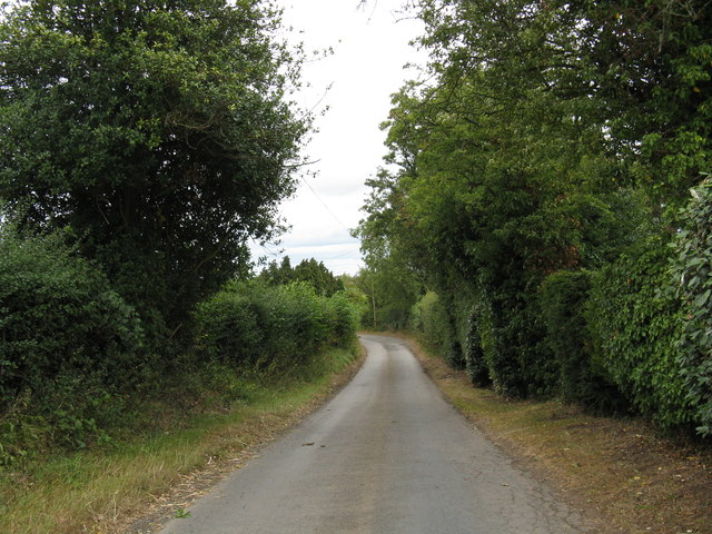
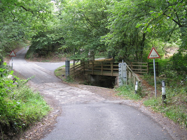
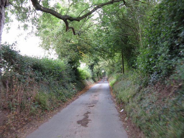
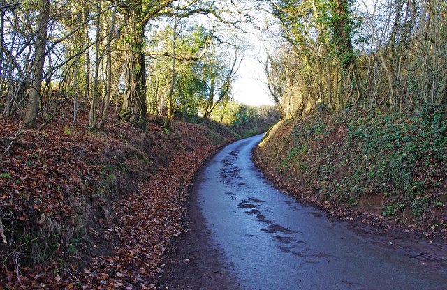
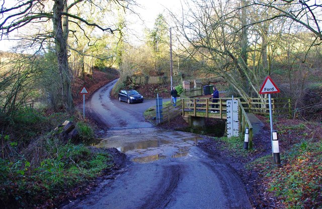
Ribbesford Woods is a charming forest situated in the county of Worcestershire, England. It covers an area of approximately 300 acres and is located near the town of Bewdley. The woodland is nestled within the picturesque Wyre Forest District and is known for its natural beauty and diverse wildlife.

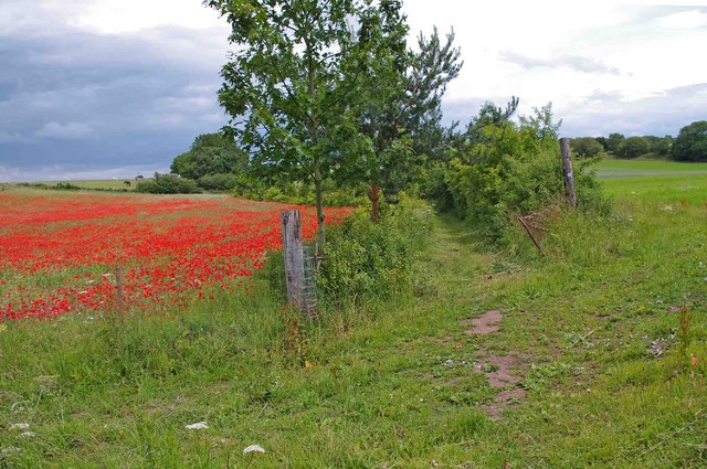
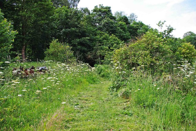
The woods are predominantly composed of deciduous and coniferous trees, creating a rich and vibrant canopy that changes with the seasons. Oak, beech, and birch trees dominate the landscape, providing a stunning display of colors during autumn. The forest floor is covered with a carpet of bluebells and wildflowers during the spring, adding to its enchanting allure.

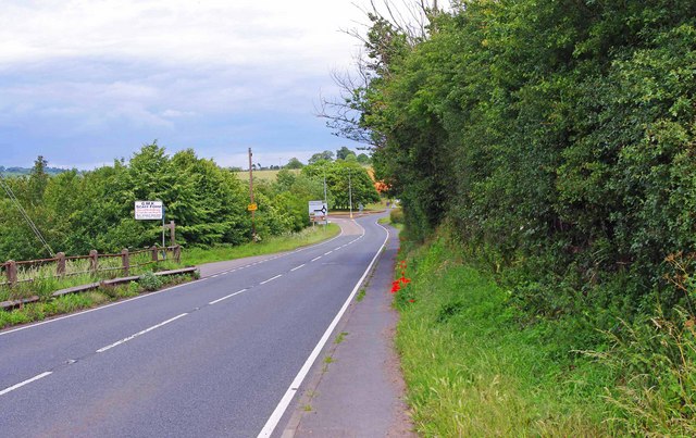
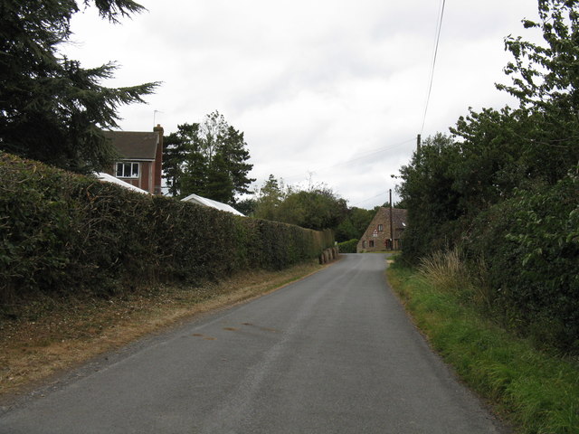
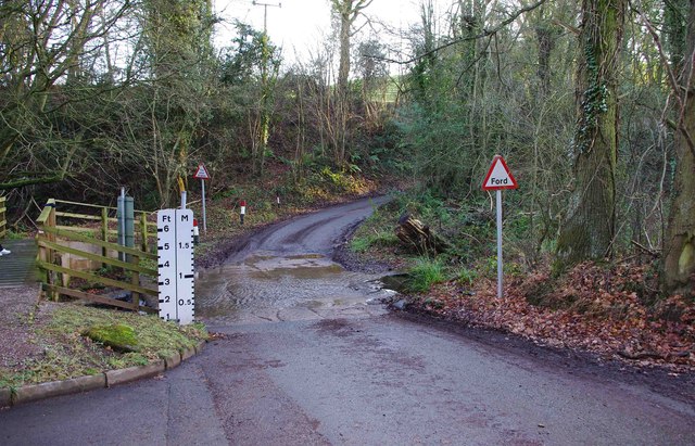
Ribbesford Woods are intersected by numerous walking trails and footpaths, making it a popular destination for nature enthusiasts and hikers. The trails wind through the woodland, offering breathtaking views of the surrounding countryside and the meandering River Severn.

The forest also boasts an impressive array of wildlife. Visitors may encounter deer, badgers, foxes, and a variety of bird species, including woodpeckers and owls. The woods provide a vital habitat for these creatures and contribute to the overall ecological diversity of the area.

The tranquility and natural beauty of Ribbesford Woods make it an ideal location for outdoor activities such as picnics, wildlife spotting, and photography. Additionally, the forest is often used for educational purposes, with schools and nature organizations organizing guided walks and workshops to educate visitors about the importance of conservation and the local ecosystem.

Overall, Ribbesford Woods is a captivating woodland that offers a peaceful retreat for those seeking solace in nature. Its diverse flora and fauna, along with its scenic trails, make it a must-visit destination for nature lovers in Worcestershire.

If you have any feedback on the listing, please let us know in the comments section below.

Ribbesford Woods Images

Images are sourced within 2km of 52.350668/-2.3156287 or Grid Reference SO7872. Thanks to Geograph Open Source API. All images are credited.

St David's Close, Lickhill
Public bridleway, Blackstone The bridleway runs straight ahead. The field, on the left, is one of those in this area where poppies have flowered this year.
Public bridleway, Blackstone
The bridleway runs straight ahead. The field, on the left, is one of those in this area where poppies have flowered this year.
The approach to the roundabout at the junction of the B4195 & A456, Blackstone In the foreground is the B4195 from Stourport-on-Severn. In the distance is the roundabout at the junction with the Bewdley Bypass, the A456.
The approach to the roundabout at the junction of the B4195 & A456, Blackstone
In the foreground is the B4195 from Stourport-on-Severn. In the distance is the roundabout at the junction with the Bewdley Bypass, the A456.
Poppies in field by B4195 road, Blackstone These poppies were flowering in June 2011 in this and other nearby fields. The field is next to the B4195 road, from which the photograph was taken. There is no public access to this field, nor over the track seen in this view.
Poppies in field by B4195 road, Blackstone
These poppies were flowering in June 2011 in this and other nearby fields. The field is next to the B4195 road, from which the photograph was taken. There is no public access to this field, nor over the track seen in this view.
Public bridleway, Blackstone The bridleway is about to enter a wooded section, before coming out onto the B4195 Stourport-on-Severn to Bewdley road.
Public bridleway, Blackstone
The bridleway is about to enter a wooded section, before coming out onto the B4195 Stourport-on-Severn to Bewdley road.
Poppies in field by public bridleway, Blackstone The roof in the distance is that of a farm building belonging to Upper Blackstone Farm.
Poppies in field by public bridleway, Blackstone
The roof in the distance is that of a farm building belonging to Upper Blackstone Farm.
Poppies in field by public bridleway, Blackstone Poppies were to be seen in several fields around Blackstone in June 2011, although the most spectacular display was in the field opposite Blackstone Picnic Site. See:- <a href="https://www.geograph.org.uk/photo/2465767">SO7974 : Poppy display by A456 in June 2011, Blackstone</a>.
Poppies in field by public bridleway, Blackstone
Poppies were to be seen in several fields around Blackstone in June 2011, although the most spectacular display was in the field opposite Blackstone Picnic Site. See:- SO7974 : Poppy display by A456 in June 2011, Blackstone.
Jennings Wood Lane
Jennings Wood Lane
Heightington Road, looking south from Jennings Wood Lane
Heightington Road, looking north from Jennings Wood Lane
Gladder Brook ford, Heightington Road
Heightington Road The lane climbs steeply on both sides of Gladder Brook's deeply incised valley.
Heightington Road
The lane climbs steeply on both sides of Gladder Brook's deeply incised valley.
Heightington Road near The Lodge
Pig playing the bagpipes One of a number of carvings from a 15th-century rood screen, now affixed to the pulpit in St Leonard's Church.  For more on this church see <span class="nowrap"><a title="http://greatenglishchurches.co.uk/html/ribbesford.html" rel="nofollow ugc noopener" href="http://greatenglishchurches.co.uk/html/ribbesford.html">Link</a><img style="margin-left:2px;" alt="External link" title="External link - shift click to open in new window" src="https://s1.geograph.org.uk/img/external.png" width="10" height="10"/></span>
Pig playing the bagpipes
One of a number of carvings from a 15th-century rood screen, now affixed to the pulpit in St Leonard's Church. For more on this church see LinkExternal link
Memorial to John Tiler The Bailiff of Bewdley is commemorated by one of the oldest memorials in St Leonard's Church, of simple painted stone:

1626
===
Here vnder lyeth
bvried, the bodie of
Iohn Tyler  Gent:
late Bayliffe of
Bewdlie, who dyed
the XXVIII daye of
Ianvarie, in the
yeare of ovr
Lord God,
-- 1626. --

For more on this church see <span class="nowrap"><a title="http://greatenglishchurches.co.uk/html/ribbesford.html" rel="nofollow ugc noopener" href="http://greatenglishchurches.co.uk/html/ribbesford.html">Link</a><img style="margin-left:2px;" alt="External link" title="External link - shift click to open in new window" src="https://s1.geograph.org.uk/img/external.png" width="10" height="10"/></span>
Memorial to John Tiler
The Bailiff of Bewdley is commemorated by one of the oldest memorials in St Leonard's Church, of simple painted stone: 1626 === Here vnder lyeth bvried, the bodie of Iohn Tyler Gent: late Bayliffe of Bewdlie, who dyed the XXVIII daye of Ianvarie, in the yeare of ovr Lord God, -- 1626. -- For more on this church see LinkExternal link
Heightington Road north of Gladder Brook ford, near Ribbesford A narrow lane which involves crossing a normally shallow ford.
Heightington Road north of Gladder Brook ford, near Ribbesford
A narrow lane which involves crossing a normally shallow ford.
The Gladder Brook ford on Heightington Road, near Ribbesford It is interesting to see that the brook can rise to a level where this road would become impassable. However in dry summers it can be completely dry here. On the left is a footbridge for pedestrians.
The Gladder Brook ford on Heightington Road, near Ribbesford
It is interesting to see that the brook can rise to a level where this road would become impassable. However in dry summers it can be completely dry here. On the left is a footbridge for pedestrians.
The Gladder Brook ford on Heightington Road, near Ribbesford The water was very shallow on this day in early January. On the right is a bridge for pedestrians.
The Gladder Brook ford on Heightington Road, near Ribbesford
The water was very shallow on this day in early January. On the right is a bridge for pedestrians.
Show me another place!

Ribbesford Woods is located at Grid Ref: SO7872 (Lat: 52.350668, Lng: -2.3156287)

Administrative County: Worcestershire

District: Wyre Forest

Police Authority: West Mercia

What 3 Words

///amuse.hiker.abolish. Near Stourport-on-Severn, Worcestershire

Related Wikis

Bewdley Town F.C.

Bewdley Town Football Club is a football club based in Bewdley, Worcestershire, England. They are currently members of the Midland League Premier Division...

Ribbesford

Ribbesford is a village and civil parish in the Wyre Forest District of Worcestershire, England. At the 2001 census it had a population of 237.Notable...
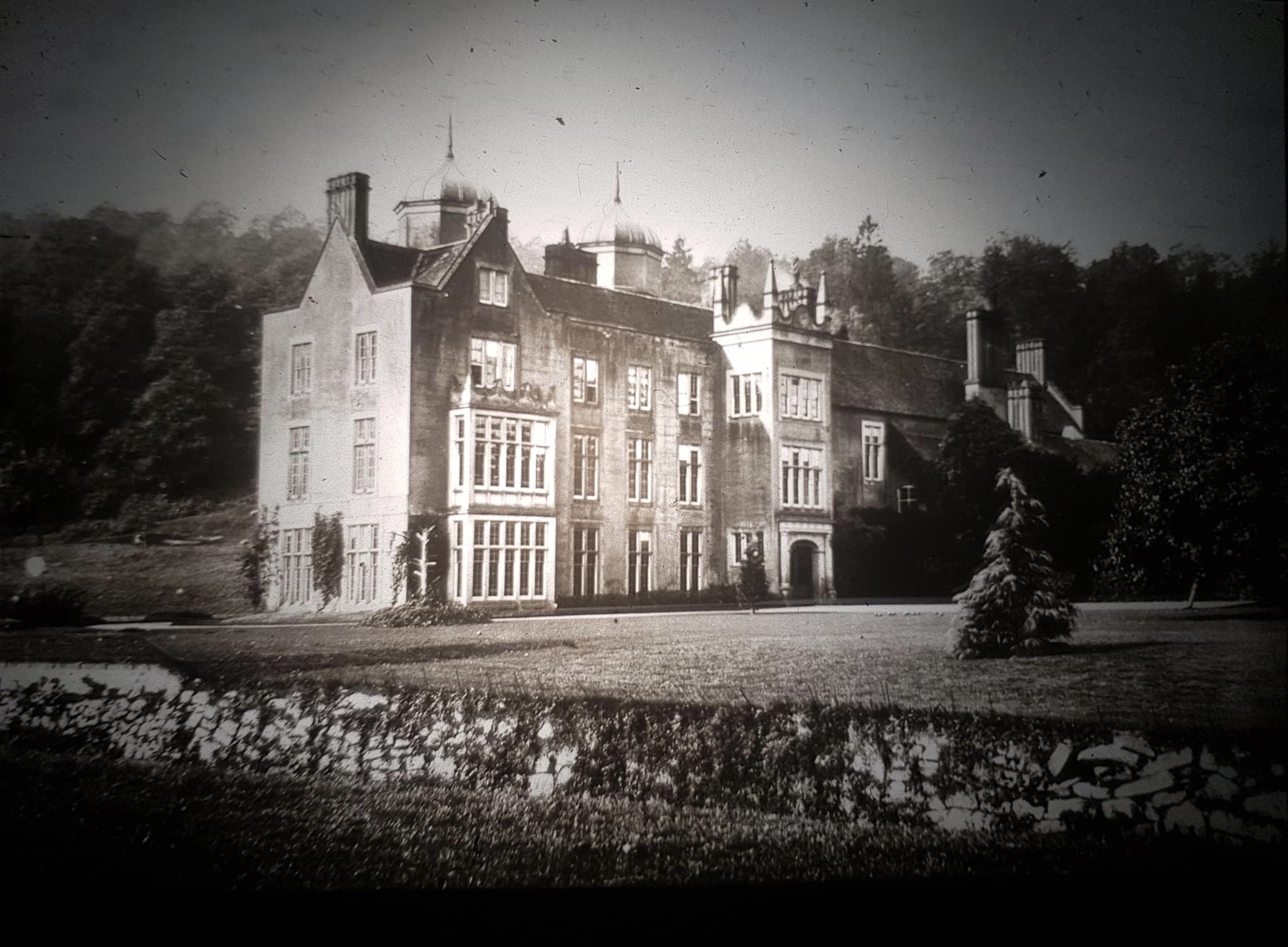
Ribbesford House

Ribbesford House is a historic English mansion in Ribbesford, near Bewdley, Worcestershire. The house and its surrounding estate have a history dating...

Burlish Halt railway station

Burlish Halt railway station was a station on the Severn Valley Railway in Stourport-on-Severn, Worcestershire, England. The halt opened on 31 March 1930...

A456 road

Known as the Hagley Road in Birmingham, the A456 is a main road in England running between Central Birmingham and Woofferton, Shropshire, south of Ludlow...

Heightington

Heightington is a small village in Worcestershire, England. It lies a little to the south-west of Bewdley and a little to the west of Stourport-on-Severn...

Areley Hall

Areley Hall is a Grade II listed country house near Areley Kings in Stourport-on-Severn, Worcestershire, England. It is not to be confused with nearby...

The Bewdley School

The Bewdley School is a senior school and sixth form in Bewdley, serving north-west Worcestershire, England. Its campus is very close to the River Severn...

Nearby Amenities

Located within 500m of 52.350668,-2.3156287
Stagborough Hill Trig Pillar
Man Made: survey_point_disused
Lat/Long: 52.3471342/-2.3113015
The data included in this document is from www.openstreetmap.org. The data is made available under ODbL.

Have you been to Ribbesford Woods?

Leave your review of Ribbesford Woods below (or comments, questions and feedback).