Loam Wood

Wood, Forest in Shropshire

England

Loam Wood

Farmland near Tong
Farmland near Tong Credit: Stephen Richards

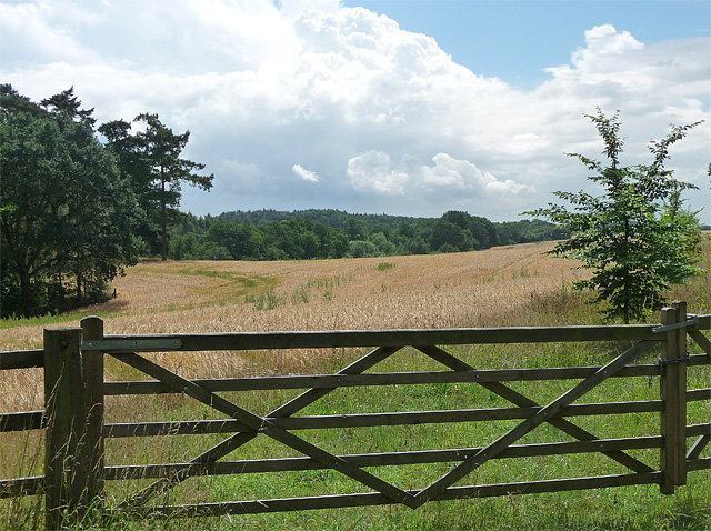
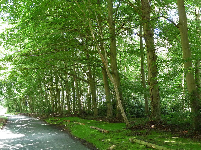
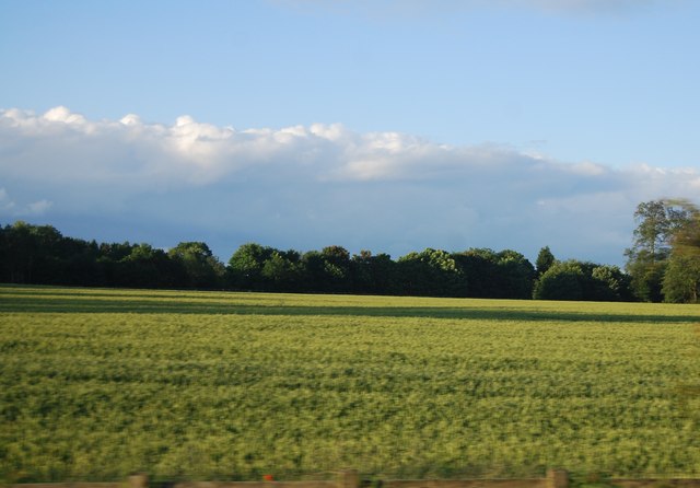
Loam Wood is a picturesque forest located in the county of Shropshire, England. Covering an area of approximately 100 hectares, it is a popular destination for nature enthusiasts and hikers alike. The woodland is situated about 10 miles west of the town of Shrewsbury and is easily accessible by car or public transportation.

Loam Wood is known for its diverse range of tree species, including oak, birch, and beech. These tall, majestic trees create a dense canopy that provides shelter and habitat for a variety of wildlife. Visitors to the forest can expect to encounter various bird species, such as woodpeckers and owls, as well as small mammals like squirrels and foxes.

The woodland offers several well-maintained trails, allowing visitors to explore its beauty at their own pace. These paths wind through the forest, offering breathtaking views of the surrounding countryside and providing opportunities for birdwatching and photography. Additionally, there are designated picnic areas and benches scattered throughout the wood, providing the perfect spot for a leisurely lunch or a moment of tranquility.

Loam Wood is managed by a local conservation organization that works diligently to preserve and protect its natural beauty. They regularly organize events and guided walks to educate visitors about the flora and fauna found within the wood. The organization also actively engages in habitat restoration and conservation efforts to ensure the long-term sustainability of the forest ecosystem.

Overall, Loam Wood is a serene and captivating forest that offers a peaceful escape from the hustle and bustle of everyday life. Its natural beauty, diverse wildlife, and well-maintained trails make it a must-visit destination for nature lovers and outdoor enthusiasts in Shropshire.

If you have any feedback on the listing, please let us know in the comments section below.
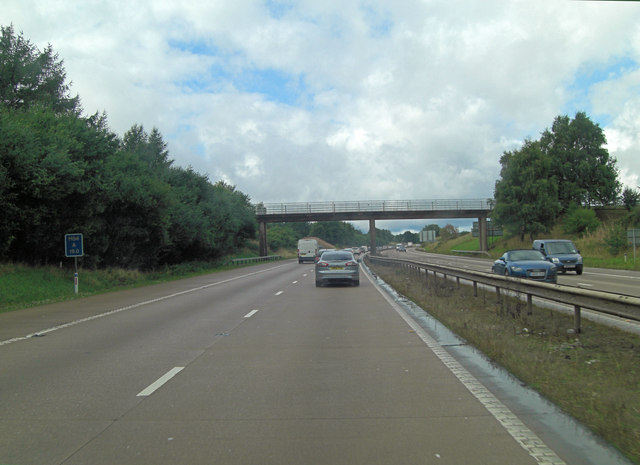
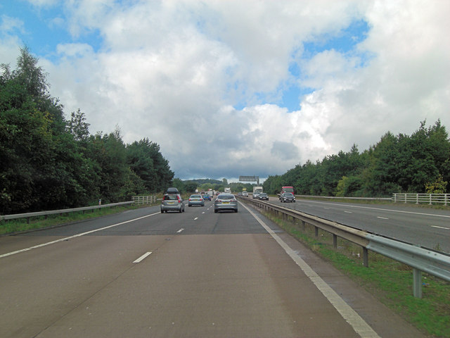
Loam Wood Images

Images are sourced within 2km of 52.659719/-2.34028 or Grid Reference SJ7706. Thanks to Geograph Open Source API. All images are credited.

Farmland near Tong
Farmland near Tong
Neachley Lane near Tong (1) Behind the wall lies a field and then a pumping station.
Neachley Lane near Tong (1)
Behind the wall lies a field and then a pumping station.
Pumping station near Tong Neachley Pumping Station, probably dating from the 1950s or 1960s.
Pumping station near Tong
Neachley Pumping Station, probably dating from the 1950s or 1960s.
Neachley Lane near Tong (2) Heading towards Shifnal through a small, unnamed wood.
Neachley Lane near Tong (2)
Heading towards Shifnal through a small, unnamed wood.
M54 south of Vauxhall Farm
M54 westbound near Timlet Bridge
M54 south of Cramp Pools
M54 near Cramp Pools The M54 is a 23 mile east-west motorway in Shropshire and Staffordshire. It is a two-lane dual carriageway for the majority of its length, with sections of three-lane.
The M54 spur connects the M6 motorway near Essington, Staffordshire with the A5 trunk road at Wellington, Shropshire. The motorway forms part of the route to North Wales, roughly following the path of the Roman Watling Street and the A5 north-westwards, towards the port of Holyhead.
M54 near Cramp Pools
The M54 is a 23 mile east-west motorway in Shropshire and Staffordshire. It is a two-lane dual carriageway for the majority of its length, with sections of three-lane. The M54 spur connects the M6 motorway near Essington, Staffordshire with the A5 trunk road at Wellington, Shropshire. The motorway forms part of the route to North Wales, roughly following the path of the Roman Watling Street and the A5 north-westwards, towards the port of Holyhead.
M54, eastbound The M54 is a 23 mile east-west motorway in Shropshire and Staffordshire. It is a two-lane dual carriageway for the majority of its length, with sections of three-lane.
The M54 spur connects the M6 motorway near Essington, Staffordshire with the A5 trunk road at Wellington, Shropshire. The motorway forms part of the route to North Wales, roughly following the path of the Roman Watling Street and the A5 north-westwards, towards the port of Holyhead.
M54, eastbound
The M54 is a 23 mile east-west motorway in Shropshire and Staffordshire. It is a two-lane dual carriageway for the majority of its length, with sections of three-lane. The M54 spur connects the M6 motorway near Essington, Staffordshire with the A5 trunk road at Wellington, Shropshire. The motorway forms part of the route to North Wales, roughly following the path of the Roman Watling Street and the A5 north-westwards, towards the port of Holyhead.
Farmland near Vauxhall Farm
Bridleway bridge, M54 The M54 is a 23 mile east-west motorway in Shropshire and Staffordshire. It is a two-lane dual carriageway for the majority of its length, with sections of three-lane.
The M54 spur connects the M6 motorway near Essington, Staffordshire with the A5 trunk road at Wellington, Shropshire. The motorway forms part of the route to North Wales, roughly following the path of the Roman Watling Street and the A5 north-westwards, towards the port of Holyhead.
Bridleway bridge, M54
The M54 is a 23 mile east-west motorway in Shropshire and Staffordshire. It is a two-lane dual carriageway for the majority of its length, with sections of three-lane. The M54 spur connects the M6 motorway near Essington, Staffordshire with the A5 trunk road at Wellington, Shropshire. The motorway forms part of the route to North Wales, roughly following the path of the Roman Watling Street and the A5 north-westwards, towards the port of Holyhead.
M54, eastbound The M54 is a 23 mile east-west motorway in Shropshire and Staffordshire. It is a two-lane dual carriageway for the majority of its length, with sections of three-lane.
The M54 spur connects the M6 motorway near Essington, Staffordshire with the A5 trunk road at Wellington, Shropshire. The motorway forms part of the route to North Wales, roughly following the path of the Roman Watling Street and the A5 north-westwards, towards the port of Holyhead.
M54, eastbound
The M54 is a 23 mile east-west motorway in Shropshire and Staffordshire. It is a two-lane dual carriageway for the majority of its length, with sections of three-lane. The M54 spur connects the M6 motorway near Essington, Staffordshire with the A5 trunk road at Wellington, Shropshire. The motorway forms part of the route to North Wales, roughly following the path of the Roman Watling Street and the A5 north-westwards, towards the port of Holyhead.
Windmill in Shifnal Taken on the 3rd Jan 2013.
Sun was behind subject & the sun just broke through for a few minutes on what was a dull day
Windmill in Shifnal
Taken on the 3rd Jan 2013. Sun was behind subject & the sun just broke through for a few minutes on what was a dull day
OS Flush Bracket 2494 - Aston Hall Mews FB 2494, situated on the corner of No 11, a mews conversion of the former Aston Hall farm buildings. Easily seen over the fence, adjacent to a couple of red gas bottles.
OS Flush Bracket 2494 - Aston Hall Mews
FB 2494, situated on the corner of No 11, a mews conversion of the former Aston Hall farm buildings. Easily seen over the fence, adjacent to a couple of red gas bottles.
OS benchmark - no 52, Aston Road OS cutmark low down on the front wall of no 52, Aston Road. This is a private house, much extended since its early life as a small school, but the owner was happy to show me the benchmark. Levelled at 87.6209m, 288'6" above Ordnance Datum Newlyn.
OS benchmark - no 52, Aston Road
OS cutmark low down on the front wall of no 52, Aston Road. This is a private house, much extended since its early life as a small school, but the owner was happy to show me the benchmark. Levelled at 87.6209m, 288'6" above Ordnance Datum Newlyn.
OS benchmark - Stanton Road A cut benchmark low on the wall bounding the NW side of Stanton Road, about 70 metres beyond the junction with Lamledge Lane. This one took some finding, as the vegetation is rampant at this time of year. Levelled at a height of 88.5535m, 290'6" above Ordnance Datum Newlyn.
OS benchmark - Stanton Road
A cut benchmark low on the wall bounding the NW side of Stanton Road, about 70 metres beyond the junction with Lamledge Lane. This one took some finding, as the vegetation is rampant at this time of year. Levelled at a height of 88.5535m, 290'6" above Ordnance Datum Newlyn.
M54 footbridge northwest of Neachley Hall
M54 crosses over Stanton Road
Show me another place!

Loam Wood is located at Grid Ref: SJ7706 (Lat: 52.659719, Lng: -2.34028)

Unitary Authority: Shropshire

Police Authority: West Mercia

What 3 Words

///chicken.universe.lollipop. Near Shifnal, Shropshire

Related Wikis

Shifnal Town F.C.

Shifnal Town Football Club is a football club based in Shifnal, Shropshire, England. They have reached the 4th round of the FA Vase three times in their...

Idsall School

Idsall School is a coeducational secondary school with academy status located in the town of Shifnal in Shropshire, England. Idsall has its own Sixth Form...

Shifnal railway station

Shifnal railway station is a railway station which serves the town of Shifnal in Shropshire, England. The station is managed by West Midlands Trains, who...

Shifnal

Shifnal () is a market town and civil parish in Shropshire, England, about 4 miles (6 km) east of Telford, 17 miles (27 km) east of Shrewsbury and 13 miles...

Nearby Amenities

Located within 500m of 52.659719,-2.34028
Power: pole
Source: Bing
Lat/Long: 52.655809/-2.3389493
The data included in this document is from www.openstreetmap.org. The data is made available under ODbL.

Have you been to Loam Wood?

Leave your review of Loam Wood below (or comments, questions and feedback).