Grundy's Meadow

Wood, Forest in Herefordshire

England

Grundy's Meadow

Path on Perseverance Hill  Path in woodland on the eastern slopes of Perseverance Hill.
Path on Perseverance Hill Credit: Philip Halling

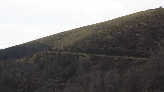
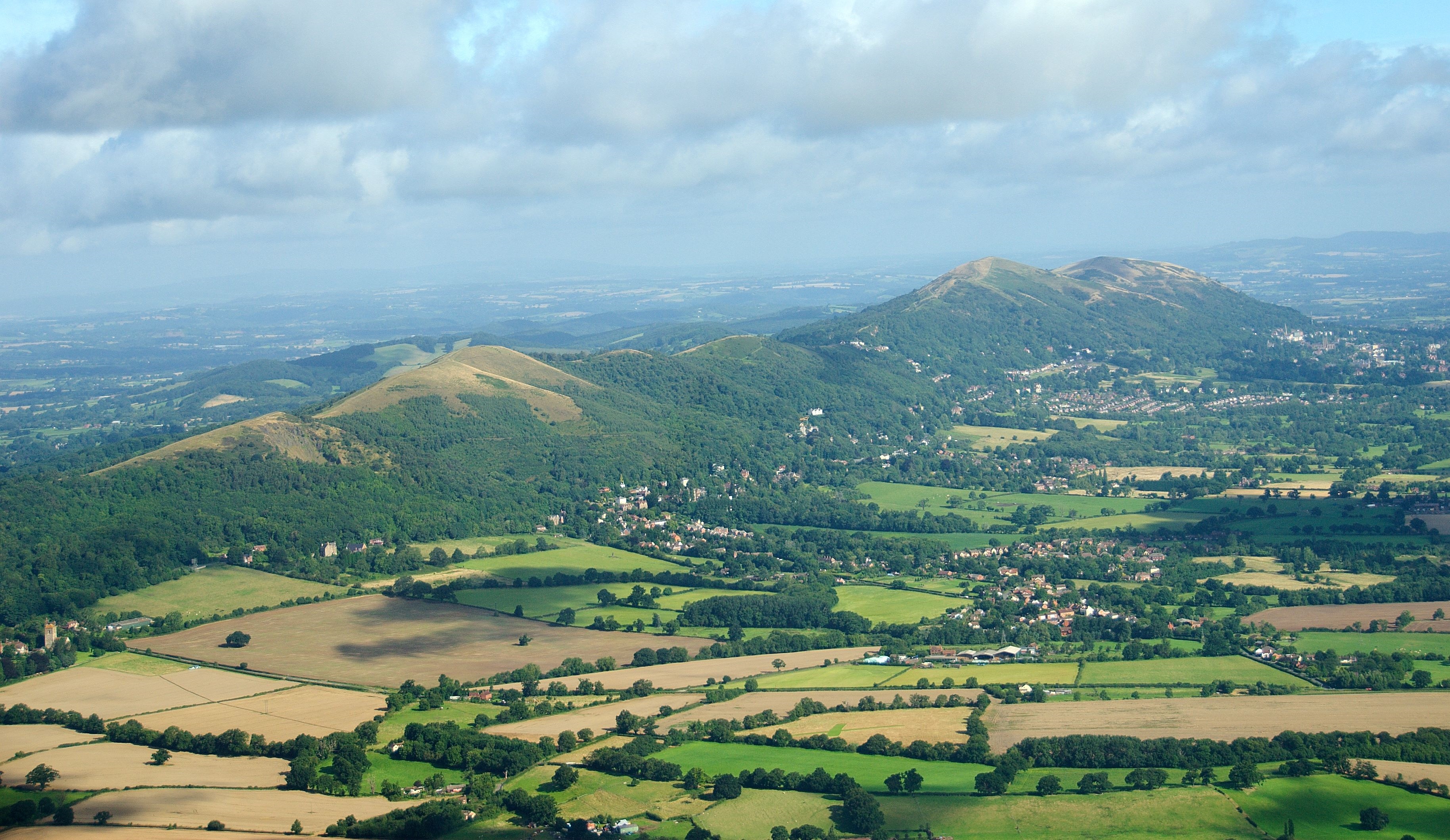
Grundy's Meadow is a picturesque wood located in the county of Herefordshire, England. Situated in the heart of the region, this enchanting forest covers an expansive area and is known for its natural beauty and tranquility. The meadow is nestled amidst rolling hills and is surrounded by a diverse range of flora and fauna, making it a haven for nature enthusiasts and a popular destination for outdoor activities.

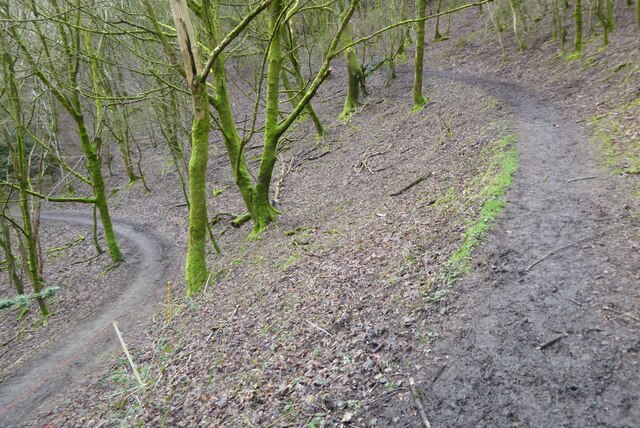
The forest boasts a rich variety of trees, including majestic oaks, beech, and birch, creating a lush and vibrant canopy that provides shade and shelter to the woodland floor below. The forest floor itself is adorned with a carpet of wildflowers, ferns, and mosses, adding to the area's ethereal charm.

Grundy's Meadow is crisscrossed with numerous walking trails, allowing visitors to explore its hidden gems and discover its breathtaking vistas. The paths wind through the dense forest, leading to captivating sights such as babbling brooks, tranquil ponds, and ancient stone ruins. The serenity of the meadow is often interrupted by the melodious chirping of birds and the occasional scurrying of woodland creatures, enhancing the immersive experience of being in nature.

The wood is not only a natural wonderland but also holds historical significance. It is believed to have been used for timber production in the past, contributing to the local economy. Today, it stands as a testament to the region's rich heritage and is cherished by both locals and tourists alike.

Grundy's Meadow in Herefordshire is a true gem, offering a sanctuary of tranquility and a chance to immerse oneself in the beauty of nature. Whether it's a leisurely walk, a picnic, or simply a moment of peaceful reflection, this idyllic forest provides a perfect escape from the bustling modern world.

If you have any feedback on the listing, please let us know in the comments section below.

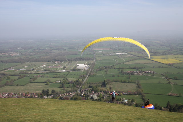
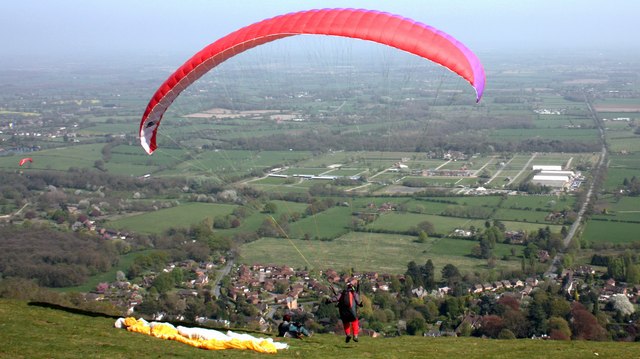
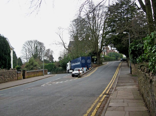
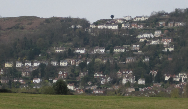
Grundy's Meadow Images

Images are sourced within 2km of 52.092226/-2.3397815 or Grid Reference SO7643. Thanks to Geograph Open Source API. All images are credited.

Path on Perseverance Hill  Path in woodland on the eastern slopes of Perseverance Hill.
Path on Perseverance Hill
Path in woodland on the eastern slopes of Perseverance Hill.
Path around Pinnacle Hill This fairly level path climbs gently to the ridge path.
Path around Pinnacle Hill
This fairly level path climbs gently to the ridge path.
Jubilee Hill A small, but distinct peak on the Malvern ridge.
It was one of the un-named peaks until Queen Elizabeth's golden jubilee in 2002.
Her son Prince Andrew walked to the top of the hill (which was adorned with a flagpole flying the union flag for the one day only) to name it.
Jubilee Hill
A small, but distinct peak on the Malvern ridge. It was one of the un-named peaks until Queen Elizabeth's golden jubilee in 2002. Her son Prince Andrew walked to the top of the hill (which was adorned with a flagpole flying the union flag for the one day only) to name it.
Pinnacle Hill Taken from the larch trees of Thirds Land by Jubilee Hill.
Pinnacle Hill
Taken from the larch trees of Thirds Land by Jubilee Hill.
Larch buds at Thirds Land Close to Jubilee Hill. 
The flowering buds will form into cones as the seasons pass.
The land got the name "Thirds Land" as it was part of the Malvern Chase common handed to King Charles II as compensation for the disafforestation of the Chase.
Larch buds at Thirds Land
Close to Jubilee Hill. The flowering buds will form into cones as the seasons pass. The land got the name "Thirds Land" as it was part of the Malvern Chase common handed to King Charles II as compensation for the disafforestation of the Chase.
Yellow Horse Gate, Three Counties Showground The approach road and gate known as the 'Yellow Horse Gate' at the Three Counties Showground, Malvern. The colour refers to the shade of ticket rather than an equestrian breed!
Yellow Horse Gate, Three Counties Showground
The approach road and gate known as the 'Yellow Horse Gate' at the Three Counties Showground, Malvern. The colour refers to the shade of ticket rather than an equestrian breed!
Equestrian Paddock and Associated Buildings, Three Counties Showground The paddock areas used for horse events and other animal showing activities at the Three Counties Showground. The Malvern Hills are to be seen behind the buildings which accompany the paddocks
Equestrian Paddock and Associated Buildings, Three Counties Showground
The paddock areas used for horse events and other animal showing activities at the Three Counties Showground. The Malvern Hills are to be seen behind the buildings which accompany the paddocks
The Wells Road near Ashdown Villa Looking in a southerly direction towards Little Malvern.
This stretch of the road is still lit by gas lamps.
On the right is the "Gothic Well" - not open to the public.
<span class="nowrap"><a title="http://www.malvern-hills.co.uk/malvernspa/well-info/gothic.html" rel="nofollow ugc noopener" href="http://www.malvern-hills.co.uk/malvernspa/well-info/gothic.html">Link</a><img style="margin-left:2px;" alt="External link" title="External link - shift click to open in new window" src="https://s1.geograph.org.uk/img/external.png" width="10" height="10"/></span>
The Wells Road near Ashdown Villa
Looking in a southerly direction towards Little Malvern. This stretch of the road is still lit by gas lamps. On the right is the "Gothic Well" - not open to the public. LinkExternal link
The Wells Road below Hanley Terrace Looking in a northerly direction towards Great Malvern.
The houses are on Hanley Terrace high above the main road.
On the left, built into the hillside, is the "Gothic Well".
<span class="nowrap"><a title="http://www.malvern-hills.co.uk/malvernspa/well-info/gothic.html" rel="nofollow ugc noopener" href="http://www.malvern-hills.co.uk/malvernspa/well-info/gothic.html">Link</a><img style="margin-left:2px;" alt="External link" title="External link - shift click to open in new window" src="https://s1.geograph.org.uk/img/external.png" width="10" height="10"/></span>
The Wells Road below Hanley Terrace
Looking in a northerly direction towards Great Malvern. The houses are on Hanley Terrace high above the main road. On the left, built into the hillside, is the "Gothic Well". LinkExternal link
The Gothic Well on Wells Road, Malvern An old wooden green door stood under the central arch until recently, but this has now been bricked up.
This gave access to a chamber going 30 feet into the hillside to the well which supplied 30,000 gallons of water per day. 
During the war the chamber was used as an air raid shelter. 
<span class="nowrap"><a title="http://www.malvern-hills.co.uk/malvernspa/well-info/gothic.html" rel="nofollow ugc noopener" href="http://www.malvern-hills.co.uk/malvernspa/well-info/gothic.html">Link</a><img style="margin-left:2px;" alt="External link" title="External link - shift click to open in new window" src="https://s1.geograph.org.uk/img/external.png" width="10" height="10"/></span>
The Gothic Well on Wells Road, Malvern
An old wooden green door stood under the central arch until recently, but this has now been bricked up. This gave access to a chamber going 30 feet into the hillside to the well which supplied 30,000 gallons of water per day. During the war the chamber was used as an air raid shelter. LinkExternal link
Paraglider on Pinnacle Hill One of dozens of paragliders taking off and flying around Pinnacle Hill with the breeze blowing from the south-east.
Permission to use the hill (owned by the Malvern hills Conservators) is under the strict safety rules of the Malvern Hills Hang Gliding Club.
<span class="nowrap"><a title="http://www.malvern-hang.org.uk/pinnacle.shtml" rel="nofollow ugc noopener" href="http://www.malvern-hang.org.uk/pinnacle.shtml">Link</a><img style="margin-left:2px;" alt="External link" title="External link - shift click to open in new window" src="https://s1.geograph.org.uk/img/external.png" width="10" height="10"/></span>
In the background is the Three Counties Showground.
Paraglider on Pinnacle Hill
One of dozens of paragliders taking off and flying around Pinnacle Hill with the breeze blowing from the south-east. Permission to use the hill (owned by the Malvern hills Conservators) is under the strict safety rules of the Malvern Hills Hang Gliding Club. LinkExternal link In the background is the Three Counties Showground.
Paraglider on Pinnacle Hill Just at the point of take-off.
Malvern Wells and the Three Counties Showground in the background.
Paraglider on Pinnacle Hill
Just at the point of take-off. Malvern Wells and the Three Counties Showground in the background.
Paraglider on Pinnacle Hill Now I know why they wear crash helmets. 
Taken just at the point of take-off. 
The breeze then shifted the paraglider and pilot the left, narrowly missing the other helmeted pilot sitting on the ground.
From here we get a good view of Malvern Wells sitting below Pinnacle Hill and the Three Counties Showground where occasionally we get to see expensive firework displays.
Paraglider on Pinnacle Hill
Now I know why they wear crash helmets. Taken just at the point of take-off. The breeze then shifted the paraglider and pilot the left, narrowly missing the other helmeted pilot sitting on the ground. From here we get a good view of Malvern Wells sitting below Pinnacle Hill and the Three Counties Showground where occasionally we get to see expensive firework displays.
Paraglider on Pinnacle Hill A walker on the upper path and a paraglider above the ridge: going for the moon.
Paraglider on Pinnacle Hill
A walker on the upper path and a paraglider above the ridge: going for the moon.
Junction of Priory Road and Abbey Road, Great Malvern Priory Road is on the left, and Abbey Road is on the right.
Junction of Priory Road and Abbey Road, Great Malvern
Priory Road is on the left, and Abbey Road is on the right.
Pinnacle Hill The Malvern Hang Gliding Club use the East side of this ridge for ridge soaring when the wind is from NE-ESE (45-120 degrees). The Malvern Hills are aligned roughly North/South and rise to almost 1,400 feet above sea level.
Pinnacle Hill
The Malvern Hang Gliding Club use the East side of this ridge for ridge soaring when the wind is from NE-ESE (45-120 degrees). The Malvern Hills are aligned roughly North/South and rise to almost 1,400 feet above sea level.
Gardners Quarry
Gardners Quarry
Cave at Gardners Quarry
Show me another place!

Grundy's Meadow is located at Grid Ref: SO7643 (Lat: 52.092226, Lng: -2.3397815)

Unitary Authority: County of Herefordshire

Police Authority: West Mercia

What 3 Words

///resists.announced.swarm. Near Great Malvern, Worcestershire

Related Wikis

Wyche, Worcestershire

Wyche ( WITCH), often referred to locally as The Wyche, is a village and a suburb of the town of Malvern, Worcestershire, England, and part of the civil...

Malvern water

Malvern water is a natural spring water from the Malvern Hills on the border of the counties of Herefordshire and Worcestershire in England. The Hills...

Downs Light Railway

The Downs Light Railway is the world's oldest private miniature railway, with a track gauge of 9+1⁄2 in (241 mm). The railway is located within the grounds...

Malvern Hills

The Malvern Hills are in the English counties of Worcestershire, Herefordshire and a small area of northern Gloucestershire, dominating the surrounding...

The Downs Malvern

The Downs Malvern is a private prep school in the United Kingdom, founded in 1900. It is located on a 55-acre (22 ha) site in Colwall in the County of...

Malvern Wells railway station

Malvern Wells railway station was a station on the Worcester and Hereford section of the Great Western Railway at Lower Wyche, between Great Malvern and...

Colwall Tunnels

The Colwall Tunnels are a pair of railway tunnels that connect Colwall and Malvern Wells on the Cotswold Line, passing under the Malvern Hills in the Welsh...

Jubilee Hill

Jubilee Hill is situated in the range of Malvern Hills that runs about 13 kilometres (8 mi) north-south along the Herefordshire-Worcestershire border....

Nearby Amenities

Located within 500m of 52.092226,-2.3397815
Give Way
Lat/Long: 52.0906619/-2.3345813
Telephone
Booth: K6
Covered: booth
Listed Status: Grade II
Payment Coins: no
Phone: +44 1684 573999
Lat/Long: 52.0909393/-2.3391145
Parking
Fee: yes
Fee Amount: £4.00
Lit: no
Parking: surface
Surface: asphalt
Lat/Long: 52.0920585/-2.3392074
Bench
Lat/Long: 52.0916155/-2.3389072
Place Of Worship
Wyche Free Church
Addr Street: Jubilee Drive
Religion: christian
Lat/Long: 52.0889809/-2.3399011
Parking
Fee: yes
Fee Amount: £4.00
Lit: no
Parking: surface
Surface: asphalt
Lat/Long: 52.0936659/-2.3390232
Post Box
Collection Plate: CP2
Collection Times: Mo-Fr 17:30; Sa 11:00
Historic Operator: Post Office
Post Box Type: wall
Ref: WR14 67
Royal Cypher: EVIIR
Royal Cypher Wikidata: Q33102324
Lat/Long: 52.0922832/-2.3346437
Bus Stop
Wyche Primary school
Bus: yes
Naptan AtcoCode: 2000G008600
Naptan Bearing: NE
Naptan CommonName: Wyche Primary school
Naptan Indicator: adj
Naptan Landmark: School
Naptan NaptanCode: wocgdwjw
Naptan PlusbusZoneRef: GTMLVRN
Naptan Street: Wells Road
Naptan Verified: no
Public Transport: platform
Source: naptan_import
Lat/Long: 52.0938402/-2.3338618
Bus Stop
Wyche Primary School
Bus: yes
Naptan AtcoCode: 2000G323406
Naptan Bearing: SW
Naptan CommonName: Wyche Primary School
Naptan Indicator: opp
Naptan Landmark: School
Naptan NaptanCode: wocdmdtm
Naptan PlusbusZoneRef: GTMLVRN
Naptan Street: Wells Road
Naptan Verified: no
Public Transport: platform
Source: naptan_import
Lat/Long: 52.0938181/-2.3336962
Bus Stop
King Edward's Road- Fruitlands
Bus: yes
Naptan AtcoCode: 2000G323407
Naptan Bearing: N
Naptan BusStopType: CUS
Naptan CommonName: King Edward's Road- Fruitlands
Naptan Indicator: opp
Naptan Landmark: King Edward's Road- Fruitlands
Naptan NaptanCode: wocdmdtp
Naptan PlusbusZoneRef: GTMLVRN
Naptan Street: King Edward's Road- Fruitlands
Naptan Verified: no
Public Transport: platform
Source: naptan_import
Lat/Long: 52.0935763/-2.332928
Bus Stop
Eaton Road
Bus: yes
Naptan AtcoCode: 2000G500825
Naptan Bearing: N
Naptan CommonName: Eaton Road
Naptan Crossing: Eaton Road
Naptan Indicator: adj
Naptan NaptanCode: wocdmjgp
Naptan PlusbusZoneRef: GTMLVRN
Naptan Street: Wells Road
Naptan Verified: no
Public Transport: platform
Source: naptan_import
Lat/Long: 52.0905773/-2.3347156
Bus Stop
Eaton Road
Bus: yes
Naptan AtcoCode: 2000G500826
Naptan Bearing: SE
Naptan CommonName: Eaton Road
Naptan Indicator: opp
Naptan NaptanCode: wocdmjgt
Naptan PlusbusZoneRef: GTMLVRN
Naptan Street: Wells Road
Naptan Verified: no
Public Transport: platform
Source: naptan_import
Lat/Long: 52.0895275/-2.3339634
Bus Stop
Post Office
Bus: yes
Naptan AtcoCode: 2000G502671
Naptan Bearing: S
Naptan BusStopType: CUS
Naptan CommonName: Post Office
Naptan Indicator: Adj
Naptan NaptanCode: wocgjdap
Naptan PlusbusZoneRef: GTMLVRN
Naptan Street: Wyche Road
Naptan Verified: no
Public Transport: platform
Source: naptan_import
Lat/Long: 52.0923939/-2.3375166
Bus Stop
West Malvern Road (Northbound)
Bus: yes
Naptan AtcoCode: 2000G702672
Naptan Bearing: N
Naptan BusStopType: CUS
Naptan CommonName: West Malvern Road (Northbound)
Naptan Indicator: Northbound
Naptan NaptanCode: wocgpagm
Naptan PlusbusZoneRef: GTMLVRN
Naptan Street: West Malvern Road
Naptan Verified: no
Public Transport: platform
Source: naptan_import
Lat/Long: 52.096476/-2.3407595
Bus Stop
Post Office
Bus: yes
Naptan AtcoCode: 2000G792672
Naptan Bearing: N
Naptan BusStopType: CUS
Naptan CommonName: Post Office
Naptan Indicator: opp
Naptan NaptanCode: wocgpagp
Naptan PlusbusZoneRef: GTMLVRN
Naptan Street: Wyche Road
Naptan Verified: no
Public Transport: platform
Source: naptan_import
Lat/Long: 52.0922851/-2.3373959
Booth: K6
Old Phone: +44 1684 574999
Removed Amenity: telephone
Lat/Long: 52.0940875/-2.3334357
Bus Stop
Wyche Cutting
Bench: no
Bin: no
Bus: yes
Lit: yes
Naptan AtcoCode: 2090A022400
Naptan Bearing: S
Naptan CommonName: Wyche Cutting
Naptan Indicator: adj
Naptan Landmark: Shelter - Public Toilets
Naptan NaptanCode: heraptgp
Naptan PlusbusZoneRef: GTMLVRN
Naptan Street: Walwyn Road
Public Transport: platform
Shelter: no
Source: naptan_import
Tactile Paving: no
Lat/Long: 52.0910253/-2.3391045
Bus Stop
Wyche Cutting
Bench: no
Bin: no
Bus: yes
Lit: yes
Naptan AtcoCode: 2090A022401
Naptan Bearing: N
Naptan CommonName: Wyche Cutting
Naptan Indicator: opp
Naptan Landmark: Shelter- Public Toilets
Naptan NaptanCode: heraptgt
Naptan PlusbusZoneRef: GTMLVRN
Naptan Street: Walwyn Road
Naptan Verified: no
Public Transport: platform
Shelter: no
Source: naptan_import
Tactile Paving: no
Lat/Long: 52.0910129/-2.3392494
Wellingtonia Guest House
Tourism: guest_house
Lat/Long: 52.0927913/-2.3402672
Post Box
Collection Plate: none
Historic Operator: Post Office
Post Box Type: lamp
Ref: WR14 65
Royal Cypher: EIIR
Royal Cypher Wikidata: Q33102113
Lat/Long: 52.0921008/-2.3375767
Post Box
Collection Plate: CP7
Collection Times: Mo-Fr 09:00; Sa 07:00
Historic Operator: Post Office
Post Box Type: lamp
Ref: WR13 103
Royal Cypher: EIIR
Royal Cypher Wikidata: Q33102113
Lat/Long: 52.090111/-2.3398
Pub
Railway Inn
Addr City: Malvern
Addr Housenumber: 78
Addr Postcode: WR14 4PA
Addr Street: Wells Road
Fhrs Id: 672569
Operator: Marston's
Source Addr: FHRS Open Data
Lat/Long: 52.0928615/-2.3345961
Post Box
Collection Plate: CP1
Collection Times: Mo-Fr 17:15; Sa 11:00
Description: In gatepost of number 10, on W side of road
Historic Operator: Post Office
Post Box Type: wall
Ref: WR14 136
Royal Cypher: GVIR
Royal Cypher Wikidata: Q33102169
Lat/Long: 52.0916947/-2.3331387
Post Box
Collection Plate: CP5
Collection Times: Mo-Fr 17:15; Sa 11:15
Historic Operator: Post Office
Post Box Apertures: 1
Post Box Manufacturer: ?? Allen & Co. London
Post Box Type: wall
Ref: WR14 127
Royal Cypher: VR
Royal Cypher Wikidata: Q33102356
Lat/Long: 52.0960954/-2.3403123
The Goldmine
Description: Not exactly a sign post, but instead a large, round stone platform with signs on its top.
Information: guidepost
Tourism: information
Lat/Long: 52.0953207/-2.3384835
Information: map
Map Size: site
Tourism: information
Lat/Long: 52.092157/-2.3392465
Bench
Lat/Long: 52.096151/-2.3387664
Fixme: not sure where this connects
Lat/Long: 52.0925585/-2.3392756
Entrance: main
Source: bing
Lat/Long: 52.0937076/-2.3343631
Give Way
Lat/Long: 52.0925162/-2.3344876
Entrance: main
Source: survey
Lat/Long: 52.0943302/-2.334276
Entrance: service
Lat/Long: 52.0943833/-2.3340606
Entrance: main
Source: bing
Lat/Long: 52.0937587/-2.334619
Entrance: main
Source: bing
Lat/Long: 52.094313/-2.3345477
Entrance: main
Source: survey
Lat/Long: 52.0945235/-2.3344229
Cafe
Cafe H2O
Addr Housename: Wyche Innovation Centre
Addr Place: Upper Colwall
Addr Postcode: WR13 6PL
Addr Street: Walwyn Road
Fhrs Id: 507673
Opening Hours: Mo,Tu,Th-Sa 10:00-16:00
Operator: Team Jamboree
Source Addr: FHRS Open Data
Website: https://wyche-innovation.com/index.php/cafe-h2o
Lat/Long: 52.0900821/-2.3402074
Wyche
Place: neighbourhood
Wikidata: Q8039560
Wikipedia: en:Wyche, Worcestershire
Lat/Long: 52.0919588/-2.3373047
Malvern Hills GeoCentre
Information: office
Operator: Key IQ Ltd
Phone: +44 1684 252 414
Tourism: information
Website: https://geocentre.co.uk/
Lat/Long: 52.0901315/-2.3402637
Bench
Lat/Long: 52.091008/-2.3393754
Barrier: bollard
Lat/Long: 52.0906663/-2.3395855
Wyche Spout
Natural: spring
Lat/Long: 52.0909141/-2.3393339
Bench
Backrest: yes
Lat/Long: 52.0902944/-2.3397509
Defibrillator
Emergency: defibrillator
Lat/Long: 52.0945018/-2.3343954
Bicycle Parking
Bicycle Parking: stands
Capacity: 4
Covered: no
Lit: no
Surface: asphalt
Lat/Long: 52.0940969/-2.3390231
Aces Dust Control
Addr Street: Fossil Bank
Addr Unit: 3
Office: company
Phone: +44 1684 576 573
Website: https://www.acesdustcontrol.com/
Lat/Long: 52.09023/-2.3401845
Playground: swing
Lat/Long: 52.090249/-2.3399055
Defibrillator
Defibrillator Location: In the car park of the Malvern GeoCentre.
Emergency: defibrillator
Emergency Telephone Code: 999
Fixme: Needs confirming, as it was added only from information on https://geocentre.co.uk/index.php/how-to-find-us .
Indoor: no
Opening Hours: 24/7
Source: https://geocentre.co.uk/index.php/how-to-find-us
Lat/Long: 52.0900693/-2.3402984
Charging Station
Malvern Hills GeoCentre
Amperage: 32
Capacity: 1
Fixme: Needs confirming, as it was added only from information on https://geocentre.co.uk/index.php/how-to-find-us .
Motorcar: yes
Source: https://geocentre.co.uk/index.php/how-to-find-us
Lat/Long: 52.0901007/-2.3403467
Bicycle Parking
Capacity: 6
Covered: no
Fixme: Location need to be confirmed
Lat/Long: 52.0900067/-2.3402274
Bench
Backrest: no
Capacity: 4
Material: wood
Lat/Long: 52.0898244/-2.3382448
The data included in this document is from www.openstreetmap.org. The data is made available under ODbL.

Have you been to Grundy's Meadow?

Leave your review of Grundy's Meadow below (or comments, questions and feedback).