Àird Asaig

Settlement in Inverness-shire

Scotland

Àird Asaig

Long abandoned whaling station at Bunavoneader Viewed from across the water, with the bulk of Mònan rising beyond.

Whaling Station, 1904 Gaunt remains of a long-defunct industry, with a lone, tapering red brick chimney rising from the foundations of the boiling house/desiccator. Little else but the carcass ramp survives. Founded by Norwegian Karl Herlofsen, the factory was acquired by Lever Bros in 1922 when the market was declining, but was abandoned by them in 1929, a financial failure. Leverhulme never pursued his bizarre notion of turning whale meat into tinned sausages for Africans. The whaling station finally closed in 1951.

Taken from "Western Seaboard: An Illustrated Architectural Guide", by Mary Miers, 2008. Published by the Rutland Press.
Long abandoned whaling station at Bunavoneader Credit: Richard Dorrell

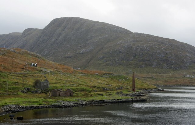
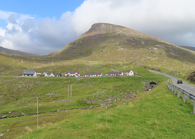
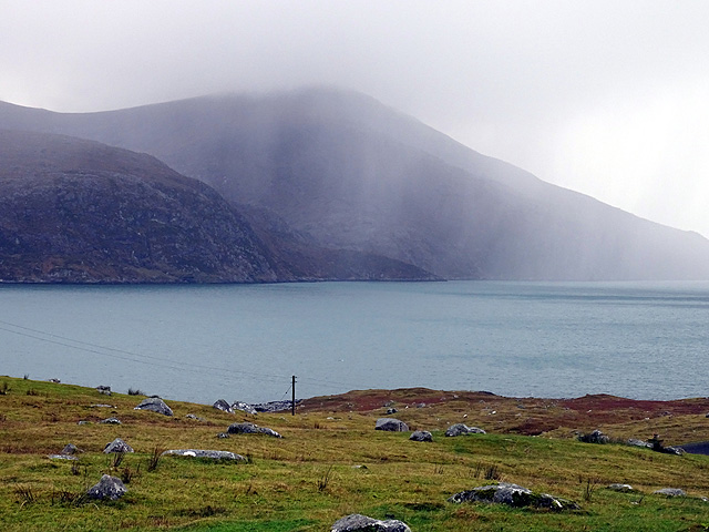
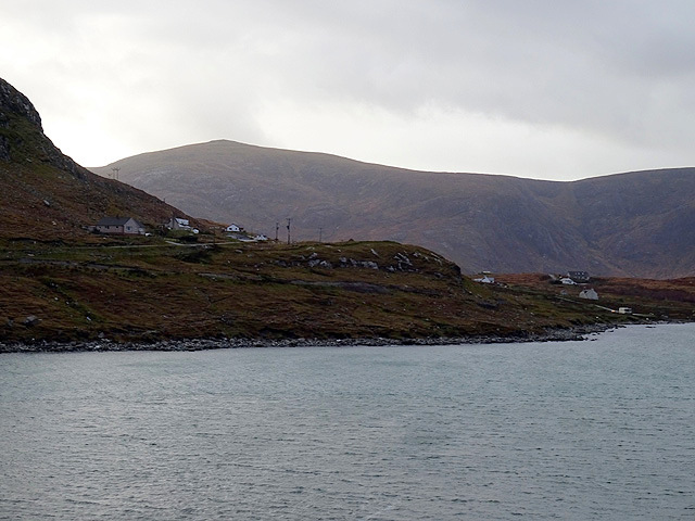
Àird Asaig is a small rural settlement located in Inverness-shire, Scotland. Situated on the west coast of the Scottish Highlands, it is nestled between the scenic Loch Nevis and the majestic Knoydart Peninsula. With a population of around 50 residents, it offers a tranquil and idyllic setting for those seeking a peaceful retreat.

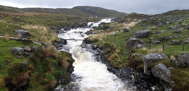
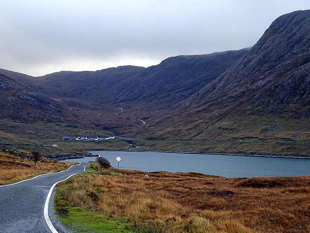
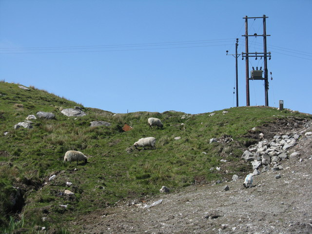
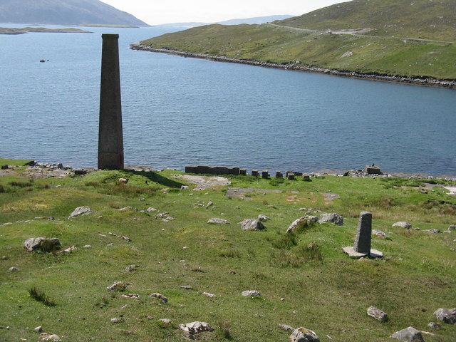
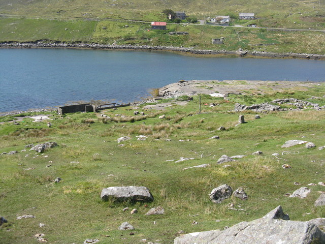
The geographical features of Àird Asaig are characterized by its rugged coastline, rolling hills, and expansive moorlands. The surrounding area is abundant in natural beauty, offering stunning views of the mountains and the sea. The region is also home to diverse wildlife, including red deer, golden eagles, and otters, making it a haven for nature enthusiasts and wildlife photographers.

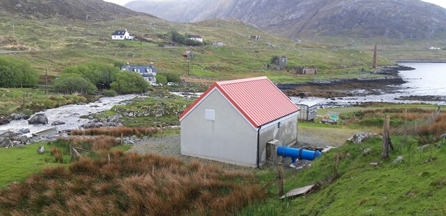
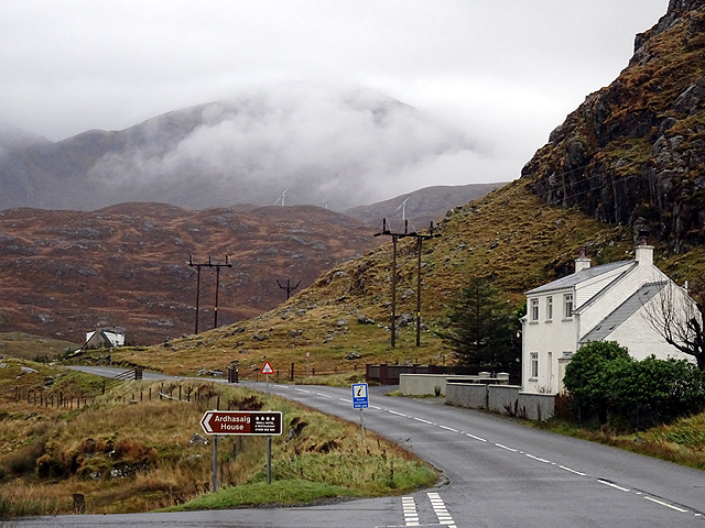
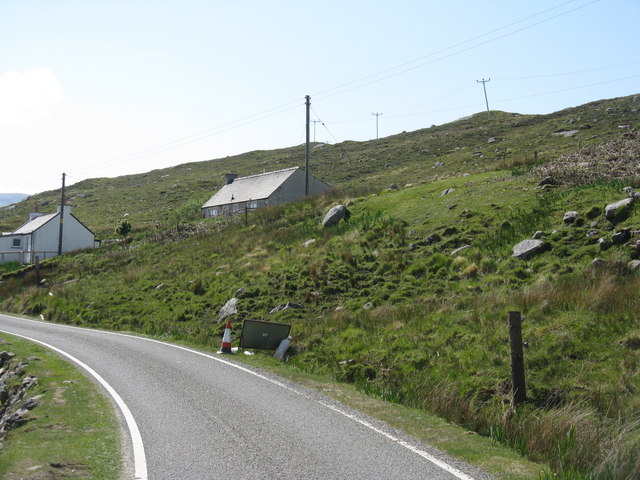
The settlement itself consists of a handful of traditional stone houses and cottages, showcasing the area's rich historical heritage. The local community prides itself on preserving the traditional way of life, with fishing and farming being the primary occupations. Residents engage in the sustainable harvesting of shellfish and the rearing of livestock, contributing to the local economy and maintaining the area's cultural identity.

While Àird Asaig may be remote, it attracts visitors and outdoor enthusiasts who appreciate its untouched beauty and unspoiled landscapes. Hiking, fishing, and sailing are popular activities, with various trails and routes available for exploration. Visitors can also enjoy boat trips to nearby islands or indulge in the local cuisine at the charming village pub.

Overall, Àird Asaig offers a serene and picturesque escape from the bustling city life, allowing visitors to immerse themselves in the natural wonders of the Scottish Highlands.

If you have any feedback on the listing, please let us know in the comments section below.
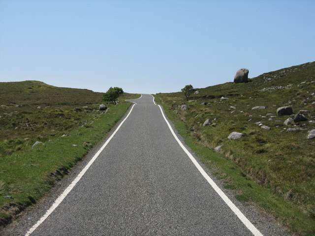
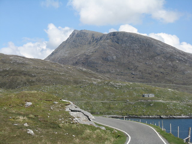
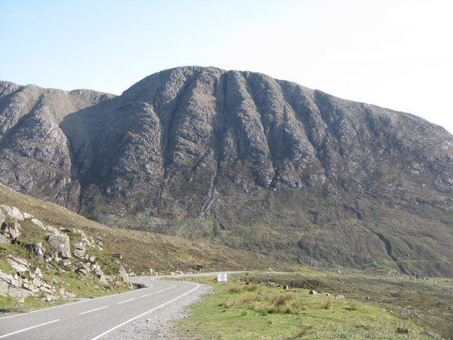
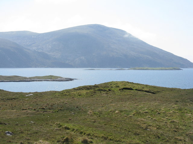
Àird Asaig Images

Images are sourced within 2km of 57.919353/-6.85334 or Grid Reference NB1202. Thanks to Geograph Open Source API. All images are credited.

Long abandoned whaling station at Bunavoneader Viewed from across the water, with the bulk of Mònan rising beyond.

Whaling Station, 1904 Gaunt remains of a long-defunct industry, with a lone, tapering red brick chimney rising from the foundations of the boiling house/desiccator. Little else but the carcass ramp survives. Founded by Norwegian Karl Herlofsen, the factory was acquired by Lever Bros in 1922 when the market was declining, but was abandoned by them in 1929, a financial failure. Leverhulme never pursued his bizarre notion of turning whale meat into tinned sausages for Africans. The whaling station finally closed in 1951.

Taken from "Western Seaboard: An Illustrated Architectural Guide", by Mary Miers, 2008. Published by the Rutland Press.
Long abandoned whaling station at Bunavoneader
Viewed from across the water, with the bulk of Mònan rising beyond. Whaling Station, 1904 Gaunt remains of a long-defunct industry, with a lone, tapering red brick chimney rising from the foundations of the boiling house/desiccator. Little else but the carcass ramp survives. Founded by Norwegian Karl Herlofsen, the factory was acquired by Lever Bros in 1922 when the market was declining, but was abandoned by them in 1929, a financial failure. Leverhulme never pursued his bizarre notion of turning whale meat into tinned sausages for Africans. The whaling station finally closed in 1951. Taken from "Western Seaboard: An Illustrated Architectural Guide", by Mary Miers, 2008. Published by the Rutland Press.
Hydro-electric Power Station at Bun Abhainn Eadarra The nearby whaling station is visible in the background.
Hydro-electric Power Station at Bun Abhainn Eadarra
The nearby whaling station is visible in the background.
Abhainn Eadarra after heavy rain
Ceann an Ora A row of modern houses dwarfed by Sròn a' Sgaoth rising above.
Ceann an Ora
A row of modern houses dwarfed by Sròn a' Sgaoth rising above.
By Ãird Asaig Looking towards Beinn Dhubh which is swathed in a rainstorm.
By Ãird Asaig
Looking towards Beinn Dhubh which is swathed in a rainstorm.
Skirting Ãird Bun Abhainn Eadarra Beside Loch Bun Abhainn Eadarra.
Skirting Ãird Bun Abhainn Eadarra
Beside Loch Bun Abhainn Eadarra.
Road junction at Ãird Asaig/Ardhasaig The appropriately named 'Roadside Cottage' on the right, with Mulla bho Dheas partially obscured by cloud.
Road junction at Ãird Asaig/Ardhasaig
The appropriately named 'Roadside Cottage' on the right, with Mulla bho Dheas partially obscured by cloud.
A view towards Ãird Asaig/Ardhasaig Looking across Loch Bun Abhainn Eadarra.
A view towards Ãird Asaig/Ardhasaig
Looking across Loch Bun Abhainn Eadarra.
Glacial erratic by the B887 The road to Hushinish from Tarbert.
Glacial erratic by the B887
The road to Hushinish from Tarbert.
Looking east from Ãird Bun Abhainn Eadarra With Sgaoth Iosal beyond and Loch Bun Abhainn Eadarra below to the right.
Looking east from Ãird Bun Abhainn Eadarra
With Sgaoth Iosal beyond and Loch Bun Abhainn Eadarra below to the right.
The cliffs of Geodhan Dubh The northern aspect of Gillaval Dubh, seen from the A859 looking south.
The cliffs of Geodhan Dubh
The northern aspect of Gillaval Dubh, seen from the A859 looking south.
Loch Bun Abhainn Eadarra Looking southwest from above Gob an Sgurr to Beinn Dubh.
Loch Bun Abhainn Eadarra
Looking southwest from above Gob an Sgurr to Beinn Dubh.
Rough grazing at Bun Abhainn Eadarra With electricity transmission poles; these seem to be replacements for those seen in Google Earth imagery of 2009.
Rough grazing at Bun Abhainn Eadarra
With electricity transmission poles; these seem to be replacements for those seen in Google Earth imagery of 2009.
Houses at Bun Abhainn Eadarra On a rough hillside. The road is the B887, ending at Huisinis.
Houses at Bun Abhainn Eadarra
On a rough hillside. The road is the B887, ending at Huisinis.
Remains of whaling station at Bun Abhainn Eadarra Apart from the chimney, not much now remains of the whaling station on Loch Bun Abhainn Eadarra, near Ardhasaig.
Remains of whaling station at Bun Abhainn Eadarra
Apart from the chimney, not much now remains of the whaling station on Loch Bun Abhainn Eadarra, near Ardhasaig.
Old whaling station remains At Bun Abhainn Eadarra; little remains apart from the chimney <a href="https://www.geograph.org.uk/photo/5007689">NB1303 : Remains of whaling station at Bun Abhainn Eadarra</a> and concrete bases of buildings.
Old whaling station remains
At Bun Abhainn Eadarra; little remains apart from the chimney NB1303 : Remains of whaling station at Bun Abhainn Eadarra and concrete bases of buildings.
The B887 at Loch Bun Abhainn Eadarra Looking north, to the road end at Huisinis, about 20km further on. The hill is possibly Uisgneabhal Mòr, west of the main North Harris summit of An Cliseam.
The B887 at Loch Bun Abhainn Eadarra
Looking north, to the road end at Huisinis, about 20km further on. The hill is possibly Uisgneabhal Mòr, west of the main North Harris summit of An Cliseam.
Track by a burn near Bun Abhainn Eadarra Leading to Frith na Hearadh/Forest of Harris.
Track by a burn near Bun Abhainn Eadarra
Leading to Frith na Hearadh/Forest of Harris.
Show me another place!

Àird Asaig is located at Grid Ref: NB1202 (Lat: 57.919353, Lng: -6.85334)

Unitary Authority: Na h-Eileanan an Iar

Police Authority: Highlands and Islands

Also known as: Ardhasaig

What 3 Words

///driveways.quiz.surfaces. Near Tarbert, Na h-Eileanan Siar

Related Wikis

Ardhasaig

Ardhasaig (Scottish Gaelic: Àird Àsaig) is a settlement on the western coast of north Harris, in the Outer Hebrides, Scotland. Ardhasaig is also within...

Bun Abhainn Eadarra

Bun Abhainn Eadarra or Bunavoneadar is a hamlet adjacent to the Loch Bun Abhainn Eadarra, on the south shore of North Harris, in the Outer Hebrides, Scotland...

Harris, Outer Hebrides

Harris (Scottish Gaelic: Na Hearadh, pronounced [nə ˈhɛɾəɣ] ) is the southern and more mountainous part of Lewis and Harris, the largest island in the...

Tarbert, Harris

Tarbert (Scottish Gaelic: An Tairbeart [ən̪ˠ ˈt̪ɛrʲɛbərˠʃt̪]) is the main community on Harris in the Western Isles of Scotland. The name means "isthmus...

Nearby Amenities

Located within 500m of 57.919353,-6.85334
Barrier: cattle_grid
Source: OS_OpenData_StreetView
Lat/Long: 57.9178767/-6.8499989
Post Box
Collection Times: Mo-Fr 09:30; Sa 09:30
Operator: Royal Mail
Post Box Mounting: pier
Post Box Type: lamp
Ref: HS3 170
Royal Cypher: scottish_crown
Source: survey
Lat/Long: 57.9217967/-6.8484144
Fuel
Ardhasaig Filling Station
Opening Hours: Mo-Fr 08:00-18:00, 20:00-21:00, 09:00-18:00; Sa 09:00-21:00
Operator: Gleaner
Source: survey
Lat/Long: 57.9218635/-6.8480727
Ardhasaig
Naptan AtcoCode: 6010731509
Naptan Bearing: SW
Naptan BusStopType: CUS
Naptan CommonName: Ardhasaig
Naptan Indicator: Shop
Naptan Landmark: shop/filling station
Naptan NaptanCode: 94723685
Naptan Street: Shop
Naptan Verified: no
Source: naptan_import
Lat/Long: 57.9215251/-6.8480181
Power: pole
Lat/Long: 57.9202752/-6.8473408
Power: pole
Lat/Long: 57.9222032/-6.8468745
Power: pole
Lat/Long: 57.9214571/-6.8470588
Power: pole
Lat/Long: 57.920806/-6.8472161
Power: pole
Lat/Long: 57.919551/-6.8475186
Power: pole
Lat/Long: 57.9191131/-6.8476292
Power: pole
Lat/Long: 57.9181389/-6.8478667
Power: pole
Lat/Long: 57.9172548/-6.8480871
Power: pole
Lat/Long: 57.9167556/-6.8473183
Barrier: cattle_grid
Lat/Long: 57.9199164/-6.8532417
Turning Circle
Lat/Long: 57.9212969/-6.8523484
Barrier: cattle_grid
Source: OS_OpenData_StreetView
Lat/Long: 57.9225103/-6.8480153
Turning Circle
Lat/Long: 57.92033/-6.8557033
Barrier: cattle_grid
Lat/Long: 57.923095/-6.8497698
Àird Àsaig
Name En: Ardhasaig
Name Gd: Àird Àsaig
Place: village
Wikidata: Q4788032
Wikipedia: en:Ardhasaig
Lat/Long: 57.9227094/-6.8504032
Passing Place
Lat/Long: 57.9185614/-6.8525743
Barrier: cattle_grid
Lat/Long: 57.9219653/-6.848413
Barrier: cattle_grid
Lat/Long: 57.9227742/-6.8494499
Hebscape
Phone: +44 1859 502363
Tourism: gallery
Website: https://www.hebscapegallery.co.uk
Lat/Long: 57.9174934/-6.8491199
Cafe
Hebscape
Addr City: Na Hearadh
Addr City En: Isle of Harris
Addr Country: GB
Addr Postcode: HS3 3AJ
Facebook: https://www.facebook.com/hebscapegallery/
Fhrs Id: 806908
Website: https://www.hebscapegallery.co.uk/
Lat/Long: 57.9174528/-6.8491012
RMA Ltd
Office: yes
Lat/Long: 57.9215363/-6.848385
Material: wood
Power: pole
Lat/Long: 57.9174575/-6.8498204
Material: wood
Power: pole
Lat/Long: 57.9179505/-6.8498633
Material: wood
Power: pole
Lat/Long: 57.9179262/-6.8503837
Material: wood
Power: pole
Lat/Long: 57.9179448/-6.8509738
Material: wood
Power: pole
Lat/Long: 57.917949/-6.8517328
Material: wood
Power: pole
Lat/Long: 57.918219/-6.8523216
Material: wood
Power: pole
Lat/Long: 57.918432/-6.8528138
Material: wood
Power: pole
Lat/Long: 57.9187219/-6.8534294
Material: wood
Power: pole
Lat/Long: 57.919024/-6.8540918
Material: wood
Power: pole
Lat/Long: 57.9193216/-6.8547423
Barrier: bollard
Bollard: rock
Material: stone
Lat/Long: 57.9205703/-6.8530879
Man Made: mast
Tower Construction: lattice
Tower Type: communication
Lat/Long: 57.9193159/-6.8528951
Material: wood
Power: pole
Lat/Long: 57.9192364/-6.8499637
Material: wood
Power: pole
Lat/Long: 57.9186744/-6.8499275
Material: wood
Power: pole
Lat/Long: 57.9179799/-6.8494822
Material: wood
Power: pole
Lat/Long: 57.919881/-6.8499147
Material: wood
Power: pole
Lat/Long: 57.9205014/-6.8498071
Material: wood
Power: pole
Lat/Long: 57.9211234/-6.8497373
Material: wood
Power: pole
Lat/Long: 57.9217753/-6.8496728
Material: wood
Power: pole
Lat/Long: 57.9220548/-6.8494768
Material: wood
Power: pole
Lat/Long: 57.9228245/-6.8503373
Material: wood
Power: pole
Lat/Long: 57.9157885/-6.8486004
Material: wood
Power: pole
Lat/Long: 57.9171804/-6.8486782
Material: wood
Power: pole
Lat/Long: 57.9167245/-6.8479862
Material: wood
Power: pole
Lat/Long: 57.9197619/-6.8559453
Material: wood
Power: pole
Lat/Long: 57.9219262/-6.8502471
Material: wood
Power: pole
Lat/Long: 57.9225147/-6.8507318
Material: wood
Power: pole
Lat/Long: 57.9232323/-6.8505296
Material: wood
Power: pole
Lat/Long: 57.9222146/-6.8511042
Access: private
Entrance: yes
Lat/Long: 57.9178094/-6.8494014
Barrier: cattle_grid
Lat/Long: 57.9217496/-6.8484122
Telephone
Booth: K6
Covered: booth
Operator: BT
Phone: +44 1859 502299
Lat/Long: 57.9219052/-6.8483339
Power: pole
Lat/Long: 57.9213011/-6.8523339
Power: pole
Lat/Long: 57.9217643/-6.8517237
Power: pole
Lat/Long: 57.923034/-6.854496
Power: pole
Lat/Long: 57.9233136/-6.853995
Power: pole
Lat/Long: 57.9236001/-6.8534728
Power: pole
Lat/Long: 57.922864/-6.8491192
The data included in this document is from www.openstreetmap.org. The data is made available under ODbL.

Have you been to Àird Asaig?

Leave your review of Àird Asaig below (or comments, questions and feedback).