Walmspout Coppice

Wood, Forest in Worcestershire Malvern Hills

England

Walmspout Coppice

Cowleigh Gate Farm
Cowleigh Gate Farm Credit: Bob Embleton

Walsmspout Coppice is a charming woodland located in Worcestershire, England. Nestled in the heart of the county, it covers an area of approximately 50 acres and is known for its natural beauty and diverse ecosystem.

The coppice is primarily made up of deciduous trees, including oak, ash, and beech, which create a dense canopy that provides shade and shelter for a variety of wildlife. The forest floor is blanketed with a rich carpet of ferns, wildflowers, and mosses, adding to its enchanting atmosphere.

Walking through Walmmspout Coppice, visitors will be delighted by the tranquil ambiance and the soothing sound of birdsong. The woodland is home to a wide range of bird species, including woodpeckers, owls, and warblers, making it a haven for birdwatchers and nature enthusiasts.

In addition to its avian inhabitants, the coppice is also home to a diverse array of mammals, such as foxes, badgers, and deer. These creatures can often be spotted foraging for food or seeking shelter within the dense undergrowth.

Walsmspout Coppice offers a network of well-maintained footpaths and trails, allowing visitors to explore the woodland at their own pace. These paths lead to various points of interest, including a small pond teeming with aquatic life and an ancient oak tree that is said to be over 300 years old.

Whether you are a nature lover, a keen photographer, or simply seeking a peaceful escape from the hustle and bustle of everyday life, Walsmspout Coppice is a must-visit destination in Worcestershire.

If you have any feedback on the listing, please let us know in the comments section below.

Walmspout Coppice Images

Images are sourced within 2km of 52.118575/-2.3495773 or Grid Reference SO7646. Thanks to Geograph Open Source API. All images are credited.

Cowleigh Gate Farm
Cowleigh Gate Farm
Birches Farm
Birches Farm
Plant sale outside Greenlink Organic
Mc Cann / Hook gravestone in Malvern churchyard
Belle Vue Island
Belle Vue Island
Belle Vue Island
Belle Vue Island
Young lambs near Birches Farm
Reception, West Malvern Outdoor Centre
Old Hollow, West Malvern
The road to West Malvern Outdoor Centre
West Malvern allotments
Confidence course
Confidence course
Camp fire, West Malvern Outdoor Education Centre
Field boundary and stream near Birches Farm
Ewes and lambs near Birches Farm
Gas lamp on Belle Vue Island
Junction of Priory Road and Abbey Road, Great Malvern
Grange Road, Great Malvern
Show me another place!

Walmspout Coppice is located at Grid Ref: SO7646 (Lat: 52.118575, Lng: -2.3495773)

Administrative County: Worcestershire

District: Malvern Hills

Police Authority: West Mercia

What 3 Words

///something.trousers.warnings. Near Great Malvern, Worcestershire

Related Wikis

West Malvern

West Malvern is a village and a civil parish on the west side of the north part of the Malvern Hills, on the western edge of Worcestershire, England. It...

End Hill

End Hill is the northernmost top of the Malvern Hills that runs approximately 13 kilometres (8 mi) north-south along the Herefordshire-Worcestershire border...

Regents Theological College

Regents Theological College is a theological college in Malvern, Worcestershire, England. It is the training centre of the Elim Pentecostal Church. First...
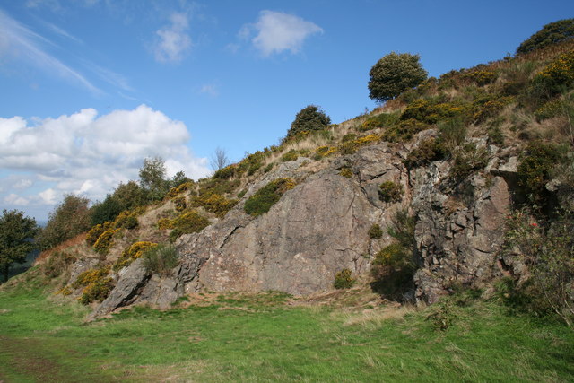
Table Hill

Table Hill is situated in the range of Malvern Hills that runs about 13 kilometres (8 mi) north-south along the Herefordshire-Worcestershire border. It...

Nearby Amenities

Located within 500m of 52.118575,-2.3495773
Fixme: There is a track proceeding SW of here. Need to look at.
Lat/Long: 52.1205357/-2.3467465
Bench
Lat/Long: 52.1169137/-2.3439196
Barrier: stile
Lat/Long: 52.1200858/-2.3534027
Bridge: yes
Lat/Long: 52.1209007/-2.3520385
Barrier: stile
Description: dog gate
Lat/Long: 52.1200327/-2.351964
Bar
West Malvern Social Club
Addr City: Malvern
Addr Housenumber: 145
Addr Postcode: WR14 4AY
Addr Street: West Malvern Road
Fhrs Id: 684677
Opening Hours: Open Mic night Thu 20:30-00:00; Music Session Sun eve; Quiz 2nd Fridays 20:00
Outdoor Seating: no
Source Addr: FHRS Open Data
Website: http://www.wmsc.org.uk
Lat/Long: 52.1181215/-2.3449816
Barrier: stile
Lat/Long: 52.1197667/-2.3528938
Barrier: stile
Lat/Long: 52.1203845/-2.3515001
Bench
Lat/Long: 52.1224807/-2.3484993
Bus Stop
St. James's & The Abbey
Bus: yes
Naptan AtcoCode: 2000G502674
Naptan Bearing: N
Naptan CommonName: St. James's & The Abbey
Naptan Indicator: Opp
Naptan NaptanCode: wocgjdga
Naptan PlusbusZoneRef: GTMLVRN
Naptan Street: West Malvern Road
Naptan Verified: no
Public Transport: platform
Source: naptan_import
Lat/Long: 52.1142841/-2.3478321
Bus Stop
Village Hall
Bus: yes
Naptan AtcoCode: 2000G502675
Naptan Bearing: N
Naptan CommonName: Village Hall
Naptan Indicator: opp
Naptan Landmark: Village Hall
Naptan NaptanCode: wocgjdgd
Naptan PlusbusZoneRef: GTMLVRN
Naptan Street: West Malvern Road
Naptan Verified: no
Public Transport: platform
Source: naptan_import
Lat/Long: 52.1174002/-2.3460453
Bus Stop
Village Hall
Bus: yes
Naptan AtcoCode: 2000G502676
Naptan Bearing: S
Naptan CommonName: Village Hall
Naptan Indicator: Adj
Naptan Landmark: Village Hall
Naptan NaptanCode: wocgjdgj
Naptan PlusbusZoneRef: GTMLVRN
Naptan Street: West Malvern Road
Naptan Verified: no
Network: 675
Operator: First Bus
Public Transport: platform
Shelter: no
Source: naptan_import
Lat/Long: 52.1178064/-2.345351
Bus Stop
The Lamb
Bus: yes
Naptan AtcoCode: 2000G502677
Naptan Bearing: SW
Naptan CommonName: The Lamb
Naptan Indicator: Adj
Naptan Landmark: Public House
Naptan NaptanCode: wocgjdgm
Naptan PlusbusZoneRef: GTMLVRN
Naptan Street: West Malvern Road
Naptan Verified: no
Public Transport: platform
Source: naptan_import
Lat/Long: 52.1209122/-2.3454106
Bus Stop
The Lamb
Bench: yes
Bus: yes
Naptan AtcoCode: 2000G502678
Naptan Bearing: NE
Naptan CommonName: The Lamb
Naptan Indicator: opp
Naptan NaptanCode: wocgjdgp
Naptan PlusbusZoneRef: GTMLVRN
Naptan Street: West Malvern Road
Naptan Verified: no
Network: 675
Operator: First Bus
Public Transport: platform
Shelter: yes
Source: naptan_import
Lat/Long: 52.1213569/-2.3451583
Post Box
Collection Plate: CP7
Collection Times: Mo-Fr 17:15; Sa 11:30
Historic Operator: Post Office
Post Box Type: lamp
Ref: WR14 151
Royal Cypher: EIIR
Royal Cypher Wikidata: Q33102113
Lat/Long: 52.1199711/-2.3470674
Post Box
Old Ref: M083 West Malvern Road
Post Box Design: type_k
Post Box Type: pillar
Ref: WR14 83
Royal Cypher: EIIR
Royal Cypher Wikidata: Q33102113
Lat/Long: 52.1168089/-2.3465444
Fixme: There seems to be a new housing estate here
Lat/Long: 52.1156451/-2.3468611
Barrier: kissing_gate
Foot: yes
Lat/Long: 52.115441/-2.3453831
West Malvern
Place: village
Wikidata: Q1911268
Wikipedia: en:West Malvern
Lat/Long: 52.1179676/-2.3453983
Clock
Lat/Long: 52.1179029/-2.3452662
Defibrillator
Defibrillator Location: by entrance to West Malvern Social Club
Emergency: defibrillator
Indoor: no
Lat/Long: 52.1180229/-2.3451394
West Malvern Club
Club: social
Lat/Long: 52.1175714/-2.3475866
Barrier: stile
Source: survey;gps
Lat/Long: 52.1201875/-2.3516544
Generator Method: photovoltaic
Generator Output Electricity: yes
Generator Source: solar
Generator Type: solar_photovoltaic_panel
Location: roof
Power: generator
Lat/Long: 52.1187091/-2.3444304
Generator Method: photovoltaic
Generator Output Electricity: yes
Generator Source: solar
Generator Type: solar_photovoltaic_panel
Location: roof
Power: generator
Lat/Long: 52.1159092/-2.3481908
Public Bookcase
Booth: K6
Colour: red
Disused Amenity: telephone
Man Made: telephone_box
Public Bookcase Type: phone_box
Lat/Long: 52.1177718/-2.3453387
Bench
Lat/Long: 52.1177414/-2.3453749
Advertising: board
Lat/Long: 52.1178204/-2.3453016
The data included in this document is from www.openstreetmap.org. The data is made available under ODbL.

Have you been to Walmspout Coppice?

Leave your review of Walmspout Coppice below (or comments, questions and feedback).