Ducton Coppice

Wood, Forest in Worcestershire Malvern Hills

England

Ducton Coppice

Cob House Fisheries This is the nearly new Mayfly Cafe and reception area. The fisheries now boast various animals and walks to delight the visitor.
Cob House Fisheries Credit: Chris Allen

Ducton Coppice is a picturesque woodland located in Worcestershire, England. Spanning over a vast area, it is renowned for its natural beauty and rich biodiversity. The coppice is situated in close proximity to the village of Ducton and is easily accessible, attracting visitors from both nearby towns and afar.

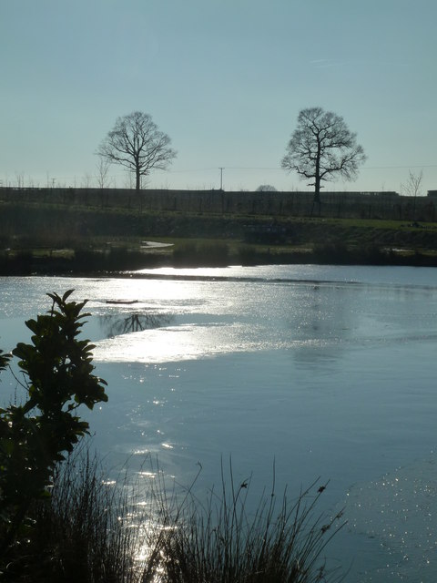
This woodland is primarily composed of dense deciduous trees, including oak, beech, and ash, which create a lush canopy during the warmer months. The forest floor is adorned with a variety of wildflowers and ferns, adding to its overall charm. Additionally, Ducton Coppice is intersected by several small streams, enhancing its scenic beauty and providing a habitat for various aquatic species.

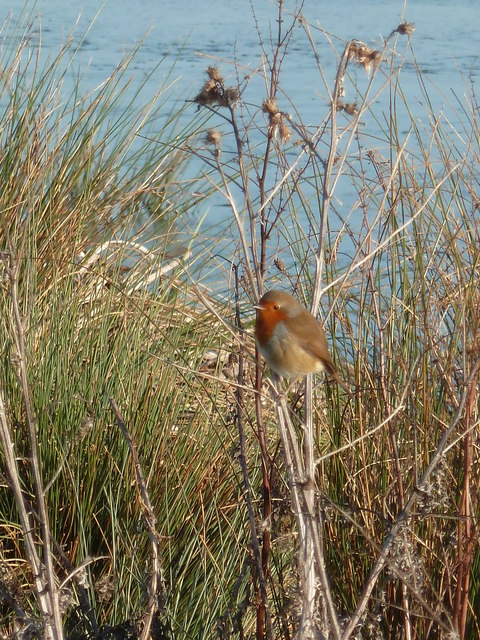
The woodland is a haven for wildlife, serving as a home to a diverse range of animals. It is not uncommon to spot deer, foxes, badgers, and rabbits roaming freely within the coppice. Birdwatchers will also find delight in the numerous species of birds that inhabit the area, including woodpeckers, owls, and various songbirds.

Ducton Coppice offers a tranquil retreat for nature enthusiasts and outdoor enthusiasts alike. It provides ample opportunities for walking, hiking, and nature photography. The well-maintained trails wind through the woodland, allowing visitors to immerse themselves in the serene atmosphere and take in the breathtaking scenery.

Overall, Ducton Coppice is a captivating woodland that showcases the natural beauty of Worcestershire. Its diverse ecosystem, scenic landscapes, and abundant wildlife make it a must-visit destination for those seeking a peaceful escape in the heart of nature.

If you have any feedback on the listing, please let us know in the comments section below.

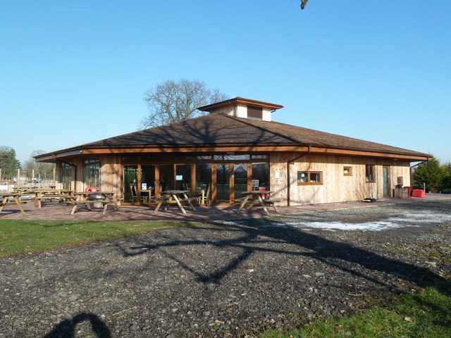
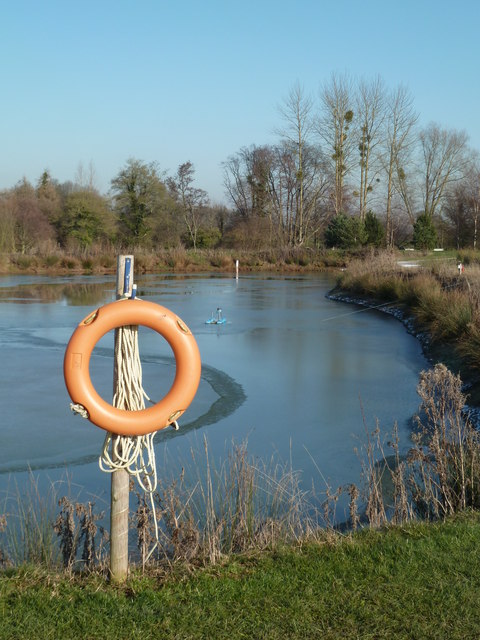
Ducton Coppice Images

Images are sourced within 2km of 52.234171/-2.3509392 or Grid Reference SO7659. Thanks to Geograph Open Source API. All images are credited.

Cob House Fisheries This is the nearly new Mayfly Cafe and reception area. The fisheries now boast various animals and walks to delight the visitor.
Cob House Fisheries
This is the nearly new Mayfly Cafe and reception area. The fisheries now boast various animals and walks to delight the visitor.
Cob House Fisheries - Robin On the edge of the fishing pond called Wyatts. Very often there are fishing competitions at the weekend and the public are kept out of this area. But not today - the lakes were largely frozen.
Cob House Fisheries - Robin
On the edge of the fishing pond called Wyatts. Very often there are fishing competitions at the weekend and the public are kept out of this area. But not today - the lakes were largely frozen.
Laurel Pool - Cob House Fisheries
Potential life saver - Cob House Fisheries This pool is called Pear and is a no fishing area.
Potential life saver - Cob House Fisheries
This pool is called Pear and is a no fishing area.
Ducks walk on water - Cob House Fisheries Well it is frozen! The fishing lake called Wyatts with 30 pegs.
Ducks walk on water - Cob House Fisheries
Well it is frozen! The fishing lake called Wyatts with 30 pegs.
Thirsty reindeer - Cob House Fisheries The position and direction are approximate because this development is not on the aerial photograph.
Thirsty reindeer - Cob House Fisheries
The position and direction are approximate because this development is not on the aerial photograph.
Who're you looking at? Cob House Fisheries Position and direction approximate. The Fisheries now have goats, Alpacas (this is one), Reindeer and Kune Kune pigs to delight the visitor. I'm no Peter Trimming though.
Who're you looking at? Cob House Fisheries
Position and direction approximate. The Fisheries now have goats, Alpacas (this is one), Reindeer and Kune Kune pigs to delight the visitor. I'm no Peter Trimming though.
The Masons Arms The Masons Arms on the B4204 to the east of Martley.
The Masons Arms
The Masons Arms on the B4204 to the east of Martley.
Farmland near Newhouse Farm Farmland near Newhouse Farm near Martley.
Farmland near Newhouse Farm
Farmland near Newhouse Farm near Martley.
Berrow Hill Walked north from the pub then made may through tracks or gaps in woodland to gain summit field. Beacon bagged first then headed south to next knoll to bag trig.
Name: Berrow Hill
Hill number: 5377
Height: 183m / 600ft
Area: 38B: West Gloucestershire, Hereford & Worcester
Class: Hu
Grid ref: SO 74462 58607
Summit feature: beacon
Drop: 105m
Col: 78m  SO745595
Berrow Hill
Walked north from the pub then made may through tracks or gaps in woodland to gain summit field. Beacon bagged first then headed south to next knoll to bag trig. Name: Berrow Hill Hill number: 5377 Height: 183m / 600ft Area: 38B: West Gloucestershire, Hereford & Worcester Class: Hu Grid ref: SO 74462 58607 Summit feature: beacon Drop: 105m Col: 78m SO745595
Admiral Rodney (1), Berrow Green near Martley, Worcs A popular pub, with accommodation, on the B4197 road in the small village of Berrow Green.

<a href="https://www.geograph.org.uk/photo/3426621">SO7458 : Admiral Rodney (2) - sign, Berrow Green near Martley, Worcs</a>.
Admiral Rodney (1), Berrow Green near Martley, Worcs
A popular pub, with accommodation, on the B4197 road in the small village of Berrow Green. SO7458 : Admiral Rodney (2) - sign, Berrow Green near Martley, Worcs.
Admiral Rodney (2) - sign, Berrow Green near Martley, Worcs There are several public houses in England named after Admiral Rodney, who was a famous naval figure in the late 18th century. George Brydges Rodney, 1st Baron Rodney, KB (baptised 13 February 1718; died 24 May 1792) is particularly remembered for his commands in the American War of Independence, and especially for his victory over the French at the Battle of the Saintes in 1782. The use of Rodney as a first name for boys was due to the Admiral's fame. It became a popular name at the end of the 18th century.

The sign for this pub, as with most, has changed over the years. The present one, which is fairly recent, is virtually a copy of the well-known portrait by Thomas Gainsborough of 1782. It depicts the Admiral at the Battle of the Saintes, and behind him is the French Fleur de Lys naval ensign from the captured ship "Ville de Paris".

<a href="https://www.geograph.org.uk/photo/3426573">SO7458 : Admiral Rodney (1), Berrow Green near Martley, Worcs</a>.
Admiral Rodney (2) - sign, Berrow Green near Martley, Worcs
There are several public houses in England named after Admiral Rodney, who was a famous naval figure in the late 18th century. George Brydges Rodney, 1st Baron Rodney, KB (baptised 13 February 1718; died 24 May 1792) is particularly remembered for his commands in the American War of Independence, and especially for his victory over the French at the Battle of the Saintes in 1782. The use of Rodney as a first name for boys was due to the Admiral's fame. It became a popular name at the end of the 18th century. The sign for this pub, as with most, has changed over the years. The present one, which is fairly recent, is virtually a copy of the well-known portrait by Thomas Gainsborough of 1782. It depicts the Admiral at the Battle of the Saintes, and behind him is the French Fleur de Lys naval ensign from the captured ship "Ville de Paris". SO7458 : Admiral Rodney (1), Berrow Green near Martley, Worcs.
The Crown (1), Martley, Worcs The Crown is a large and much extended public house and restaurant in the village of Martley, on the B4197 road. Photographed early on a Saturday afternoon, the pub looked firmly closed but apparently on most days it does not open until 6pm, and on Mondays it doesn't open at all.

<a href="https://www.geograph.org.uk/photo/3426691">SO7559 : The Crown (2) - sign, Martley, Worcs</a>.
<a href="https://www.geograph.org.uk/photo/3426723">SO7559 : The Crown (3), Martley, Worcs</a>.
The Crown (1), Martley, Worcs
The Crown is a large and much extended public house and restaurant in the village of Martley, on the B4197 road. Photographed early on a Saturday afternoon, the pub looked firmly closed but apparently on most days it does not open until 6pm, and on Mondays it doesn't open at all. SO7559 : The Crown (2) - sign, Martley, Worcs. SO7559 : The Crown (3), Martley, Worcs.
The Crown (2) - sign, Martley, Worcs The pub is not a Marston's house, according to the brewery website, although it may well sell their beer.

The name of the Crown indicates loyalty to the reigning monarch. It has been used as an inn or pub sign for hundreds of years. In the past, when most people were illiterate, the sign was easily recognised by people. The Crown is almost as popular as the Red Lion as a pub name.

<a href="https://www.geograph.org.uk/photo/3426671">SO7559 : The Crown (1), Martley, Worcs</a>.
<a href="https://www.geograph.org.uk/photo/3426723">SO7559 : The Crown (3), Martley, Worcs</a>.
The Crown (2) - sign, Martley, Worcs
The pub is not a Marston's house, according to the brewery website, although it may well sell their beer. The name of the Crown indicates loyalty to the reigning monarch. It has been used as an inn or pub sign for hundreds of years. In the past, when most people were illiterate, the sign was easily recognised by people. The Crown is almost as popular as the Red Lion as a pub name. SO7559 : The Crown (1), Martley, Worcs. SO7559 : The Crown (3), Martley, Worcs.
The Crown (3), Martley, Worcs Viewed from this side, the considerable extension to the original building can clearly be seen. The pub is adjacent to some farmland. There is currently a very controversial planning application to build fifty one houses on some of this.

<a href="https://www.geograph.org.uk/photo/3426671">SO7559 : The Crown (1), Martley, Worcs</a>.
<a href="https://www.geograph.org.uk/photo/3426691">SO7559 : The Crown (2) - sign, Martley, Worcs</a>.
The Crown (3), Martley, Worcs
Viewed from this side, the considerable extension to the original building can clearly be seen. The pub is adjacent to some farmland. There is currently a very controversial planning application to build fifty one houses on some of this. SO7559 : The Crown (1), Martley, Worcs. SO7559 : The Crown (2) - sign, Martley, Worcs.
Martley Post Office and Off-licence, Martley, Worcs The Post Office and Off-licence is next door to the garage and petrol station, and opposite to the junction of the B4197 and B4204 roads.
Martley Post Office and Off-licence, Martley, Worcs
The Post Office and Off-licence is next door to the garage and petrol station, and opposite to the junction of the B4197 and B4204 roads.
Admiral Rodney at dusk on New Year's Eve
Oast House at Hope House Farm, Martley
Show me another place!

Ducton Coppice is located at Grid Ref: SO7659 (Lat: 52.234171, Lng: -2.3509392)

Administrative County: Worcestershire

District: Malvern Hills

Police Authority: West Mercia

What 3 Words

///alongside.racetrack.scrambles. Near Lower Broadheath, Worcestershire

Nearby Locations

Ducton Coppice

Related Wikis

The Chantry School

The Chantry School is a mixed gender secondary school with academy status located in Martley, Worcestershire, England. The school has about 700 students...

Martley

Martley is a village and civil parish in the Malvern Hills district of the English county of Worcestershire. It is approximately nine miles north-west...

Berrow Green

Berrow Green is a village in Worcestershire, England. == Berrow Hill Camp == Berrow Green is situated just below Berrow Hill Camp, an Iron Age encampment...

Wichenford

Wichenford is a village and civil parish (with Kenswick) in the Malvern Hills District in the county of Worcestershire, England. It lies 7 miles (11km...

Horsham, Worcestershire

Horsham is a village in Worcestershire, England. Remains of an old Iron Age fort are located within the village. == External links ==

Doddenham

Doddenham is a hamlet and civil parish (with Knightwick) in the Malvern Hills district in the county of Worcestershire, England. Doddenham was in the...

Stanford with Orleton

Stanford with Orleton is a civil parish in the Malvern Hills district, in the county of Worcestershire, England. The parish comprises the villages of Stanford...

Kenswick, Worcestershire

Kenswick is a village and civil parish (with Wichenford) in the Malvern Hills District in the county of Worcestershire, England. == External links... ==

Nearby Amenities

Located within 500m of 52.234171,-2.3509392
Power: pole
Lat/Long: 52.2313821/-2.3505359
Power: pole
Lat/Long: 52.2314316/-2.345635
Power: pole
Lat/Long: 52.2314352/-2.3492669
Power: pole
Lat/Long: 52.2314806/-2.3484073
Power: pole
Lat/Long: 52.2315334/-2.3475626
Power: pole
Lat/Long: 52.2315723/-2.3466962
Power: pole
Lat/Long: 52.2316148/-2.3517327
Power: pole
Lat/Long: 52.231815/-2.352799
Power: pole
Lat/Long: 52.2320139/-2.3538581
Power: pole
Lat/Long: 52.2322482/-2.3549219
Power: pole
Lat/Long: 52.2324877/-2.3561667
Power: pole
Lat/Long: 52.2327446/-2.3574636
Historic: milestone
Lat/Long: 52.2374291/-2.3506879
Generator Method: photovoltaic
Generator Output Electricity: yes
Generator Source: solar
Generator Type: solar_photovoltaic_panel
Location: roof
Power: generator
Lat/Long: 52.2370431/-2.35609
Power: pole
Lat/Long: 52.2301964/-2.3476289
Power: pole
Lat/Long: 52.2308839/-2.3475699
Hope House Farm
Power: pole
Transformer: distribution
Voltage Primary: 11000
Lat/Long: 52.2304017/-2.3524797
Power: pole
Lat/Long: 52.2310022/-2.3520908
Stoney Bridge Farm
Power: pole
Transformer: distribution
Voltage Primary: 11000
Lat/Long: 52.2370887/-2.3495554
Power: pole
Lat/Long: 52.2366715/-2.350981
Power: pole
Lat/Long: 52.2364818/-2.352135
Power: pole
Lat/Long: 52.2362083/-2.353053
Power: pole
Lat/Long: 52.2362543/-2.3544551
Hawthorn Close Martley
Power: transformer
Transformer: distribution
Voltage Primary: 11000
Lat/Long: 52.2367546/-2.354616
Location Transition: yes
Power: pole
Lat/Long: 52.2363697/-2.3551096
Power: pole
Lat/Long: 52.2360067/-2.355343
Martley Pumping Station
Power: pole
Transformer: distribution
Voltage Primary: 11000
Lat/Long: 52.2344273/-2.3535385
Power: pole
Lat/Long: 52.2346453/-2.3539938
Power: pole
Lat/Long: 52.2350445/-2.3547904
Power: pole
Lat/Long: 52.2354835/-2.3556648
Power: pole
Lat/Long: 52.2348227/-2.356045
Power: pole
Lat/Long: 52.2339078/-2.3560812
Power: pole
Lat/Long: 52.2331053/-2.3561134
The data included in this document is from www.openstreetmap.org. The data is made available under ODbL.

Have you been to Ducton Coppice?

Leave your review of Ducton Coppice below (or comments, questions and feedback).