Mainshead Plantation

Wood, Forest in Northumberland

England

Mainshead Plantation

Sheepfold in Hope Cleugh Hope Cleugh is the main valley in this vicinity where a number of streams come together - stones in the oddly named Quonister Cleugh can just be seen at the top left corner in the image. There are several sheepfolds in the area too; this is the most intricately made of them.
Sheepfold in Hope Cleugh Credit: Trevor Littlewood

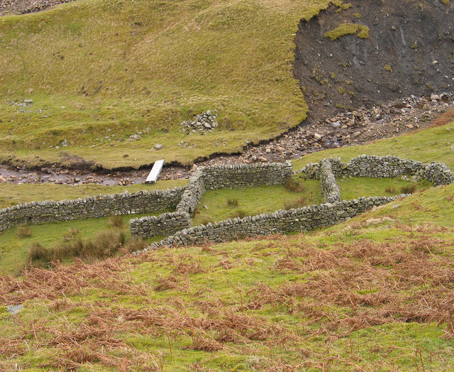
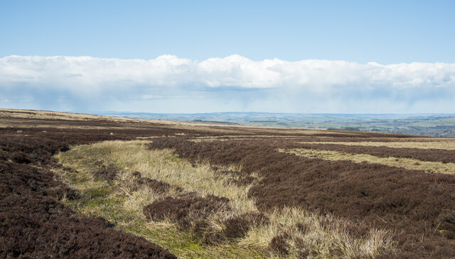
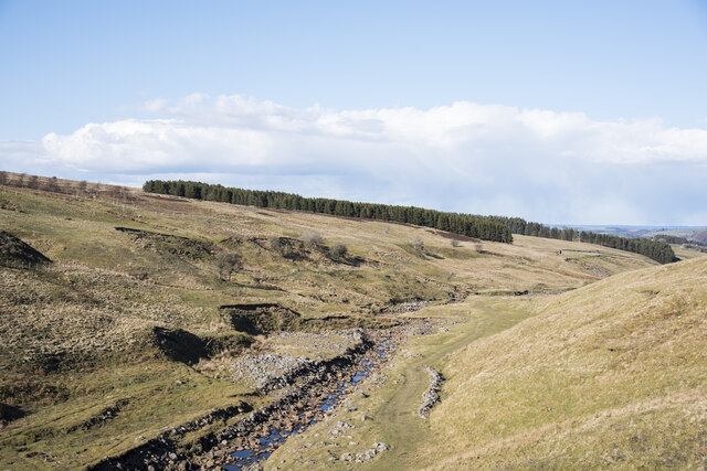
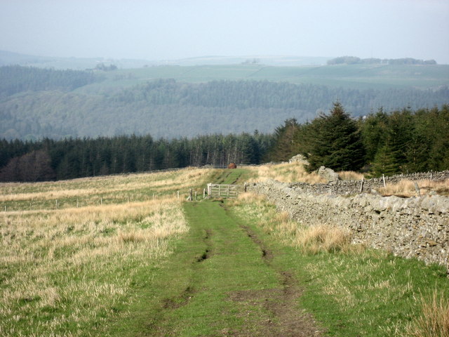
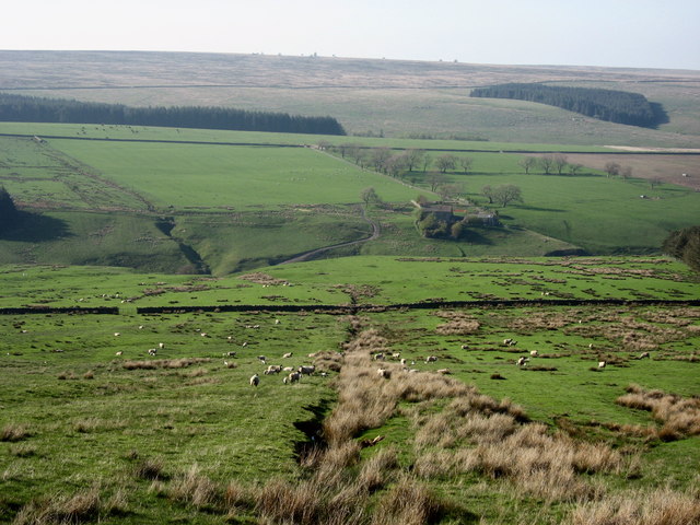
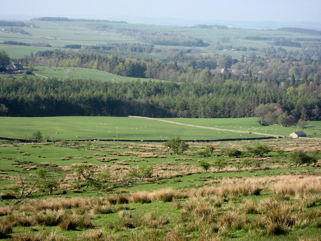
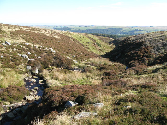
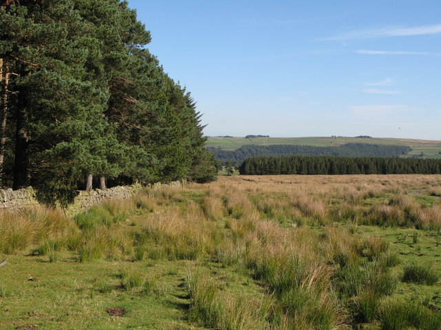
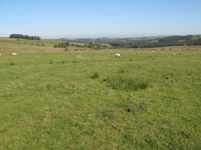
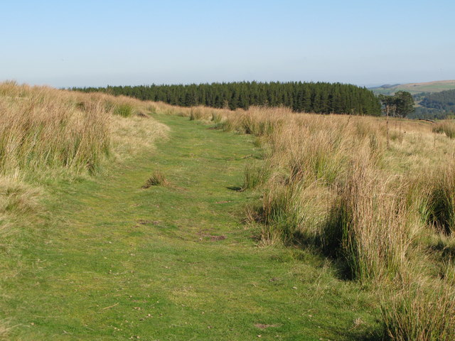
Mainshead Plantation is a picturesque woodland located in Northumberland, England. Situated in the heart of the county, it covers an area of approximately 200 acres. The plantation is part of the wider Mainshead Forest, which spans across several surrounding areas.

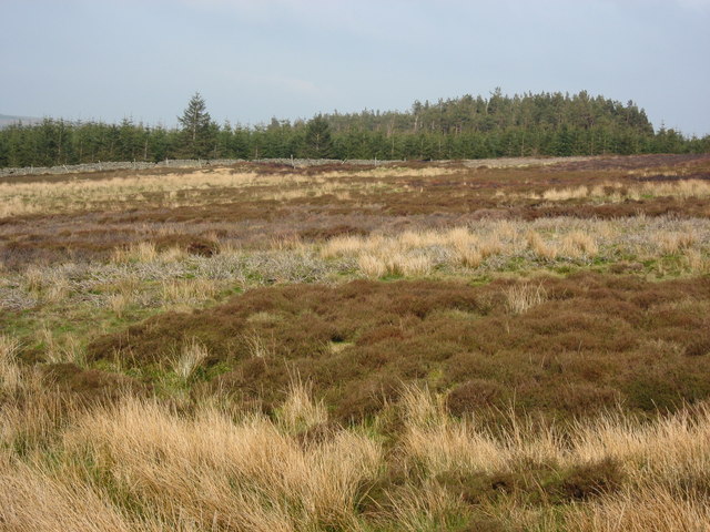
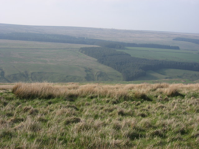
The woodland is characterized by its diverse and dense tree cover, consisting mainly of native species such as oak, beech, and birch. These trees create a rich canopy that provides a habitat for a wide variety of wildlife, including birds, mammals, and insects.

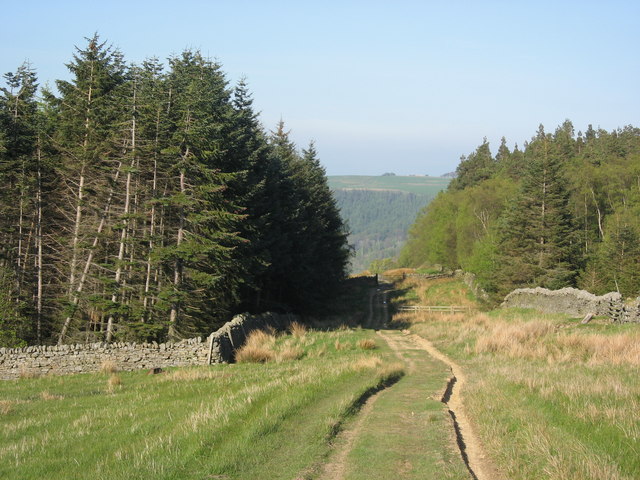
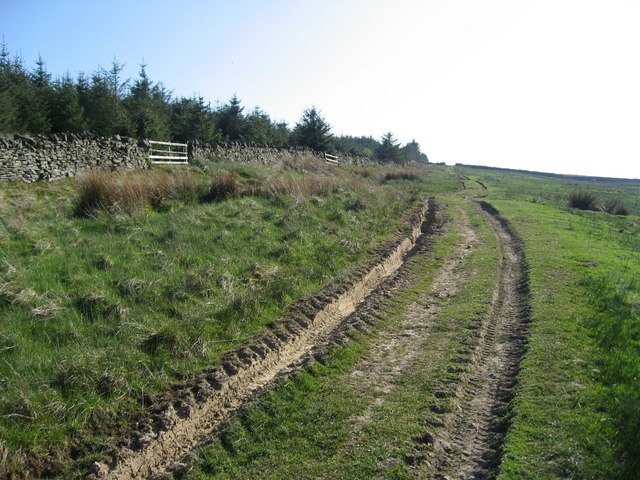
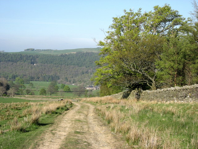
Mainshead Plantation is known for its tranquil atmosphere and scenic beauty. It offers visitors an opportunity to immerse themselves in nature and enjoy peaceful walks along its well-maintained paths. These paths wind through the plantation, leading visitors through different sections of the forest and providing stunning views of the surrounding landscape.

The plantation is also home to a small lake, which adds to its charm and attracts various water birds. The lake is a popular spot for birdwatching, and visitors can often observe species such as mallards, swans, and herons.

Mainshead Plantation is open to the public throughout the year, and there are designated picnic areas and benches for visitors to relax and enjoy the surroundings. The plantation is easily accessible by car, with a dedicated parking area available. It is a favorite destination for nature lovers, photographers, and families looking for a peaceful retreat in the heart of Northumberland.

If you have any feedback on the listing, please let us know in the comments section below.

Mainshead Plantation Images

Images are sourced within 2km of 54.892512/-2.3845895 or Grid Reference NY7555. Thanks to Geograph Open Source API. All images are credited.

Sheepfold in Hope Cleugh Hope Cleugh is the main valley in this vicinity where a number of streams come together - stones in the oddly named Quonister Cleugh can just be seen at the top left corner in the image. There are several sheepfolds in the area too; this is the most intricately made of them.
Sheepfold in Hope Cleugh
Hope Cleugh is the main valley in this vicinity where a number of streams come together - stones in the oddly named Quonister Cleugh can just be seen at the top left corner in the image. There are several sheepfolds in the area too; this is the most intricately made of them.
Rushes in groove leading to Little Willy's Sike There's water hidden beneath the vegetation in this minor groove; the Sike itself is just a short distance ahead.
Rushes in groove leading to Little Willy's Sike
There's water hidden beneath the vegetation in this minor groove; the Sike itself is just a short distance ahead.
Erosion scar on south side of Carr's Burn The scar shows signs of 'healing' and other similar scars further up the valley have done so.
Erosion scar on south side of Carr's Burn
The scar shows signs of 'healing' and other similar scars further up the valley have done so.
Carr's Burn Carr's Burn, the product of a number of feeder streams coming together just out of view to the left, flowing downstream to join the River West Allen.
Carr's Burn
Carr's Burn, the product of a number of feeder streams coming together just out of view to the left, flowing downstream to join the River West Allen.
Track and plantation The southern edge of Parmontley Plantation is on the right, behind the drystone wall to the right of the gate.
Track and plantation
The southern edge of Parmontley Plantation is on the right, behind the drystone wall to the right of the gate.
Parmontley Plantation
Moorland Almost featureless; the odd-shaped plantation in <a href="https://www.geograph.org.uk/gridref/NY7554">NY7554</a> and Mainshead Plantation in <a href="https://www.geograph.org.uk/gridref/NY7555">NY7555</a> below Parkhead Fell are in the distance.
Moorland
Almost featureless; the odd-shaped plantation in NY7554 and Mainshead Plantation in NY7555 below Parkhead Fell are in the distance.
Track through Parmontley Plantation
Track to Whitfield Moor Parmontley Plantation on the left; the track passes through the gap in the drystone wall on the horizon in <a href="https://www.geograph.org.uk/gridref/NY7853">NY7853</a>.
Track to Whitfield Moor
Parmontley Plantation on the left; the track passes through the gap in the drystone wall on the horizon in NY7853.
Moorland sike This is one of many sikes feeding into Carr's Burn; The Hope farm is on the far side of the burn. Part of Mainshead Plantation in <a href="https://www.geograph.org.uk/gridref/NY7555">NY7555</a> and the wood on Nichol's Hill in <a href="https://www.geograph.org.uk/gridref/NY7556">NY7556</a> and <a href="https://www.geograph.org.uk/gridref/NY7656">NY7656</a> are in the distance.
Moorland sike
This is one of many sikes feeding into Carr's Burn; The Hope farm is on the far side of the burn. Part of Mainshead Plantation in NY7555 and the wood on Nichol's Hill in NY7556 and NY7656 are in the distance.
Morley Hill Farm The plantation on Nichol's Hill in <a href="https://www.geograph.org.uk/gridref/NY7556">NY7556</a> and <a href="https://www.geograph.org.uk/gridref/NY7656">NY7656</a> can be seen in the distance across the valley of Carr's Burn.
Morley Hill Farm
The plantation on Nichol's Hill in NY7556 and NY7656 can be seen in the distance across the valley of Carr's Burn.
Pastures east of Morley Hill The small building on the northern edge of <a href="https://www.geograph.org.uk/gridref/NY7754">NY7754</a> is on the right; Hope Head Plantation around Carr's Burn is in the middle distance; and the woods to the west of Whitfield are in the far distance.
Pastures east of Morley Hill
The small building on the northern edge of NY7754 is on the right; Hope Head Plantation around Carr's Burn is in the middle distance; and the woods to the west of Whitfield are in the far distance.
Descending track The northern edge of Parmontley Plantation is on the right. Parmontley Hall in <a href="https://www.geograph.org.uk/gridref/NY7855">NY7855</a> is directly above the track where it swings left, with the woods on the east bank of the West Allen behind.
Descending track
The northern edge of Parmontley Plantation is on the right. Parmontley Hall in NY7855 is directly above the track where it swings left, with the woods on the east bank of the West Allen behind.
Shooting boxes Marked on the 1:25000 map OL43, but not on LR87.
Shooting boxes
Marked on the 1:25000 map OL43, but not on LR87.
Blaeberry Cleugh
Blaeberry Cleugh
Mainshead Plantation and rough pasture
Pastures near Mainsrigg
Green track above Carr's Burn
Show me another place!

Mainshead Plantation is located at Grid Ref: NY7555 (Lat: 54.892512, Lng: -2.3845895)

Unitary Authority: Northumberland

Police Authority: Northumbria

What 3 Words

///rural.decays.natural. Near Bardon Mill, Northumberland

Nearby Locations

Mainshead Plantation

Related Wikis

Ouston, Ninebanks

Ouston is a small settlement in south west Northumberland, England in the North Pennines Area of Outstanding Natural Beauty 8 miles (13 km) north-east...

Ninebanks

Ninebanks is a small village in south west Northumberland, England in the North Pennines Area of Outstanding Natural Beauty 8 miles (13 km) north-east...

Bearsbridge

Bearsbridge is a village in Northumberland, in England. It is situated to the west of Hexham, on the A686. == Governance == Bearsbridge is in the parliamentary...

Whitfield, Northumberland

Whitfield is a village and former civil parish, now in the parish of Plenmeller with Whitfield, in the county of Northumberland, England about 10 miles...

Nearby Amenities

Located within 500m of 54.892512,-2.3845895
Mainsrigg Fell
Place: locality
Source: Bing
Lat/Long: 54.889498/-2.3877956
Whitfield Moor
Place: locality
Source: Bing
Lat/Long: 54.8908894/-2.3899516
The data included in this document is from www.openstreetmap.org. The data is made available under ODbL.

Have you been to Mainshead Plantation?

Leave your review of Mainshead Plantation below (or comments, questions and feedback).