Fair Hill Fell

Wood, Forest in Yorkshire Ribble Valley

England

Fair Hill Fell

Millstone Whelp Stone Crag Not the first abandoned millstone I have encountered in Bowland. Looks like it fell off the natural Trig Point shaped rock behind it. Perhaps it's a message saying 'Finding vacant squares to photo is becoming a bit of a millstone....'
Millstone Whelp Stone Crag Credit: Michael Graham

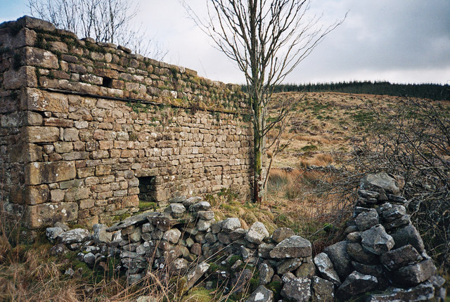
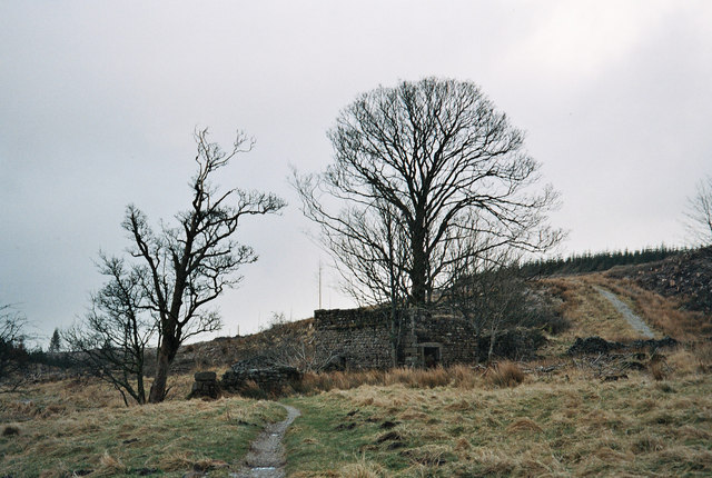
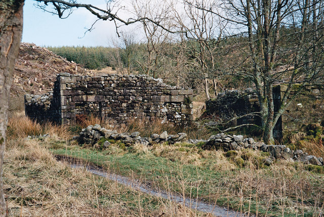
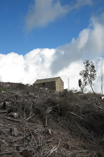
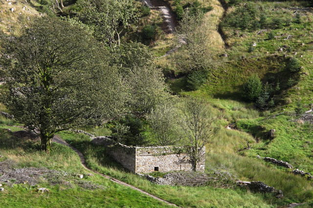
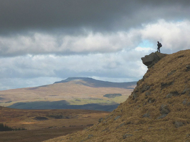
Fair Hill Fell is a picturesque area situated in Yorkshire, England. Nestled within the lush countryside, it is known for its enchanting woodlands and sprawling forests. Covering a vast expanse of land, Fair Hill Fell showcases the natural beauty of Yorkshire, offering a tranquil retreat for nature lovers and outdoor enthusiasts alike.

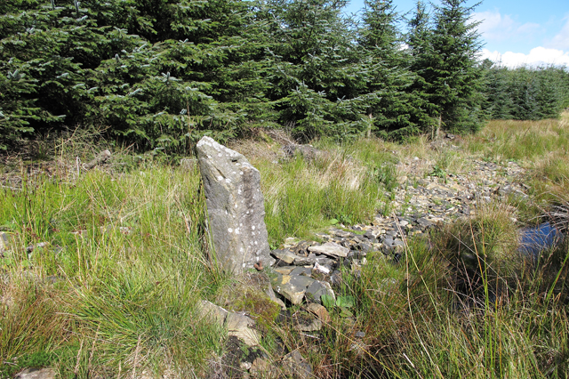
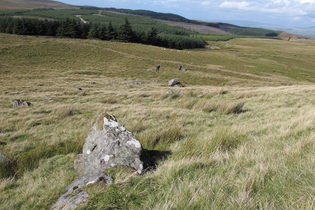
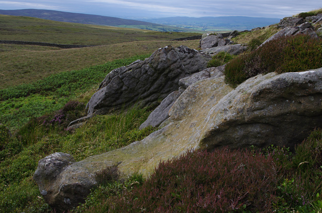
The area is characterized by its rolling hills, dense foliage, and diverse range of flora and fauna. Towering trees, such as oak and beech, dominate the landscape, creating a serene and peaceful atmosphere. The forest floor is blanketed with a variety of wildflowers, adding vibrant splashes of color to the surroundings.

Fair Hill Fell is home to a plethora of wildlife, providing a haven for species such as deer, foxes, and a myriad of bird species. The forest acts as a crucial habitat, supporting the biodiversity of the region.

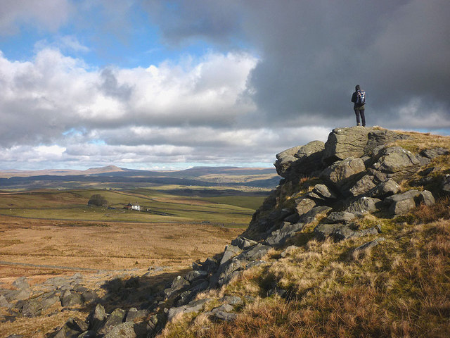
Visitors to Fair Hill Fell can explore its numerous walking trails, allowing them to immerse themselves in the natural wonders of the area. The paths wind through the forest, offering glimpses of breathtaking vistas and hidden gems along the way. From peaceful strolls to challenging hikes, there is something for everyone to enjoy.

The area also boasts various recreational activities, including cycling, horse riding, and picnicking. Its serene ambiance and idyllic setting make it a popular destination for families, couples, and individuals seeking solace in nature.

Fair Hill Fell truly encapsulates the essence of Yorkshire's natural beauty, promising a memorable and rejuvenating experience for all who visit.

If you have any feedback on the listing, please let us know in the comments section below.

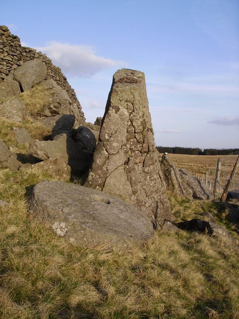
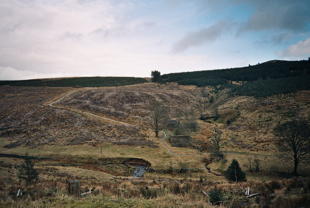
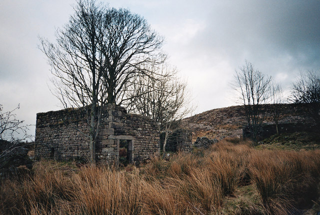
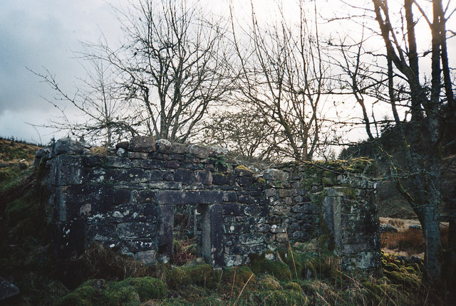
Fair Hill Fell Images

Images are sourced within 2km of 54.04655/-2.3778918 or Grid Reference SD7561. Thanks to Geograph Open Source API. All images are credited.

Millstone Whelp Stone Crag Not the first abandoned millstone I have encountered in Bowland. Looks like it fell off the natural Trig Point shaped rock behind it. Perhaps it's a message saying 'Finding vacant squares to photo is becoming a bit of a millstone....'
Millstone Whelp Stone Crag
Not the first abandoned millstone I have encountered in Bowland. Looks like it fell off the natural Trig Point shaped rock behind it. Perhaps it's a message saying 'Finding vacant squares to photo is becoming a bit of a millstone....'
Felled Forest - Bowland Looking down and over Dob Dale Beck one can see the old farm house ruins of 'Dob Dale' just between the narrow track and the stream to the right which joins Dob Dale Beck. Many years ago this farm was known by locals as 'Dob Dol. I believe this farm was already abandoned decades before the 1920s clearance of farms in this area for Catchment land of the 'Stocks Reservoir' being constructed late 20s early 30s. A large area has been felled here as elsewhere in this the Gisburn Forest in Bowland.
Felled Forest - Bowland
Looking down and over Dob Dale Beck one can see the old farm house ruins of 'Dob Dale' just between the narrow track and the stream to the right which joins Dob Dale Beck. Many years ago this farm was known by locals as 'Dob Dol. I believe this farm was already abandoned decades before the 1920s clearance of farms in this area for Catchment land of the 'Stocks Reservoir' being constructed late 20s early 30s. A large area has been felled here as elsewhere in this the Gisburn Forest in Bowland.
Forest Commission Track - Bowland A forestry track in 'Gisburn Forest' descending to a unwalled bridge that crosses the 'Dob Dale Beck. The conifer trees on the left are now felled.
Forest Commission Track - Bowland
A forestry track in 'Gisburn Forest' descending to a unwalled bridge that crosses the 'Dob Dale Beck. The conifer trees on the left are now felled.
Mini Ford - Gisburn Forest - Bowland Approaching the small ford through the 'Dob Dale Beck'. Some of these tracks in 'Gisburn Forest' are popular with mountain bikers besides the traveller on foot. A short distance ahead are the old farm ruins of 'Dob Dale' which can be seen to the left of the near tree as a right angle on the sky line.
Mini Ford - Gisburn Forest - Bowland
Approaching the small ford through the 'Dob Dale Beck'. Some of these tracks in 'Gisburn Forest' are popular with mountain bikers besides the traveller on foot. A short distance ahead are the old farm ruins of 'Dob Dale' which can be seen to the left of the near tree as a right angle on the sky line.
Dob Dale Farm Ruins - Gisburn Forest - Bowland I'd walked through the forest 'n' found a stream with no name, it was good to be out in the wild. In the reed grass there's a stream flowing by collecting the rain from the sky, in a short run or two the stream with no name joins the 'Dob Dale Beck' running by; la la la lal, la la lal, lal la la la lah! (The oldie song 'A Horse With No Name' (changed lyrics) in the Desert etc sung by 'America' you older ones may 'get it'!!)  The farm ruin of 'Dob Dale' known many years ago by locals as 'Dob Dol'!
Dob Dale Farm Ruins - Gisburn Forest - Bowland
I'd walked through the forest 'n' found a stream with no name, it was good to be out in the wild. In the reed grass there's a stream flowing by collecting the rain from the sky, in a short run or two the stream with no name joins the 'Dob Dale Beck' running by; la la la lal, la la lal, lal la la la lah! (The oldie song 'A Horse With No Name' (changed lyrics) in the Desert etc sung by 'America' you older ones may 'get it'!!) The farm ruin of 'Dob Dale' known many years ago by locals as 'Dob Dol'!
Farm Ruins - Gisburn Forest - Bowland Good solid stone work at the farm ruins of 'Dob Dol', this is the very old name for the farm abandoned I believe in the late 19th or possible very early 20th century, the official name of this isolated ruin is 'Dob Dale'.
Farm Ruins - Gisburn Forest - Bowland
Good solid stone work at the farm ruins of 'Dob Dol', this is the very old name for the farm abandoned I believe in the late 19th or possible very early 20th century, the official name of this isolated ruin is 'Dob Dale'.
Dob Dale Ruins - Bowland Solid walls standing at the old farm ruin of 'Dob Dale' in the 'Gisburn Forest'.
Dob Dale Ruins - Bowland
Solid walls standing at the old farm ruin of 'Dob Dale' in the 'Gisburn Forest'.
Dob Dale Farm Ruins - Gisburn Forest in Bowland Having just crossed the small ford through 'Dob Dale Beck' we approach the farm ruins of 'Dob Dale'. A little further ahead one can see the marsh grass just before the ruins, this is where the narrow track crosses yet another stream by a small ford. This stream is nameless, it flows from right to left, in a short distance joining the 'Dob Dale Beck'.
Dob Dale Farm Ruins - Gisburn Forest in Bowland
Having just crossed the small ford through 'Dob Dale Beck' we approach the farm ruins of 'Dob Dale'. A little further ahead one can see the marsh grass just before the ruins, this is where the narrow track crosses yet another stream by a small ford. This stream is nameless, it flows from right to left, in a short distance joining the 'Dob Dale Beck'.
Old Farm Ruins of Dob Dale (Dob Dol) Gisburn Forest - Bowland
Confluence of Dob Dale Beck and Brock Clough Beck Note the ancient Lime Kiln in the background
Confluence of Dob Dale Beck and Brock Clough Beck
Note the ancient Lime Kiln in the background
Fair Hill Barn and harvested forestry plantation
Ruined farm at Dob Dale The track coming down to the right of the ruins is one of the new Gisburn Forest mountain biking trails
Ruined farm at Dob Dale
The track coming down to the right of the ruins is one of the new Gisburn Forest mountain biking trails
Old gate post on footpath in Gisburn Forest
Overgrown footpath to Clough Hall
Moorland north of Whelp Stone Crag
North east from Whelp Stone Crag The north eastern end of the crag has its own jumble of gritstone boulders and outcrops. In the middle distance is the white farmhouse at Owlshaw with Pen-y-ghent (left) and Fountains Fell rising on the skyline above.
North east from Whelp Stone Crag
The north eastern end of the crag has its own jumble of gritstone boulders and outcrops. In the middle distance is the white farmhouse at Owlshaw with Pen-y-ghent (left) and Fountains Fell rising on the skyline above.
An outcrop on Whelp Stone Crag Near the northern end of the summit ridge looking towards Ingleborough.
An outcrop on Whelp Stone Crag
Near the northern end of the summit ridge looking towards Ingleborough.
Knotteranum Gritstone rocks
Knotteranum
Gritstone rocks
Show me another place!

Fair Hill Fell is located at Grid Ref: SD7561 (Lat: 54.04655, Lng: -2.3778918)

Division: West Riding

Administrative County: Lancashire

District: Ribble Valley

Police Authority: Lancashire

What 3 Words

///anchorman.cattle.inspector. Near Settle, North Yorkshire

Nearby Locations

Black Hill Fair Hill Fell

Related Wikis

Eldroth

Eldroth is a village in North Yorkshire, England. It is in the civil parish of Lawkland, part of the former Craven District, some 3.25 miles (5.23 km)...

Giggleswick railway station

Giggleswick is a railway station on the Bentham Line, which runs between Leeds and Morecambe via Skipton. The station, situated 41+1⁄4 miles (66 km) north...

Rathmell

Rathmell is a village and civil parish in the Craven district of North Yorkshire, England. The population of the civil parish in the 2011 census was 305...

Lawkland

Lawkland is a civil parish in North Yorkshire, England, near the A65 and 4 miles (6.4 km) west of Settle. It lies within the Forest of Bowland Area of...

Nearby Amenities

Located within 500m of 54.04655,-2.3778918
Natural: stone
Lat/Long: 54.0491306/-2.3740735
The data included in this document is from www.openstreetmap.org. The data is made available under ODbL.

Have you been to Fair Hill Fell?

Leave your review of Fair Hill Fell below (or comments, questions and feedback).