Castle Wood

Wood, Forest in Somerset

England

Castle Wood

A lane into the estate The view is along Top Lane, which is in the Stourhead estate. There is a benchmark on the left which took some effort to free from the undergrowth. The wall mentioned in the OS description (see <a href="https://www.geograph.org.uk/photo/6935237">ST7633 : Benchmark freed from nettles and ivy</a>) is actually the lower parapet over the stream connecting the various ornamental lakes – the headwaters of the River Stour.
A lane into the estate Credit: Neville Goodman

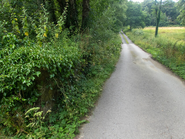
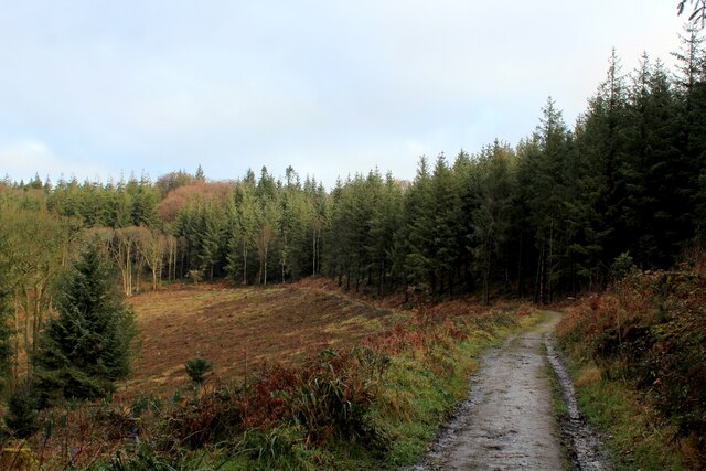
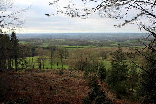
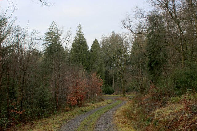
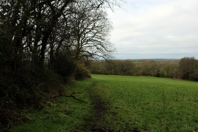
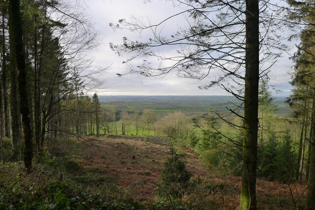
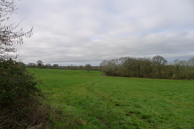
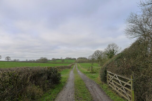
Castle Wood is a picturesque woodland located in Somerset, England. The wood is situated near the small village of Castle Cary, offering a tranquil and natural retreat for visitors. Covering an area of approximately 200 acres, Castle Wood boasts a diverse range of flora and fauna, making it a haven for nature enthusiasts and wildlife lovers.

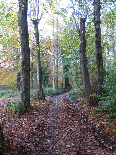
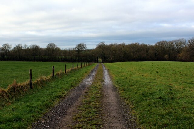
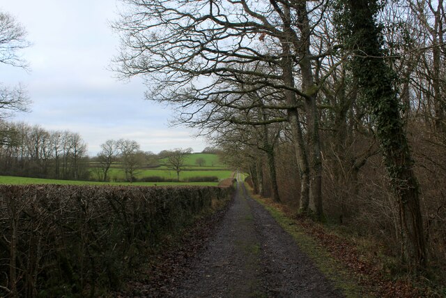
The woodland is primarily composed of deciduous trees, including oak, beech, and ash, which create a dense canopy and provide a welcoming shade during the summer months. The forest floor is rich with bluebells, wild garlic, and other native plants, adding a burst of color to the surroundings. Several well-maintained trails crisscross the wood, allowing visitors to explore its beauty at their leisure.

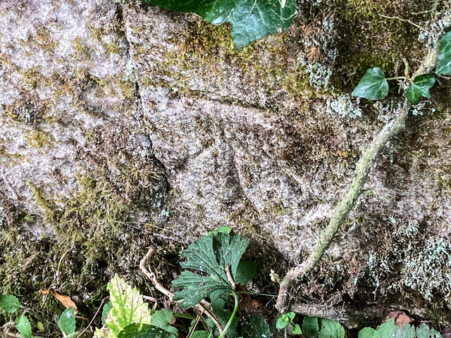
One of the main attractions of Castle Wood is its historical significance. The wood is home to the remnants of a medieval castle, which once stood proudly in this location. Visitors can still see the remains of the castle's stone walls and the outline of its former structure, providing a fascinating glimpse into the region's past.

The woodland is also a popular spot for birdwatching, with a variety of bird species calling Castle Wood their home. Visitors may catch sight of woodpeckers, thrushes, and owls, among others. Additionally, various mammals such as deer, foxes, and badgers can be spotted in the early morning or evening hours.

Castle Wood offers a peaceful and idyllic setting for those seeking a break from the hustle and bustle of everyday life. With its natural beauty, historical significance, and abundant wildlife, it is no wonder that Castle Wood is a beloved destination for both locals and tourists alike.

If you have any feedback on the listing, please let us know in the comments section below.

Castle Wood Images

Images are sourced within 2km of 51.099161/-2.3569237 or Grid Reference ST7533. Thanks to Geograph Open Source API. All images are credited.

A lane into the estate The view is along Top Lane, which is in the Stourhead estate. There is a benchmark on the left which took some effort to free from the undergrowth. The wall mentioned in the OS description (see <a href="https://www.geograph.org.uk/photo/6935237">ST7633 : Benchmark freed from nettles and ivy</a>) is actually the lower parapet over the stream connecting the various ornamental lakes – the headwaters of the River Stour.
A lane into the estate
The view is along Top Lane, which is in the Stourhead estate. There is a benchmark on the left which took some effort to free from the undergrowth. The wall mentioned in the OS description (see ST7633 : Benchmark freed from nettles and ivy) is actually the lower parapet over the stream connecting the various ornamental lakes – the headwaters of the River Stour.
Benchmark freed from nettles and ivy Once the ivy, nettles, brambles, moss and various other bits and pieces had been scraped aside <a href="https://www.geograph.org.uk/photo/6935234">ST7633 : A lane into the estate</a>, the benchmark (NBM WALL SW SIDE TOP LANE NE FACE E ANG) was revealed as remarkably undamaged.
Benchmark freed from nettles and ivy
Once the ivy, nettles, brambles, moss and various other bits and pieces had been scraped aside ST7633 : A lane into the estate, the benchmark (NBM WALL SW SIDE TOP LANE NE FACE E ANG) was revealed as remarkably undamaged.
Path through the woods west of Iron Bridge
Beside Tower Road on the Stourhead Estate
King Alfred's Tower Revisited Huge folly standing on top of Kingsettle Hill, just inside the Somerset border with Wiltshire.
Grade I Listed Building belonging to the National Trust, it was completed in 1772 by Henry Hoare to commemorate the ending of the Seven Years War with France and the accession of George III.
The location is believed to be near Egbert's Stone where Alfred rallied the Anglo-Saxons before the decisive Battle of Edington.
<a href="https://www.geograph.org.uk/photo/286353">ST7435 : Alfred's Tower</a>
The triangular tower is 161 foot high, with a hollow interior containing a spiral staircase.
King Alfred's Tower Revisited
Huge folly standing on top of Kingsettle Hill, just inside the Somerset border with Wiltshire. Grade I Listed Building belonging to the National Trust, it was completed in 1772 by Henry Hoare to commemorate the ending of the Seven Years War with France and the accession of George III. The location is believed to be near Egbert's Stone where Alfred rallied the Anglo-Saxons before the decisive Battle of Edington. ST7435 : Alfred's Tower The triangular tower is 161 foot high, with a hollow interior containing a spiral staircase.
View Eastwards from the Base of King Alfred's Tower In the Stourhead Estate, National Trust
View Eastwards from the Base of King Alfred's Tower
In the Stourhead Estate, National Trust
Track in Beaumont's Wood Tree covered escarpment below King Alfred's Tower - part of the Stourhead Estate, belonging to the National Trust.
The photograph shows the track branching off the Leland Trail/MacMillan Way Long Distance Footpaths.
Track in Beaumont's Wood
Tree covered escarpment below King Alfred's Tower - part of the Stourhead Estate, belonging to the National Trust. The photograph shows the track branching off the Leland Trail/MacMillan Way Long Distance Footpaths.
View from Hilcombe Hanging As seen from the Leland Trail/Macmillan Way long distance footpaths - recent forest felling has opened up the views over the Somerset countryside to the south west.
View from Hilcombe Hanging
As seen from the Leland Trail/Macmillan Way long distance footpaths - recent forest felling has opened up the views over the Somerset countryside to the south west.
Leland Trail in Blackslough Wood The trail in the woods of the Stourhead Estate, before emerging into open countryside
Leland Trail in Blackslough Wood
The trail in the woods of the Stourhead Estate, before emerging into open countryside
Leland Trail emerging from the Woods on the Stourhead Estate This path has been adopted by two long distance footpaths - the relatively short Leland Trail, and the lengthy MacMillan Way.
Here they emerge from extensive woodland into open countryside.
Leland Trail emerging from the Woods on the Stourhead Estate
This path has been adopted by two long distance footpaths - the relatively short Leland Trail, and the lengthy MacMillan Way. Here they emerge from extensive woodland into open countryside.
Leland Trail adopts an Old Coach Road The Leland Trail now adopts a path that describes a perfect straight line on the map for roughly three miles - this is an old coach road heading for Redlynch. Sometimes a track, sometimes a mud quagmire and sometimes pasture with all evidence of a historic route rendered invisible.
Leland Trail adopts an Old Coach Road
The Leland Trail now adopts a path that describes a perfect straight line on the map for roughly three miles - this is an old coach road heading for Redlynch. Sometimes a track, sometimes a mud quagmire and sometimes pasture with all evidence of a historic route rendered invisible.
Leland Trail beside Stavordale Wood The Leland Trail and Macmillan Way long distance footpaths adopt the old coach road that once ran between Stourhead and Redlynch.
Leland Trail beside Stavordale Wood
The Leland Trail and Macmillan Way long distance footpaths adopt the old coach road that once ran between Stourhead and Redlynch.
Log piles, Stourhead Estate The woods are managed on a system called Continuous Cover Forestry, and sustainably produce 4000 tonnes of timber a year (local notice board)
Log piles, Stourhead Estate
The woods are managed on a system called Continuous Cover Forestry, and sustainably produce 4000 tonnes of timber a year (local notice board)
King Alfred's Tower A listed Grade I monument belonging to the National Trust. " ... a 160ft (49m) high folly, designed by Henry Flitcroft for Henry Hoare II in 1772. It is believed to mark the site where King Alfred the Great rallied his troops in 878. The tower commemorates the accession of George III to the throne in 1760 and the end of the Seven Years War." <span class="nowrap"><a title="https://www.nationaltrust.org.uk/stourhead/trails/stourhead-king-alfreds-tower-walk" rel="nofollow ugc noopener" href="https://www.nationaltrust.org.uk/stourhead/trails/stourhead-king-alfreds-tower-walk">Link</a><img style="margin-left:2px;" alt="External link" title="External link - shift click to open in new window" src="https://s1.geograph.org.uk/img/external.png" width="10" height="10"/></span>
And a convenient marker of the eastern end of the Leland Trail, which we will now follow to the west.
King Alfred's Tower
A listed Grade I monument belonging to the National Trust. " ... a 160ft (49m) high folly, designed by Henry Flitcroft for Henry Hoare II in 1772. It is believed to mark the site where King Alfred the Great rallied his troops in 878. The tower commemorates the accession of George III to the throne in 1760 and the end of the Seven Years War." LinkExternal link And a convenient marker of the eastern end of the Leland Trail, which we will now follow to the west.
Footpath maintenance near King Alfred's Tower Cutting back brambles on the Leland Trail
Footpath maintenance near King Alfred's Tower
Cutting back brambles on the Leland Trail
Forest clearing The Stourhead forest is managed on a system called Continuous Cover Forestry  <span class="nowrap"><a title="https://www.ccfg.org.uk/" rel="nofollow ugc noopener" href="https://www.ccfg.org.uk/">Link</a><img style="margin-left:2px;" alt="External link" title="External link - shift click to open in new window" src="https://s1.geograph.org.uk/img/external.png" width="10" height="10"/></span>
Forest clearing
The Stourhead forest is managed on a system called Continuous Cover Forestry LinkExternal link
The Leland Trail / MacMillan Way leaving the Stourhead woods Leaving the higher ground of Cretaceous chalks and sandstones for softer Jurassic terrain
The Leland Trail / MacMillan Way leaving the Stourhead woods
Leaving the higher ground of Cretaceous chalks and sandstones for softer Jurassic terrain
The Redlynch-Stourhead coach road Passing Stavordale Wood.
The Redlynch-Stourhead coach road
Passing Stavordale Wood.
Show me another place!

Castle Wood is located at Grid Ref: ST7533 (Lat: 51.099161, Lng: -2.3569237)

Unitary Authority: Wiltshire

Police Authority: Wiltshire

What 3 Words

///itself.flippers.scribbled. Near Bourton, Dorset

Related Wikis

Kenwalch's Castle

Kenwalch's Castle is probably an Iron Age hill fort that may have been converted into a Roman fortress, near Penselwood, Somerset, England, 6.6 kilometres...

Heath Hill Farm

Heath Hill Farm (grid reference ST757336) is a 20.73 hectare biological Site of Special Scientific Interest near Stourton in Wiltshire, notified in 1997...

Nozarego

Nozarego is a village in the commune of Santa Margherita Ligure in Liguria, Italy. It is a natural terrace over the Bay of Tigullio. Here there is the...

Cockroad Wood Castle

Cockroad Wood Castle was a castle near Wincanton but now in the parish of Charlton Musgrove, Somerset, England. == History == Cockroad Wood Castle was...
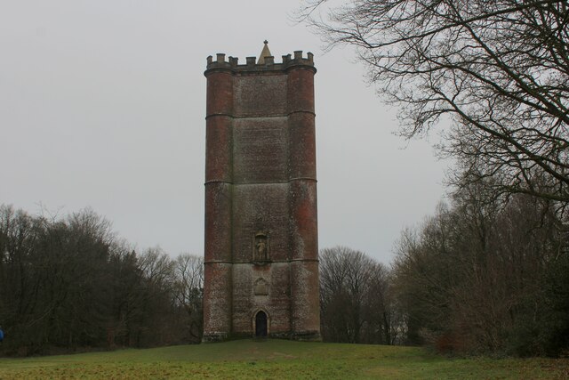
King Alfred's Tower

Alfred's Tower is a folly in Somerset, England, on the edge of the border with Wiltshire, on the Stourhead estate. The tower stands on Kingsettle Hill...

Penselwood

Penselwood is a village and civil parish in the English county of Somerset. It is located 4 miles (6.4 km) north east of Wincanton, 4 miles (6.4 km) south...

Stavordale Priory

Stavordale Priory near Charlton Musgrove, Somerset, England was built as a priory of Augustinian canons in the 13th century and was converted into a private...

Church of St Michael and All Angels, Penselwood

The Anglican Church of St Michael and All Angels in Penselwood, Somerset, England was built in the 15th century. It is a Grade II* listed building. �...

Have you been to Castle Wood?

Leave your review of Castle Wood below (or comments, questions and feedback).