Bowsber Plantation

Wood, Forest in Yorkshire Craven

England

Bowsber Plantation

Direction Sign – Signpost on Eldroth Road, Lawkland Located on the northwest side of the T junction of Eldroth Road and Fummerber Lane in Lawkland parish. 3 arms and annulus & bar finial. See also <a title="https://www.geograph.org.uk/photo/5834757" href="https://www.geograph.org.uk/photo/5834757">Link</a> and <a title="https://www.geograph.org.uk/photo/4613723" href="https://www.geograph.org.uk/photo/4613723">Link</a>.

Milestone Society National ID: YW_SD7466A
Direction Sign – Signpost on Eldroth Road, Lawkland Credit: D Phillips

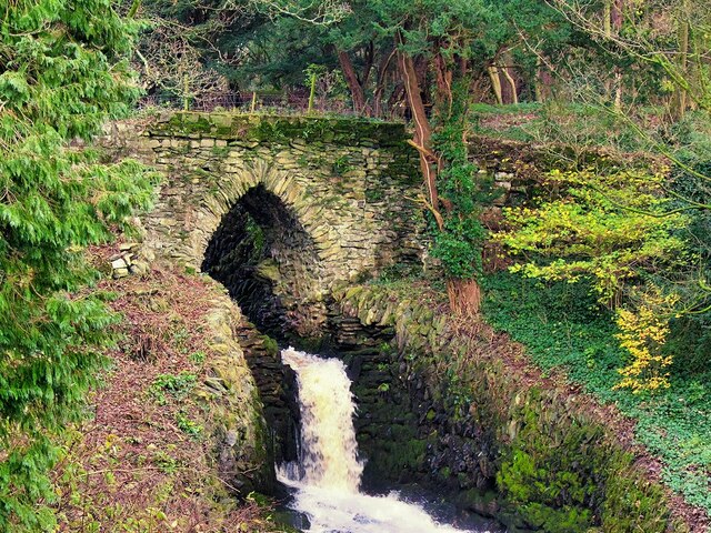
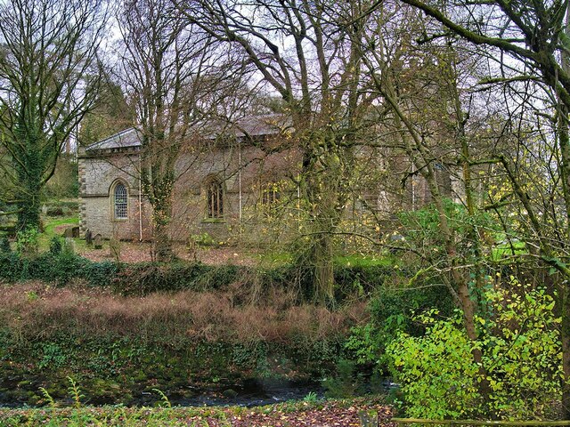
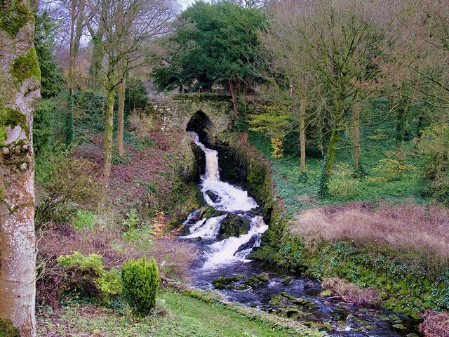
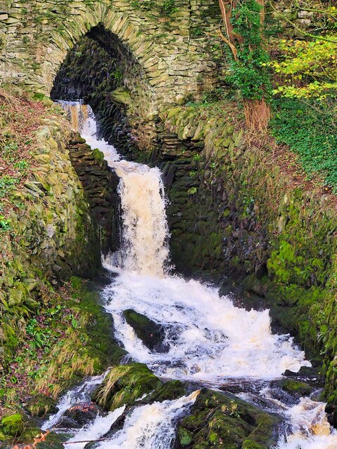
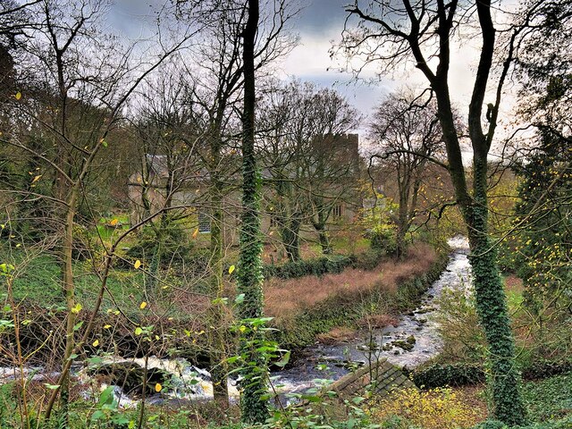
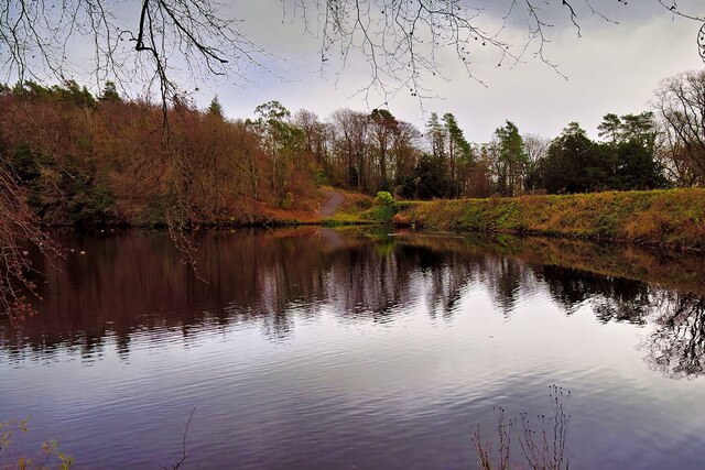
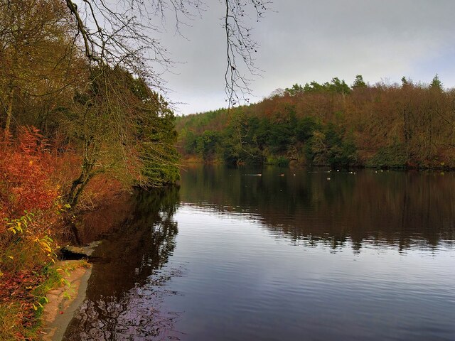
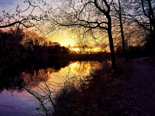
Bowsber Plantation is a pristine woodland located in the county of Yorkshire, England. Situated amidst the picturesque landscape, this enchanting forest covers an expansive area and boasts a rich diversity of flora and fauna.

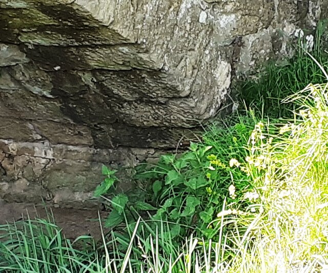
The woodland is characterized by its dense canopy of towering trees, predominantly comprising ancient oaks, beeches, and birches. These majestic specimens create a serene and peaceful atmosphere, with sunlight filtering through the branches and casting dappled shadows on the forest floor. The lush undergrowth is adorned with a variety of wildflowers, ferns, and mosses, adding to the area's natural beauty.

Bowsber Plantation is renowned for its abundant wildlife population. The forest provides a habitat for numerous animal species, including deer, foxes, badgers, and an array of birdlife. Nature enthusiasts can often spot woodpeckers, tawny owls, and buzzards, amongst others, soaring through the treetops or nesting in the nooks and crannies of the woodland.

Visitors to Bowsber Plantation can explore the many walking trails that wind through the forest, offering opportunities for peaceful strolls and refreshing hikes. The woodland is also a popular destination for nature photography, with its stunning vistas and diverse wildlife providing endless inspiration.

Managed by local authorities, Bowsber Plantation is well-maintained, with signage and designated picnic areas available for visitors. It is important to note that certain areas of the woodland may have restricted access during specific times of the year to preserve the natural ecosystem.

Overall, Bowsber Plantation is an idyllic woodland retreat, offering visitors a chance to immerse themselves in the tranquility and beauty of Yorkshire's natural wonders.

If you have any feedback on the listing, please let us know in the comments section below.

Bowsber Plantation Images

Images are sourced within 2km of 54.108151/-2.3834229 or Grid Reference SD7568. Thanks to Geograph Open Source API. All images are credited.

Direction Sign – Signpost on Eldroth Road, Lawkland Located on the northwest side of the T junction of Eldroth Road and Fummerber Lane in Lawkland parish. 3 arms and annulus & bar finial. See also <a title="https://www.geograph.org.uk/photo/5834757" href="https://www.geograph.org.uk/photo/5834757">Link</a> and <a title="https://www.geograph.org.uk/photo/4613723" href="https://www.geograph.org.uk/photo/4613723">Link</a>.

Milestone Society National ID: YW_SD7466A
Direction Sign – Signpost on Eldroth Road, Lawkland
Located on the northwest side of the T junction of Eldroth Road and Fummerber Lane in Lawkland parish. 3 arms and annulus & bar finial. See also Link and Link. Milestone Society National ID: YW_SD7466A
Clapham Bridge
Clapham Bridge
Fingerpost sign next to River Wenning A repaired fingerpost sign near Clapham Station, North Yorkshire
Fingerpost sign next to River Wenning
A repaired fingerpost sign near Clapham Station, North Yorkshire
Wenning Bank Bridge Stone bridge over the River Wenning near Clapham Station, North Yorkshire
Wenning Bank Bridge
Stone bridge over the River Wenning near Clapham Station, North Yorkshire
Bridge over Clapham Beck Waterfall Clapham Falls is a man-made waterfall which sees Clapham Beck drop below a bridge, in  three separate tiers, from the lake above into Clapham itself. The waterfall was constructed in 1837 by Oliver and James William Farrar as part of the remodelling of the estate of Ingleborough Hall.
Bridge over Clapham Beck Waterfall
Clapham Falls is a man-made waterfall which sees Clapham Beck drop below a bridge, in three separate tiers, from the lake above into Clapham itself. The waterfall was constructed in 1837 by Oliver and James William Farrar as part of the remodelling of the estate of Ingleborough Hall.
St James' Church, Clapham Looking across Clapham Beck towards the Church of St James at Clapham. 
The majority of the current church dates from 1814 although the tower has been retained from an earlier, fifteenth century, church. It is a Grade II listed building (List Entry Number: 1132398 <span class="nowrap"><a title="https://historicengland.org.uk/listing/the-list/list-entry/1132398" rel="nofollow ugc noopener" href="https://historicengland.org.uk/listing/the-list/list-entry/1132398">Link</a><img style="margin-left:2px;" alt="External link" title="External link - shift click to open in new window" src="https://s1.geograph.org.uk/img/external.png" width="10" height="10"/></span> Historic England)
St James' Church, Clapham
Looking across Clapham Beck towards the Church of St James at Clapham. The majority of the current church dates from 1814 although the tower has been retained from an earlier, fifteenth century, church. It is a Grade II listed building (List Entry Number: 1132398 LinkExternal link Historic England)
Clapham Falls Clapham Falls is a man-made waterfall which sees Clapham Beck drop below a bridge, in  three separate tiers, from the lake above into Clapham itself. The waterfall was constructed in 1837 by Oliver and James William Farrar as part of the remodelling of the estate of Ingleborough Hall.
Clapham Falls
Clapham Falls is a man-made waterfall which sees Clapham Beck drop below a bridge, in three separate tiers, from the lake above into Clapham itself. The waterfall was constructed in 1837 by Oliver and James William Farrar as part of the remodelling of the estate of Ingleborough Hall.
Clapham Beck Waterfall Clapham Falls is a man-made waterfall which sees Clapham Beck drop below a bridge, in  three separate tiers, from the lake above into Clapham itself. The waterfall was constructed in 1837 by Oliver and James William Farrar as part of the remodelling of the estate of Ingleborough Hall.
Clapham Beck Waterfall
Clapham Falls is a man-made waterfall which sees Clapham Beck drop below a bridge, in three separate tiers, from the lake above into Clapham itself. The waterfall was constructed in 1837 by Oliver and James William Farrar as part of the remodelling of the estate of Ingleborough Hall.
Clapham Beck and the Church of St James Looking across Clapham Beck towards the Church of St James at Clapham. 
The majority of the current church dates from 1814 although the tower has been retained from an earlier, fifteenth century, church. It is a Grade II listed building (List Entry Number: 1132398 <span class="nowrap"><a title="https://historicengland.org.uk/listing/the-list/list-entry/1132398" rel="nofollow ugc noopener" href="https://historicengland.org.uk/listing/the-list/list-entry/1132398">Link</a><img style="margin-left:2px;" alt="External link" title="External link - shift click to open in new window" src="https://s1.geograph.org.uk/img/external.png" width="10" height="10"/></span> Historic England)
Clapham Beck and the Church of St James
Looking across Clapham Beck towards the Church of St James at Clapham. The majority of the current church dates from 1814 although the tower has been retained from an earlier, fifteenth century, church. It is a Grade II listed building (List Entry Number: 1132398 LinkExternal link Historic England)
Clapham Lake Clapham Lake is a man-made ornamental lake in Clapdale, just above the village of Clapham. It is surrounded by woodland and is seen here from Clapdale Drive, a wide track that passes along the western side of the lake on its through Clapdale Wood towards Ingleborough Cave.

Known simply as The Lake, this artificial lake was constructed in the 18th century as part of the remodelling of the Ingleborough estate by the Farrar family who built a dam to hold back the waters of Clapham Beck, which drains via the artificial watercourse of Clapham Falls.
Clapham Lake
Clapham Lake is a man-made ornamental lake in Clapdale, just above the village of Clapham. It is surrounded by woodland and is seen here from Clapdale Drive, a wide track that passes along the western side of the lake on its through Clapdale Wood towards Ingleborough Cave. Known simply as The Lake, this artificial lake was constructed in the 18th century as part of the remodelling of the Ingleborough estate by the Farrar family who built a dam to hold back the waters of Clapham Beck, which drains via the artificial watercourse of Clapham Falls.
Lake at Clapham Known simply as The Lake, this artificial lake, just above the village of Clapham, was constructed in the 18th century as part of the remodelling of the Ingleborough estate by the Farrar family who built a dam to hold back the waters of Clapham Beck, which drains via the artificial watercourse of Clapham Falls.

The ornamental lake is surrounded by woodland and is seen here from Clapdale Drive, a wide track that passes along the western side of the lake on its through Clapdale Wood towards Ingleborough Cave.
Lake at Clapham
Known simply as The Lake, this artificial lake, just above the village of Clapham, was constructed in the 18th century as part of the remodelling of the Ingleborough estate by the Farrar family who built a dam to hold back the waters of Clapham Beck, which drains via the artificial watercourse of Clapham Falls. The ornamental lake is surrounded by woodland and is seen here from Clapdale Drive, a wide track that passes along the western side of the lake on its through Clapdale Wood towards Ingleborough Cave.
Cat Hole Sike The shallow streambed that passes beneath Clapdale Drive is called Cat Hole Syke. ("Syke" or "sike" is a colloquial term for a small stream). The steeply dipping Ordovician rocks, some more than 400 million years old, were pushed to the surface by a major disturbance in the earth's crust which caused massive earth movements tilting them to their present angle. This is part of the Craven Fault System <span class="nowrap"><a title="https://en.wikipedia.org/wiki/Craven_Fault_System" rel="nofollow ugc noopener" href="https://en.wikipedia.org/wiki/Craven_Fault_System">Link</a><img style="margin-left:2px;" alt="External link" title="External link - shift click to open in new window" src="https://s1.geograph.org.uk/img/external.png" width="10" height="10"/></span> .
Cat Hole Sike
The shallow streambed that passes beneath Clapdale Drive is called Cat Hole Syke. ("Syke" or "sike" is a colloquial term for a small stream). The steeply dipping Ordovician rocks, some more than 400 million years old, were pushed to the surface by a major disturbance in the earth's crust which caused massive earth movements tilting them to their present angle. This is part of the Craven Fault System LinkExternal link .
The Lake, Clapham Known simply as The Lake, this artificial lake, just above the village of Clapham, was constructed in the 18th century as part of the remodelling of the Ingleborough estate by the Farrar family who built a dam to hold back the waters of Clapham Beck, which drains via the artificial watercourse of Clapham Falls.

The ornamental lake is surrounded by woodland and is seen here from Clapdale Drive, a wide track that passes along the western side of the lake on its route through Clapdale Wood towards Ingleborough Cave.
The Lake, Clapham
Known simply as The Lake, this artificial lake, just above the village of Clapham, was constructed in the 18th century as part of the remodelling of the Ingleborough estate by the Farrar family who built a dam to hold back the waters of Clapham Beck, which drains via the artificial watercourse of Clapham Falls. The ornamental lake is surrounded by woodland and is seen here from Clapdale Drive, a wide track that passes along the western side of the lake on its route through Clapdale Wood towards Ingleborough Cave.
Diesel multiple unit 158850 leaves Clapham Station for Morecambe The train is the Northern service from Leeds
Diesel multiple unit 158850 leaves Clapham Station for Morecambe
The train is the Northern service from Leeds
Benchmark on Calter Barn Ordnance Survey cut mark benchmark levelled at 138.132m verified 1953
Benchmark on Calter Barn
Ordnance Survey cut mark benchmark levelled at 138.132m verified 1953
Benchmark on stone jamb of door of former post office at Wenning Bank Ordnance Survey cut mark benchmark levelled at 135.371m above Newlyn Datum verified 1953
Benchmark on stone jamb of door of former post office at Wenning Bank
Ordnance Survey cut mark benchmark levelled at 135.371m above Newlyn Datum verified 1953
House at Wenning Bank There is an Ordnance Survey benchmark <a href="https://www.geograph.org.uk/photo/7499989">SD7367 : Benchmark on stone jamb of door of former post office at Wenning Bank</a>  on the left hand jamb of the white door
House at Wenning Bank
There is an Ordnance Survey benchmark SD7367 : Benchmark on stone jamb of door of former post office at Wenning Bank on the left hand jamb of the white door
Benchmark on Calterber Bridge Ordnance Survey cut mark benchmark levelled at 128.101m above Newlyn Datum verified 1953
Benchmark on Calterber Bridge
Ordnance Survey cut mark benchmark levelled at 128.101m above Newlyn Datum verified 1953
Show me another place!

Bowsber Plantation is located at Grid Ref: SD7568 (Lat: 54.108151, Lng: -2.3834229)

Division: West Riding

Administrative County: North Yorkshire

District: Craven

Police Authority: North Yorkshire

What 3 Words

///formal.keyboard.watchdogs. Near Ingleton, North Yorkshire

Nearby Locations

Bowsber Plantation

Related Wikis

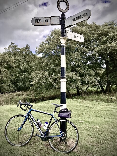
Clapham, North Yorkshire

Clapham is a village in the civil parish of Clapham cum Newby in the Craven district of North Yorkshire, England. It was previously in the West Riding...

Austwick

Austwick is a village and civil parish in the Craven district of North Yorkshire, England, about 5 miles (8 km) north-west of Settle. The village is on...

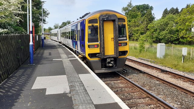
Clapham railway station

Clapham is a railway station on the Bentham Line, which runs between Leeds and Morecambe via Skipton. The station, situated 48 miles (77 km) north-west...

Clapham cum Newby

Clapham cum Newby is a civil parish in the Craven district of North Yorkshire, England. It was formerly in the Settle Rural District. It contains the villages...
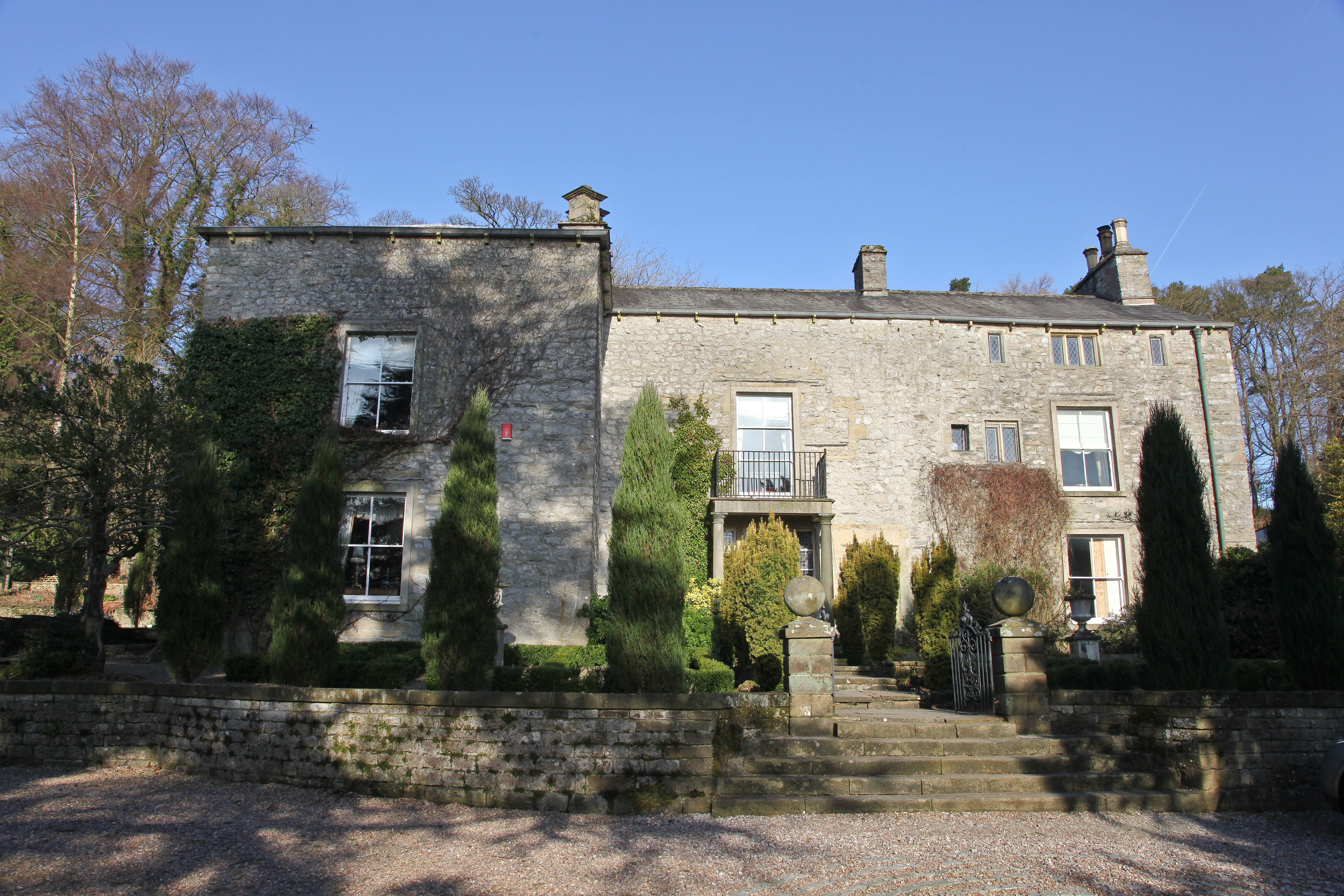
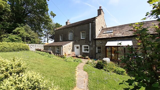
Austwick Hall

Austwick Hall is an historic manor house situated above the village of Austwick in North Yorkshire, England. The house is a Grade II listed building and...

Norber erratics

The Norber erratics are one of the finest groups of glacial erratic boulders in Britain. They are found on the southern slopes of Ingleborough, close to...
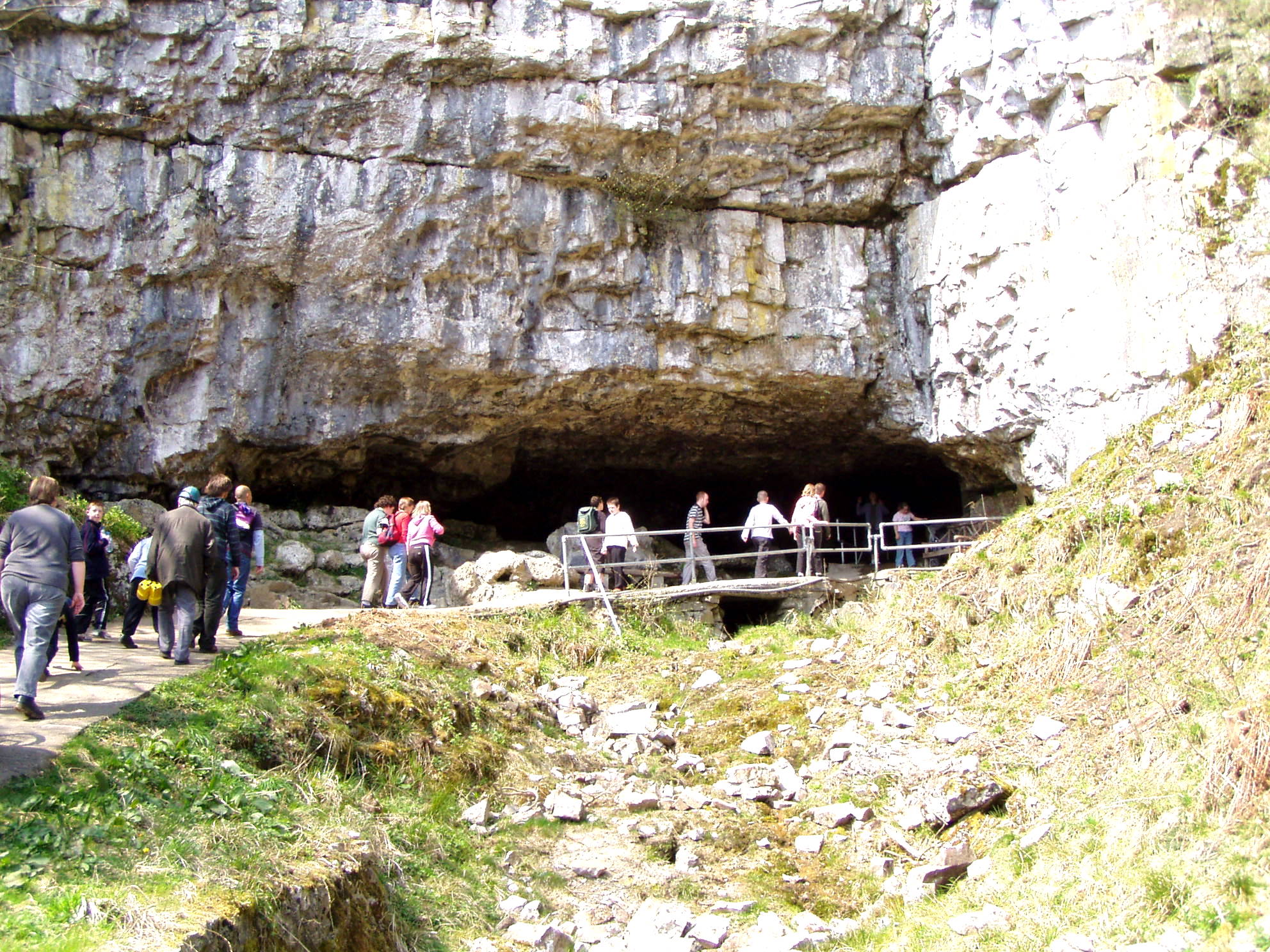
Ingleborough Cave

Ingleborough Cave (formerly known as Clapham Caves) is a show cave close to the village of Clapham in North Yorkshire, England, adjacent to where the water...
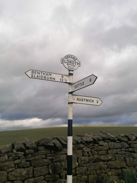
Eldroth

Eldroth is a village in North Yorkshire, England. It is in the civil parish of Lawkland, part of the former Craven District, some 3.25 miles (5.23 km)...

Nearby Amenities

Located within 500m of 54.108151,-2.3834229
Parking
Parking: layby
Lat/Long: 54.1107312/-2.3843158
Give Way
Direction: forward
Lat/Long: 54.1088114/-2.3789077
Give Way
Direction: backward
Lat/Long: 54.1089711/-2.3793438
Give Way
Direction: forward
Lat/Long: 54.1090787/-2.3791957
Material: wood
Power: pole
Lat/Long: 54.1113788/-2.3882975
Material: wood
Power: pole
Lat/Long: 54.1106802/-2.3862606
Material: wood
Power: pole
Lat/Long: 54.1102804/-2.3850717
Material: wood
Power: pole
Lat/Long: 54.1094523/-2.3827297
Power: pole
Lat/Long: 54.1090624/-2.3815495
Power: pole
Lat/Long: 54.1086567/-2.3802406
Power: pole
Lat/Long: 54.1082353/-2.3789638
Power: pole
Lat/Long: 54.1077635/-2.3776978
Power: pole
Lat/Long: 54.1073515/-2.3764372
Power: pole
Lat/Long: 54.1109588/-2.387073
Power: pole
Lat/Long: 54.1098547/-2.3838677
The data included in this document is from www.openstreetmap.org. The data is made available under ODbL.

Have you been to Bowsber Plantation?

Leave your review of Bowsber Plantation below (or comments, questions and feedback).