Russellsend Coppice

Wood, Forest in Gloucestershire Forest of Dean

England

Russellsend Coppice

M50 looking west at junction 2
M50 looking west at junction 2 Credit: Colin Pyle

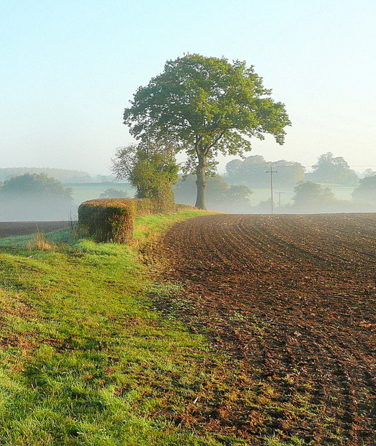
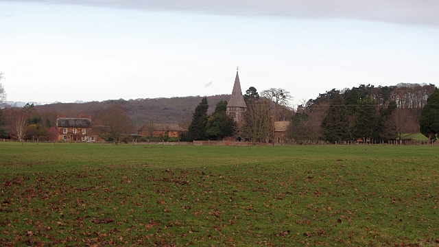
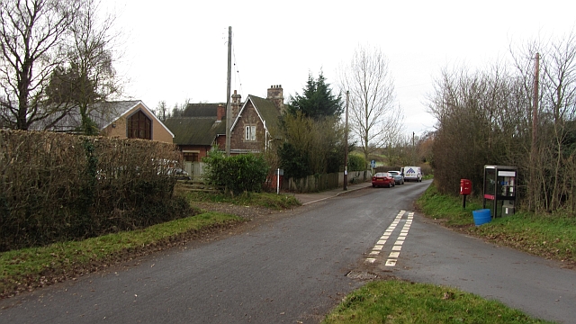
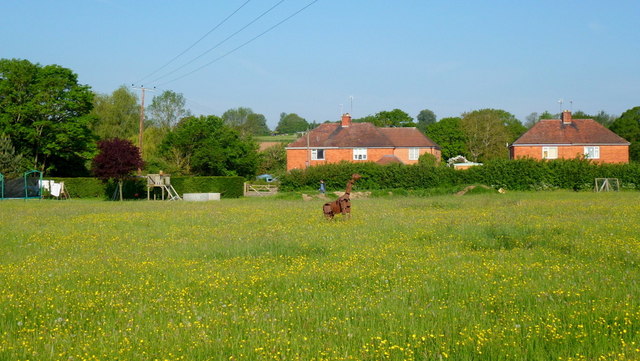
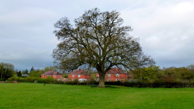
Russellsend Coppice is a picturesque woodland area located in the county of Gloucestershire, England. Covering an expansive area, the coppice is characterized by its abundant growth of trees, making it a haven for nature enthusiasts and wildlife alike. The woodland is nestled in a rural setting, providing a serene and peaceful environment for visitors to explore.

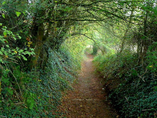
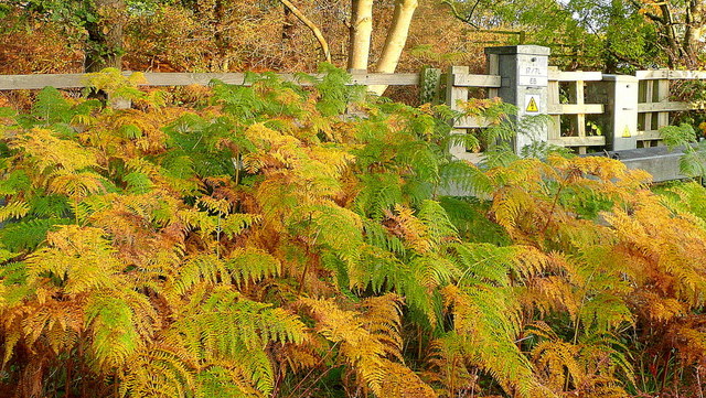
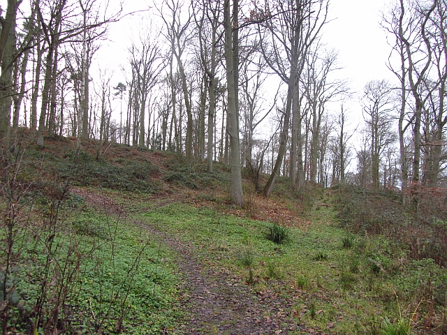
The coppice boasts a diverse range of trees, including oak, beech, and hazel, which create a beautiful tapestry of colors throughout the seasons. The forest floor is also adorned with a variety of wildflowers and ferns, adding to its natural charm. Walking trails wind their way through the wood, allowing visitors to immerse themselves in the tranquil surroundings and enjoy the beauty of the landscape.

Wildlife thrives in Russellsend Coppice, with numerous species calling the woodland home. Birdwatchers can spot a variety of feathered creatures, including woodpeckers, jays, and songbirds. Squirrels and rabbits can also be spotted darting among the trees, while deer occasionally make appearances in the early morning or late evening.

The coppice is not only a natural wonder but also holds historical significance. It has been managed as a traditional coppice woodland for centuries, where trees are periodically cut back to promote new growth and provide a sustainable source of timber. This traditional management technique has preserved the woodland's unique character and contributed to its ecological value.

Overall, Russellsend Coppice is a hidden gem in Gloucestershire, offering visitors a chance to escape the hustle and bustle of modern life and reconnect with nature in a truly enchanting setting.

If you have any feedback on the listing, please let us know in the comments section below.

Russellsend Coppice Images

Images are sourced within 2km of 51.996/-2.3662446 or Grid Reference SO7433. Thanks to Geograph Open Source API. All images are credited.

M50 looking west at junction 2
M50 looking west
M50 looking west
M50 westbound at Bromsberrow Heath
Wild daffodils by the M50 These Narcissus pseudonarcissus clothe the slopes surrounding the Highways Authority depot at Junction 2 of the M50.
Wild daffodils by the M50
These Narcissus pseudonarcissus clothe the slopes surrounding the Highways Authority depot at Junction 2 of the M50.
Autumn edge The morning mist in the shallow Glynch valley is burning off on this fine September day.
Autumn edge
The morning mist in the shallow Glynch valley is burning off on this fine September day.
Redmarley bridleway A country route to Ryton.
Redmarley bridleway
A country route to Ryton.
Tunnel-like bridleway Heading west from Redmarley towards Ryton.
Tunnel-like bridleway
Heading west from Redmarley towards Ryton.
Autumnal dawn The line of the public path from Pound House to Parkgate.
Autumnal dawn
The line of the public path from Pound House to Parkgate.
Sunrise over the M50 Early morning commuters and delivery drivers are out on the nation's road system.
Sunrise over the M50
Early morning commuters and delivery drivers are out on the nation's road system.
Bracken by the M50 Whilst waiting in a traffic queue I noticed this little slice of autumn out of my passenger side window!
Bracken by the M50
Whilst waiting in a traffic queue I noticed this little slice of autumn out of my passenger side window!
A big grass field, Bromesberrow Looking towards the limestone hills at Ledbury, beyond Bromesberrow Court and church.
A big grass field, Bromesberrow
Looking towards the limestone hills at Ledbury, beyond Bromesberrow Court and church.
School, Bromesberrow Village primary school and telephone box seen from the green.
School, Bromesberrow
Village primary school and telephone box seen from the green.
Hayes Coppice One of the many small woodlands in the surrounds of the Malvern Hills. This is a great place to visit if you like traditional old English woodland.  This is the Bromesberrow Estate in Gloucestershire, just to the north in Herefordshire is Eastnor which is also well wooded and very light on the Sitka.
 Oaks dominate the deep soils on the sandstones. Further up the hill on thin soils above Uriconian rocks ashes, some huge are the favoured tree.  Sadly the invasive sycamore is too common in the Malvern Hills, it thrived when grazing stopped.
Hayes Coppice
One of the many small woodlands in the surrounds of the Malvern Hills. This is a great place to visit if you like traditional old English woodland. This is the Bromesberrow Estate in Gloucestershire, just to the north in Herefordshire is Eastnor which is also well wooded and very light on the Sitka. Oaks dominate the deep soils on the sandstones. Further up the hill on thin soils above Uriconian rocks ashes, some huge are the favoured tree. Sadly the invasive sycamore is too common in the Malvern Hills, it thrived when grazing stopped.
Single track lane near Bromesberrow
Memorial to Marie Every spring this floral tribute by the M50 reminds me of the tragic and as yet (2012) unsolved murder of Marie Wilks in June 1988; see <span class="nowrap"><a title="http://www.bbc.co.uk/herefordandworcester/content/articles/2008/05/14/m50_marie_wilks_timeline_feature.shtml" rel="nofollow ugc noopener" href="http://www.bbc.co.uk/herefordandworcester/content/articles/2008/05/14/m50_marie_wilks_timeline_feature.shtml">Link</a><img style="margin-left:2px;" alt="External link" title="External link - shift click to open in new window" src="https://s1.geograph.org.uk/img/external.png" width="10" height="10"/></span>
Memorial to Marie
Every spring this floral tribute by the M50 reminds me of the tragic and as yet (2012) unsolved murder of Marie Wilks in June 1988; see LinkExternal link
Lake in Bromesberrow Park Looking northwards across the man-made lake towards Toney's Coppice on the left and High Wood on the right.
Lake in Bromesberrow Park
Looking northwards across the man-made lake towards Toney's Coppice on the left and High Wood on the right.
The Redmarley Giraffe Another sculpture in a public setting.
This metal animal can be seen from the A417 at playley Green.
The Redmarley Giraffe
Another sculpture in a public setting. This metal animal can be seen from the A417 at playley Green.
Redmarley oak Photo taken pre-leafing on this cold wet April morning.
Redmarley oak
Photo taken pre-leafing on this cold wet April morning.
Show me another place!

Russellsend Coppice is located at Grid Ref: SO7433 (Lat: 51.996, Lng: -2.3662446)

Administrative County: Gloucestershire

District: Forest of Dean

Police Authority: Gloucestershire

What 3 Words

///renew.congested.fills. Near Donnington, Herefordshire

Related Wikis

Bromsberrow

Bromsberrow (or Bromesberrow) is part of the Forest of Dean district. The village is close to the meeting point between Gloucestershire, Herefordshire...

Redmarley D'Abitot

Redmarley D'Abitot is a civil parish and village in the Forest of Dean district, Gloucestershire, South West England. In addition to the village of Redmarley...

Three Counties (Gloucestershire, Herefordshire and Worcestershire)

The Three Counties of England are traditionally the three agrarian counties of Gloucestershire, Herefordshire and Worcestershire.Including towns and cities...

Whiteleaved Oak

Whiteleaved Oak is a hamlet in the English county of Herefordshire, lying in a valley at the southern end of the Malvern Hills between Raggedstone Hill...

Nearby Amenities

Located within 500m of 51.996,-2.3662446
Motorway Junction
Bury Court Interchange
Exit To: A417 Ledbury, Great Malvern
Layer: 3
Ref: 2
Lat/Long: 51.9973927/-2.3649651
Russells End
Place: hamlet
Source: OS 1:25k
Lat/Long: 51.9958851/-2.3693868
Phone
Emergency: phone
Source: survey
Lat/Long: 51.997232/-2.3703586
Phone
Emergency: phone
Source: survey
Lat/Long: 51.9969875/-2.3703109
Bury Court Depot
Power: pole
Transformer: distribution
Voltage Primary: 11000
Lat/Long: 51.9976706/-2.3615871
Power: pole
Lat/Long: 51.9978629/-2.363057
Russells End
Power: pole
Transformer: distribution
Voltage Primary: 11000
Lat/Long: 51.996607/-2.3682135
Power: pole
Lat/Long: 51.9968572/-2.367838
Location Transition: yes
Power: pole
Lat/Long: 51.9971314/-2.3670776
Location Transition: yes
Power: pole
Lat/Long: 51.9980818/-2.3648112
Power: pole
Lat/Long: 51.998673/-2.3662723
Power: pole
Lat/Long: 51.9992584/-2.3677012
Power: pole
Lat/Long: 51.9998194/-2.3690933
Russells End Caravan
Power: pole
Transformer: distribution
Voltage Primary: 11000
Lat/Long: 51.9955476/-2.3595648
The data included in this document is from www.openstreetmap.org. The data is made available under ODbL.

Have you been to Russellsend Coppice?

Leave your review of Russellsend Coppice below (or comments, questions and feedback).