Summer House Plantation

Wood, Forest in Dorset

England

Summer House Plantation

Nordon Hill from private road to Higher Melcombe
Nordon Hill from private road to Higher Melcombe Credit: Becky Williamson

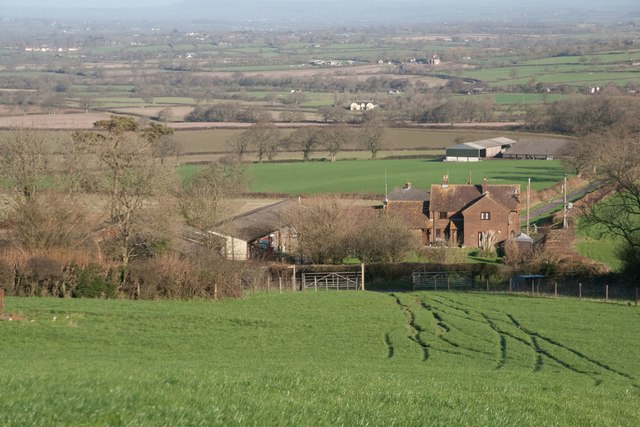
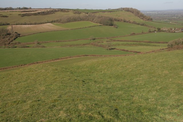
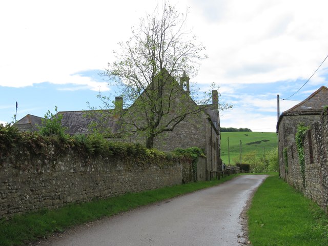
Summer House Plantation is a picturesque woodland estate located in the county of Dorset, England. Set amidst a sprawling forest, this historic property spans over several acres and offers a serene and tranquil environment for nature enthusiasts and history buffs alike.

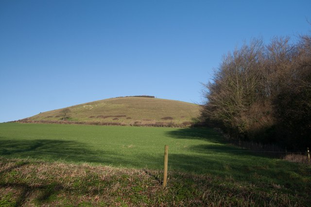
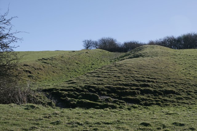
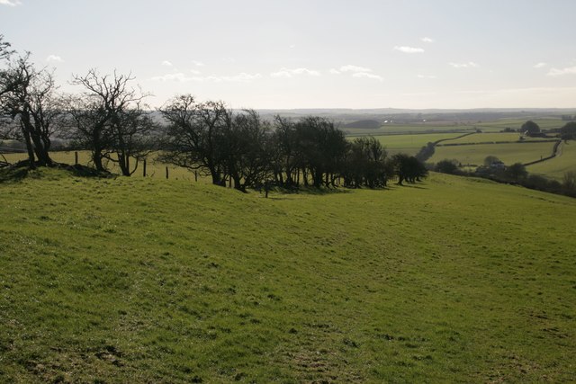
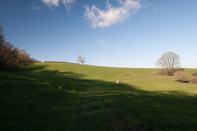
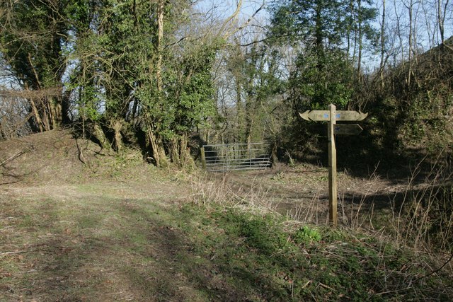
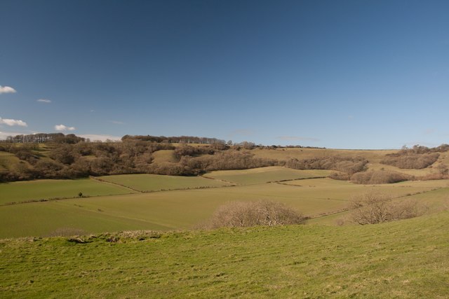
The estate is known for its dense and lush woodlands, which are home to a diverse array of flora and fauna. Towering oak and beech trees dominate the landscape, creating a majestic canopy that provides shade and shelter. The forest floor is adorned with a vibrant carpet of wildflowers, ferns, and moss, adding to the enchanting atmosphere.

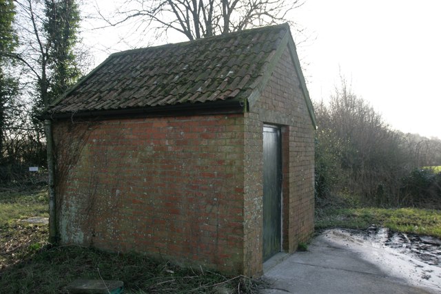
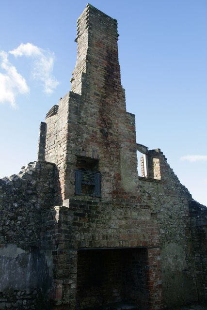
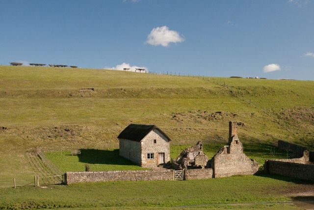
The centerpiece of Summer House Plantation is the titular summer house, a charming and rustic structure nestled within the heart of the woodland. This well-preserved architectural gem dates back to the 18th century and offers visitors a glimpse into the past. Surrounded by well-manicured gardens, the summer house provides a peaceful retreat where visitors can relax and enjoy the serenity of their surroundings.

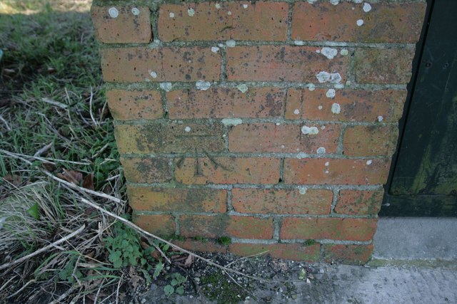
In addition to its natural beauty, Summer House Plantation also boasts a rich history. The estate has been owned and maintained by the same family for generations, with each successive owner adding their own unique touches to the property. As a result, the plantation is a testament to the evolution of architectural styles and landscaping techniques over the centuries.

With its captivating woodlands, historic summer house, and fascinating history, Summer House Plantation is a must-visit destination for those seeking a peaceful escape in the heart of Dorset. Whether exploring the forest trails, admiring the beautiful gardens, or simply soaking in the tranquility, visitors are sure to be enchanted by this idyllic estate.

If you have any feedback on the listing, please let us know in the comments section below.

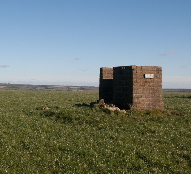
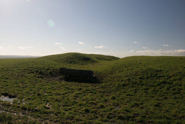
Summer House Plantation Images

Images are sourced within 2km of 50.816332/-2.3575442 or Grid Reference ST7401. Thanks to Geograph Open Source API. All images are credited.

Nordon Hill from private road to Higher Melcombe
Leading to Melcombe Park Farm from the south
Trig point on Henning Hill
Flush Bracket on Henning Hill trigpoint
Benchmark on Pump House, Cross Lanes Ordnance Survey benchmark, described on database at <span class="nowrap"><a title="http://www.bench-marks.org.uk/bm47096" rel="nofollow ugc noopener" href="http://www.bench-marks.org.uk/bm47096">Link</a><img style="margin-left:2px;" alt="External link" title="External link - shift click to open in new window" src="https://s1.geograph.org.uk/img/external.png" width="10" height="10"/></span>. See also <a href="https://www.geograph.org.uk/photo/4807920">ST7502 : Pump House, Cross Lanes</a>.
Benchmark on Pump House, Cross Lanes
Ordnance Survey benchmark, described on database at LinkExternal link. See also ST7502 : Pump House, Cross Lanes.
Pump House, Cross Lanes There is an Ordnance Survey benchmark on this building (left side of door). For photo, see <a href="https://www.geograph.org.uk/photo/4807918">ST7502 : Benchmark on Pump House, Cross Lanes</a>. For full description on database, see <span class="nowrap"><a title="http://www.bench-marks.org.uk/bm47096" rel="nofollow ugc noopener" href="http://www.bench-marks.org.uk/bm47096">Link</a><img style="margin-left:2px;" alt="External link" title="External link - shift click to open in new window" src="https://s1.geograph.org.uk/img/external.png" width="10" height="10"/></span>.
Pump House, Cross Lanes
There is an Ordnance Survey benchmark on this building (left side of door). For photo, see ST7502 : Benchmark on Pump House, Cross Lanes. For full description on database, see LinkExternal link.
Cross dyke on Higher Hill Cross dykes apparently formed prehistoric land boundaries. There are quite a few on this ridgeway in this beautiful part of Dorset.
Cross dyke on Higher Hill
Cross dykes apparently formed prehistoric land boundaries. There are quite a few on this ridgeway in this beautiful part of Dorset.
Cross dyke on Higher Hill Another prehistoric land boundary on this beautiful ridge.
Cross dyke on Higher Hill
Another prehistoric land boundary on this beautiful ridge.
Funny building at footpath crossroads on Nettlecombe Tout This building appears to have no other purpose than being a place to put footpath signs, but maybe I'm missing something.
Funny building at footpath crossroads on Nettlecombe Tout
This building appears to have no other purpose than being a place to put footpath signs, but maybe I'm missing something.
Cross dyke near Higher Melcombe A prehistoric land boundary. There is a plethora of these in the area.
Cross dyke near Higher Melcombe
A prehistoric land boundary. There is a plethora of these in the area.
Hedge on Hog Hill
Hedge on Hog Hill
Ruined cottage, Lyscombe It is unusual to see an upper storey fireplace intact like this one. this cottage would have accommodated the priest for the adjacent chapel, which was restored in 2005 and is now maintained by the Dorset Historic Churches Trust.
Ruined cottage, Lyscombe
It is unusual to see an upper storey fireplace intact like this one. this cottage would have accommodated the priest for the adjacent chapel, which was restored in 2005 and is now maintained by the Dorset Historic Churches Trust.
Lyscombe Chapel and cottage The chapel dates from the 12th century and is situated in the bowl of a beautiful valley, Lyscombe Bottom in the heartland of Dorset. It is built of flint, stone and rock chalk and was part of the endowment of nearby Milton Abbey. The chapel is thought to have become a dwelling place in the 17th century, then a farm-worker's cottage and then a bake house. It is now cared for by the Dorset Historic Churches Trust, and has been beautifully restored to retain some of its original features.
Lyscombe Chapel and cottage
The chapel dates from the 12th century and is situated in the bowl of a beautiful valley, Lyscombe Bottom in the heartland of Dorset. It is built of flint, stone and rock chalk and was part of the endowment of nearby Milton Abbey. The chapel is thought to have become a dwelling place in the 17th century, then a farm-worker's cottage and then a bake house. It is now cared for by the Dorset Historic Churches Trust, and has been beautifully restored to retain some of its original features.
Eastern flanks of Nettlecombe Tout
Signpost at Dorsetshire Gap This ancient intersection has a visitors' book for passers-by to sign as they pass through.
Signpost at Dorsetshire Gap
This ancient intersection has a visitors' book for passers-by to sign as they pass through.
Lyscombe Bottom
Lyscombe Bottom
Higher Melcombe Farm There is a benchmark on the building on the right. See <a href="https://www.geograph.org.uk/photo/4963247">ST7402 : Benchmark on building, Higher Melcombe Farm</a>.
Higher Melcombe Farm
There is a benchmark on the building on the right. See ST7402 : Benchmark on building, Higher Melcombe Farm.
Benchmark on building, Higher Melcombe Farm Ordnance Survey benchmark, described on database at <span class="nowrap"><a title="http://www.bench-marks.org.uk/bm75743" rel="nofollow ugc noopener" href="http://www.bench-marks.org.uk/bm75743">Link</a><img style="margin-left:2px;" alt="External link" title="External link - shift click to open in new window" src="https://s1.geograph.org.uk/img/external.png" width="10" height="10"/></span>. See also <a href="https://www.geograph.org.uk/photo/4963245">ST7402 : Higher Melcombe Farm</a>.
Benchmark on building, Higher Melcombe Farm
Ordnance Survey benchmark, described on database at LinkExternal link. See also ST7402 : Higher Melcombe Farm.
Show me another place!

Summer House Plantation is located at Grid Ref: ST7401 (Lat: 50.816332, Lng: -2.3575442)

Unitary Authority: Dorset

Police Authority: Dorset

What 3 Words

///increases.hype.solves. Near Milborne St Andrew, Dorset

Nearby Locations

Summer House Plantation

Related Wikis

Melcombe Horsey

Melcombe Horsey is a civil parish in the county of Dorset in South West England. It contains the small settlements of Melcombe Bingham, Bingham's Melcombe...

Ansty Cross

Ansty Cross is a village in Dorset, England.

Aller, Dorset

Aller is a village in Dorset, England.

Lyscombe Hill

Lyscombe Hill (262 metres, 860 feet high) is a hill near Melcombe Bingham about 14 kilometres north-northeast of Dorchester in the county of Dorset, England...

Cheselbourne

Cheselbourne (sometimes spelled Chesilborne or Cheselborne) is a village and civil parish in Dorset, England, situated in the Dorset Downs, 7 miles (11...

Ansty, Dorset

Ansty is a village in Dorset, England, north of Cheselbourne and west of Milton Abbas. It consists of the settlements of Higher Ansty, Lower Ansty, Pleck...

Doles Ash

Doles Ash is a farm in Dorset, England, a few kilometers east of Piddletrenthide and south of Plush. The farm features in Thomas Hardy's Tess of the D...

Ball Hill, Dorset

At 251 metres, Ball Hill is one of the highest hills in the county of Dorset, England, and is on the Wessex Ridgeway. == Location == The summit of Ball...

Nearby Amenities

Located within 500m of 50.816332,-2.3575442
Material: wood
Power: pole
Source: bing
Switch: yes
Lat/Long: 50.8148353/-2.3509048
Material: wood
Power: pole
Source: bing
Lat/Long: 50.8156781/-2.3514254
Material: wood
Power: pole
Source: bing
Lat/Long: 50.8160849/-2.350502
Material: wood
Power: pole
Source: bing
Lat/Long: 50.816892/-2.353798
Material: wood
Power: pole
Source: bing
Lat/Long: 50.8174963/-2.3549843
Material: wood
Power: pole
Source: bing
Lat/Long: 50.8180992/-2.3561574
Material: wood
Power: pole
Source: bing
Lat/Long: 50.818711/-2.3573264
Material: wood
Power: pole
Source: bing
Lat/Long: 50.8193109/-2.3584869
Material: wood
Power: pole
Source: bing
Lat/Long: 50.8199134/-2.3596688
Power: pole
Source: bing
Lat/Long: 50.8138634/-2.360175
Power: pole
Source: bing
Lat/Long: 50.8136905/-2.3589277
Power: pole
Source: bing
Lat/Long: 50.813521/-2.3577261
Power: pole
Source: bing
Lat/Long: 50.8134193/-2.3565647
Power: pole
Source: bing
Lat/Long: 50.8133244/-2.355414
Material: wood
Power: pole
Source: survey
Lat/Long: 50.8134109/-2.3521632
Material: wood
Power: pole
Source: survey
Lat/Long: 50.8131126/-2.353
Material: wood
Power: pole
Source: survey
Lat/Long: 50.8132143/-2.354207
Power: pole
Source: bing
Lat/Long: 50.8162825/-2.3526004
The data included in this document is from www.openstreetmap.org. The data is made available under ODbL.

Have you been to Summer House Plantation?

Leave your review of Summer House Plantation below (or comments, questions and feedback).