Copy Wood

Wood, Forest in Lancashire Hyndburn

England

Copy Wood

Checco's Pizzeria
Checco's Pizzeria Credit: Anthony Parkes

Copy Wood is a small forest area located in the county of Lancashire, England. Situated near the village of Wood, this woodland offers a tranquil and scenic environment for visitors to explore and enjoy nature.

Covering an area of approximately 50 acres, Copy Wood is primarily composed of deciduous trees such as oak, ash, and birch, providing a diverse habitat for various wildlife species. The forest floor is adorned with a rich carpet of wildflowers, ferns, and mosses, adding to the natural beauty of the surroundings.

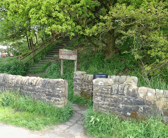
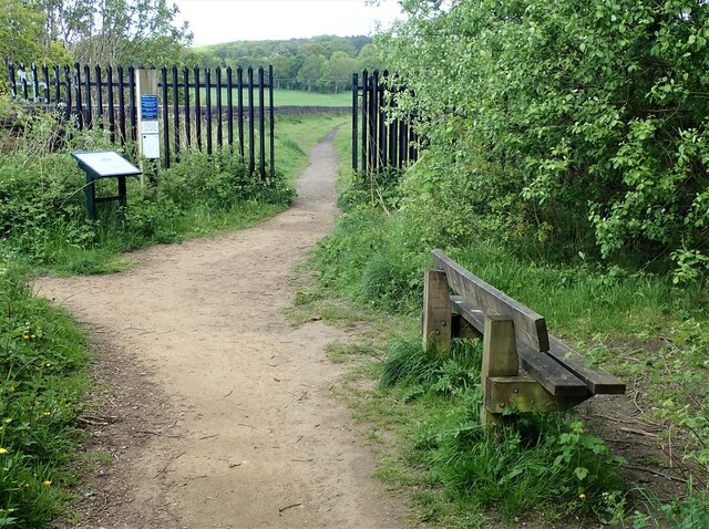
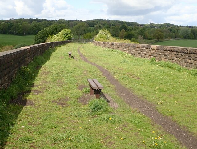
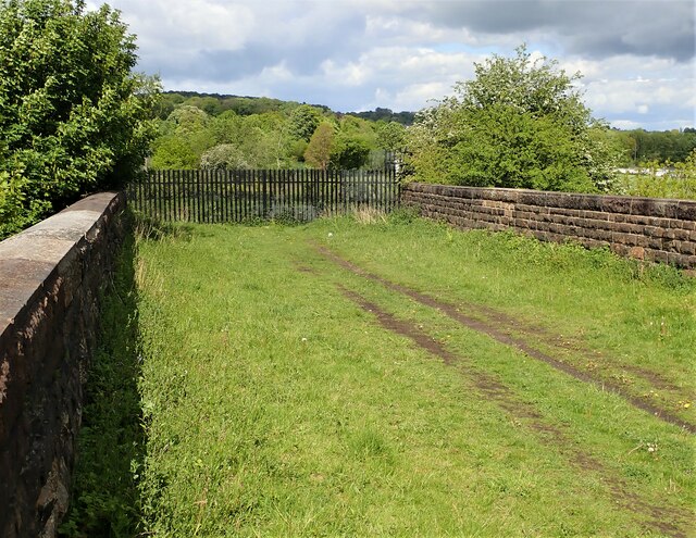
The wood is crisscrossed by a network of well-maintained footpaths, making it easily accessible for hikers and nature enthusiasts. These trails meander through the forest, allowing visitors to witness the changing seasons and appreciate the vibrant colors of the foliage. The peaceful ambiance of Copy Wood also makes it a favored spot for birdwatchers, as numerous avian species can be spotted throughout the year.

In addition to its natural attractions, Copy Wood boasts several amenities for visitors. There is a small parking area at the entrance, providing convenient access for those arriving by car. Furthermore, benches and picnic tables are scattered around the woodland, offering visitors the opportunity to relax, have a meal, or simply soak in the serene atmosphere.

Overall, Copy Wood in Lancashire is a charming and picturesque forest, perfect for individuals seeking solace in nature. Its accessibility, diverse flora and fauna, and tranquil ambiance make it a popular destination for locals and tourists alike.

If you have any feedback on the listing, please let us know in the comments section below.
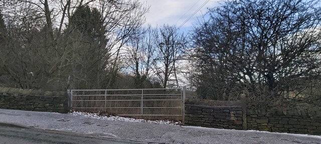
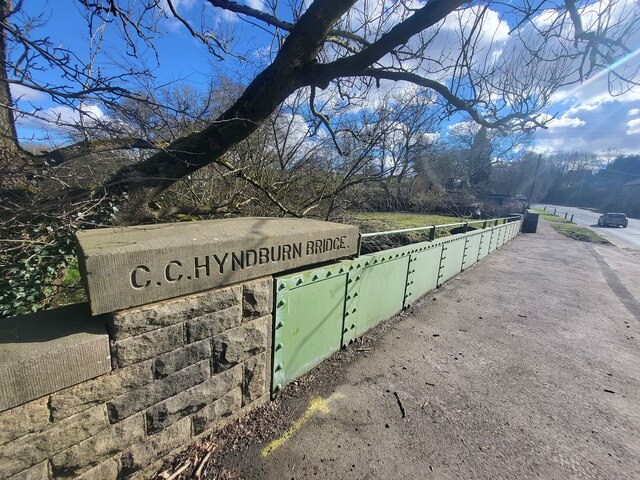
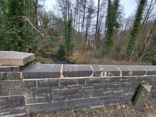
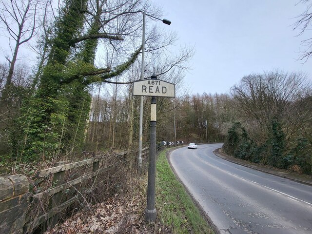
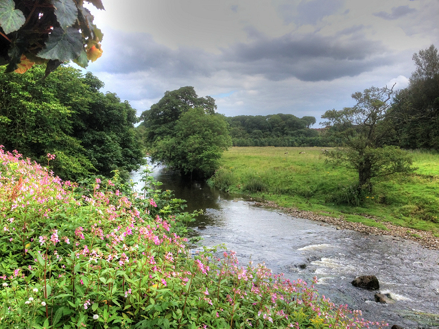
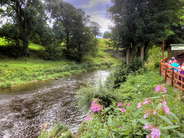
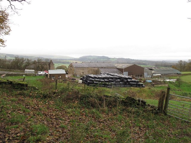
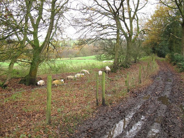
Copy Wood Images

Images are sourced within 2km of 53.794883/-2.3831843 or Grid Reference SD7433. Thanks to Geograph Open Source API. All images are credited.

Checco's Pizzeria
Checco's Pizzeria
Gated Track near Hyndburn Bridge
Park Head
Park Head
Old Bridge Marker on the A680 Whalley Road Bridge Marker inscribed in the capstone of the north pier of Hyndburn Bridge, Hyndburn Brook, on the east side of the A680 Whalley Road. On the boundary of Great Harwood and Clayton le Moors parishes until 1974 when both were abolished. REBUILT 1930 in inscribed on the capstone of the south pier on the east side of the road.

Milestone Society National ID: LA_GHACLM01br
Old Bridge Marker on the A680 Whalley Road
Bridge Marker inscribed in the capstone of the north pier of Hyndburn Bridge, Hyndburn Brook, on the east side of the A680 Whalley Road. On the boundary of Great Harwood and Clayton le Moors parishes until 1974 when both were abolished. REBUILT 1930 in inscribed on the capstone of the south pier on the east side of the road. Milestone Society National ID: LA_GHACLM01br
Old Bridge Marker on the A671 Whalley Road Bridge Marker set in the parapet of Read New Bridge, Sabden Brook, next to boundary marker LA_BUCL06pb, on the north side of the A671 Whalley Road. On the boundary of Whalley and Read parishes.

Milestone Society National ID: LA_WHAREA01br
Old Bridge Marker on the A671 Whalley Road
Bridge Marker set in the parapet of Read New Bridge, Sabden Brook, next to boundary marker LA_BUCL06pb, on the north side of the A671 Whalley Road. On the boundary of Whalley and Read parishes. Milestone Society National ID: LA_WHAREA01br
Village Signpost on the A671 Whalley Road near Read New Bridge Located on the northeast side of the A671 Whalley Road at the east end of Read New Bridge in Read parish. 

Milestone Society National ID: LA_SD7434V
Village Signpost on the A671 Whalley Road near Read New Bridge
Located on the northeast side of the A671 Whalley Road at the east end of Read New Bridge in Read parish. Milestone Society National ID: LA_SD7434V
Village Signpost on the A671 Whalley Road on Read New Bridge Located on the southwest side of the A671 Whalley Road on Read New Bridge in Read parish. 

Milestone Society National ID: LA_SD7434W
Village Signpost on the A671 Whalley Road on Read New Bridge
Located on the southwest side of the A671 Whalley Road on Read New Bridge in Read parish. Milestone Society National ID: LA_SD7434W
Gateway for steps leading to Viaduct The gateway leading to the 74 steps providing access from Martholme Lane up to the Viaduct and Martholme Greenway.
Gateway for steps leading to Viaduct
The gateway leading to the 74 steps providing access from Martholme Lane up to the Viaduct and Martholme Greenway.
Access to Martholme Viaduct The barrier with gateway providing access to Martholme Viaduct from Martholme Greenway. The path leading off on the left leads to the 74 steps going down to Martholme Lane.
Access to Martholme Viaduct
The barrier with gateway providing access to Martholme Viaduct from Martholme Greenway. The path leading off on the left leads to the 74 steps going down to Martholme Lane.
Wooden Benches on Martholme Viaduct The benches on the path over Martholme Viaduct. Access beyond the viaduct has been closed off see closer view here - <a title="https://www.geograph.org.uk/photo/7483819" href="https://www.geograph.org.uk/photo/7483819">Link</a>
Wooden Benches on Martholme Viaduct
The benches on the path over Martholme Viaduct. Access beyond the viaduct has been closed off see closer view here - Link
End of Access from Martholme Viaduct A closer view of the barrier erected at the end of the path leading over Martholme Viaduct towards Read and Simmonstone.
End of Access from Martholme Viaduct
A closer view of the barrier erected at the end of the path leading over Martholme Viaduct towards Read and Simmonstone.
Martholme Gatehouse and outer archway Martholme manor house dates from the 13th century when the house belonged to the de Fitton family. It was passed through marriage to the Hesketh family and re-built in 1577 during the reign of Queen Elizabeth I. During that time the Lords of the Manor would carry out their own code of justice on local law breakers and this was dispensed at the Gatehouse. The Gatehouse can be seen in the picture with the Outer Archway which was added in 1607. The remaining buildings are located off to the left and obscured by trees.
Manor House - <span class="nowrap"><a title="https://redrosecollections.lancashire.gov.uk/view-item?i=274760&WINID=1690967778154" rel="nofollow ugc noopener" href="https://redrosecollections.lancashire.gov.uk/view-item?i=274760&WINID=1690967778154">Link</a><img style="margin-left:2px;" alt="External link" title="External link - shift click to open in new window" src="https://s1.geograph.org.uk/img/external.png" width="10" height="10"/></span>
Martholme Gatehouse and outer archway
Martholme manor house dates from the 13th century when the house belonged to the de Fitton family. It was passed through marriage to the Hesketh family and re-built in 1577 during the reign of Queen Elizabeth I. During that time the Lords of the Manor would carry out their own code of justice on local law breakers and this was dispensed at the Gatehouse. The Gatehouse can be seen in the picture with the Outer Archway which was added in 1607. The remaining buildings are located off to the left and obscured by trees. Manor House - LinkExternal link
Old Milestone by the A680, Rodger Hey Farm, Great Harwood parish Carved stone post by the A680, in parish of GREAT HARWOOD (HYNDBURN District), North of Rodger Hey, by the road, on West side of road. Lancs CC stone triangle, erected by the County Council in the 19th/20th century. 

Inscription reads:-
: WHALLEY / 2 MILES / CLITHEROE / 6 MILES : : GREAT / HARWOOD : : ACCRINGTON / 3 MILES : 

Milestone Society National ID: LA_CLAC06.
Old Milestone by the A680, Rodger Hey Farm, Great Harwood parish
Carved stone post by the A680, in parish of GREAT HARWOOD (HYNDBURN District), North of Rodger Hey, by the road, on West side of road. Lancs CC stone triangle, erected by the County Council in the 19th/20th century. Inscription reads:- : WHALLEY / 2 MILES / CLITHEROE / 6 MILES : : GREAT / HARWOOD : : ACCRINGTON / 3 MILES : Milestone Society National ID: LA_CLAC06.
Leeds and Liverpool Canal Just after passing Pilkington Canal Bridge. The towpath now has competition from an illuminated housing estate path that follows the other bank.
Leeds and Liverpool Canal
Just after passing Pilkington Canal Bridge. The towpath now has competition from an illuminated housing estate path that follows the other bank.
River Calder, Looking Upstream from Read Garden Centre
River Calder, Looking Downstream from Read Garden Centre
Heys Farm, Dean Lane The main farmhouse, behind the trees to the left of the buildings in the foreground, and dating from the 17th century, is listed grade 2 (list entry 1205975).
Heys Farm, Dean Lane
The main farmhouse, behind the trees to the left of the buildings in the foreground, and dating from the 17th century, is listed grade 2 (list entry 1205975).
Sheep by Dean Lane This stretch of Dean Lane (the historic route from Whalley to Great Harwood) is a muddy bridleway.
Sheep by Dean Lane
This stretch of Dean Lane (the historic route from Whalley to Great Harwood) is a muddy bridleway.
Show me another place!

Copy Wood is located at Grid Ref: SD7433 (Lat: 53.794883, Lng: -2.3831843)

Administrative County: Lancashire

District: Hyndburn

Police Authority: Lancashire

What 3 Words

///could.ordering.following. Near Great Harwood, Lancashire

Nearby Locations

Copy Wood

Related Wikis

Martholme Viaduct

Martholme Viaduct is a 19th-century railway viaduct in the English county of Lancashire. It lies between the town of Great Harwood and the village of Read...
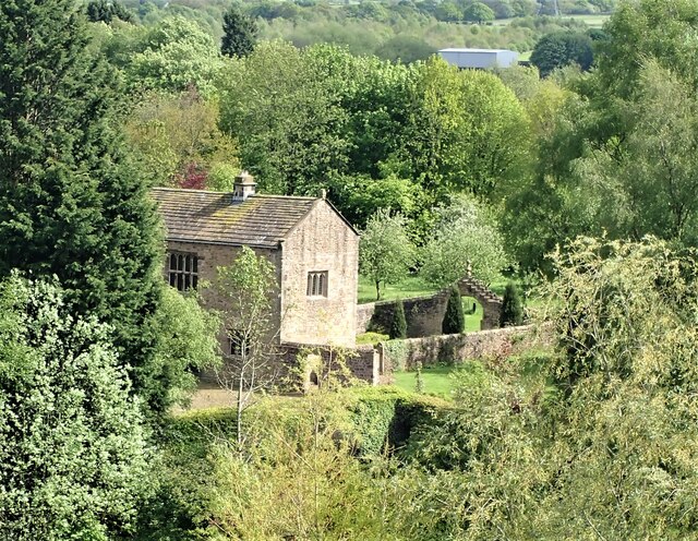
Martholme

Martholme is a Grade I listed medieval manor house standing on the banks of the River Calder 1+1⁄4 miles (2 km) from Great Harwood, Lancashire, England...

Hyndburn Brook

Hyndburn Brook is a minor river in eastern Lancashire. It is approximately 4.5 miles (7.3 km) long, and has the catchment area (not including the River...

Sabden Brook

Sabden Brook is a small river running through Lancashire in England. It is 7.59 miles (12.21 km) long and has a catchment area of 6.84 square miles (17...

Nearby Amenities

Located within 500m of 53.794883,-2.3831843
Bus Stop
Bus: yes
Public Transport: platform
Lat/Long: 53.7923673/-2.3885788
Bus Stop
Bus: yes
Public Transport: platform
Lat/Long: 53.7920659/-2.3889317
Bus Stop
Bus: yes
Public Transport: platform
Lat/Long: 53.7960026/-2.38783
Bus Stop
Bus: yes
Public Transport: platform
Lat/Long: 53.7960033/-2.3878397
Restaurant
Checcos
Lat/Long: 53.7970077/-2.3874009
Fuel
Texaco
Brand: Texaco
Brand Wikidata: Q775060
Website: https://locations.valero.com/en-gb/LocationDetails/Index/WHALLEY-ROAD/0000702250
Lat/Long: 53.792907/-2.3876355
Bus Stop
Bus: yes
Public Transport: platform
Lat/Long: 53.7910568/-2.3869937
Bus Stop
Bus: yes
Public Transport: platform
Lat/Long: 53.7912723/-2.3867898
Pipeline: manhole
Lat/Long: 53.7987267/-2.3828766
Pipeline: valve
Lat/Long: 53.7965022/-2.3822768
Pipeline: valve
Lat/Long: 53.7962508/-2.3822052
The data included in this document is from www.openstreetmap.org. The data is made available under ODbL.

Have you been to Copy Wood?

Leave your review of Copy Wood below (or comments, questions and feedback).