High Crossber Plantation

Wood, Forest in Westmorland Eden

England

High Crossber Plantation

Field track near Soulby
Field track near Soulby Credit: Karl and Ali

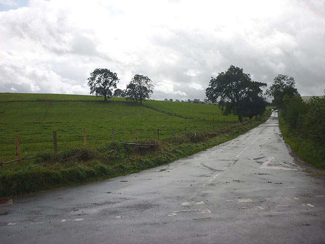
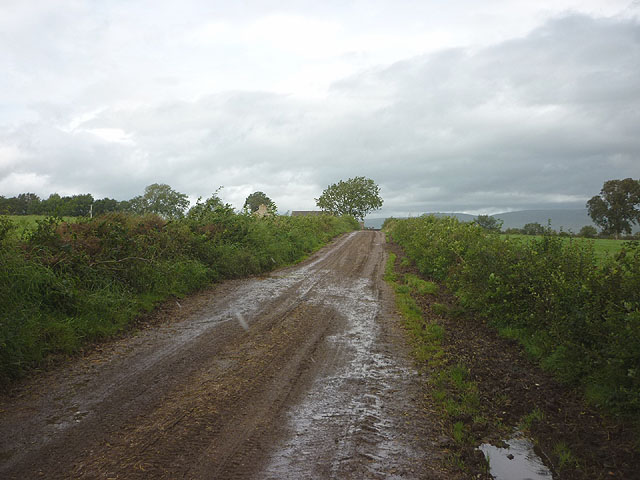
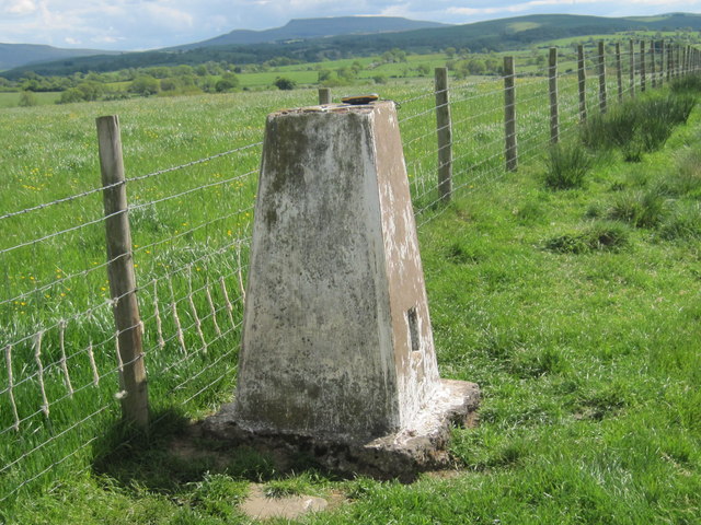
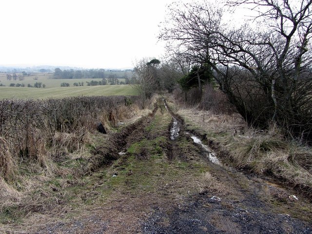
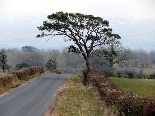
High Crossber Plantation is a picturesque woodland located in the heart of Westmorland, a county in the northwestern region of England. The plantation covers an expansive area of lush greenery, with tall, majestic trees dominating the landscape. It is a prime example of a thriving forest ecosystem, providing a habitat for a diverse range of flora and fauna.

The plantation is characterized by its dense tree cover, mainly consisting of native species such as oak, beech, and ash. These towering giants create a serene and tranquil atmosphere, allowing visitors to escape the hustle and bustle of everyday life. The forest floor is adorned with a carpet of wildflowers, offering a burst of color and beauty during the spring and summer months.

High Crossber Plantation is not only aesthetically pleasing but also holds significant ecological importance. The dense foliage acts as a natural carbon sink, absorbing and storing carbon dioxide from the atmosphere, thereby contributing to the fight against climate change. Additionally, the woodland provides a natural habitat for a plethora of wildlife, including various species of birds, mammals, and insects.

Visitors to the plantation can enjoy a range of recreational activities, such as hiking, birdwatching, and nature photography. There are well-maintained trails that wind through the forest, allowing visitors to explore its enchanting beauty at their own pace. The peaceful ambiance and breathtaking scenery make High Crossber Plantation a popular destination for nature lovers and outdoor enthusiasts alike.

If you have any feedback on the listing, please let us know in the comments section below.

High Crossber Plantation Images

Images are sourced within 2km of 54.497604/-2.3895784 or Grid Reference NY7411. Thanks to Geograph Open Source API. All images are credited.

Field track near Soulby
Former Church of St Luke, Soulby The church is Grade II listed <span class="nowrap"><a title="http://www.britishlistedbuildings.co.uk/en-73027-church-of-st-luke-soulby" rel="nofollow ugc noopener" href="http://www.britishlistedbuildings.co.uk/en-73027-church-of-st-luke-soulby">Link</a><img style="margin-left:2px;" alt="External link" title="External link - shift click to open in new window" src="https://s1.geograph.org.uk/img/external.png" width="10" height="10"/></span> but appears to be defunct as there is a for sale sign. It was built in 1663 and the 'wrought-iron weathercock has Musgrave arms and 1830 date' although I didn't notice this.
Former Church of St Luke, Soulby
The church is Grade II listed LinkExternal link but appears to be defunct as there is a for sale sign. It was built in 1663 and the 'wrought-iron weathercock has Musgrave arms and 1830 date' although I didn't notice this.
The road to Crosby Garrett west of Soulby
The track to Soulby Grange
Ordnance Survey Trig Pillar 10691 This pillar can be found on Strutforth Hill.
Ordnance Survey Trig Pillar 10691
This pillar can be found on Strutforth Hill.
Ordnance Survey  Flush Bracket 1246 This bracket is on the wall of Sandriggs.
For more detail see : <span class="nowrap"><a title="http://www.bench-marks.org.uk/bm2399" rel="nofollow ugc noopener" href="http://www.bench-marks.org.uk/bm2399">Link</a><img style="margin-left:2px;" alt="External link" title="External link - shift click to open in new window" src="https://s1.geograph.org.uk/img/external.png" width="10" height="10"/></span>
Ordnance Survey Flush Bracket 1246
This bracket is on the wall of Sandriggs. For more detail see : LinkExternal link
Ordnance Survey  Flush Bracket 1245 This bracket can be found on the wall of the Methodist Chapel.
For more detail see : <span class="nowrap"><a title="http://www.bench-marks.org.uk/bm2398" rel="nofollow ugc noopener" href="http://www.bench-marks.org.uk/bm2398">Link</a><img style="margin-left:2px;" alt="External link" title="External link - shift click to open in new window" src="https://s1.geograph.org.uk/img/external.png" width="10" height="10"/></span>
Ordnance Survey Flush Bracket 1245
This bracket can be found on the wall of the Methodist Chapel. For more detail see : LinkExternal link
Ordnance Survey Cut Mark This mark can be found on the wall of St Lukes Church, Soulby.
For more detail see : <span class="nowrap"><a title="http://www.bench-marks.org.uk/bm43365" rel="nofollow ugc noopener" href="http://www.bench-marks.org.uk/bm43365">Link</a><img style="margin-left:2px;" alt="External link" title="External link - shift click to open in new window" src="https://s1.geograph.org.uk/img/external.png" width="10" height="10"/></span>
Ordnance Survey Cut Mark
This mark can be found on the wall of St Lukes Church, Soulby. For more detail see : LinkExternal link
St Lukes Church in Soulby The posts surrounding the green are to prevent travellers camping on their way to Appleby Horse Fair.
St Lukes Church in Soulby
The posts surrounding the green are to prevent travellers camping on their way to Appleby Horse Fair.
Posts on the Green The posts surrounding the green are to prevent travellers camping on their way to Appleby Horse Fair.
Posts on the Green
The posts surrounding the green are to prevent travellers camping on their way to Appleby Horse Fair.
Crossroads in Soulby
Stockber Lane off Mask Road
Mask Road
Mask Road
Scandal Beck at Soulby
Farm buildings by Scandal Beck, Soulby The old buildings on the bank of Scandal Beck close to Barney Scar below Denmark Hall.
Farm buildings by Scandal Beck, Soulby
The old buildings on the bank of Scandal Beck close to Barney Scar below Denmark Hall.
Soulby from the bridge
Children's playground and old school, Soulby
Show me another place!

High Crossber Plantation is located at Grid Ref: NY7411 (Lat: 54.497604, Lng: -2.3895784)

Administrative County: Cumbria

District: Eden

Police Authority: Cumbria

What 3 Words

///looms.gamer.loose. Near Kirkby Stephen, Cumbria

Related Wikis

Soulby

Soulby is a village and civil parish in the Eden district of Cumbria, England. The parish had a population of 186 in 2001, increasing slightly to 187 at...

East Westmorland Rural District

East Westmorland was the name of a rural district in the administrative county of Westmorland from 1894 to 1935. The district was created by the Local...

Little Musgrave

Little Musgrave is a small village and former civil parish, now in the parish of Musgrave, in the Eden district of Cumbria, England. In 1891 the parish...

Musgrave, Cumbria

Musgrave is a civil parish in the Eden District of Cumbria, England. It has a population of 152, and contains the villages of Little Musgrave and Great...

River Belah

The River Belah is a river in the county of Cumbria in England. Its name derives from the Old English word Belge and means the "Roaring River".The Belah...

St Andrew's Church, Crosby Garrett

St Andrew's Church is in the village of Crosby Garrett, Cumbria, England. It is an active Anglican parish church in the deanery of Appleby, the archdeaconry...

Musgrave railway station

Musgrave railway station was a railway station situated on the Eden Valley Railway and located between Penrith and Kirkby Stephen East, England. ��2�...

Great Musgrave

Great Musgrave is a village and former civil parish, now in the parish of Musgrave, in the Eden district of Cumbria, England. It is about a mile west of...

Nearby Amenities

Located within 500m of 54.497604,-2.3895784
Soulby
Is In Country Code: GB
Is In County: Cumbria
Is In Municipality: Eden
Place: village
Source: NPE
Lat/Long: 54.494103/-2.3886578
Disused Amenity: place_of_worship
Religion: christian
Lat/Long: 54.4946473/-2.3897096
Bus Stop
Post Office
Bus: yes
Local Ref: AT
Naptan AtcoCode: 090074621029
Naptan Bearing: E
Naptan CommonName: Post Office
Naptan Indicator: at
Naptan Landmark: Soulby Bridge and phone box
Naptan NaptanCode: cumdgjat
Naptan Street: No name
Naptan Verified: no
Public Transport: platform
Shelter: no
Source: naptan_import
Lat/Long: 54.4939334/-2.3886212
Sandriggs
Naptan AtcoCode: 090074622762
Naptan Bearing: W
Naptan BusStopType: CUS
Naptan CommonName: Sandriggs
Naptan Indicator: o/s
Naptan Landmark: Sandriggs
Naptan NaptanCode: cumdgjaw
Naptan Street: No name
Naptan Verified: no
Source: naptan_import
Lat/Long: 54.4993844/-2.3966344
Post Box
Post Box Type: lamp
Ref: CA17 95
Lat/Long: 54.4937451/-2.3883574
Place Of Worship
Soulby Methodist Chapel
Denomination: methodist
Religion: christian
Lat/Long: 54.4943734/-2.3887866
Telephone
Booth: K6
Covered: booth
Man Made: telephone_box
Lat/Long: 54.4939221/-2.3885893
Crossbers Hill
Ele: 175
Natural: peak
Lat/Long: 54.497809/-2.3919161
Washber Hill
Ele: 160.3
Natural: peak
Lat/Long: 54.4998526/-2.3840626
Generator Method: photovoltaic
Generator Output Electricity: yes
Generator Source: solar
Generator Type: solar_photovoltaic_panel
Location: roof
Power: generator
Lat/Long: 54.4947733/-2.3885446
Generator Method: photovoltaic
Generator Output Electricity: yes
Generator Source: solar
Generator Type: solar_photovoltaic_panel
Location: roof
Power: generator
Lat/Long: 54.4944342/-2.3881132
Give Way
Direction: forward
Lat/Long: 54.4940107/-2.3886339
Give Way
Direction: backward
Lat/Long: 54.493938/-2.3887951
Power: pole
Lat/Long: 54.4936352/-2.3921319
Power: pole
Lat/Long: 54.4945838/-2.3920014
Power: pole
Lat/Long: 54.4952372/-2.3918748
Power: pole
Lat/Long: 54.4959618/-2.3931482
Power: pole
Lat/Long: 54.4966612/-2.3944118
Power: pole
Lat/Long: 54.4973077/-2.3951197
Power: pole
Lat/Long: 54.4980863/-2.3959739
Power: pole
Lat/Long: 54.4946561/-2.391078
Power: pole
Lat/Long: 54.4941497/-2.3866783
Power: pole
Lat/Long: 54.4950454/-2.3867317
The data included in this document is from www.openstreetmap.org. The data is made available under ODbL.

Have you been to High Crossber Plantation?

Leave your review of High Crossber Plantation below (or comments, questions and feedback).