Bishop's Wood

Wood, Forest in Staffordshire Stafford

England

Bishop's Wood

Free Gospel Chapel The Chapel, built in 1874 according to the stone above the door, appears to be under development for residential use.
Free Gospel Chapel Credit: Peter Fleming

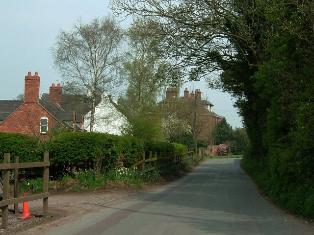
Bishop's Wood is a picturesque village located in Staffordshire, England. Nestled in the heart of the county, this charming village is renowned for its stunning woodlands and idyllic countryside. It is situated near the larger towns of Wolverhampton and Cannock, making it easily accessible for both residents and visitors.

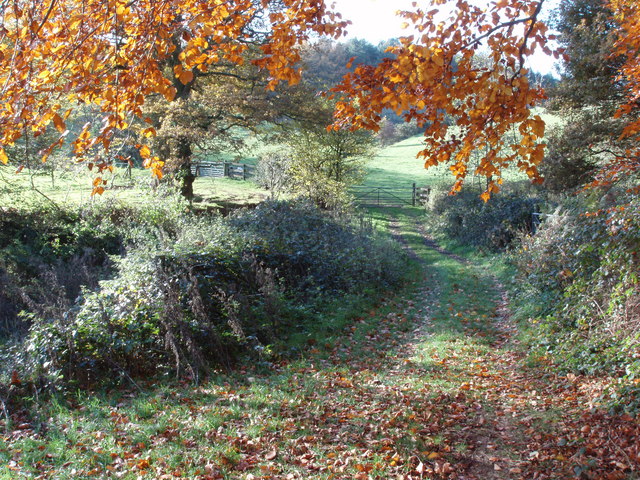
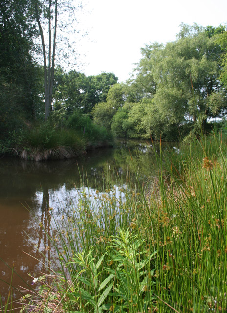
The main attraction of Bishop's Wood is its namesake forest, which spans across a vast area of the village. The forest is home to a diverse range of flora and fauna, making it a haven for nature enthusiasts and walkers. The towering trees provide a serene environment, with their foliage changing colors throughout the seasons, creating a breathtaking landscape.

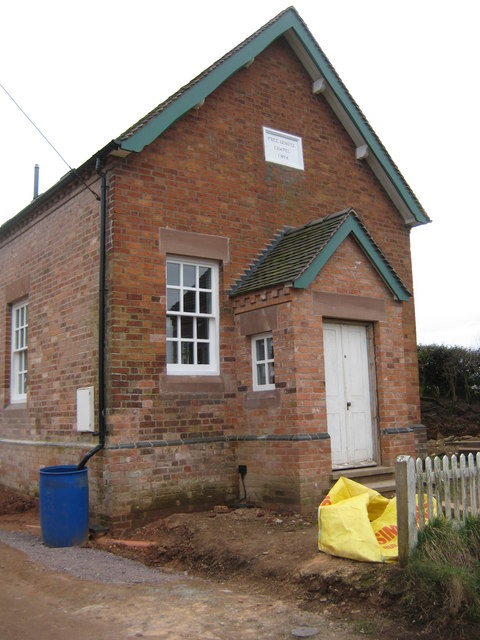
In addition to the natural beauty, Bishop's Wood boasts a close-knit community with a rich history. The village is dotted with quaint cottages and traditional buildings, giving it a sense of old-world charm. The residents take great pride in preserving the village's heritage, evident in the well-maintained architecture.

There are also several amenities available in Bishop's Wood, including a village hall, a primary school, and a local pub. These establishments serve as gathering points for locals and visitors alike, fostering a sense of community spirit.

For those seeking outdoor activities, Bishop's Wood offers ample opportunities for exploration. There are numerous walking and cycling trails, allowing visitors to immerse themselves in the natural beauty of the area. The forest also features picnic areas, perfect for enjoying a leisurely lunch in the midst of nature.

Overall, Bishop's Wood in Staffordshire is a charming village that combines natural beauty, a rich history, and a warm community spirit. It is a hidden gem for those seeking a peaceful retreat in the heart of England.

If you have any feedback on the listing, please let us know in the comments section below.

Bishop's Wood Images

Images are sourced within 2km of 52.899903/-2.3782698 or Grid Reference SJ7433. Thanks to Geograph Open Source API. All images are credited.

Free Gospel Chapel The Chapel, built in 1874 according to the stone above the door, appears to be under development for residential use.
Free Gospel Chapel
The Chapel, built in 1874 according to the stone above the door, appears to be under development for residential use.
Eccleshall Road, Hookgate
Garden at the entrance to Broughton Hall This is also the home for the Caudwell lyme disease charity. <span class="nowrap"><a title="https://caudwelllyme.com/" rel="nofollow ugc noopener" href="https://caudwelllyme.com/">Link</a><img style="margin-left:2px;" alt="External link" title="External link - shift click to open in new window" src="https://s1.geograph.org.uk/img/external.png" width="10" height="10"/></span>
Garden at the entrance to Broughton Hall
This is also the home for the Caudwell lyme disease charity. LinkExternal link
Broughton Folly Farm This is between Loggerheads and Eccleshall
Broughton Folly Farm
This is between Loggerheads and Eccleshall
Broughton Hall Gates The beautiful entrance to Broughton Hall.
Broughton Hall Gates
The beautiful entrance to Broughton Hall.
St Peter's Church, Broughton According to the stone tablet below the end window the church has been around since 1633 though some of the rather fine stained glass windows are apparently dated even earlier having been brought in from other places. Not surprisingly it's a Grade 1 listed building.
St Peter's Church, Broughton
According to the stone tablet below the end window the church has been around since 1633 though some of the rather fine stained glass windows are apparently dated even earlier having been brought in from other places. Not surprisingly it's a Grade 1 listed building.
Track and Bridleway This is where the farm track meets the bridleway just on the northern edge of Bishop's wood.
Track and Bridleway
This is where the farm track meets the bridleway just on the northern edge of Bishop's wood.
After the harvest A field of stubble left at the end of the season. The autumn colours are well advanced.
After the harvest
A field of stubble left at the end of the season. The autumn colours are well advanced.
Providence Chapel, Hookgate Small red and yellow brick chapel dating from the 19th century, with later extension (left), in the hamlet of Hookgate, now part of Loggerheads; independent Methodist until 1992, now independent Baptist. Formerly one of two chapels in Hookgate; the one to the north west shown on the OS map has been converted into a private house; see: <a href="https://www.geograph.org.uk/photo/463890">SJ7435 : Former Methodist chapel, Hookgate</a>
Providence Chapel, Hookgate
Small red and yellow brick chapel dating from the 19th century, with later extension (left), in the hamlet of Hookgate, now part of Loggerheads; independent Methodist until 1992, now independent Baptist. Formerly one of two chapels in Hookgate; the one to the north west shown on the OS map has been converted into a private house; see: SJ7435 : Former Methodist chapel, Hookgate
Heathland at Burnt Wood This area is marked on the OS 1:25,000 as part of the conifer plantation of Burnt Wood. This part of the conifer plantation has been felled and the area currently appears to be managed as heathland, with sparse replanting of deciduous trees
Heathland at Burnt Wood
This area is marked on the OS 1:25,000 as part of the conifer plantation of Burnt Wood. This part of the conifer plantation has been felled and the area currently appears to be managed as heathland, with sparse replanting of deciduous trees
Pasture by Burnt Wood Two large fields of gently sloping lush sheep pasture south west of the plantation of Burnt Wood. The narrow neck connecting the east and west parts of Burnt Wood is in the distance (centre right), with the western part visible on the left. View from the track from Hookgate
Pasture by Burnt Wood
Two large fields of gently sloping lush sheep pasture south west of the plantation of Burnt Wood. The narrow neck connecting the east and west parts of Burnt Wood is in the distance (centre right), with the western part visible on the left. View from the track from Hookgate
Marsh plants by a small mere, near Knowleswood One of several small meres in a small patch of deciduous woodland between the farms of Park Springs and Knowleswood. An area of richly vegetated marshland lies to the immediate east (right)
Marsh plants by a small mere, near Knowleswood
One of several small meres in a small patch of deciduous woodland between the farms of Park Springs and Knowleswood. An area of richly vegetated marshland lies to the immediate east (right)
Reentrant north east of Dales Wood Sloping lush cattle pasture looking SSW down one of several reentrants towards the valley of Coal Brook. The woodland (left) is an unnamed conifer plantation to the east of Dales Wood. View from the footpath from Hookgate
Reentrant north east of Dales Wood
Sloping lush cattle pasture looking SSW down one of several reentrants towards the valley of Coal Brook. The woodland (left) is an unnamed conifer plantation to the east of Dales Wood. View from the footpath from Hookgate
Mere near Glass Houses The westerly of two meres in pasture south of Glass Houses, in the valley of Coal Brook. View from the footpath between Hales and Fair Oak
Mere near Glass Houses
The westerly of two meres in pasture south of Glass Houses, in the valley of Coal Brook. View from the footpath between Hales and Fair Oak
Bishop's Wood Mature conifer plantation managed by the Forestry Commission covers the southern flanks of a low hill, with ferns dominating the undergrowth. View south (downhill) from the public footpath running north-south
Bishop's Wood
Mature conifer plantation managed by the Forestry Commission covers the southern flanks of a low hill, with ferns dominating the undergrowth. View south (downhill) from the public footpath running north-south
Cottage, Hookgate Cottage on a junction of the B5026 on the southern edge of the hamlet of Hookgate. The white-painted brick cottage probably dates from the 19th century, and is typical of many in this area. <a href="https://www.geograph.org.uk/photo/463475">SJ7435 : Providence Chapel, Hookgate</a> is on the left
Cottage, Hookgate
Cottage on a junction of the B5026 on the southern edge of the hamlet of Hookgate. The white-painted brick cottage probably dates from the 19th century, and is typical of many in this area. SJ7435 : Providence Chapel, Hookgate is on the left
Former Methodist chapel, Hookgate Small, red and purple brick former Primitive Methodist Justice chapel, dating from 1860; now a private house. Formerly one of two chapels in Hookgate; for the one to the south east, see: <a href="https://www.geograph.org.uk/photo/463475">SJ7435 : Providence Chapel, Hookgate</a>
Former Methodist chapel, Hookgate
Small, red and purple brick former Primitive Methodist Justice chapel, dating from 1860; now a private house. Formerly one of two chapels in Hookgate; for the one to the south east, see: SJ7435 : Providence Chapel, Hookgate
Show me another place!

Bishop's Wood is located at Grid Ref: SJ7433 (Lat: 52.899903, Lng: -2.3782698)

Administrative County: Staffordshire

District: Stafford

Police Authority: Staffordshire

What 3 Words

///bluntly.technical.hostels. Near Standon, Staffordshire

Related Wikis

Loggerheads, Staffordshire

Loggerheads is a village and civil parish in north-west Staffordshire, England, on the A53 between Market Drayton and Newcastle-under-Lyme. == Name... ==

Armsdale

Armsdale is a village in Staffordshire, England. Population details for the 2011 census can be found under Eccleshall.

Blore Heath Rural District

Blore Heath was a rural district in Staffordshire, England from 1894 to 1932. It was created under the Local Government Act 1894 from that part of the...

Ashley, Staffordshire

Ashley is a village and former civil parish, now in the parish of Loggerheads, in the Newcastle-under-Lyme district, in the county of Staffordshire, England...

Hales, Staffordshire

Hales is a village in Staffordshire approximately 2 miles east of Market Drayton. Population details as taken at the 2011 census can be found under Loggerheads...

Battle of Blore Heath

The Battle of Blore Heath was a battle in the English Wars of the Roses that was fought on 23 September 1459, at Blore Heath, Staffordshire. Blore Heath...

Audley's Cross

Audley's Cross is a cross sited in Blore Heath, Staffordshire to mark the spot on which James Touchet, Lord Audley was killed at the battle of Blore Heath...

Almington

Almington is a small village in Staffordshire, England. It is about 2 miles (3.2 km) east-northeast of Market Drayton by road, to the northwest of the...

Nearby Amenities

Located within 500m of 52.899903,-2.3782698
Power: pole
Lat/Long: 52.9038796/-2.37707
Power: pole
Lat/Long: 52.902867/-2.3768035
Power: pole
Lat/Long: 52.9022483/-2.3766285
Power: pole
Lat/Long: 52.9013844/-2.3763875
Power: pole
Lat/Long: 52.9004076/-2.3747385
Power: pole
Lat/Long: 52.9000357/-2.3740655
Power: pole
Lat/Long: 52.8996216/-2.3738945
Power: pole
Lat/Long: 52.899084/-2.3737828
Power: pole
Lat/Long: 52.8987143/-2.3735023
Power: pole
Lat/Long: 52.8979401/-2.373159
Power: pole
Lat/Long: 52.9008483/-2.3754826
Power: pole
Lat/Long: 52.8972365/-2.3728871
The data included in this document is from www.openstreetmap.org. The data is made available under ODbL.

Have you been to Bishop's Wood?

Leave your review of Bishop's Wood below (or comments, questions and feedback).