Badger Wood

Wood, Forest in Staffordshire Newcastle-under-Lyme

England

Badger Wood

Track and Bridleway This is where the farm track meets the bridleway just on the northern edge of Bishop's wood.
Track and Bridleway Credit: Paul Sumner

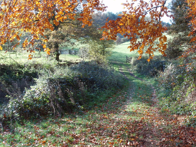
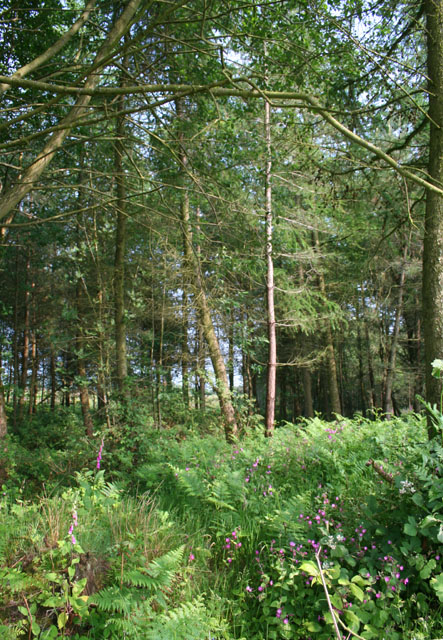
Badger Wood is a small woodland area located in the county of Staffordshire, England. Nestled within the picturesque countryside, it covers an approximate area of 50 acres. The wood is predominantly made up of deciduous trees, including oak, birch, and beech, creating a diverse and vibrant ecosystem.

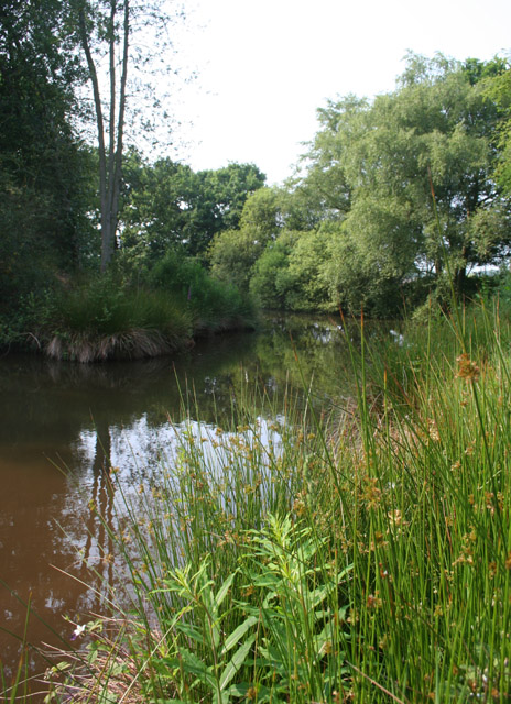
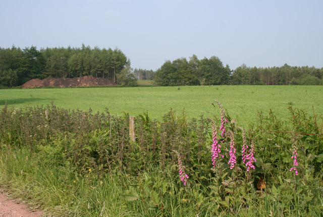
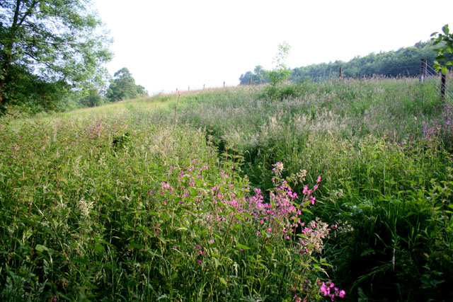
The wood is known for its rich biodiversity, providing a habitat for a variety of wildlife species. It is home to numerous bird species such as woodpeckers, tawny owls, and songbirds, making it an ideal spot for birdwatching enthusiasts. Mammals such as badgers, after which the wood is named, can also be found here, along with other small mammals like squirrels and hedgehogs.

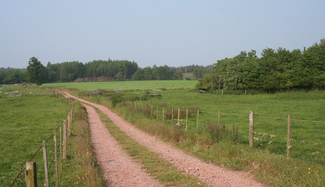
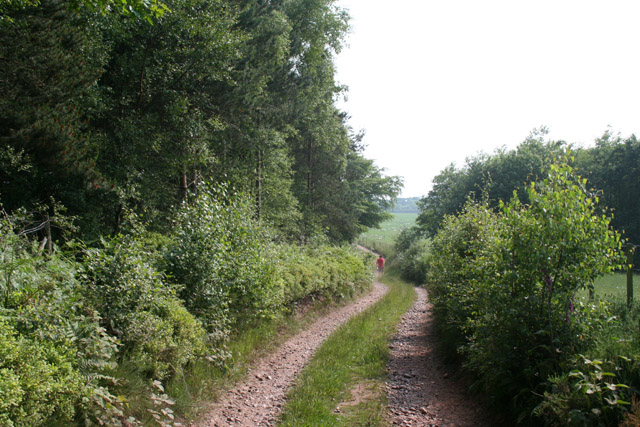
The wood offers a peaceful and tranquil environment, making it a popular destination for nature lovers and walkers alike. A network of well-maintained footpaths and trails crisscross the wood, allowing visitors to explore its beauty and enjoy the serenity of the surroundings.

Badger Wood is managed by the local forestry commission, ensuring the preservation and conservation of the woodland. Regular maintenance work is carried out to promote the growth of native flora and fauna and to protect the wood from invasive species.

Overall, Badger Wood in Staffordshire is a charming and enchanting natural haven, offering a delightful escape from the hustle and bustle of everyday life. It provides an opportunity to immerse oneself in nature, appreciate its beauty, and experience the wonders of the Staffordshire countryside.

If you have any feedback on the listing, please let us know in the comments section below.

Badger Wood Images

Images are sourced within 2km of 52.894101/-2.3878512 or Grid Reference SJ7433. Thanks to Geograph Open Source API. All images are credited.

Track and Bridleway This is where the farm track meets the bridleway just on the northern edge of Bishop's wood.
Track and Bridleway
This is where the farm track meets the bridleway just on the northern edge of Bishop's wood.
After the harvest A field of stubble left at the end of the season. The autumn colours are well advanced.
After the harvest
A field of stubble left at the end of the season. The autumn colours are well advanced.
Heathland at Burnt Wood This area is marked on the OS 1:25,000 as part of the conifer plantation of Burnt Wood. This part of the conifer plantation has been felled and the area currently appears to be managed as heathland, with sparse replanting of deciduous trees
Heathland at Burnt Wood
This area is marked on the OS 1:25,000 as part of the conifer plantation of Burnt Wood. This part of the conifer plantation has been felled and the area currently appears to be managed as heathland, with sparse replanting of deciduous trees
Pasture by Burnt Wood Two large fields of gently sloping lush sheep pasture south west of the plantation of Burnt Wood. The narrow neck connecting the east and west parts of Burnt Wood is in the distance (centre right), with the western part visible on the left. View from the track from Hookgate
Pasture by Burnt Wood
Two large fields of gently sloping lush sheep pasture south west of the plantation of Burnt Wood. The narrow neck connecting the east and west parts of Burnt Wood is in the distance (centre right), with the western part visible on the left. View from the track from Hookgate
Marsh plants by a small mere, near Knowleswood One of several small meres in a small patch of deciduous woodland between the farms of Park Springs and Knowleswood. An area of richly vegetated marshland lies to the immediate east (right)
Marsh plants by a small mere, near Knowleswood
One of several small meres in a small patch of deciduous woodland between the farms of Park Springs and Knowleswood. An area of richly vegetated marshland lies to the immediate east (right)
Reentrant north east of Dales Wood Sloping lush cattle pasture looking SSW down one of several reentrants towards the valley of Coal Brook. The woodland (left) is an unnamed conifer plantation to the east of Dales Wood. View from the footpath from Hookgate
Reentrant north east of Dales Wood
Sloping lush cattle pasture looking SSW down one of several reentrants towards the valley of Coal Brook. The woodland (left) is an unnamed conifer plantation to the east of Dales Wood. View from the footpath from Hookgate
Mere near Glass Houses The westerly of two meres in pasture south of Glass Houses, in the valley of Coal Brook. View from the footpath between Hales and Fair Oak
Mere near Glass Houses
The westerly of two meres in pasture south of Glass Houses, in the valley of Coal Brook. View from the footpath between Hales and Fair Oak
Bishop's Wood Mature conifer plantation managed by the Forestry Commission covers the southern flanks of a low hill, with ferns dominating the undergrowth. View south (downhill) from the public footpath running north-south
Bishop's Wood
Mature conifer plantation managed by the Forestry Commission covers the southern flanks of a low hill, with ferns dominating the undergrowth. View south (downhill) from the public footpath running north-south
Track and remnant of Burnt Wood The track from Ashley Heath and Hookgate continues south through gently sloping sheep pasture and arable fields (distance, centre; mainly in <a href="https://www.geograph.org.uk/gridref/SJ7434">SJ7434</a>). The small square of woodland (right) appears to be the remnant of the Burnt Wood plantation shown on the OS 1:25,000 (revised 2005) in this location
Track and remnant of Burnt Wood
The track from Ashley Heath and Hookgate continues south through gently sloping sheep pasture and arable fields (distance, centre; mainly in SJ7434). The small square of woodland (right) appears to be the remnant of the Burnt Wood plantation shown on the OS 1:25,000 (revised 2005) in this location
Near the southern edge of Bishop's Wood Mature conifer plantation managed by the Forestry Commission covers the southern flanks of a low hill, with ferns dominating the undergrowth. View north east along the sunken footpath running broadly east-west near the southern edge of the wood
Near the southern edge of Bishop's Wood
Mature conifer plantation managed by the Forestry Commission covers the southern flanks of a low hill, with ferns dominating the undergrowth. View north east along the sunken footpath running broadly east-west near the southern edge of the wood
Arable field south of Burnt Wood The farmed areas of this gridsquare are a mixture of sheep pasture and arable fields, as here. The plantation of Burnt Wood is in the distance; the earth bank (left) has been removed from the plantation. View from the track from Hookgate and Ashley Heath
Arable field south of Burnt Wood
The farmed areas of this gridsquare are a mixture of sheep pasture and arable fields, as here. The plantation of Burnt Wood is in the distance; the earth bank (left) has been removed from the plantation. View from the track from Hookgate and Ashley Heath
Western part of Burnt Wood Small square of the Burnt Wood conifer plantation lying to the west of the track from Hookgate and Ashley Heath. The planting is relatively loose here compared with the main eastern part of Burnt Wood, with a rich undergrowth of ferns and flowering plants
Western part of Burnt Wood
Small square of the Burnt Wood conifer plantation lying to the west of the track from Hookgate and Ashley Heath. The planting is relatively loose here compared with the main eastern part of Burnt Wood, with a rich undergrowth of ferns and flowering plants
Track beside Burnt Wood The track from Ashley Heath and Hookgate forms the western border of the Burnt Wood plantation for much of this gridsquare. This view shows sheep pasture to the west (right) with a narrow neck of woodland in the distance, as the track descends from a low hill
Track beside Burnt Wood
The track from Ashley Heath and Hookgate forms the western border of the Burnt Wood plantation for much of this gridsquare. This view shows sheep pasture to the west (right) with a narrow neck of woodland in the distance, as the track descends from a low hill
Sheep in small pasture Small field of flat pasture with thick hedges housing a few sheep, adjacent to the public footpath running along a private road from the B5026 to Fairoak Grange
Sheep in small pasture
Small field of flat pasture with thick hedges housing a few sheep, adjacent to the public footpath running along a private road from the B5026 to Fairoak Grange
Small mere by Bishop's Wood This small mere in a hayfield near the junction of two streams by Bishop's Wood was a haven for damselflies
Small mere by Bishop's Wood
This small mere in a hayfield near the junction of two streams by Bishop's Wood was a haven for damselflies
Footpath south of Bishop's Wood The public footpath from the Glass Houses lane runs broadly north through a valley beside an unnamed stream which forms a district boundary. Parts of the path have become overgrown with nettles and thistles. View from where the path enters Bishop's Wood
Footpath south of Bishop's Wood
The public footpath from the Glass Houses lane runs broadly north through a valley beside an unnamed stream which forms a district boundary. Parts of the path have become overgrown with nettles and thistles. View from where the path enters Bishop's Wood
Vegetation by stream, near Bishop's Wood The public footpath from the Glass Houses lane runs broadly north through a valley beside an unnamed stream, lined with trees, which forms a district boundary. This view in the south of the gridsquare shows some of the plantlife surrounding the stream (not visible from the path)
Vegetation by stream, near Bishop's Wood
The public footpath from the Glass Houses lane runs broadly north through a valley beside an unnamed stream, lined with trees, which forms a district boundary. This view in the south of the gridsquare shows some of the plantlife surrounding the stream (not visible from the path)
Birches in Smith's Rough Smith's Rough is primarily a conifer plantation, but the margin near the track from Ashley Heath and Hookgate has many birch trees with an undergrowth of ferns. View just north of a track junction
Birches in Smith's Rough
Smith's Rough is primarily a conifer plantation, but the margin near the track from Ashley Heath and Hookgate has many birch trees with an undergrowth of ferns. View just north of a track junction
Show me another place!

Badger Wood is located at Grid Ref: SJ7433 (Lat: 52.894101, Lng: -2.3878512)

Administrative County: Staffordshire

District: Newcastle-under-Lyme

Police Authority: Staffordshire

What 3 Words

///nerves.crunching.suitcase. Near Market Drayton, Shropshire

Related Wikis

Blore Heath Rural District

Blore Heath was a rural district in Staffordshire, England from 1894 to 1932. It was created under the Local Government Act 1894 from that part of the...

Loggerheads, Staffordshire

Loggerheads is a village and civil parish in north-west Staffordshire, England, on the A53 between Market Drayton and Newcastle-under-Lyme. == Name... ==

Hales, Staffordshire

Hales is a village in Staffordshire approximately 2 miles east of Market Drayton. Population details as taken at the 2011 census can be found under Loggerheads...

Armsdale

Armsdale is a village in Staffordshire, England. Population details for the 2011 census can be found under Eccleshall.

Battle of Blore Heath

The Battle of Blore Heath was a battle in the English Wars of the Roses that was fought on 23 September 1459, at Blore Heath, Staffordshire. Blore Heath...

Audley's Cross

Audley's Cross is a cross sited in Blore Heath, Staffordshire to mark the spot on which James Touchet, Lord Audley was killed at the battle of Blore Heath...

Almington

Almington is a small village in Staffordshire, England. It is about 2 miles (3.2 km) east-northeast of Market Drayton by road, to the northwest of the...

Cheswardine

Cheswardine ( CHEZ-war-dyne) is a rural village and civil parish in north east Shropshire, England. The village lies close to the border with Staffordshire...

Nearby Amenities

Located within 500m of 52.894101,-2.3878512
Barrier: stile
Lat/Long: 52.8934298/-2.3934339
Power: pole
Lat/Long: 52.8904101/-2.3841276
Power: pole
Lat/Long: 52.8911516/-2.3856054
Power: pole
Lat/Long: 52.8915331/-2.3863443
The data included in this document is from www.openstreetmap.org. The data is made available under ODbL.

Have you been to Badger Wood?

Leave your review of Badger Wood below (or comments, questions and feedback).