Empool Heath

Wood, Forest in Dorset

England

Empool Heath

Defending Dorset in 1940: the Maiden Newton - Poole Harbour Stop Line (50) -
Pillbox (type FW3/22): DoB ID: S0000092

West Stafford - Tenantrees - Type 22 Pillbox.  Yet another overgrown pillbox in this locality, standing in a corner of a field at a road junction, and facing in the direction of the former RAF Warmwell airfield. The large quantity of coiled barbed wire blocking the entrance is supposed to date from WW2. Of standard type 22 brick construction with a concrete floor, it has a concrete roof built with corrugated asbestos sheeting laid over the walls, with the concrete laid on top. The 5 embrasures have been set in concrete within the brick walls.

<a href="https://www.geograph.org.uk/photo/4842343">SY7389 : Defending Dorset in 1940: the Maiden Newton - Poole Harbour Stop Line (51)</a>
Defending Dorset in 1940: the Maiden Newton - Poole Harbour Stop Line (50) Credit: Mike Searle

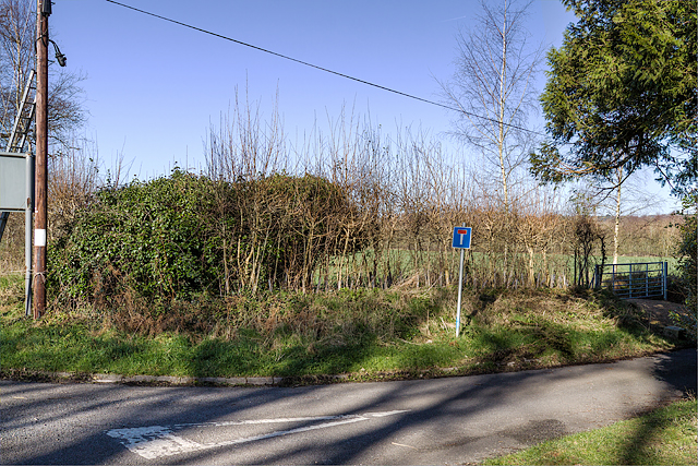
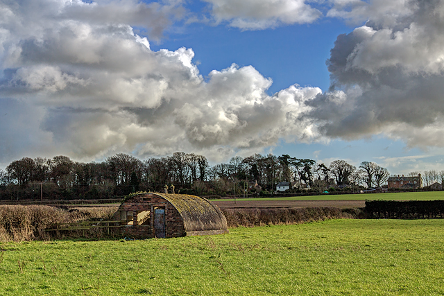
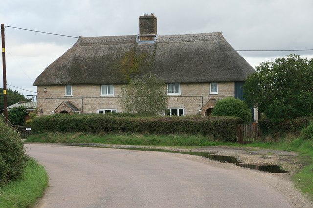
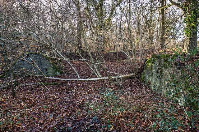
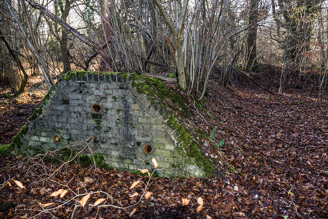
Empool Heath is a picturesque area located in the county of Dorset, England. It is known for its enchanting woodlands and dense forests, making it a haven for nature enthusiasts and outdoor adventurers alike.

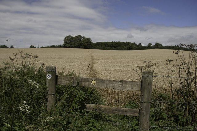
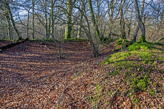
Covering an area of approximately 100 acres, Empool Heath is home to a diverse range of plant and animal species. The woodlands are primarily composed of oak and beech trees, creating a rich and vibrant ecosystem. The forest floor is adorned with a carpet of bluebells and wildflowers during the spring months, adding to the area's natural beauty.

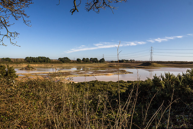
The heathland surrounding the woodlands provides a stark contrast to the dense forest, with its open and expansive landscape. It is characterized by low-growing shrubs, heather, and gorse, creating a unique habitat for many bird species, including the rare Dartford warbler.

Visitors to Empool Heath can explore the area through a network of well-maintained footpaths and trails, offering a chance to immerse themselves in the tranquil surroundings. The woodlands provide ample opportunities for hiking, birdwatching, and wildlife spotting, with the chance to glimpse deer, foxes, and various bird species.

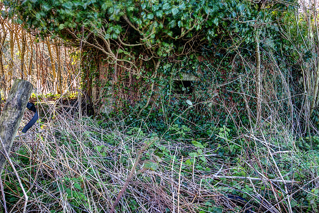
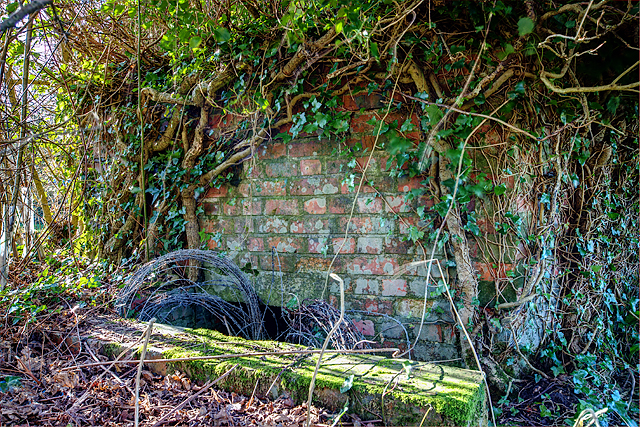
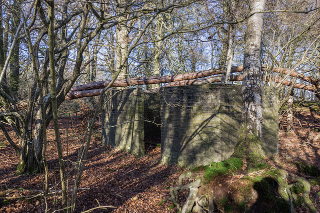
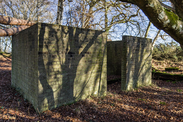
Empool Heath is also steeped in history, with evidence of human activity dating back thousands of years. Archaeological sites within the area indicate that it has been inhabited since the Bronze Age, with traces of ancient settlements and burial mounds.

In summary, Empool Heath in Dorset is a captivating destination for those seeking to connect with nature and explore the beauty of woodlands and forests. With its diverse flora and fauna, well-preserved footpaths, and rich history, it offers a truly immersive experience for visitors of all ages.

If you have any feedback on the listing, please let us know in the comments section below.
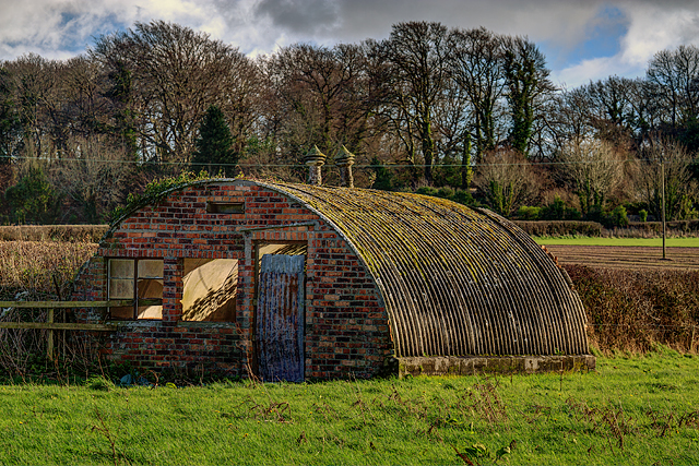
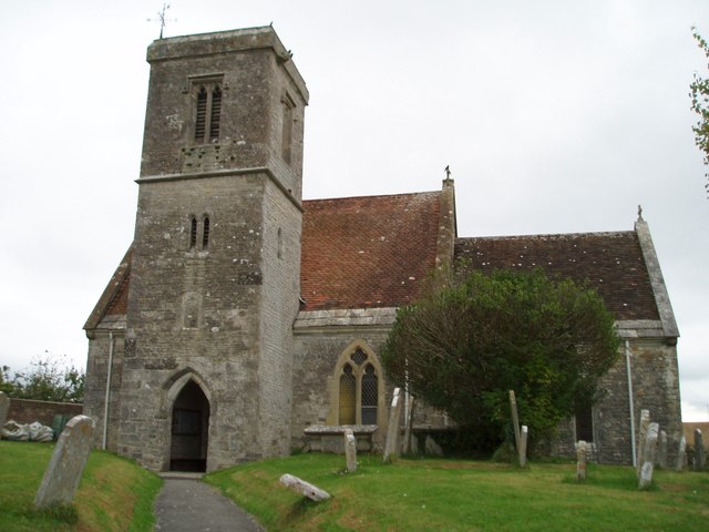
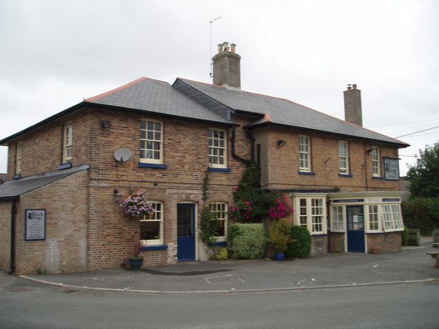
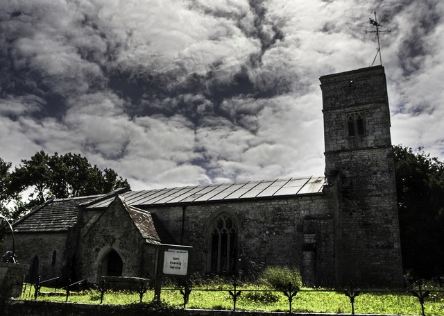
Empool Heath Images

Images are sourced within 2km of 50.688472/-2.3641726 or Grid Reference SY7487. Thanks to Geograph Open Source API. All images are credited.

Defending Dorset in 1940: the Maiden Newton - Poole Harbour Stop Line (50) -
Pillbox (type FW3/22): DoB ID: S0000092

West Stafford - Tenantrees - Type 22 Pillbox.  Yet another overgrown pillbox in this locality, standing in a corner of a field at a road junction, and facing in the direction of the former RAF Warmwell airfield. The large quantity of coiled barbed wire blocking the entrance is supposed to date from WW2. Of standard type 22 brick construction with a concrete floor, it has a concrete roof built with corrugated asbestos sheeting laid over the walls, with the concrete laid on top. The 5 embrasures have been set in concrete within the brick walls.

<a href="https://www.geograph.org.uk/photo/4842343">SY7389 : Defending Dorset in 1940: the Maiden Newton - Poole Harbour Stop Line (51)</a>
Defending Dorset in 1940: the Maiden Newton - Poole Harbour Stop Line (50)
- Pillbox (type FW3/22): DoB ID: S0000092 West Stafford - Tenantrees - Type 22 Pillbox. Yet another overgrown pillbox in this locality, standing in a corner of a field at a road junction, and facing in the direction of the former RAF Warmwell airfield. The large quantity of coiled barbed wire blocking the entrance is supposed to date from WW2. Of standard type 22 brick construction with a concrete floor, it has a concrete roof built with corrugated asbestos sheeting laid over the walls, with the concrete laid on top. The 5 embrasures have been set in concrete within the brick walls. SY7389 : Defending Dorset in 1940: the Maiden Newton - Poole Harbour Stop Line (51)
Defending Dorset in 1940: the Maiden Newton - Poole Harbour Stop Line (51) -
Pillbox (type FW3/22): DoB ID: S0000092

West Stafford - Tenantrees - Type 22 Pillbox.  A view of the rear of the pillbox which is just visible (the front is totally obscured by vegetation).

<a href="https://www.geograph.org.uk/photo/4842345">SY7389 : Defending Dorset in 1940: the Maiden Newton - Poole Harbour Stop Line (52)</a>
Defending Dorset in 1940: the Maiden Newton - Poole Harbour Stop Line (51)
- Pillbox (type FW3/22): DoB ID: S0000092 West Stafford - Tenantrees - Type 22 Pillbox. A view of the rear of the pillbox which is just visible (the front is totally obscured by vegetation). SY7389 : Defending Dorset in 1940: the Maiden Newton - Poole Harbour Stop Line (52)
Defending Dorset in 1940: the Maiden Newton - Poole Harbour Stop Line (52) -
Pillbox (type FW3/22): DoB ID: S0000092

West Stafford - Tenantrees - Type 22 Pillbox.  The entrance doorway below ground level with its retaining wall and 3 steps down, now leads to coils of barbed wire making entry difficult.

<a href="https://www.geograph.org.uk/photo/4842348">SY7489 : Defending Dorset in 1940: the Maiden Newton - Poole Harbour Stop Line (53)</a>
Defending Dorset in 1940: the Maiden Newton - Poole Harbour Stop Line (52)
- Pillbox (type FW3/22): DoB ID: S0000092 West Stafford - Tenantrees - Type 22 Pillbox. The entrance doorway below ground level with its retaining wall and 3 steps down, now leads to coils of barbed wire making entry difficult. SY7489 : Defending Dorset in 1940: the Maiden Newton - Poole Harbour Stop Line (53)
Defending Dorset in 1940: the Maiden Newton - Poole Harbour Stop Line (53) West Stafford - Lower Lewell Farm - Home Guard Hut.  This hut was the Headquarters of a local unit of the Home Guard responsible for the manning of some of the Frome Valley pillboxes, as well as having a commitment to the defence of nearby RAF Warmwell.

Sometimes confused with the ubiquitous Nissen hut, I believe this to be a Turner's Curved Asbestos Hut, built by the Turner Asbestos Company of Trafford Park, Manchester. Similar examples can be seen at a searchlight site at Winterborne Whitechurch: <a title="https://www.geograph.org.uk/photo/5728586" href="https://www.geograph.org.uk/photo/5728586">Link</a>

<a href="https://www.geograph.org.uk/photo/4842351">SY7489 : Defending Dorset in 1940: the Maiden Newton - Poole Harbour Stop Line (54)</a>
Defending Dorset in 1940: the Maiden Newton - Poole Harbour Stop Line (53)
West Stafford - Lower Lewell Farm - Home Guard Hut. This hut was the Headquarters of a local unit of the Home Guard responsible for the manning of some of the Frome Valley pillboxes, as well as having a commitment to the defence of nearby RAF Warmwell. Sometimes confused with the ubiquitous Nissen hut, I believe this to be a Turner's Curved Asbestos Hut, built by the Turner Asbestos Company of Trafford Park, Manchester. Similar examples can be seen at a searchlight site at Winterborne Whitechurch: Link SY7489 : Defending Dorset in 1940: the Maiden Newton - Poole Harbour Stop Line (54)
Defending Dorset in 1940: the Maiden Newton - Poole Harbour Stop Line (54) West Stafford - Lower Lewell Farm - Home Guard Hut.  Located in a field to the south of Lower Lewell Farm is a hut that was once the Headquarters of a local unit of the Home Guard. They were responsible for the manning of some of the Frome Valley pillboxes, as well as having a commitment to the defence of nearby RAF Warmwell.

Sometimes confused with the ubiquitous Nissen hut, I believe this to be a Turner's Curved Asbestos Hut, built by the Turner Asbestos Company of Trafford Park, Manchester. Similar examples can be seen at a searchlight site at Winterborne Whitechurch: <a title="https://www.geograph.org.uk/photo/5728586" href="https://www.geograph.org.uk/photo/5728586">Link</a>

<a href="https://www.geograph.org.uk/photo/4842359">SY7590 : Defending Dorset in 1940: the Maiden Newton - Poole Harbour Stop Line (55)</a>
Defending Dorset in 1940: the Maiden Newton - Poole Harbour Stop Line (54)
West Stafford - Lower Lewell Farm - Home Guard Hut. Located in a field to the south of Lower Lewell Farm is a hut that was once the Headquarters of a local unit of the Home Guard. They were responsible for the manning of some of the Frome Valley pillboxes, as well as having a commitment to the defence of nearby RAF Warmwell. Sometimes confused with the ubiquitous Nissen hut, I believe this to be a Turner's Curved Asbestos Hut, built by the Turner Asbestos Company of Trafford Park, Manchester. Similar examples can be seen at a searchlight site at Winterborne Whitechurch: Link SY7590 : Defending Dorset in 1940: the Maiden Newton - Poole Harbour Stop Line (55)
St Martin's Church, Broadmayne
The Black Dog, Broadmayne
St Peter's Church, West Knighton Thomas Hardy was involved in the reconstruction of this church in the 19th Century.
St Peter's Church, West Knighton
Thomas Hardy was involved in the reconstruction of this church in the 19th Century.
Footpath near Lower Glebe Farm There is a junction in the footpaths here, a local footpath heading north towards West Stafford and the Jubilee Trail heading west.
Footpath near Lower Glebe Farm
There is a junction in the footpaths here, a local footpath heading north towards West Stafford and the Jubilee Trail heading west.
Old Milestone by the A352, Broadmayne Metal plate attached to stone post by the A352, in parish of Broadmayne (West Dorset District), by Broadmayne Church, set into wall at south end of lay-by by church, on North-east side of road. Dorset 3 and 4 (iron plated), erected by the Dorchester & Wool Turnpike Trust in the 19th century. 

Inscription reads:-
4
DORCHESTER
WAREHAM
13 

Milestone Society National ID: DO_DOWA04.
Old Milestone by the A352, Broadmayne
Metal plate attached to stone post by the A352, in parish of Broadmayne (West Dorset District), by Broadmayne Church, set into wall at south end of lay-by by church, on North-east side of road. Dorset 3 and 4 (iron plated), erected by the Dorchester & Wool Turnpike Trust in the 19th century. Inscription reads:- 4 DORCHESTER WAREHAM 13 Milestone Society National ID: DO_DOWA04.
Old Milestone by the A352,  Main Street, Broadmayne Metal plate attached to stone post by the A352, in parish of BROADMAYNE (WEST DORSET District), by Broadmayne Church, set into wall at south end of lay-by near church, on North side of road. Dorset 3 and 4 (iron plated), erected by the Dorchester & Wool turnpike trust in the 19th century. 

Inscription reads:-
4
DORCHESTER
WAREHAM
13

Milestone Society National ID: DO_DOWA04R.
Old Milestone by the A352, Main Street, Broadmayne
Metal plate attached to stone post by the A352, in parish of BROADMAYNE (WEST DORSET District), by Broadmayne Church, set into wall at south end of lay-by near church, on North side of road. Dorset 3 and 4 (iron plated), erected by the Dorchester & Wool turnpike trust in the 19th century. Inscription reads:- 4 DORCHESTER WAREHAM 13 Milestone Society National ID: DO_DOWA04R.
Lewell Corner
Lewell Corner
WWII Dorset: discovering RAF Warmwell (19) -
Knighton Heath Wood - Bomb Component Store

Subterranean structure built into the two ends of an earth revetment for the storage of small bombs carried by fighter aircraft under the wings.

<a href="https://www.geograph.org.uk/photo/6372884">SY7488 : WWII Dorset: discovering RAF Warmwell (20)</a>
WWII Dorset: discovering RAF Warmwell (19)
- Knighton Heath Wood - Bomb Component Store Subterranean structure built into the two ends of an earth revetment for the storage of small bombs carried by fighter aircraft under the wings. SY7488 : WWII Dorset: discovering RAF Warmwell (20)
WWII Dorset: discovering RAF Warmwell (20) -
Knighton Heath Wood - Bomb Component Store

Not surprisingly, the store was situated in the furthest corner of the wood away from the fighter pens where most of the action took place. 

As the war progressed, offensive fighter sweeps over France were conducted from Warmwell using Hurricanes carrying bombs under their wings. The bombs would have been supplied from these stores.

<a href="https://www.geograph.org.uk/photo/6372896">SY7588 : WWII Dorset: discovering RAF Warmwell (21)</a>
WWII Dorset: discovering RAF Warmwell (20)
- Knighton Heath Wood - Bomb Component Store Not surprisingly, the store was situated in the furthest corner of the wood away from the fighter pens where most of the action took place. As the war progressed, offensive fighter sweeps over France were conducted from Warmwell using Hurricanes carrying bombs under their wings. The bombs would have been supplied from these stores. SY7588 : WWII Dorset: discovering RAF Warmwell (21)
WWII Dorset: discovering RAF Warmwell (21) -
Knighton Heath Wood - Fighter Pen

One of six or seven fighter pens still extant on the east side of the wood. They were built using sandbags stacked in a shallow 'U' shape, that were then covered over with soil to form an earth bank surround. The Spitfires and Hurricanes would have been well camouflaged here under their canopy of trees, whilst at the same time made ready to roar across the facing grass strip of the airfield during scrambles. One well known local author has described these fighter pens as national monuments that should be preserved.

<a href="https://www.geograph.org.uk/photo/6372909">SY7588 : WWII Dorset: discovering RAF Warmwell (22)</a>
WWII Dorset: discovering RAF Warmwell (21)
- Knighton Heath Wood - Fighter Pen One of six or seven fighter pens still extant on the east side of the wood. They were built using sandbags stacked in a shallow 'U' shape, that were then covered over with soil to form an earth bank surround. The Spitfires and Hurricanes would have been well camouflaged here under their canopy of trees, whilst at the same time made ready to roar across the facing grass strip of the airfield during scrambles. One well known local author has described these fighter pens as national monuments that should be preserved. SY7588 : WWII Dorset: discovering RAF Warmwell (22)
WWII Dorset: discovering RAF Warmwell (22) -
Knighton Heath Wood - the former Airfield

Some imagination is required here as this is the view of the former airfield from one of the fighter pens. Today, extensive quarrying has all but obliterated all traces of the airfield, although its few remaining artefacts continue to cling on precariously within the comparative safety of Knighton Heath Wood.

<a href="https://www.geograph.org.uk/photo/6372914">SY7488 : WWII Dorset: discovering RAF Warmwell (23)</a>
WWII Dorset: discovering RAF Warmwell (22)
- Knighton Heath Wood - the former Airfield Some imagination is required here as this is the view of the former airfield from one of the fighter pens. Today, extensive quarrying has all but obliterated all traces of the airfield, although its few remaining artefacts continue to cling on precariously within the comparative safety of Knighton Heath Wood. SY7488 : WWII Dorset: discovering RAF Warmwell (23)
WWII Dorset: discovering RAF Warmwell (23) -
Knighton Heath Wood - M & E Plinth

A Mechanical and Electrical Plinth housing for an electrical transformer and switchgear required to transform the supply of 440/230 volts.

<a href="https://www.geograph.org.uk/photo/6372918">SY7488 : WWII Dorset: discovering RAF Warmwell (24)</a>
WWII Dorset: discovering RAF Warmwell (23)
- Knighton Heath Wood - M & E Plinth A Mechanical and Electrical Plinth housing for an electrical transformer and switchgear required to transform the supply of 440/230 volts. SY7488 : WWII Dorset: discovering RAF Warmwell (24)
WWII Dorset: discovering RAF Warmwell (24) -
Knighton Heath Wood - M & E Plinth

<a href="https://www.geograph.org.uk/photo/6372924">SY7488 : WWII Dorset: discovering RAF Warmwell (25)</a>
WWII Dorset: discovering RAF Warmwell (24)
- Knighton Heath Wood - M & E Plinth SY7488 : WWII Dorset: discovering RAF Warmwell (25)
Show me another place!

Empool Heath is located at Grid Ref: SY7487 (Lat: 50.688472, Lng: -2.3641726)

Unitary Authority: Dorset

Police Authority: Dorset

What 3 Words

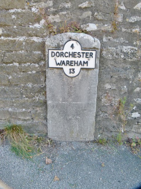
///shining.elevate.quilting. Near Dorchester, Dorset

Related Wikis

West Knighton, Dorset

West Knighton is a village and civil parish in Dorset, England, situated 3 miles (4.8 km) southeast of the county town Dorchester. It has an 11th-century...

Warmwell

Warmwell is a small village and civil parish in south west Dorset, England, situated on the B3390 road about 5 miles (8.0 km) southeast of Dorchester....

RAF Warmwell

Royal Air Force Warmwell or more simply RAF Warmwell is a former Royal Air Force station near Warmwell in Dorset, England from 1937 to 1946, located about...

Broadmayne

Broadmayne is a village in the English county of Dorset. It lies two miles south-east of the county town Dorchester. The A352 main road between Dorchester...

Mayne Preceptory

Mayne Preceptory was a medieval house of Knights Hospitaller in Dorset, England, which caused the name of the settlement to change from Domesday-era Maine...

West Stafford

West Stafford is a village and civil parish in southwest Dorset, England, situated in the Frome valley 2 miles (3.2 km) east of Dorchester. In the 2011...

Crossways, Dorset

Crossways is a village and civil parish in the English county of Dorset. It lies 6 miles (9.7 km) east of the county town Dorchester. In the 2011 census...

Whitcombe, Dorset

Whitcombe is a small village and civil parish in the Dorset unitary authority area of Dorset, England, situated 2 miles (3.2 km) southeast of Dorchester...

Nearby Amenities

Located within 500m of 50.688472,-2.3641726
Power: tower
Ref: 4VN 45
Source: bing
Source Ref: interpolation
Lat/Long: 50.6875458/-2.3617966
Power: tower
Ref: 4VN 46
Source: Bing
Source Ref: interpolation
Lat/Long: 50.6899799/-2.3581849
Material: wood
Power: pole
Source: bing
Lat/Long: 50.690582/-2.3667279
Material: wood
Power: pole
Source: bing
Lat/Long: 50.6910306/-2.3676074
Material: wood
Power: pole
Source: bing
Lat/Long: 50.6914539/-2.3684327
The data included in this document is from www.openstreetmap.org. The data is made available under ODbL.

Have you been to Empool Heath?

Leave your review of Empool Heath below (or comments, questions and feedback).