Earnwood Copse

Wood, Forest in Shropshire

England

Earnwood Copse

Button Bridge Lane near Coppicegate For a closer view of the postbox, please see:- <a href="https://www.geograph.org.uk/photo/2439906">SO7380 : Modern post mounted postbox at Coppicegate</a>.
Button Bridge Lane near Coppicegate Credit: P L Chadwick

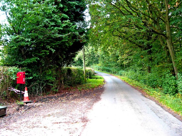
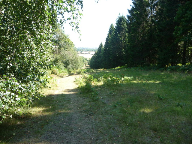
Earnwood Copse is a charming woodland area located in the county of Shropshire, England. Spread over a vast expanse of approximately 100 acres, this copse is a haven for nature lovers and outdoor enthusiasts alike.

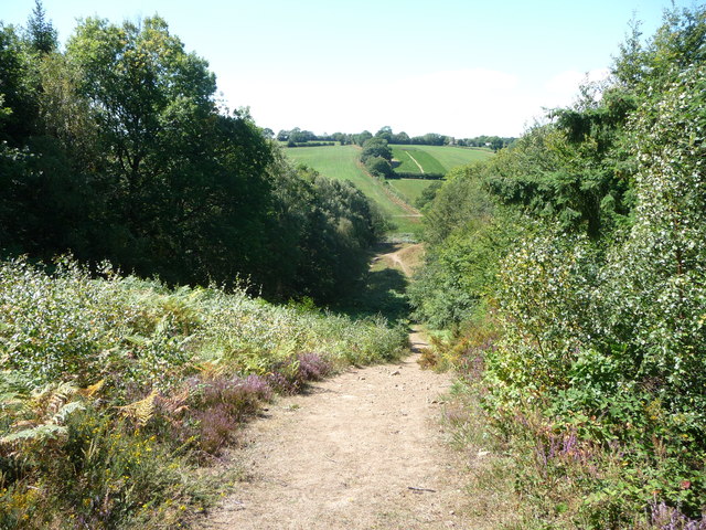
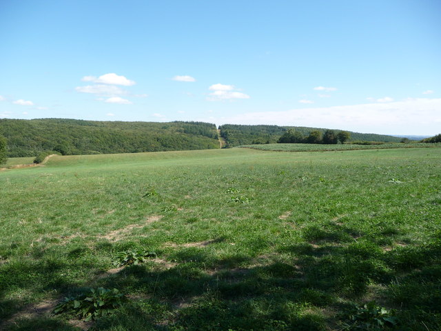
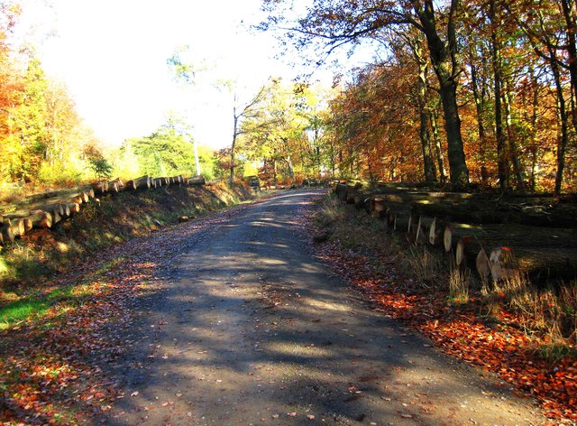
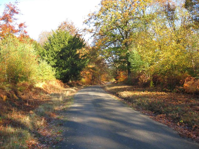
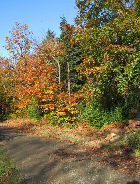
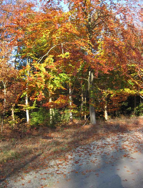
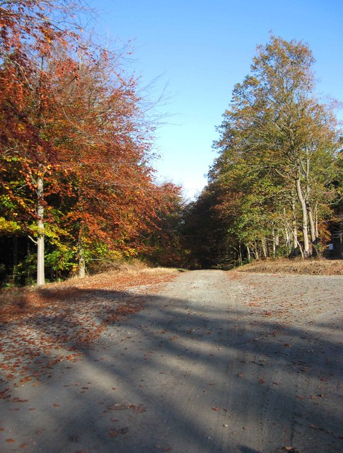
The copse is predominantly made up of mature deciduous trees, including oak, beech, and ash, which provide a lush and verdant canopy. These towering trees create a serene and peaceful atmosphere, making it an ideal location for those looking to escape the hustle and bustle of everyday life.

The forest floor is covered in a carpet of wildflowers, ferns, and mosses, further enhancing the beauty and diversity of the area. The copse is also home to a variety of wildlife, including deer, badgers, foxes, and a wide array of bird species, making it a popular destination for bird watchers and wildlife enthusiasts.

Numerous walking trails wind their way through the copse, allowing visitors to explore its natural beauty at their own pace. These trails offer stunning views of the surrounding countryside and are well-maintained, making them suitable for all levels of fitness.

Earnwood Copse is a designated Site of Special Scientific Interest (SSSI), highlighting its ecological importance and the need for its preservation. The copse is managed by local authorities, ensuring the protection of its unique flora and fauna.

Overall, Earnwood Copse is a hidden gem in the heart of Shropshire, offering a tranquil and picturesque setting for nature lovers to immerse themselves in the beauty of the natural world.

If you have any feedback on the listing, please let us know in the comments section below.

Earnwood Copse Images

Images are sourced within 2km of 52.400707/-2.379686 or Grid Reference SO7478. Thanks to Geograph Open Source API. All images are credited.

Button Bridge Lane near Coppicegate For a closer view of the postbox, please see:- <a href="https://www.geograph.org.uk/photo/2439906">SO7380 : Modern post mounted postbox at Coppicegate</a>.
Button Bridge Lane near Coppicegate
For a closer view of the postbox, please see:- SO7380 : Modern post mounted postbox at Coppicegate.
Coppicegate Farm Holiday homes
House on the B4194 at Button Bridge Lane
Cottage at Pound Green A handsome cottage in a lovely setting.
Cottage at Pound Green
A handsome cottage in a lovely setting.
Footpath in the Wyre Forest near Buttonoak The footpath here follows a fire break in the woodland but which may well actually be the route of the Elan Valley pipeline carrying water to Brum. Anyway, it is steep!
Footpath in the Wyre Forest near Buttonoak
The footpath here follows a fire break in the woodland but which may well actually be the route of the Elan Valley pipeline carrying water to Brum. Anyway, it is steep!
Footpath in the Wyre Forest Looking westwards.
Footpath in the Wyre Forest
Looking westwards.
The Elan Valley pipeline in the Wyre Forest The break in the plantation shows the line of the water pipeline from near Winwoods Farm.
The Elan Valley pipeline in the Wyre Forest
The break in the plantation shows the line of the water pipeline from near Winwoods Farm.
Cottage renovation near Kingswood in the Wyre Forest I last came by this way five years ago and this place was under renovation then.
Cottage renovation near Kingswood in the Wyre Forest
I last came by this way five years ago and this place was under renovation then.
Cottage in the Wyre Forest near Kingswood A proper cottage.
Cottage in the Wyre Forest near Kingswood
A proper cottage.
Forestry track in the Wyre Forest, off the B4194 road The track is opposite the start of the forestry road to the Postensplain area of the forest. The forest was showing its autumnal colours on this sunny day in early November.
Forestry track in the Wyre Forest, off the B4194 road
The track is opposite the start of the forestry road to the Postensplain area of the forest. The forest was showing its autumnal colours on this sunny day in early November.
Trees in Wyre Forest in autumnal colours A sunny day in early November reveals the trees in their autumnal colours.
Trees in Wyre Forest in autumnal colours
A sunny day in early November reveals the trees in their autumnal colours.
Forestry road in the Wyre Forest in autumn This forestry road leads off the B4194 road. In early November the adjacent trees were in their autumnal colours.
Forestry road in the Wyre Forest in autumn
This forestry road leads off the B4194 road. In early November the adjacent trees were in their autumnal colours.
Logs ready for auction in the Wyre Forest The logs on both sides of this forestry road have been divided into lots, ready to be sold by auction.
Logs ready for auction in the Wyre Forest
The logs on both sides of this forestry road have been divided into lots, ready to be sold by auction.
Forestry road in the Wyre Forest in autumn On a sunny day in early November, the autumnal colours were much in evidence.
Forestry road in the Wyre Forest in autumn
On a sunny day in early November, the autumnal colours were much in evidence.
Trees in Wyre Forest in autumnal colours Photographed in early November on a sunny day.
Trees in Wyre Forest in autumnal colours
Photographed in early November on a sunny day.
Forestry building in the Wyre Forest There is a lot of forestry work currently going on in this part of the forest. This building has only appeared during the last couple of years.
Forestry building in the Wyre Forest
There is a lot of forestry work currently going on in this part of the forest. This building has only appeared during the last couple of years.
Autumnal colours in the Wyre Forest The leaves on these trees were in different shades of green, yellow, gold & brown.
Autumnal colours in the Wyre Forest
The leaves on these trees were in different shades of green, yellow, gold & brown.
Forestry road in the Wyre Forest One of a network of forestry roads in this area, which is currently seeing a lot of forestry activity.
Forestry road in the Wyre Forest
One of a network of forestry roads in this area, which is currently seeing a lot of forestry activity.
Show me another place!

Earnwood Copse is located at Grid Ref: SO7478 (Lat: 52.400707, Lng: -2.379686)

Unitary Authority: Shropshire

Police Authority: West Mercia

What 3 Words

///used.essay.empire. Near Bewdley, Worcestershire

Related Wikis

Button Oak

Button Oak is a small village in the English county of Shropshire, England. It is 3 miles north west of Bewdley. Button Oak is very similar to nearby...

Pound Green

Pound Green is a hamlet in Upper Arley, Worcestershire, England. It has a number of tourist landmarks such as Ye Olde New Inn and a village hall that also...

Wyre Forest

Wyre Forest is a large, semi-natural (partially unmanaged) woodland and forest measuring 26.34 square kilometres (10.17 sq mi) which straddles the borders...

Coppicegate

Coppicegate is a small settlement in Shropshire, England. It is beside the Wyre Forest and is 10 kilometres (6 mi) northwest of Kidderminster. == External... ==

Knowles Mill

Knowles Mill is the remains of an eighteenth-century water-powered grain mill, located in the Wyre Forest in Worcestershire, England. The mill has been...

Victoria Bridge, Worcestershire

The Victoria Bridge crosses the River Severn between Arley and Bewdley in Worcestershire, England. At the time of its construction, the 200-foot railway...

Wyre Forest railway station

Wyre Forest railway station was a station to the north of Far Forest, Worcestershire, England. The station which served the Wyre Forest was opened in 1869...

Arley railway station

Arley railway station is a station on the Severn Valley Railway heritage line in Worcestershire, situated just over the River Severn from the village of...

Nearby Amenities

Located within 500m of 52.400707,-2.379686
Man Made: manhole
Manhole: water
Pipeline: inspection chamber
Lat/Long: 52.3977949/-2.3762696
Parking
Lat/Long: 52.4020201/-2.374215
The data included in this document is from www.openstreetmap.org. The data is made available under ODbL.

Have you been to Earnwood Copse?

Leave your review of Earnwood Copse below (or comments, questions and feedback).