Flashbrook Wood

Wood, Forest in Staffordshire Stafford

England

Flashbrook Wood

Field boundary near Roman Road
Field boundary near Roman Road Credit: Row17

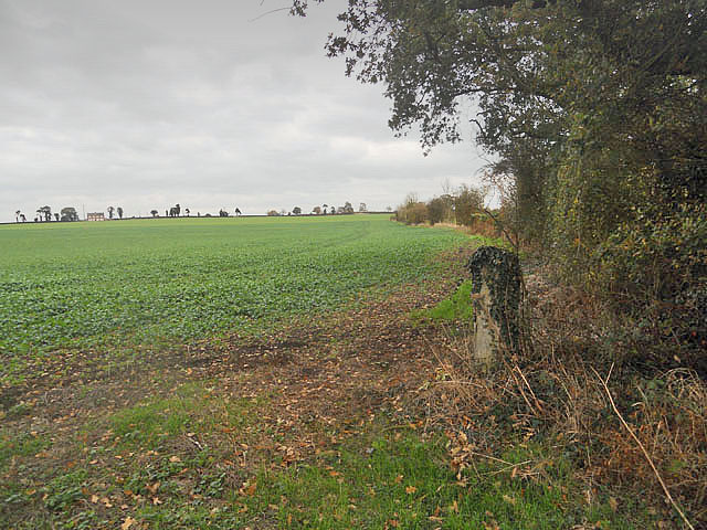
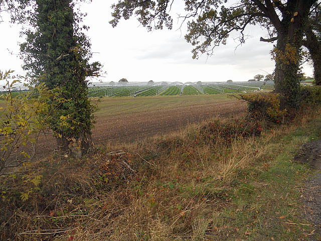
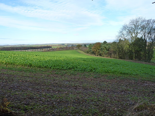
Flashbrook Wood is a picturesque woodland located in the county of Staffordshire, England. Stretching over an area of approximately 50 hectares, this ancient forest is a haven for nature lovers and outdoor enthusiasts alike. Nestled within the scenic landscape of Staffordshire Moorlands, Flashbrook Wood offers a tranquil escape from the hustle and bustle of modern life.

The wood is characterized by a diverse range of tree species, including oak, beech, birch, and ash, which create a dense canopy overhead, providing shade and shelter for a variety of wildlife. The forest floor is adorned with an array of flora, such as bluebells, wild garlic, and wood sorrel, making it an enchanting sight during springtime.

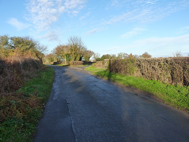
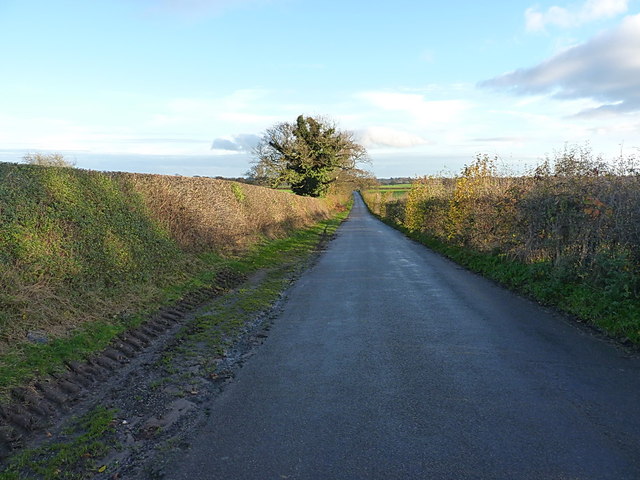
The wood is crisscrossed by a network of footpaths and trails, allowing visitors to explore its natural beauty at their own pace. These well-maintained paths lead to hidden ponds and streams, where one can spot an abundance of aquatic life, including frogs, newts, and dragonflies. In addition, Flashbrook Wood is home to a rich variety of bird species, making it a popular spot for birdwatching enthusiasts.

Nature conservation is a priority at Flashbrook Wood, with efforts made to preserve and enhance its biodiversity. The woodland is managed sustainably, with selective tree felling and coppicing carried out to promote the growth of new plants and encourage the return of rare wildlife species.

Overall, Flashbrook Wood is a cherished natural gem in Staffordshire, offering a peaceful retreat for those seeking solace in nature's embrace.

If you have any feedback on the listing, please let us know in the comments section below.

Flashbrook Wood Images

Images are sourced within 2km of 52.818718/-2.384449 or Grid Reference SJ7424. Thanks to Geograph Open Source API. All images are credited.

Field boundary near Roman Road
Protected from the winter
Lane near Puleston
Lane near Puleston
Driveway and path to Ellerton Grange
North side of Puleston Hill There is a trig on the summit of Puleston Hill; little visited and in need of a some attention. Winter wheat is currently planted in the summit field, with this root crop on the northern side, along the edge of Puleston Covert.
North side of Puleston Hill
There is a trig on the summit of Puleston Hill; little visited and in need of a some attention. Winter wheat is currently planted in the summit field, with this root crop on the northern side, along the edge of Puleston Covert.
Back lane from Pickstock A quiet, little used lane between Pickstock and the main route from Puleston to Soudley.
Back lane from Pickstock
A quiet, little used lane between Pickstock and the main route from Puleston to Soudley.
OS benchmark - Pickstock, roadside culvert An OS cutmark in the brick surround of a roadside culvert; originally levelled at 74.16m above Ordnance Datum Newlyn.
OS benchmark - Pickstock, roadside culvert
An OS cutmark in the brick surround of a roadside culvert; originally levelled at 74.16m above Ordnance Datum Newlyn.
OS benchmark - Pickstock manor cottages stile An OS benchmark on the pillar at the side of a disused field stile; originally levelled at 81.51m above Ordnance Datum Newlyn.
OS benchmark - Pickstock manor cottages stile
An OS benchmark on the pillar at the side of a disused field stile; originally levelled at 81.51m above Ordnance Datum Newlyn.
Chetwynd Airfield helicopter training area The former grass airstrip of Chetwynd Airfield, now used by the RAF as part of the Shawbury-based Defence Helicopter Flying School. Cropmarks in this aerial shot <span class="nowrap"><a title="http://www.content-delivery.co.uk/aviation/airfields/Chetwynd.html" rel="nofollow ugc noopener" href="http://www.content-delivery.co.uk/aviation/airfields/Chetwynd.html">Link</a><img style="margin-left:2px;" alt="External link" title="External link - shift click to open in new window" src="https://s1.geograph.org.uk/img/external.png" width="10" height="10"/></span> suggest that it was much more extensive in the past, and in fact officially opened in Sept 1941 as a Relief Landing Ground for Tern Hill airfield.
It saw operational use with Miles Master & Magister planes and the occasional Spitfire and Hurricane fighter. In 1942, 'E' and 'F' flights of No 5 (Pilots) Advanced Flying Unit were based at Chetwynd, and used the site for night-flying practice, with sodium flares to light the runways. Its main problem proved to be that the grass strip tended to be waterlogged, and a number of aircraft became bogged down during operations. This situation was repeated in 1999, when an 80-tonne Hercules on a training flight from RAF Lyneham in Wilts landed here, and attempted to turn around. Unfortunately the ground wouldn't stand that sort of mass, and the plane began to list to starboard. It was, eventually, extracted. and flew off under its own power.
Chetwynd Airfield helicopter training area
The former grass airstrip of Chetwynd Airfield, now used by the RAF as part of the Shawbury-based Defence Helicopter Flying School. Cropmarks in this aerial shot LinkExternal link suggest that it was much more extensive in the past, and in fact officially opened in Sept 1941 as a Relief Landing Ground for Tern Hill airfield. It saw operational use with Miles Master & Magister planes and the occasional Spitfire and Hurricane fighter. In 1942, 'E' and 'F' flights of No 5 (Pilots) Advanced Flying Unit were based at Chetwynd, and used the site for night-flying practice, with sodium flares to light the runways. Its main problem proved to be that the grass strip tended to be waterlogged, and a number of aircraft became bogged down during operations. This situation was repeated in 1999, when an 80-tonne Hercules on a training flight from RAF Lyneham in Wilts landed here, and attempted to turn around. Unfortunately the ground wouldn't stand that sort of mass, and the plane began to list to starboard. It was, eventually, extracted. and flew off under its own power.
Fork in the road The main lane goes on to Camp Farm on the old Roman Road; the right fork heads off into an unclassified road towards Puleston Common woods.
Fork in the road
The main lane goes on to Camp Farm on the old Roman Road; the right fork heads off into an unclassified road towards Puleston Common woods.
Towards Camp Farm Along the lane from Puleston to Soudley, passing Aylesland House, from where a small tree & shrub nursery operates.
Towards Camp Farm
Along the lane from Puleston to Soudley, passing Aylesland House, from where a small tree & shrub nursery operates.
South of Camp Farm
South of Camp Farm
Roman Road from Chester to Colchester A section of the Via Devana road from Deva (Chester) towards Colonia Victricensis (Colchester), which here heads more or less directly to Pennocrucium, the settlement in <a href="https://www.geograph.org.uk/gridref/SJ8910">SJ8910</a> just off Watling Street near Penkridge.
Roman Road from Chester to Colchester
A section of the Via Devana road from Deva (Chester) towards Colonia Victricensis (Colchester), which here heads more or less directly to Pennocrucium, the settlement in SJ8910 just off Watling Street near Penkridge.
OS benchmark - Puleston Common, cottage at crossroads An OS cutmark on the wall of no 1 at Flash Brook Crossroads Cottages; originally levelled at 81.64m above Ordnance Datum Newlyn.
OS benchmark - Puleston Common, cottage at crossroads
An OS cutmark on the wall of no 1 at Flash Brook Crossroads Cottages; originally levelled at 81.64m above Ordnance Datum Newlyn.
Flashbrook Crossroads cottages Or 'Piggy in the Middle' as they're locally known.
Flashbrook Crossroads cottages
Or 'Piggy in the Middle' as they're locally known.
Puleston Common The road here runs right across the middle of Puleston Common. No longer used by the commoners for grazing their pigs & livestock, the area is a tangle of trees; mostly silver birch, ash, oak and beech, with an understorey of bramble and nettle.
Puleston Common
The road here runs right across the middle of Puleston Common. No longer used by the commoners for grazing their pigs & livestock, the area is a tangle of trees; mostly silver birch, ash, oak and beech, with an understorey of bramble and nettle.
Southern edge of the woods The scrub & woodland that covers Puleston Common gives over to open fields here on the southern side.
Southern edge of the woods
The scrub & woodland that covers Puleston Common gives over to open fields here on the southern side.
Shay Lane towards Brickhill Pits copse Shay Lane is the route between Forton and Shebdon.
Shay Lane towards Brickhill Pits copse
Shay Lane is the route between Forton and Shebdon.
Show me another place!

Flashbrook Wood is located at Grid Ref: SJ7424 (Lat: 52.818718, Lng: -2.384449)

Administrative County: Staffordshire

District: Stafford

Police Authority: Staffordshire

What 3 Words

///vertical.suspended.videos. Near Chetwynd, Shropshire

Nearby Locations

Flashbrook Wood

Related Wikis

RAF Chetwynd

Royal Air Force Chetwynd or more simply RAF Chetwynd is a former Royal Air Force satellite station located in Chetwynd, Shropshire, England. The following...

Shebdon

Shebdon is a hamlet in the county of Staffordshire, England. It is part of the parish of High Offley, a small village approximately 1.5 miles to the ENE...

Pickstock

Pickstock is a hamlet in the civil parish of Chetwynd, in the Telford and Wrekin district, in the ceremonial county of Shropshire, England. It is near...

Knighton, Stafford

Knighton is a hamlet part of the parish of Adbaston in the county of Staffordshire, England. Knighton is situated close to the Staffordshire/Shropshire...

Sambrook, Shropshire

Sambrook is a small village in the ceremonial county of Shropshire, where it is part of the civil parish of Chetwynd, north of the town of Newport. To...

Ellerton, Shropshire

Ellerton is a small hamlet in Shropshire, England. It lies in a rather isolated rural area several miles north of the town of Newport, close to the village...

Chetwynd Park

Chetwynd Park is an 18th-century landscape garden with woodland, on the edge of Newport, Shropshire. The park can trace its history back to 1388, when...

Chetwynd Park estate

The Chetwynd Park estate lies in the small village of Chetwynd on the outskirts of the town of Newport, Shropshire, England. The estate is positioned in...

Nearby Amenities

Located within 500m of 52.818718,-2.384449
Flashbrook Grange
Place: farm
Lat/Long: 52.8163122/-2.380517
Give Way
Direction: backward
Lat/Long: 52.8163824/-2.389136
Give Way
Direction: forward
Lat/Long: 52.8163451/-2.3890452
The data included in this document is from www.openstreetmap.org. The data is made available under ODbL.

Have you been to Flashbrook Wood?

Leave your review of Flashbrook Wood below (or comments, questions and feedback).