Conisber Plantation

Wood, Forest in Yorkshire Craven

England

Conisber Plantation

Direction Sign – Signpost on Eldroth Road, Lawkland Located on the northwest side of the T junction of Eldroth Road and Fummerber Lane in Lawkland parish. 3 arms and annulus & bar finial. See also <a title="https://www.geograph.org.uk/photo/5834757" href="https://www.geograph.org.uk/photo/5834757">Link</a> and <a title="https://www.geograph.org.uk/photo/4613723" href="https://www.geograph.org.uk/photo/4613723">Link</a>.

Milestone Society National ID: YW_SD7466A
Direction Sign – Signpost on Eldroth Road, Lawkland Credit: D Phillips

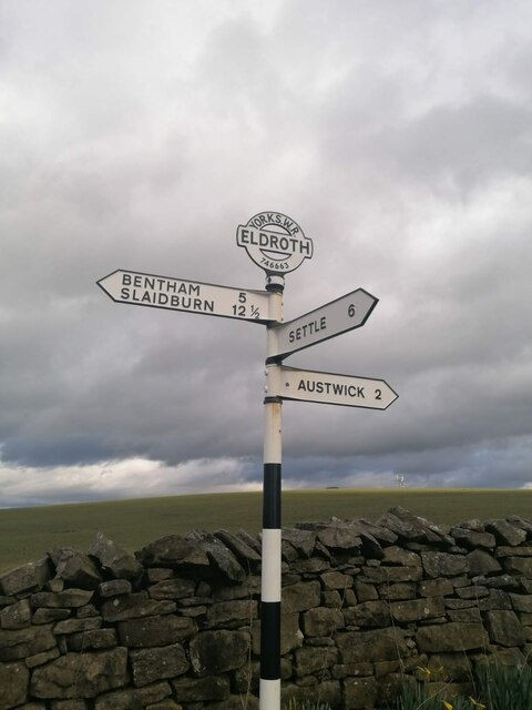
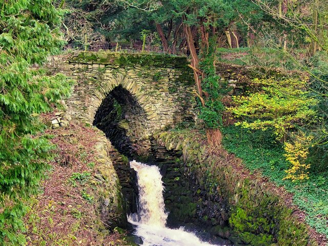
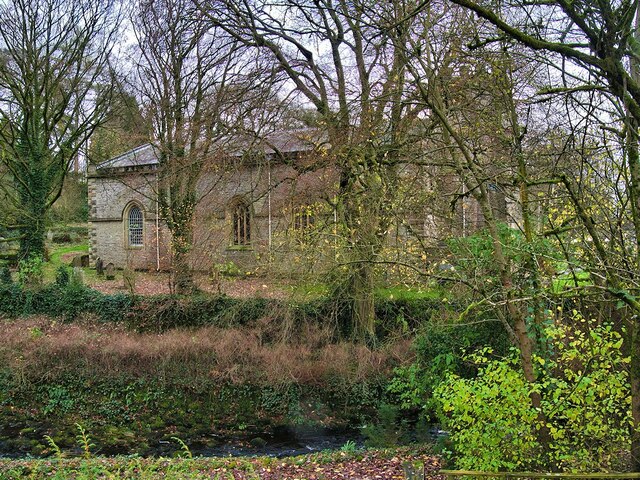
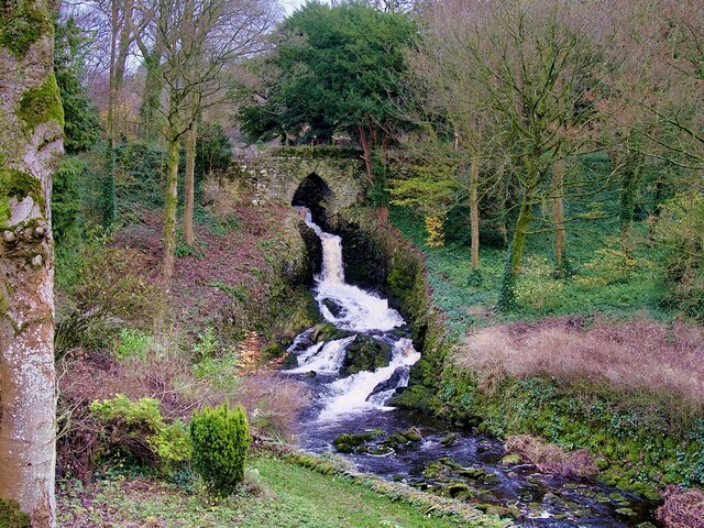
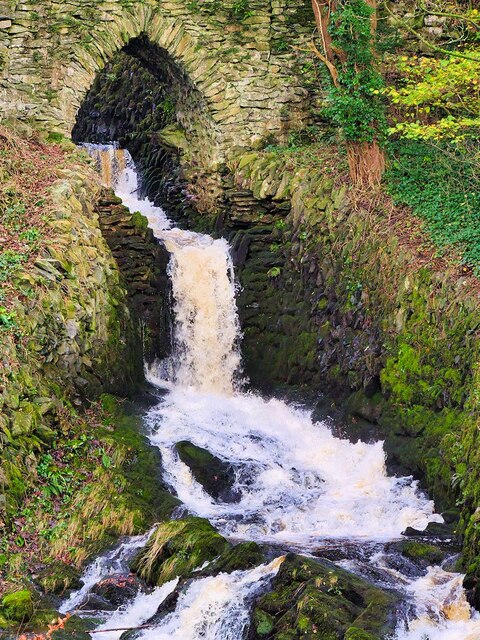
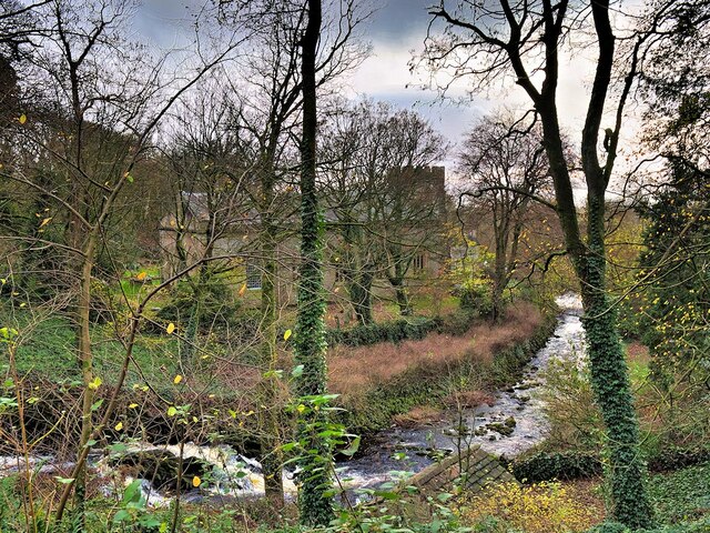
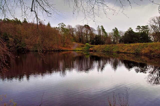
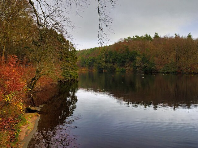
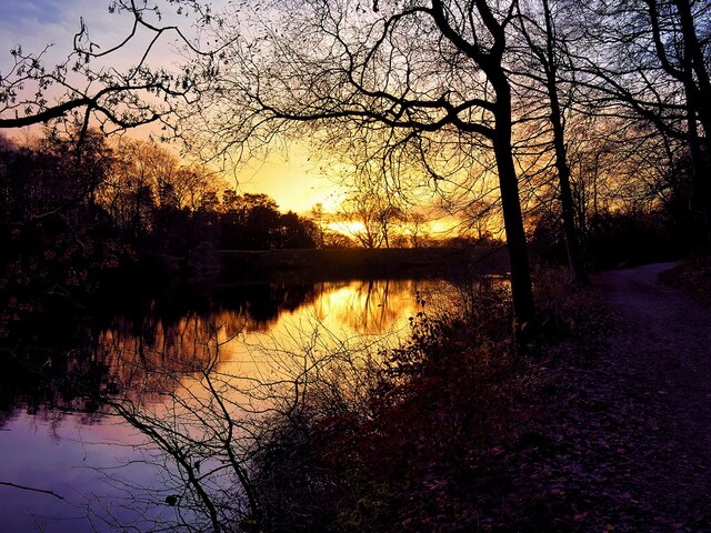
Conisber Plantation is a picturesque woodland located in Yorkshire, England. Situated on the outskirts of the town of Doncaster, this plantation spans over a vast area of approximately 200 acres. It is known for its serene and tranquil atmosphere, making it a popular destination for nature enthusiasts and locals alike.

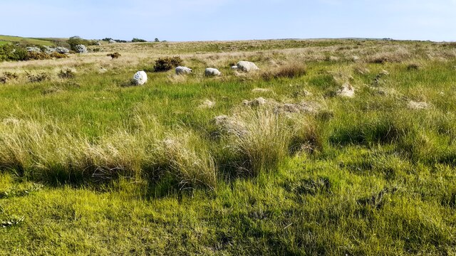
The plantation is primarily composed of broadleaved trees, including oak, birch, and beech, which form a dense and lush canopy. This dense vegetation provides a perfect habitat for a wide variety of wildlife, including squirrels, rabbits, and a diverse range of bird species such as woodpeckers and finches.

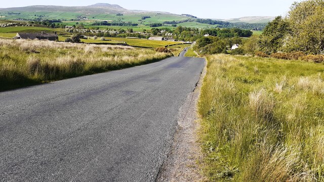
The woodland is crisscrossed by a network of well-maintained footpaths, enabling visitors to explore the plantation and enjoy its natural beauty. These paths wind through the trees, offering stunning views of the surrounding countryside and a chance to immerse oneself in nature.

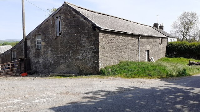
In addition to its natural offerings, Conisber Plantation also boasts several amenities for visitors. There are picnic areas and benches scattered throughout the woodland, providing opportunities for visitors to relax and enjoy a picnic amidst the peaceful surroundings. The plantation also has a designated parking area, making it easily accessible for those traveling by car.

Conisber Plantation is managed by local authorities who ensure the preservation of its natural ecosystem. They regularly undertake maintenance activities such as tree planting and woodland management to sustain the health and vitality of the plantation.

Overall, Conisber Plantation is a hidden gem in Yorkshire, offering a welcome respite from the hustle and bustle of daily life. Its tranquility, diverse wildlife, and stunning scenery make it a must-visit destination for nature lovers and those seeking a peaceful retreat in the heart of Yorkshire.

If you have any feedback on the listing, please let us know in the comments section below.

Conisber Plantation Images

Images are sourced within 2km of 54.10563/-2.3961855 or Grid Reference SD7467. Thanks to Geograph Open Source API. All images are credited.

Direction Sign – Signpost on Eldroth Road, Lawkland Located on the northwest side of the T junction of Eldroth Road and Fummerber Lane in Lawkland parish. 3 arms and annulus & bar finial. See also <a title="https://www.geograph.org.uk/photo/5834757" href="https://www.geograph.org.uk/photo/5834757">Link</a> and <a title="https://www.geograph.org.uk/photo/4613723" href="https://www.geograph.org.uk/photo/4613723">Link</a>.

Milestone Society National ID: YW_SD7466A
Direction Sign – Signpost on Eldroth Road, Lawkland
Located on the northwest side of the T junction of Eldroth Road and Fummerber Lane in Lawkland parish. 3 arms and annulus & bar finial. See also Link and Link. Milestone Society National ID: YW_SD7466A
Clapham Bridge
Clapham Bridge
Fingerpost sign next to River Wenning A repaired fingerpost sign near Clapham Station, North Yorkshire
Fingerpost sign next to River Wenning
A repaired fingerpost sign near Clapham Station, North Yorkshire
Wenning Bank Bridge Stone bridge over the River Wenning near Clapham Station, North Yorkshire
Wenning Bank Bridge
Stone bridge over the River Wenning near Clapham Station, North Yorkshire
Bridge over Clapham Beck Waterfall Clapham Falls is a man-made waterfall which sees Clapham Beck drop below a bridge, in  three separate tiers, from the lake above into Clapham itself. The waterfall was constructed in 1837 by Oliver and James William Farrar as part of the remodelling of the estate of Ingleborough Hall.
Bridge over Clapham Beck Waterfall
Clapham Falls is a man-made waterfall which sees Clapham Beck drop below a bridge, in three separate tiers, from the lake above into Clapham itself. The waterfall was constructed in 1837 by Oliver and James William Farrar as part of the remodelling of the estate of Ingleborough Hall.
St James' Church, Clapham Looking across Clapham Beck towards the Church of St James at Clapham. 
The majority of the current church dates from 1814 although the tower has been retained from an earlier, fifteenth century, church. It is a Grade II listed building (List Entry Number: 1132398 <span class="nowrap"><a title="https://historicengland.org.uk/listing/the-list/list-entry/1132398" rel="nofollow ugc noopener" href="https://historicengland.org.uk/listing/the-list/list-entry/1132398">Link</a><img style="margin-left:2px;" alt="External link" title="External link - shift click to open in new window" src="https://s1.geograph.org.uk/img/external.png" width="10" height="10"/></span> Historic England)
St James' Church, Clapham
Looking across Clapham Beck towards the Church of St James at Clapham. The majority of the current church dates from 1814 although the tower has been retained from an earlier, fifteenth century, church. It is a Grade II listed building (List Entry Number: 1132398 LinkExternal link Historic England)
Clapham Falls Clapham Falls is a man-made waterfall which sees Clapham Beck drop below a bridge, in  three separate tiers, from the lake above into Clapham itself. The waterfall was constructed in 1837 by Oliver and James William Farrar as part of the remodelling of the estate of Ingleborough Hall.
Clapham Falls
Clapham Falls is a man-made waterfall which sees Clapham Beck drop below a bridge, in three separate tiers, from the lake above into Clapham itself. The waterfall was constructed in 1837 by Oliver and James William Farrar as part of the remodelling of the estate of Ingleborough Hall.
Clapham Beck Waterfall Clapham Falls is a man-made waterfall which sees Clapham Beck drop below a bridge, in  three separate tiers, from the lake above into Clapham itself. The waterfall was constructed in 1837 by Oliver and James William Farrar as part of the remodelling of the estate of Ingleborough Hall.
Clapham Beck Waterfall
Clapham Falls is a man-made waterfall which sees Clapham Beck drop below a bridge, in three separate tiers, from the lake above into Clapham itself. The waterfall was constructed in 1837 by Oliver and James William Farrar as part of the remodelling of the estate of Ingleborough Hall.
Clapham Beck and the Church of St James Looking across Clapham Beck towards the Church of St James at Clapham. 
The majority of the current church dates from 1814 although the tower has been retained from an earlier, fifteenth century, church. It is a Grade II listed building (List Entry Number: 1132398 <span class="nowrap"><a title="https://historicengland.org.uk/listing/the-list/list-entry/1132398" rel="nofollow ugc noopener" href="https://historicengland.org.uk/listing/the-list/list-entry/1132398">Link</a><img style="margin-left:2px;" alt="External link" title="External link - shift click to open in new window" src="https://s1.geograph.org.uk/img/external.png" width="10" height="10"/></span> Historic England)
Clapham Beck and the Church of St James
Looking across Clapham Beck towards the Church of St James at Clapham. The majority of the current church dates from 1814 although the tower has been retained from an earlier, fifteenth century, church. It is a Grade II listed building (List Entry Number: 1132398 LinkExternal link Historic England)
Clapham Lake Clapham Lake is a man-made ornamental lake in Clapdale, just above the village of Clapham. It is surrounded by woodland and is seen here from Clapdale Drive, a wide track that passes along the western side of the lake on its through Clapdale Wood towards Ingleborough Cave.

Known simply as The Lake, this artificial lake was constructed in the 18th century as part of the remodelling of the Ingleborough estate by the Farrar family who built a dam to hold back the waters of Clapham Beck, which drains via the artificial watercourse of Clapham Falls.
Clapham Lake
Clapham Lake is a man-made ornamental lake in Clapdale, just above the village of Clapham. It is surrounded by woodland and is seen here from Clapdale Drive, a wide track that passes along the western side of the lake on its through Clapdale Wood towards Ingleborough Cave. Known simply as The Lake, this artificial lake was constructed in the 18th century as part of the remodelling of the Ingleborough estate by the Farrar family who built a dam to hold back the waters of Clapham Beck, which drains via the artificial watercourse of Clapham Falls.
Lake at Clapham Known simply as The Lake, this artificial lake, just above the village of Clapham, was constructed in the 18th century as part of the remodelling of the Ingleborough estate by the Farrar family who built a dam to hold back the waters of Clapham Beck, which drains via the artificial watercourse of Clapham Falls.

The ornamental lake is surrounded by woodland and is seen here from Clapdale Drive, a wide track that passes along the western side of the lake on its through Clapdale Wood towards Ingleborough Cave.
Lake at Clapham
Known simply as The Lake, this artificial lake, just above the village of Clapham, was constructed in the 18th century as part of the remodelling of the Ingleborough estate by the Farrar family who built a dam to hold back the waters of Clapham Beck, which drains via the artificial watercourse of Clapham Falls. The ornamental lake is surrounded by woodland and is seen here from Clapdale Drive, a wide track that passes along the western side of the lake on its through Clapdale Wood towards Ingleborough Cave.
The Lake, Clapham Known simply as The Lake, this artificial lake, just above the village of Clapham, was constructed in the 18th century as part of the remodelling of the Ingleborough estate by the Farrar family who built a dam to hold back the waters of Clapham Beck, which drains via the artificial watercourse of Clapham Falls.

The ornamental lake is surrounded by woodland and is seen here from Clapdale Drive, a wide track that passes along the western side of the lake on its route through Clapdale Wood towards Ingleborough Cave.
The Lake, Clapham
Known simply as The Lake, this artificial lake, just above the village of Clapham, was constructed in the 18th century as part of the remodelling of the Ingleborough estate by the Farrar family who built a dam to hold back the waters of Clapham Beck, which drains via the artificial watercourse of Clapham Falls. The ornamental lake is surrounded by woodland and is seen here from Clapdale Drive, a wide track that passes along the western side of the lake on its route through Clapdale Wood towards Ingleborough Cave.
Sheep grazing on Clapham Moor
Looking NE along moorland road leading to Clapham Station
Diesel multiple unit 158850 leaves Clapham Station for Morecambe The train is the Northern service from Leeds
Diesel multiple unit 158850 leaves Clapham Station for Morecambe
The train is the Northern service from Leeds
Barn and house at Nutta Farm on NE side of road
Benchmark on Calter Barn Ordnance Survey cut mark benchmark levelled at 138.132m verified 1953
Benchmark on Calter Barn
Ordnance Survey cut mark benchmark levelled at 138.132m verified 1953
Benchmark on stone jamb of door of former post office at Wenning Bank Ordnance Survey cut mark benchmark levelled at 135.371m above Newlyn Datum verified 1953
Benchmark on stone jamb of door of former post office at Wenning Bank
Ordnance Survey cut mark benchmark levelled at 135.371m above Newlyn Datum verified 1953
Show me another place!

Conisber Plantation is located at Grid Ref: SD7467 (Lat: 54.10563, Lng: -2.3961855)

Division: West Riding

Administrative County: North Yorkshire

District: Craven

Police Authority: North Yorkshire

What 3 Words

///udder.slows.depths. Near Ingleton, North Yorkshire

Related Wikis

Clapham railway station

Clapham is a railway station on the Bentham Line, which runs between Leeds and Morecambe via Skipton. The station, situated 48 miles (77 km) north-west...

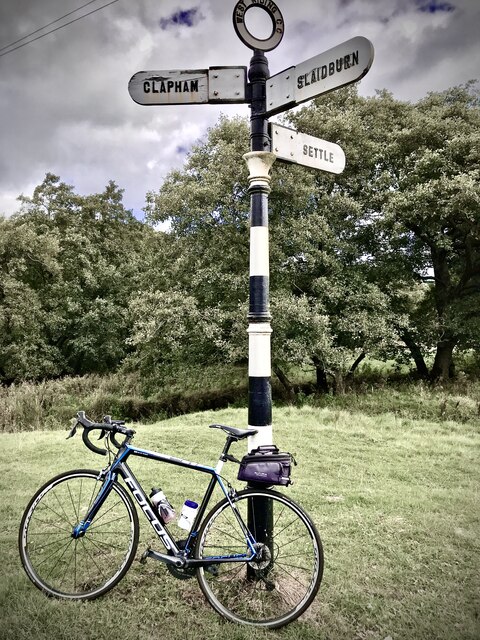
Clapham, North Yorkshire

Clapham is a village in the civil parish of Clapham cum Newby in the Craven district of North Yorkshire, England. It was previously in the West Riding...

Clapham cum Newby

Clapham cum Newby is a civil parish in the Craven district of North Yorkshire, England. It was formerly in the Settle Rural District. It contains the villages...

Keasden

Keasden is a hamlet in the civil parish of Clapham-cum-Newby, in the Craven district of the county of North Yorkshire, in the north-western England. It...

Austwick

Austwick is a village and civil parish in the Craven district of North Yorkshire, England, about 5 miles (8 km) north-west of Settle. The village is on...
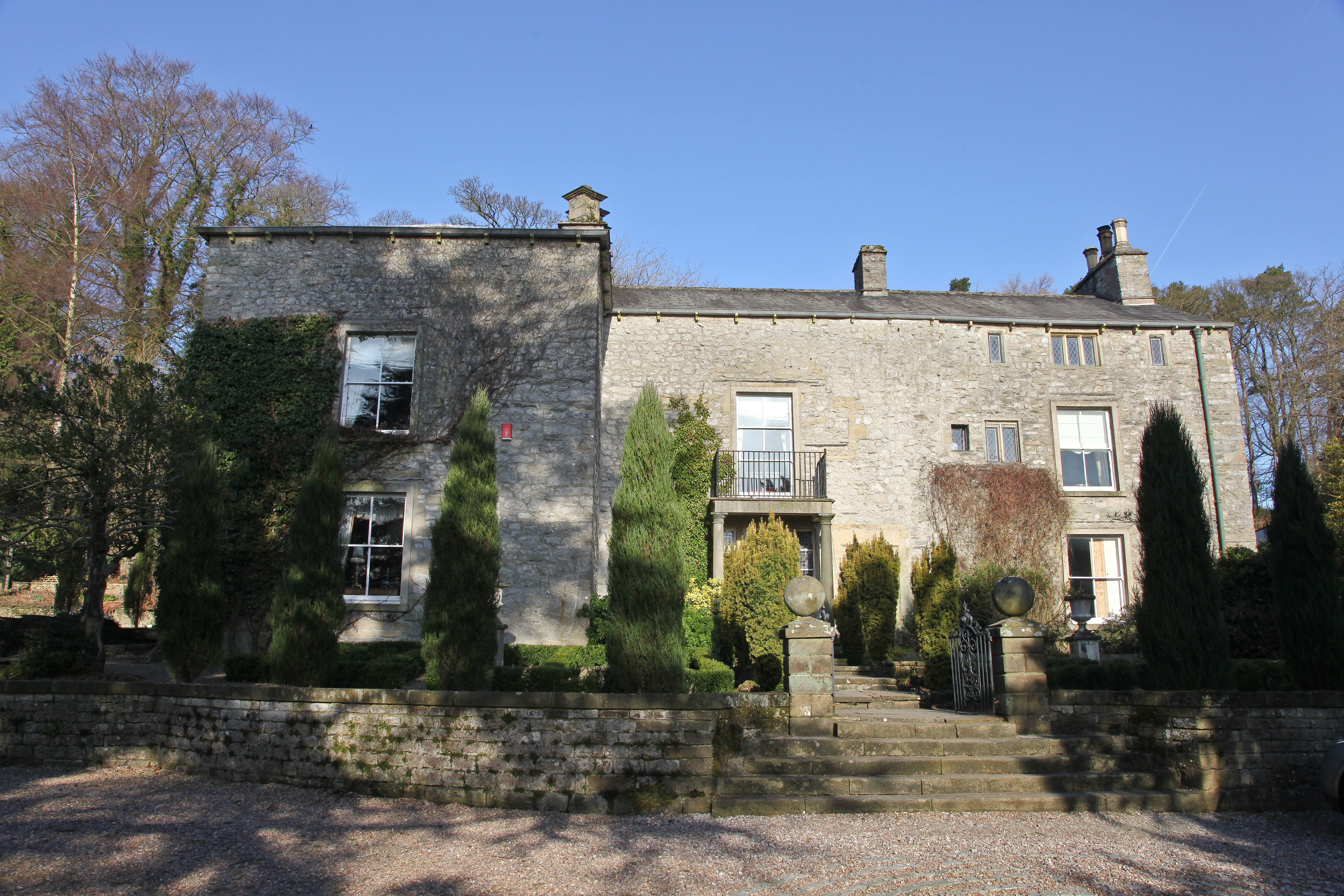
Austwick Hall

Austwick Hall is an historic manor house situated above the village of Austwick in North Yorkshire, England. The house is a Grade II listed building and...

Norber erratics

The Norber erratics are one of the finest groups of glacial erratic boulders in Britain. They are found on the southern slopes of Ingleborough, close to...

Keasden Beck

Keasden Beck is a stream in Yorkshire (formerly the West Riding) rising near Keasden Head, joining the River Wenning south west of Clapham. == References... ==

Nearby Amenities

Located within 500m of 54.10563,-2.3961855
Power: pole
Lat/Long: 54.102711/-2.3918835
Power: pole
Lat/Long: 54.1029027/-2.3932199
Power: pole
Lat/Long: 54.1031577/-2.394907
Power: pole
Lat/Long: 54.1033354/-2.3960958
Power: pole
Lat/Long: 54.1035441/-2.3975246
Power: pole
Lat/Long: 54.1037635/-2.3990086
Power: pole
Lat/Long: 54.1039444/-2.4002133
Power: pole
Lat/Long: 54.1041515/-2.401613
Power: pole
Lat/Long: 54.104357/-2.4030128
Power: pole
Lat/Long: 54.1038532/-2.3955528
Power: pole
Lat/Long: 54.1045394/-2.3948675
Power: pole
Lat/Long: 54.1053292/-2.3940582
Power: pole
Lat/Long: 54.1059968/-2.3933913
Power: pole
Lat/Long: 54.1066938/-2.3926796
Power: pole
Lat/Long: 54.1073367/-2.3920179
Power: pole
Lat/Long: 54.1083551/-2.3918703
Power: pole
Lat/Long: 54.1092453/-2.3917359
Ford: stepping_stones
Lat/Long: 54.1024098/-2.3994891
The data included in this document is from www.openstreetmap.org. The data is made available under ODbL.

Have you been to Conisber Plantation?

Leave your review of Conisber Plantation below (or comments, questions and feedback).