Cowdenend

Settlement in Fife

Scotland

Cowdenend

Hill of Beath
Hill of Beath Credit: Robert Struthers

Cowdenend is a small hamlet located in the region of Fife, Scotland. It is situated approximately 6 miles southeast of the town of Coupar Angus and lies close to the border with Perth and Kinross. Nestled within the picturesque countryside, the village offers a tranquil and idyllic setting.

The hamlet of Cowdenend is characterized by its traditional Scottish charm. It is comprised of a handful of residential properties, most of which are traditional stone-built cottages with beautiful gardens. The area is surrounded by rolling hills, lush green fields, and wooded areas, creating a stunning natural landscape.

Despite its small size, Cowdenend is well-connected to nearby towns and villages. The A94 road runs close to the hamlet, providing easy access to Coupar Angus and other surrounding areas. The nearest train station is located in Coupar Angus, offering further transport links to cities like Perth and Dundee.

Although Cowdenend does not have its own amenities or services, residents can find a range of facilities in nearby towns. Coupar Angus offers a selection of shops, supermarkets, cafes, and restaurants, as well as schools and healthcare facilities.

For outdoor enthusiasts, Cowdenend is an ideal location. The surrounding countryside provides ample opportunities for walking, hiking, and cycling. Nearby attractions include the picturesque Den of Alyth, where visitors can enjoy stunning woodland walks and spot local wildlife.

Overall, Cowdenend is a charming and peaceful hamlet, offering its residents a serene rural lifestyle amidst the stunning Scottish countryside.

If you have any feedback on the listing, please let us know in the comments section below.
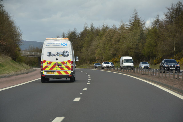
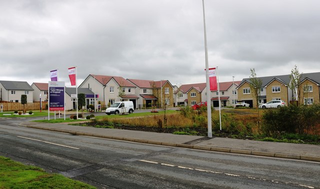
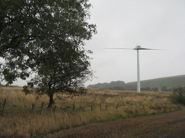
Cowdenend Images

Images are sourced within 2km of 56.086035/-3.3835807 or Grid Reference NT1489. Thanks to Geograph Open Source API. All images are credited.

Hill of Beath
Hill of Beath
Fife : Grassy Field A grassy field seen from the M90 Motorway.
Fife : Grassy Field
A grassy field seen from the M90 Motorway.
Fife : The M90 Motorway Heading north towards Perth on the M90 Motorway.
Fife : The M90 Motorway
Heading north towards Perth on the M90 Motorway.
Crop field, Kingseat  Off Kingseat Road.
Crop field, Kingseat
Off Kingseat Road.
Entering Kingseat  Looking north on Kingseat Road.
Entering Kingseat
Looking north on Kingseat Road.
Lochnood Park, Kingseat Housing development off Kingseat Road.
Lochnood Park, Kingseat
Housing development off Kingseat Road.
Kingseat Community Leisure Centre As leisure centres go this one is more functional than aesthetically pleasing.
Kingseat Community Leisure Centre
As leisure centres go this one is more functional than aesthetically pleasing.
New homes in Kingseat At the junction of Kingseat Road and the B912 Taylor Wimpey have been given planning permission to build 59 new homes. This is Russell Avenue which will be one of two entrances to the development and is also where the show home is situated.
New homes in Kingseat
At the junction of Kingseat Road and the B912 Taylor Wimpey have been given planning permission to build 59 new homes. This is Russell Avenue which will be one of two entrances to the development and is also where the show home is situated.
New homes in Kingseat This is the sales office for Taylor Wimpey's new development of 59 homes at Kingseat.
New homes in Kingseat
This is the sales office for Taylor Wimpey's new development of 59 homes at Kingseat.
New homes in Kingseat This is the site entrance to the Taylor Wimpey development of 59 homes at Kingseat.
New homes in Kingseat
This is the site entrance to the Taylor Wimpey development of 59 homes at Kingseat.
New homes in Kingseat Taylor Wimpey are building 59 new homes at Kingseat.
New homes in Kingseat
Taylor Wimpey are building 59 new homes at Kingseat.
Flower tubs At the top of Kingseat Road these flower tubs have been donated by local people in an effort brighten up the area.
Flower tubs
At the top of Kingseat Road these flower tubs have been donated by local people in an effort brighten up the area.
New homes in Kingseat Taylor Wimpey are building 59 new homes in Kingseat.
New homes in Kingseat
Taylor Wimpey are building 59 new homes in Kingseat.
Keirsbeath Ridge triangulation pillar In the bottom of a newly established garden.
Keirsbeath Ridge triangulation pillar
In the bottom of a newly established garden.
Kingseat Post Office In the Wee Shop on Henderson Street, and replacing the old Post Office on Main Street <a href="https://www.geograph.org.uk/photo/6299232">NT1290 : Ex-Post Office at Kingseat</a>.
Kingseat Post Office
In the Wee Shop on Henderson Street, and replacing the old Post Office on Main Street NT1290 : Ex-Post Office at Kingseat.
Track off Cuddyhouse Road Which might once have been a public road, but is now closed by locked gates. Footpath access is maintained and signed.
Track off Cuddyhouse Road
Which might once have been a public road, but is now closed by locked gates. Footpath access is maintained and signed.
Stubble field on Cuddyhouse Road Looking east through rain.
Stubble field on Cuddyhouse Road
Looking east through rain.
Wind turbine on Cuddyhouse Road Not generating very much on a wet, calm day.
Wind turbine on Cuddyhouse Road
Not generating very much on a wet, calm day.
Show me another place!

Cowdenend is located at Grid Ref: NT1489 (Lat: 56.086035, Lng: -3.3835807)

Unitary Authority: Fife

Police Authority: Fife

What 3 Words

///archives.cone.claw. Near Crossgates, Fife

Nearby Locations

Hill of Beath Cowdenend

Related Wikis

Crossgates, Fife

Crossgates is a village in Fife, Scotland. It is located close to the junction of the M90 and A92, about two miles east of Dunfermline and a similar distance...

Humbug Park

Humbug Park also previously known as Crossgates Greyhound Stadium is a football ground and former greyhound racing track on Inverkeithing Road in Crossgates...

Crossgates railway station (Fife)

Crossgates Fife railway station co-served the village of Crossgates, Fife, Scotland, from 1848 to 1949 on the Edinburgh and Northern Railway. == History... ==

Halbeath railway station

Halbeath railway station served the village of Halbeath, Fife, Scotland, from 1851 to 1930 on the Dunfermline Branch. == History == The station was opened...

Nearby Amenities

Located within 500m of 56.086035,-3.3835807
Motorway Junction
Crossgates
Lat/Long: 56.0880345/-3.3794237
Crossing
Crossing: traffic_signals
Crossing Island: no
Kerb: lowered
Tactile Paving: yes
Lat/Long: 56.0840976/-3.379801
Post Box
Collection Times: Mo-Fr 09:00; Sa 07:00
Operator: Royal Mail
Post Box Type: lamp
Ref: KY4 177D
Royal Cypher: scottish_crown
Lat/Long: 56.0843942/-3.3816248
Bus Stop
Stance 5
Bench: yes
Bin: yes
Bus: yes
Lit: yes
Naptan AtcoCode: 6500D1705
Naptan CommonName: Park
Naptan Indicator: Stance 5
Naptan NaptanCode: 34347936
Naptan Street: A92
Public Transport: platform
Shelter: yes
Tactile Paving: no
Lat/Long: 56.0843172/-3.3907805
Bus Stop
Lady Anne Court
Bench: no
Bin: no
Bus: yes
Departures Board: timetable
Naptan AtcoCode: 6500D0130
Naptan NaptanCode: 34325395
Public Transport: platform
Shelter: yes
Surface: tactile_paving
Tactile Paving: no
Lat/Long: 56.0843867/-3.382735
Bus Stop
Reid Avenue
Bus: yes
Departures Board: timetable
Public Transport: platform
Surface: tactile_paving
Lat/Long: 56.0842506/-3.382686
Bus Stop
Primary School
Bench: no
Bin: yes
Bus: yes
Departures Board: timetable
Public Transport: platform
Shelter: no
Surface: tactile_paving
Tactile Paving: no
Lat/Long: 56.0842243/-3.3785157
Bus Stop
Primary School
Bench: yes
Bus: yes
Departures Board: timetable
Naptan AtcoCode: 6500D0132
Naptan NaptanCode: 34325379
Public Transport: platform
Shelter: yes
Surface: tactile_paving
Lat/Long: 56.0840493/-3.3793296
Bus Stop
Stance 4
Bench: yes
Bin: yes
Bus: yes
Lit: yes
Naptan AtcoCode: 6500D1704
Naptan CommonName: Park
Naptan Indicator: Stance 4
Naptan NaptanCode: 34347935
Naptan Street: A92
Public Transport: platform
Shelter: yes
Tactile Paving: no
Lat/Long: 56.0844636/-3.3905285
Bus Stop
Stance 3
Bench: yes
Bin: yes
Bus: yes
Lit: yes
Naptan AtcoCode: 6500D1703
Naptan CommonName: Park
Naptan Indicator: Stance 3
Naptan NaptanCode: 34347934
Naptan Street: A92
Public Transport: platform
Shelter: yes
Tactile Paving: no
Lat/Long: 56.0846055/-3.3902667
Bus Stop
Stance 2
Bench: yes
Bin: yes
Bus: yes
Lit: yes
Naptan AtcoCode: 6500D1702
Naptan CommonName: Park
Naptan Indicator: Stance 2
Naptan NaptanCode: 34347932
Naptan Street: A92
Public Transport: platform
Shelter: yes
Tactile Paving: no
Lat/Long: 56.0847274/-3.3900331
Bus Stop
Stance 1
Bench: yes
Bin: yes
Bus: yes
Lit: yes
Naptan AtcoCode: 6500D1701
Naptan CommonName: Park
Naptan Indicator: Stance 1
Naptan NaptanCode: 34347929
Naptan Street: A92
Public Transport: platform
Shelter: yes
Tactile Paving: no
Lat/Long: 56.0848514/-3.3898222
Bench
Backrest: yes
Lat/Long: 56.0844587/-3.3909712
Bench
Backrest: yes
Lat/Long: 56.084806/-3.3902529
Bench
Backrest: yes
Lat/Long: 56.0848301/-3.3902095
Bench
Backrest: yes
Lat/Long: 56.0848664/-3.3901383
Bench
Backrest: yes
Lat/Long: 56.0849563/-3.3899773
Bench
Backrest: yes
Lat/Long: 56.0849787/-3.389937
Bench
Backrest: yes
Lat/Long: 56.0850167/-3.3898751
Charging Station
Access: yes
Capacity: 20
Operator: evolt
Lat/Long: 56.0851825/-3.3904532
Recycling
Recycling Type: container
Lat/Long: 56.0865264/-3.3805265
Generator Method: photovoltaic
Generator Output Electricity: yes
Generator Source: solar
Generator Type: solar_photovoltaic_panel
Power: generator
Lat/Long: 56.0854238/-3.3820952
Generator Method: photovoltaic
Generator Output Electricity: yes
Generator Source: solar
Generator Type: solar_photovoltaic_panel
Power: generator
Lat/Long: 56.0853231/-3.3829284
Generator Method: photovoltaic
Generator Output Electricity: yes
Generator Source: solar
Generator Type: solar_photovoltaic_panel
Power: generator
Lat/Long: 56.0827684/-3.3797767
Generator Method: photovoltaic
Generator Output Electricity: yes
Generator Source: solar
Generator Type: solar_photovoltaic_panel
Power: generator
Lat/Long: 56.0827582/-3.3787766
Generator Method: photovoltaic
Generator Output Electricity: yes
Generator Source: solar
Generator Type: solar_photovoltaic_panel
Power: generator
Lat/Long: 56.0827616/-3.3786953
Generator Method: photovoltaic
Generator Output Electricity: yes
Generator Source: solar
Generator Type: solar_photovoltaic_panel
Power: generator
Lat/Long: 56.0863938/-3.3769959
Barrier: cycle_barrier
Lat/Long: 56.0840254/-3.3798653
Bicycle: yes
Ref: A92
Traffic Sign: GB:2931
Traffic Sign Direction: forward
Lat/Long: 56.0866682/-3.382888
Bicycle: no
Foot: no
Horse: no
Maxspeed: 70 mph
Moped: no
Motor Vehicle: designated
Ref: M90
Traffic Sign: GB:2901
Traffic Sign Direction: forward
Lat/Long: 56.0865958/-3.3827379
Direction: both
Surface: asphalt
Traffic Calming: cushion
Lat/Long: 56.0846024/-3.3822655
Direction: both
Surface: asphalt
Traffic Calming: hump
Lat/Long: 56.0858851/-3.3760911
Toilets
Fee: no
Wheelchair: yes
Lat/Long: 56.0846752/-3.3906612
The data included in this document is from www.openstreetmap.org. The data is made available under ODbL.

Have you been to Cowdenend?

Leave your review of Cowdenend below (or comments, questions and feedback).