Upper Wood

Wood, Forest in Shropshire

England

Upper Wood

House on the B4194 at Button Bridge Lane
House on the B4194 at Button Bridge Lane Credit: Rob Purvis

Upper Wood is a small village located in the county of Shropshire in England. Situated within the larger area known as the Wood, Upper Wood is surrounded by scenic landscapes and dense forests, making it an ideal location for nature enthusiasts and those seeking tranquility.

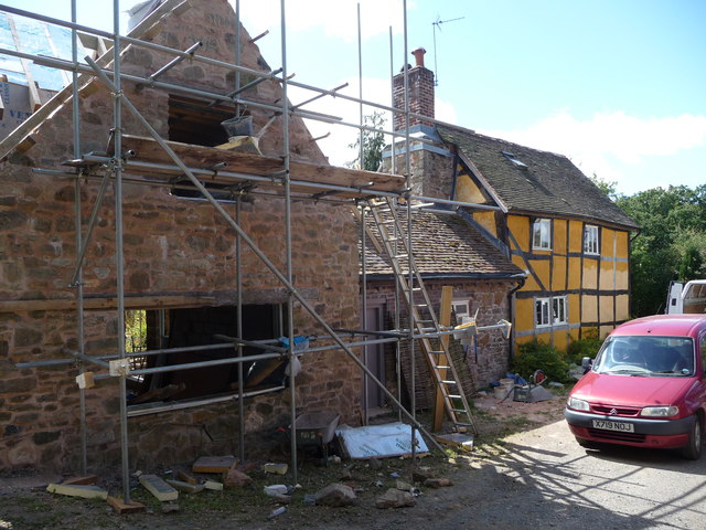
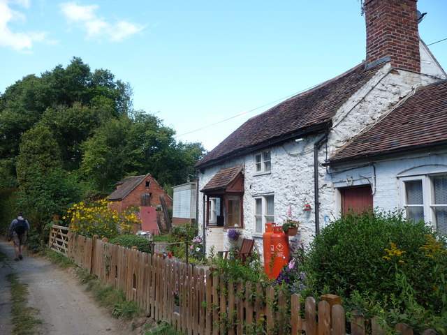
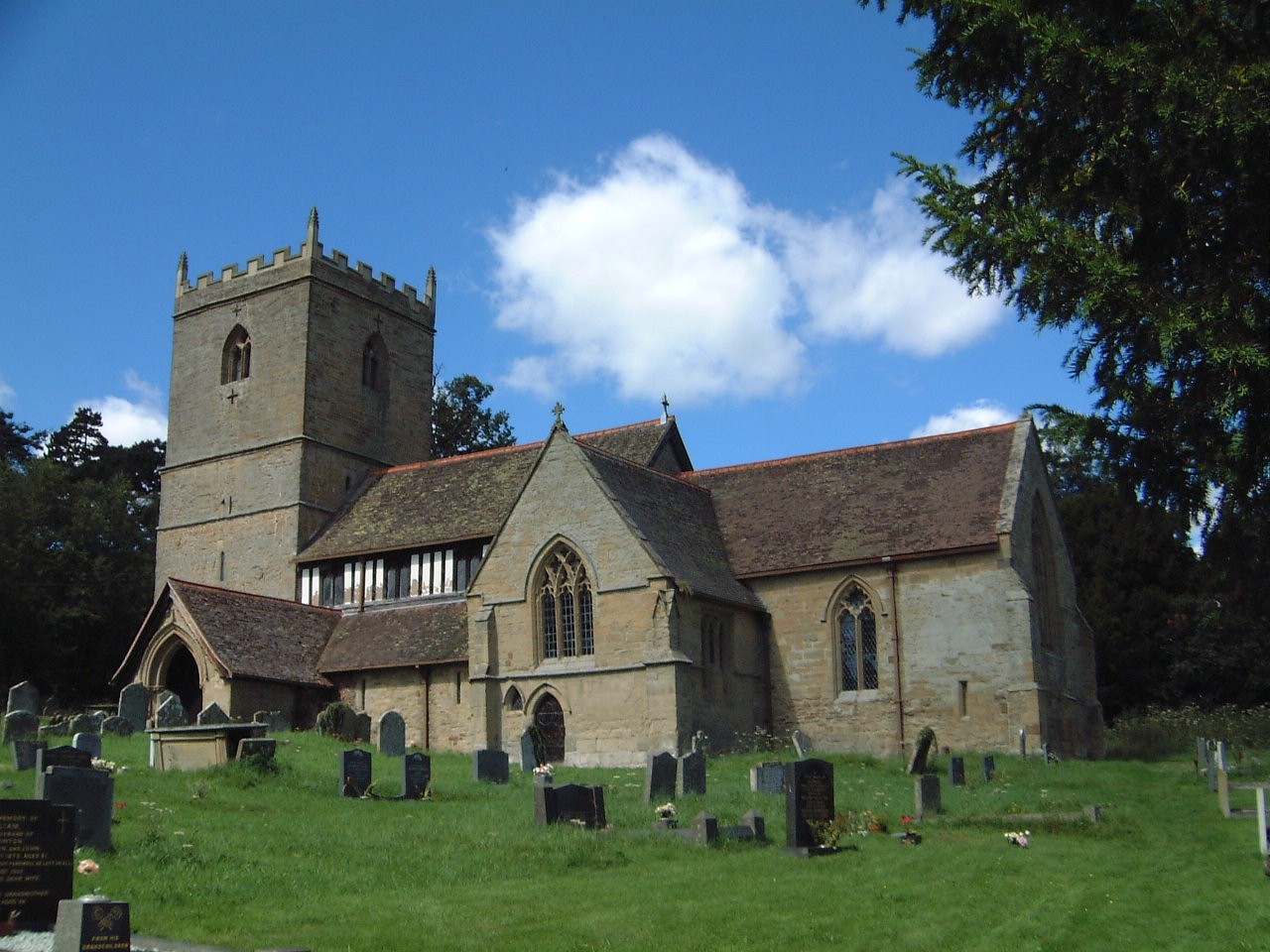
The village itself is comprised of a handful of charming cottages and houses, giving it a quaint and picturesque feel. The architecture reflects the traditional style of the region, with many buildings dating back several centuries. The community is tight-knit and friendly, with a strong sense of community spirit.

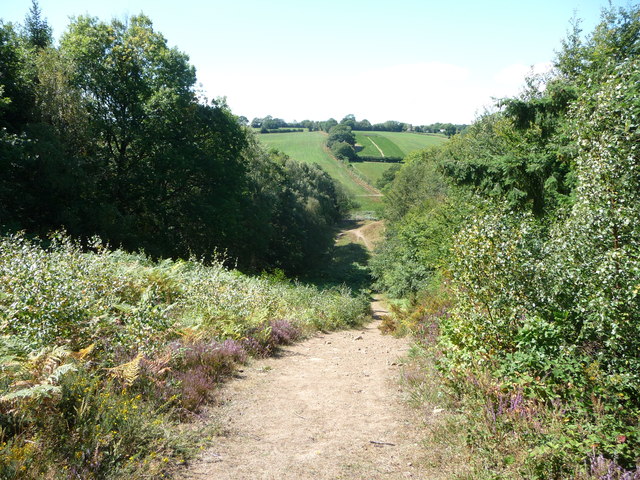
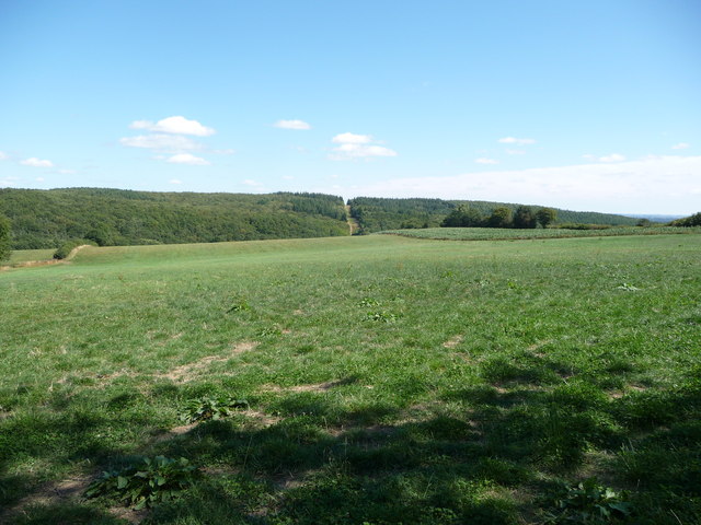
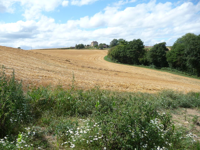
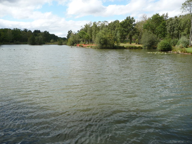
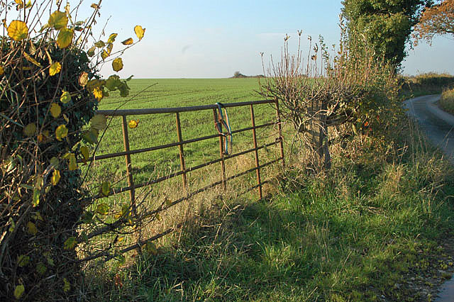
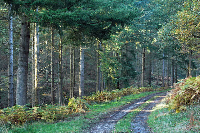
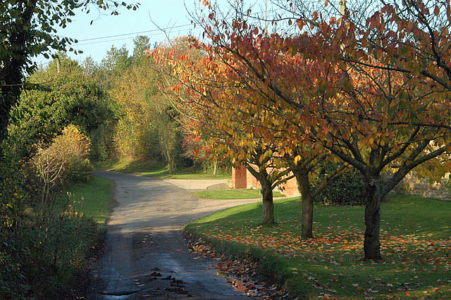
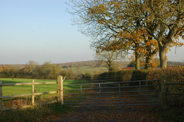
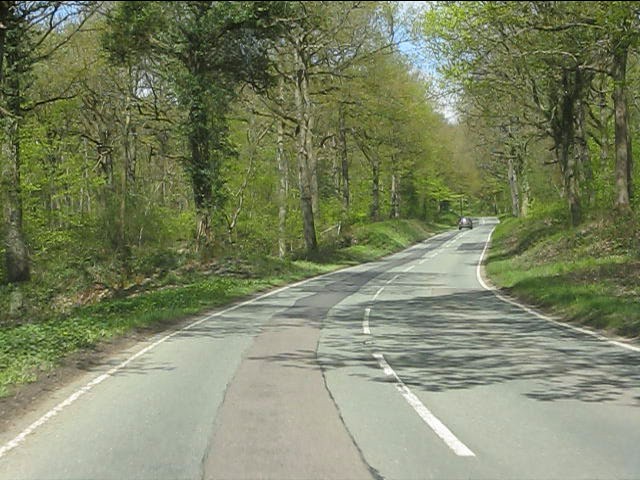
Nature lovers are drawn to Upper Wood due to its proximity to the expansive forest that surrounds the village. The forest is home to a diverse range of flora and fauna, providing ample opportunities for hiking, bird-watching, and other outdoor activities. The woodland trails are well-maintained and offer breathtaking views of the surrounding countryside.

Despite its rural location, Upper Wood is conveniently located near larger towns and cities. The village is within easy reach of the market town of Shrewsbury, which offers a range of amenities including shops, restaurants, and cultural attractions. The city of Birmingham is also within a reasonable distance, providing access to further amenities and transport links.

Overall, Upper Wood offers a peaceful and idyllic setting for those seeking a slower pace of life in the heart of nature. Its rich history, stunning landscapes, and close-knit community make it a truly special place to live or visit.

If you have any feedback on the listing, please let us know in the comments section below.

Upper Wood Images

Images are sourced within 2km of 52.396628/-2.4058841 or Grid Reference SO7277. Thanks to Geograph Open Source API. All images are credited.

House on the B4194 at Button Bridge Lane
Footpath in the Wyre Forest Looking westwards.
Footpath in the Wyre Forest
Looking westwards.
The Elan Valley pipeline in the Wyre Forest The break in the plantation shows the line of the water pipeline from near Winwoods Farm.
The Elan Valley pipeline in the Wyre Forest
The break in the plantation shows the line of the water pipeline from near Winwoods Farm.
Cottage renovation near Kingswood in the Wyre Forest I last came by this way five years ago and this place was under renovation then.
Cottage renovation near Kingswood in the Wyre Forest
I last came by this way five years ago and this place was under renovation then.
Cottage in the Wyre Forest near Kingswood A proper cottage.
Cottage in the Wyre Forest near Kingswood
A proper cottage.
Meaton Farm near the Wyre Forest The sort of farmhouse that any yeoman farmer would be proud to call his own.
Meaton Farm near the Wyre Forest
The sort of farmhouse that any yeoman farmer would be proud to call his own.
Fishery pool near the Wyre Forest "Water, water everywhere and not a drop to drink". On a really hot day long walk we had all but run out of water and the nice man here refilled our water bottles with crystal clear, cold Severn Trent's finest.
Fishery pool near the Wyre Forest
"Water, water everywhere and not a drop to drink". On a really hot day long walk we had all but run out of water and the nice man here refilled our water bottles with crystal clear, cold Severn Trent's finest.
Forestry track in the Wyre Forest, off the B4194 road The track is opposite the start of the forestry road to the Postensplain area of the forest. The forest was showing its autumnal colours on this sunny day in early November.
Forestry track in the Wyre Forest, off the B4194 road
The track is opposite the start of the forestry road to the Postensplain area of the forest. The forest was showing its autumnal colours on this sunny day in early November.
Trees in Wyre Forest in autumnal colours A sunny day in early November reveals the trees in their autumnal colours.
Trees in Wyre Forest in autumnal colours
A sunny day in early November reveals the trees in their autumnal colours.
Forestry road in the Wyre Forest in autumn This forestry road leads off the B4194 road. In early November the adjacent trees were in their autumnal colours.
Forestry road in the Wyre Forest in autumn
This forestry road leads off the B4194 road. In early November the adjacent trees were in their autumnal colours.
Disused gate
Disused gate
Little Meaton Farm
Little Meaton Farm
Woodland track
Woodland track
Silligrove in the autumn
Gate with barbed wire at Two Acres
B4194 at Lawleys Coppice
B4194 in Wyre Forest
B4194 at Buttonbridge A telephone box once existed by the bus shelter.
B4194 at Buttonbridge
A telephone box once existed by the bus shelter.
Show me another place!

Upper Wood is located at Grid Ref: SO7277 (Lat: 52.396628, Lng: -2.4058841)

Unitary Authority: Shropshire

Police Authority: West Mercia

What 3 Words

///earful.deeds.workouts. Near Cleobury Mortimer, Shropshire

Related Wikis

Wyre Forest railway station

Wyre Forest railway station was a station to the north of Far Forest, Worcestershire, England. The station which served the Wyre Forest was opened in 1869...

Kinlet

Kinlet is a small village and civil parish in the south-east of the county of Shropshire, England. The parish is on the northern edge of the Wyre Forest...

Coppicegate

Coppicegate is a small settlement in Shropshire, England. It is beside the Wyre Forest and is 10 kilometres (6 mi) northwest of Kidderminster. == External... ==

Button Oak

Button Oak is a small village in the English county of Shropshire, England. It is 3 miles north west of Bewdley. Button Oak is very similar to nearby...

Nearby Amenities

Located within 500m of 52.396628,-2.4058841
Man Made: manhole
Manhole: water
Pipeline: inspection chamber
Lat/Long: 52.3943647/-2.402106
Barrier: stile
Foot: yes
Lat/Long: 52.396147/-2.4083564
Man Made: manhole
Manhole: water
Pipeline: inspection chamber
Lat/Long: 52.3943414/-2.4022901
Man Made: manhole
Manhole: water
Pipeline: inspection chamber
Lat/Long: 52.3943841/-2.4019613
Generator Method: photovoltaic
Generator Output Electricity: yes
Generator Source: solar
Generator Type: solar_photovoltaic_panel
Location: roof
Power: generator
Lat/Long: 52.3951901/-2.4023312
The data included in this document is from www.openstreetmap.org. The data is made available under ODbL.

Have you been to Upper Wood?

Leave your review of Upper Wood below (or comments, questions and feedback).