South Loscombe Plantation

Wood, Forest in Dorset

England

South Loscombe Plantation

Winterborne Came: an autumny view of Came House Looking along the driveway to the house, with leaves all around.
Winterborne Came: an autumny view of Came House Credit: Chris Downer

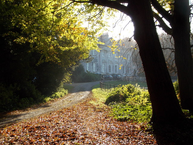
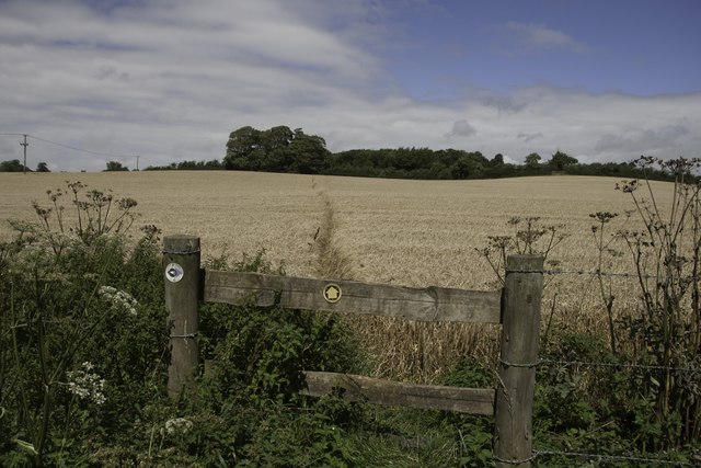
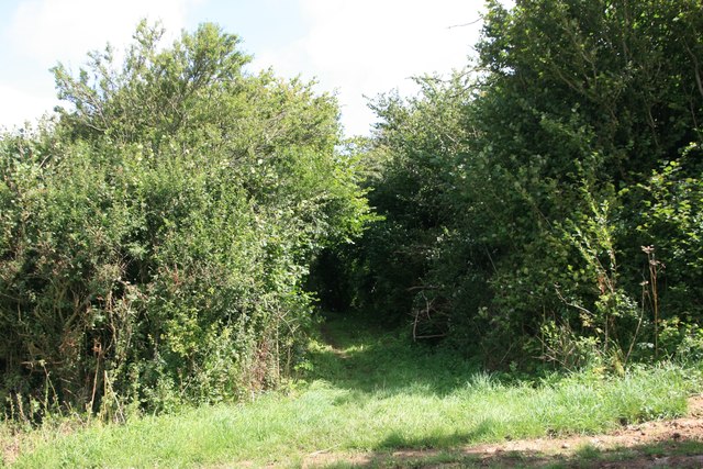
South Loscombe Plantation is a picturesque woodland located in the county of Dorset, England. Spread across an area of approximately 100 acres, this woodland is a popular destination for nature enthusiasts and outdoor adventurers alike.

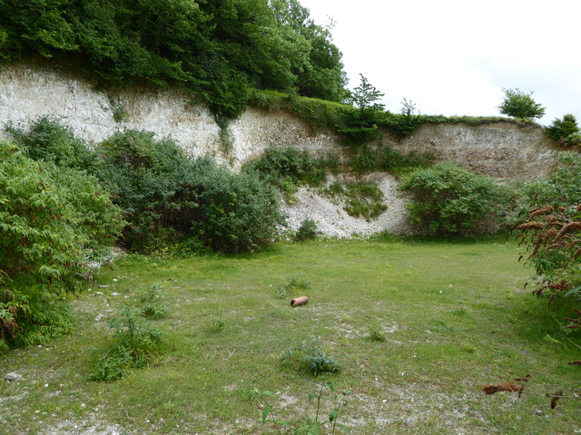
The plantation boasts a diverse range of tree species, including oak, beech, and pine, which create a stunning canopy of foliage throughout the year. The woodland floor is adorned with a rich variety of wildflowers, adding vibrant colors to the landscape. The plantation is also home to a thriving ecosystem of wildlife, including deer, foxes, and a wide array of bird species.

Visitors to South Loscombe Plantation can explore numerous well-maintained trails that wind through the woodland, providing an opportunity to immerse oneself in nature and enjoy the tranquility of the surroundings. These trails cater to all levels of fitness and offer a chance to observe the diverse flora and fauna that call the plantation home.

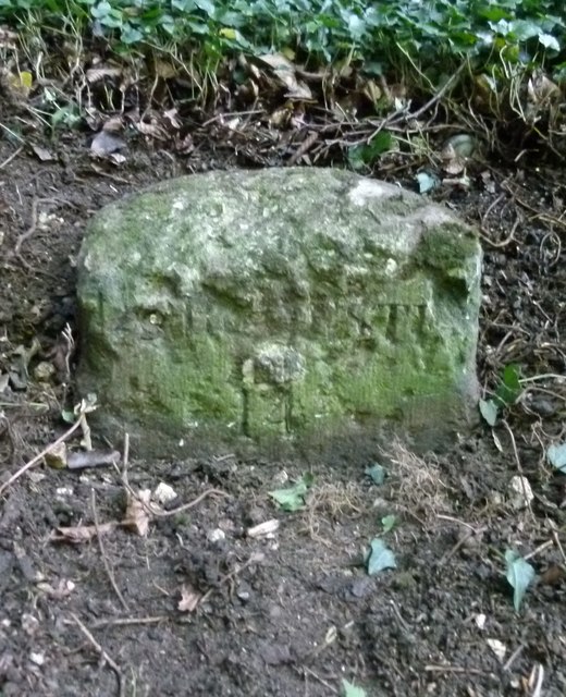
In addition to its natural beauty, South Loscombe Plantation also holds historical significance. The woodland has stood for centuries, with ancient remnants of a Roman road still visible in some areas. This adds an element of intrigue and fascination for history enthusiasts visiting the plantation.

South Loscombe Plantation is easily accessible, with ample parking facilities available nearby. The woodland provides a peaceful retreat from the hustle and bustle of everyday life, offering visitors a chance to reconnect with nature and enjoy the stunning beauty of Dorset's countryside.

If you have any feedback on the listing, please let us know in the comments section below.

South Loscombe Plantation Images

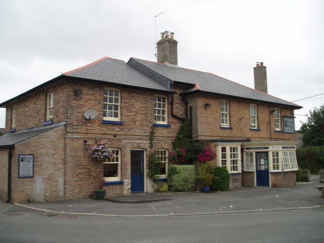
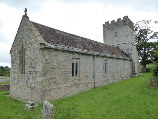
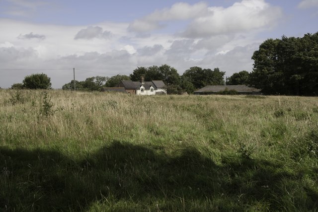
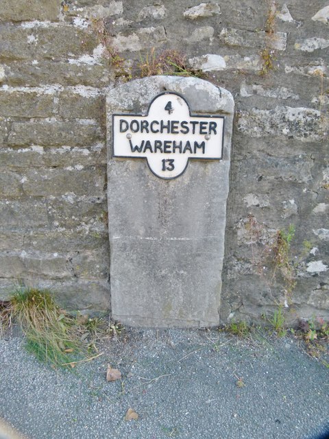
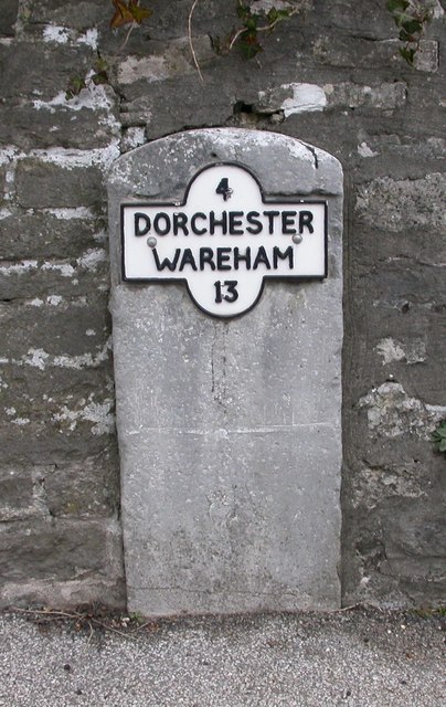
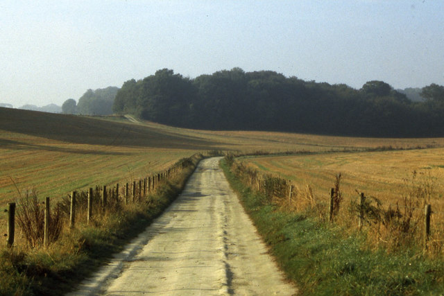
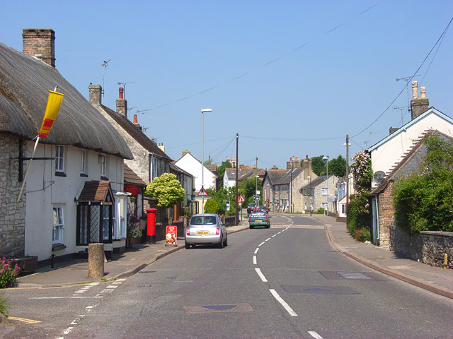
Images are sourced within 2km of 50.683608/-2.3967476 or Grid Reference SY7287. Thanks to Geograph Open Source API. All images are credited.

Winterborne Came: an autumny view of Came House Looking along the driveway to the house, with leaves all around.
Winterborne Came: an autumny view of Came House
Looking along the driveway to the house, with leaves all around.
Stafford Farm
Stafford Farm
Whitcombe Church, near Broadmayne, Dorset The church has no dedication but was built in the 12th Century. It is no longer used for regular worship, but several services are held each year in this delightful rural church.
Whitcombe Church, near Broadmayne, Dorset
The church has no dedication but was built in the 12th Century. It is no longer used for regular worship, but several services are held each year in this delightful rural church.
St Martin's Church, Broadmayne
The Black Dog, Broadmayne
Brick Hill Plantation, Jubilee Trail and Cole Hill Wood
Chalk Pit on Whitcombe Hill
Whitcombe Church
Whitcombe Church
Little Mayne Farm
Little Mayne Farm
St Peter's Church, West Knighton Thomas Hardy was involved in the reconstruction of this church in the 19th Century.
St Peter's Church, West Knighton
Thomas Hardy was involved in the reconstruction of this church in the 19th Century.
Footpath near Lower Glebe Farm There is a junction in the footpaths here, a local footpath heading north towards West Stafford and the Jubilee Trail heading west.
Footpath near Lower Glebe Farm
There is a junction in the footpaths here, a local footpath heading north towards West Stafford and the Jubilee Trail heading west.
Footpath to A352
Footpath to A352
Old Milestone by the A352, West Knighton Carved stone post by the A352, in parish of West Knighton (West Dorset District), just North of turning to West Knighton, on bank next to road approx 10m North of council storage site, on North-East side of road. Dorset 3 (limestone), erected by the Dorchester & Wool Turnpike Trust in the 19th century. 

The partially lost inscription reads:-
DORCHESTER
3
WAREHAM
(14)

Milestone Society National ID: DO_DOWA03.
Old Milestone by the A352, West Knighton
Carved stone post by the A352, in parish of West Knighton (West Dorset District), just North of turning to West Knighton, on bank next to road approx 10m North of council storage site, on North-East side of road. Dorset 3 (limestone), erected by the Dorchester & Wool Turnpike Trust in the 19th century. The partially lost inscription reads:- DORCHESTER 3 WAREHAM (14) Milestone Society National ID: DO_DOWA03.
Old Milestone by the A352, Broadmayne Metal plate attached to stone post by the A352, in parish of Broadmayne (West Dorset District), by Broadmayne Church, set into wall at south end of lay-by by church, on North-east side of road. Dorset 3 and 4 (iron plated), erected by the Dorchester & Wool Turnpike Trust in the 19th century. 

Inscription reads:-
4
DORCHESTER
WAREHAM
13 

Milestone Society National ID: DO_DOWA04.
Old Milestone by the A352, Broadmayne
Metal plate attached to stone post by the A352, in parish of Broadmayne (West Dorset District), by Broadmayne Church, set into wall at south end of lay-by by church, on North-east side of road. Dorset 3 and 4 (iron plated), erected by the Dorchester & Wool Turnpike Trust in the 19th century. Inscription reads:- 4 DORCHESTER WAREHAM 13 Milestone Society National ID: DO_DOWA04.
Old Milestone by the A352,  Main Street, Broadmayne Metal plate attached to stone post by the A352, in parish of BROADMAYNE (WEST DORSET District), by Broadmayne Church, set into wall at south end of lay-by near church, on North side of road. Dorset 3 and 4 (iron plated), erected by the Dorchester & Wool turnpike trust in the 19th century. 

Inscription reads:-
4
DORCHESTER
WAREHAM
13

Milestone Society National ID: DO_DOWA04R.
Old Milestone by the A352, Main Street, Broadmayne
Metal plate attached to stone post by the A352, in parish of BROADMAYNE (WEST DORSET District), by Broadmayne Church, set into wall at south end of lay-by near church, on North side of road. Dorset 3 and 4 (iron plated), erected by the Dorchester & Wool turnpike trust in the 19th century. Inscription reads:- 4 DORCHESTER WAREHAM 13 Milestone Society National ID: DO_DOWA04R.
On the Jubilee Trail south of Winterbourne Came
The Black Dog Inn, Broadmayne
Thatched house and village post office, Broadmayne
Show me another place!

South Loscombe Plantation is located at Grid Ref: SY7287 (Lat: 50.683608, Lng: -2.3967476)

Unitary Authority: Dorset

Police Authority: Dorset

What 3 Words

///gloom.rational.lasted. Near Dorchester, Dorset

Nearby Locations

South Loscombe Plantation

Related Wikis

Whitcombe, Dorset

Whitcombe is a small village and civil parish in the Dorset unitary authority area of Dorset, England, situated 2 miles (3.2 km) southeast of Dorchester...

Mayne Preceptory

Mayne Preceptory was a medieval house of Knights Hospitaller in Dorset, England, which caused the name of the settlement to change from Domesday-era Maine...
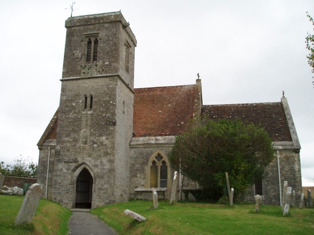
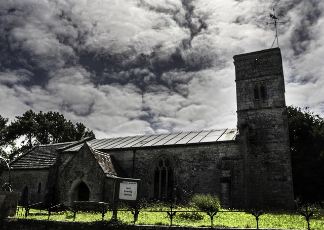
Whitcombe Church

Whitcombe Church in Whitcombe, Dorset, England was built in the 12th century. It is recorded in the National Heritage List for England as a designated...

Broadmayne

Broadmayne is a village in the English county of Dorset. It lies two miles south-east of the county town Dorchester. The A352 main road between Dorchester...

Nearby Amenities

Located within 500m of 50.683608,-2.3967476
Material: wood
Power: pole
Source: bing
Transformer: distribution
Lat/Long: 50.687611/-2.3937934
Material: wood
Power: pole
Source: bing
Lat/Long: 50.6876685/-2.3953521
Power: pole
Source: bing
Lat/Long: 50.6877928/-2.3986327
Poles: bipole
Power: pole
Source: bing
Transformer: distribution
Lat/Long: 50.6877349/-2.3970541
Mayne Stone Circle
Archaeological Site: megalith
Historic: archaeological_site
Megalith Type: stone_circle
Note: Added as a point as circle is in trees and not visible on satellite imagery
Source: https://historicengland.org.uk/listing/the-list/list-entry/1002697
Wikidata: Q17650754
Lat/Long: 50.6826666/-2.3933915
The data included in this document is from www.openstreetmap.org. The data is made available under ODbL.

Have you been to South Loscombe Plantation?

Leave your review of South Loscombe Plantation below (or comments, questions and feedback).