Eastfield Plantation

Wood, Forest in Dorset

England

Eastfield Plantation

Old Bridge Marker on King's Stag Bridge, The Common, Pulham parish Bridge Marker by the UC road, in parish of Pulham (North Dorset District), The Common, King's Stag Bridge.

Inscription reads:-
DORSET
ANY PERSON WILFULLY INJURING
ANY PART OF THIS COUNTY BRIDGE
WILL BE GUILTY OF FELONY AND
UPON CONVICTION LIABLE TO BE
TRANSPORTED FOR LIFE
BY THE COURT
7&8 GEO 4 C30 S13 T FOOKS

King's Stag Bridge is Grade II listed in two parts - one part for each parish.
Hazlebury Bryan parish - List Entry Number: 1287981 <span class="nowrap"><a title="https://historicengland.org.uk/listing/the-list/list-entry/1287981" rel="nofollow ugc noopener" href="https://historicengland.org.uk/listing/the-list/list-entry/1287981">Link</a><img style="margin-left:2px;" alt="External link" title="External link - shift click to open in new window" src="https://s1.geograph.org.uk/img/external.png" width="10" height="10"/></span>
Pulham parish - List Entry Number: 1228069 <span class="nowrap"><a title="https://historicengland.org.uk/listing/the-list/list-entry/1228069" rel="nofollow ugc noopener" href="https://historicengland.org.uk/listing/the-list/list-entry/1228069">Link</a><img style="margin-left:2px;" alt="External link" title="External link - shift click to open in new window" src="https://s1.geograph.org.uk/img/external.png" width="10" height="10"/></span>

Surveyed

Milestone Society National ID: DO_TRAKISbr
Old Bridge Marker on King's Stag Bridge, The Common, Pulham parish Credit: Milestone Society

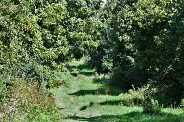
Eastfield Plantation is a picturesque woodland located in the county of Dorset, England. Covering an expansive area, it is a haven for nature enthusiasts and outdoor adventurers alike.

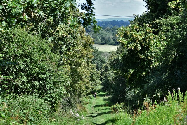
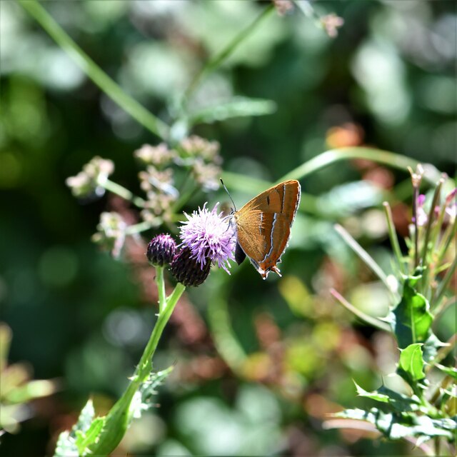
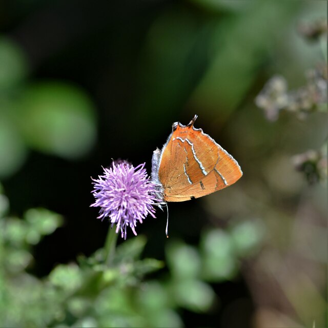
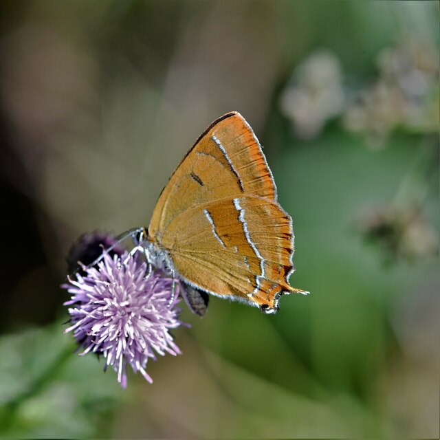
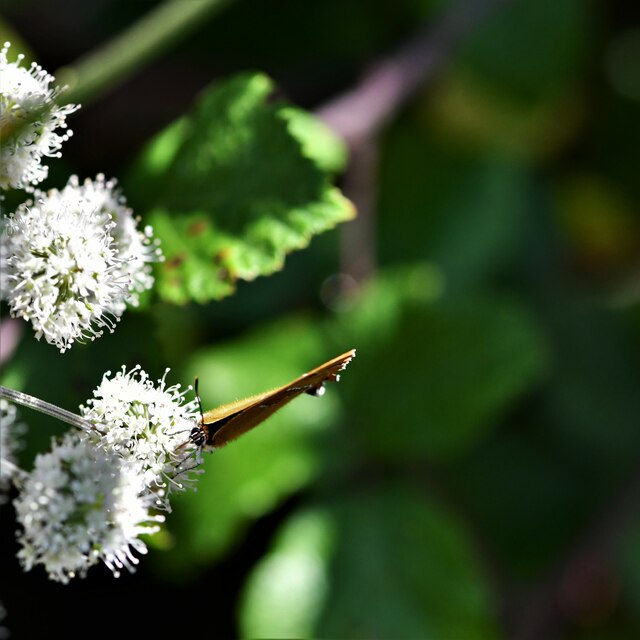
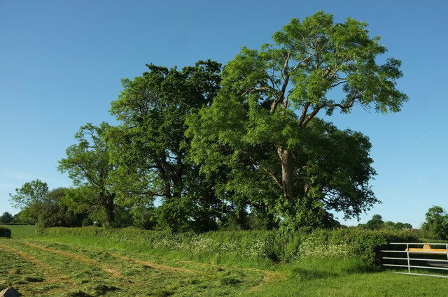
Situated in the heart of the Dorset countryside, Eastfield Plantation boasts a diverse range of flora and fauna, making it a significant ecological hotspot. The woodland is characterized by its dense canopy of towering trees, including oak, beech, and chestnut, which provide a habitat for a multitude of bird species, small mammals, and insects.

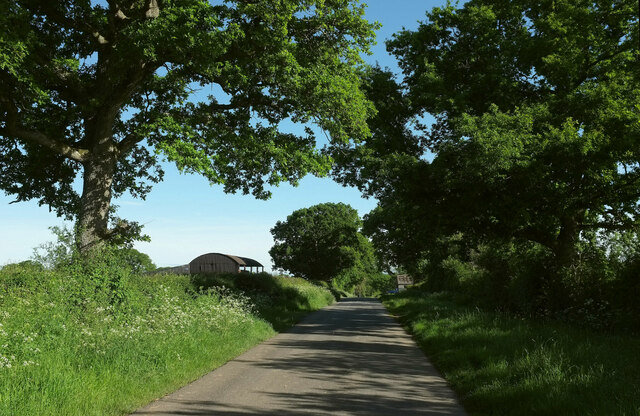
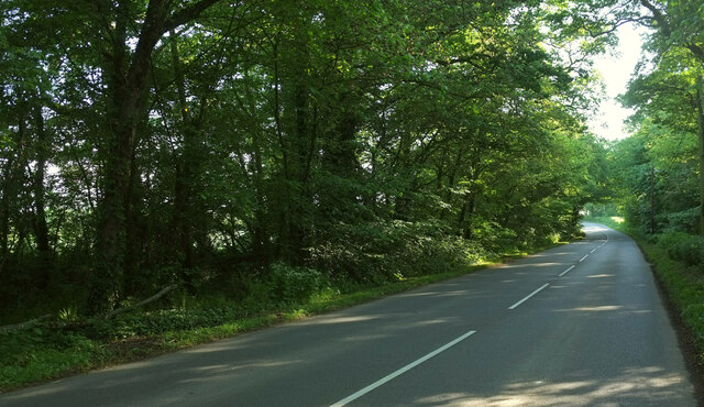
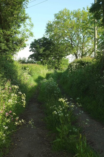
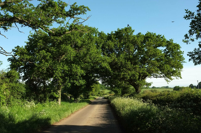
The plantation features a network of well-maintained walking trails, allowing visitors to explore its natural beauty at their own pace. Whether it's a leisurely stroll or an invigorating hike, there are options to suit every level of fitness and interest. Along the way, hikers may encounter babbling brooks, wildflowers, and even the occasional deer.

For those seeking a more immersive experience, Eastfield Plantation offers camping facilities. Set amidst the tranquil surroundings, campers have the opportunity to spend the night under a starlit sky, surrounded by the sounds of nature.

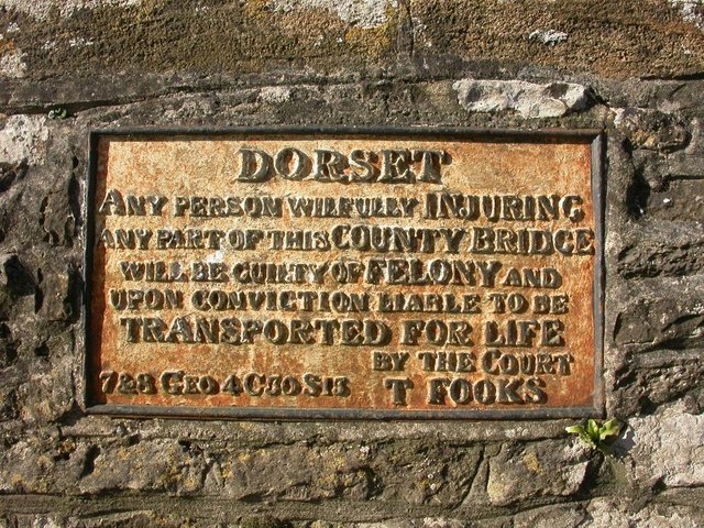
In addition to its natural appeal, Eastfield Plantation also has a rich historical background. It is believed to have been part of an ancient forest that spanned the region centuries ago, and evidence of human activity can be traced back to prehistoric times.

Overall, Eastfield Plantation is a captivating woodland that offers a breathtaking escape from the bustle of everyday life. Its combination of natural beauty, diverse wildlife, and historical significance make it a must-visit destination for anyone exploring the Dorset area.

If you have any feedback on the listing, please let us know in the comments section below.

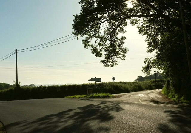
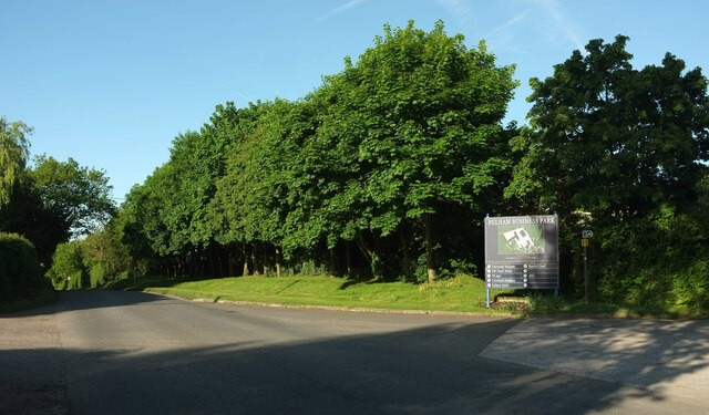
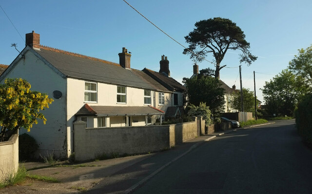
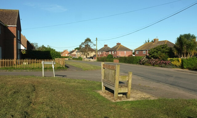
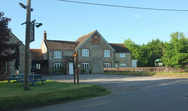
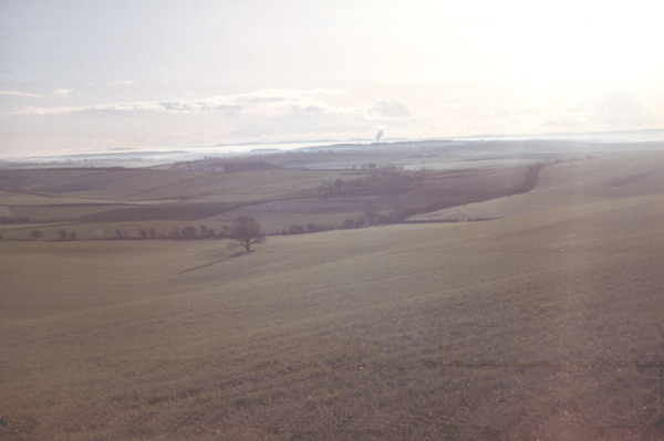
Eastfield Plantation Images

Images are sourced within 2km of 50.881664/-2.398542 or Grid Reference ST7209. Thanks to Geograph Open Source API. All images are credited.

Old Bridge Marker on King's Stag Bridge, The Common, Pulham parish Bridge Marker by the UC road, in parish of Pulham (North Dorset District), The Common, King's Stag Bridge.

Inscription reads:-
DORSET
ANY PERSON WILFULLY INJURING
ANY PART OF THIS COUNTY BRIDGE
WILL BE GUILTY OF FELONY AND
UPON CONVICTION LIABLE TO BE
TRANSPORTED FOR LIFE
BY THE COURT
7&8 GEO 4 C30 S13 T FOOKS

King's Stag Bridge is Grade II listed in two parts - one part for each parish.
Hazlebury Bryan parish - List Entry Number: 1287981 <span class="nowrap"><a title="https://historicengland.org.uk/listing/the-list/list-entry/1287981" rel="nofollow ugc noopener" href="https://historicengland.org.uk/listing/the-list/list-entry/1287981">Link</a><img style="margin-left:2px;" alt="External link" title="External link - shift click to open in new window" src="https://s1.geograph.org.uk/img/external.png" width="10" height="10"/></span>
Pulham parish - List Entry Number: 1228069 <span class="nowrap"><a title="https://historicengland.org.uk/listing/the-list/list-entry/1228069" rel="nofollow ugc noopener" href="https://historicengland.org.uk/listing/the-list/list-entry/1228069">Link</a><img style="margin-left:2px;" alt="External link" title="External link - shift click to open in new window" src="https://s1.geograph.org.uk/img/external.png" width="10" height="10"/></span>

Surveyed

Milestone Society National ID: DO_TRAKISbr
Old Bridge Marker on King's Stag Bridge, The Common, Pulham parish
Bridge Marker by the UC road, in parish of Pulham (North Dorset District), The Common, King's Stag Bridge. Inscription reads:- DORSET ANY PERSON WILFULLY INJURING ANY PART OF THIS COUNTY BRIDGE WILL BE GUILTY OF FELONY AND UPON CONVICTION LIABLE TO BE TRANSPORTED FOR LIFE BY THE COURT 7&8 GEO 4 C30 S13 T FOOKS King's Stag Bridge is Grade II listed in two parts - one part for each parish. Hazlebury Bryan parish - List Entry Number: 1287981 LinkExternal link Pulham parish - List Entry Number: 1228069 LinkExternal link Surveyed Milestone Society National ID: DO_TRAKISbr
Passing Holwell Hill Farm On the lane from Pulham to Holwell.
Passing Holwell Hill Farm
On the lane from Pulham to Holwell.
Alners Gorse Butterfly Reserve: Main track
Alners Gorse Butterfly Reserve: Sign
Alners Gorse Butterfly Reserve: Main track
Alners Gorse Butterfly Reserve: Brown Hairstreak 'Thecla betulae' 1
Alners Gorse Butterfly Reserve: Brown Hairstreak 'Thecla betulae' 2
Alners Gorse Butterfly Reserve: Brown Hairstreak 'Thecla betulae' 3
Alners Gorse Butterfly Reserve: Brown Hairstreak 'Thecla betulae' 4
B3143 northeast of Pulham The B road runs between two narrow belts of trees towards King's Stag.
B3143 northeast of Pulham
The B road runs between two narrow belts of trees towards King's Stag.
Footpath, Furze Hill Footpath N49 14 runs along this track between hedges from the B3143 before turning left to cross fields.
Footpath, Furze Hill
Footpath N49 14 runs along this track between hedges from the B3143 before turning left to cross fields.
Lane to Holwell Roadside trees on a straight lane passing Oakwood View.
Lane to Holwell
Roadside trees on a straight lane passing Oakwood View.
Grass triangle near Pulham Part of a staggered crossroads on the B3143, bearing left here. The turning on the right is Cannings Court Lane, a no through road.
Grass triangle near Pulham
Part of a staggered crossroads on the B3143, bearing left here. The turning on the right is Cannings Court Lane, a no through road.
Trees near Hartmoor Farm Along the lane from Holwell to Pulham.
Trees near Hartmoor Farm
Along the lane from Holwell to Pulham.
B3143 at Pulham Business Park The board lists seven enterprises in the park's four buildings.
B3143 at Pulham Business Park
The board lists seven enterprises in the park's four buildings.
Houses at Pulham Alongside the B3143.
Houses at Pulham
Alongside the B3143.
Pulham Not the prettiest of Dorset villages. The B3143 on the right passes through; the turning on the left is Halsey Green. The church is isolated on a side road off to the east <a title="https://www.geograph.org.uk/gridref/ST7108?centi=ST711085" href="https://www.geograph.org.uk/gridref/ST7108?centi=ST711085">Link</a> .
Pulham
Not the prettiest of Dorset villages. The B3143 on the right passes through; the turning on the left is Halsey Green. The church is isolated on a side road off to the east Link .
The Halsey Arms, Pulham The pub is set back from the B3143 (foreground).
The Halsey Arms, Pulham
The pub is set back from the B3143 (foreground).
Show me another place!

Eastfield Plantation is located at Grid Ref: ST7209 (Lat: 50.881664, Lng: -2.398542)

Unitary Authority: Dorset

Police Authority: Dorset

What 3 Words

///greed.honeybees.charmingly. Near Sturminster Newton, Dorset

Related Wikis

Pulham

Pulham is a village and civil parish in the county of Dorset in south-west England. It is situated in the Blackmore Vale, 7 miles (11 kilometres) southeast...

King's Stag Memorial Chapel

King's Stag Memorial Chapel is a Church of England chapel in King's Stag, Dorset, England. == History == The memorial chapel at King's Stag was built in...

Holwell, Dorset

Holwell is a village and civil parish in the county of Dorset in southern England, situated approximately 5 miles (8.0 km) south-east of Sherborne. It...

Hazelbury Bryan

Hazelbury Bryan is a village and civil parish in the county of Dorset in southern England. It is situated in the Blackmore Vale, approximately five miles...

Dorset Downs

The Dorset Downs are an area of chalk downland in the centre of the county Dorset in south west England. The downs are the most western part of a larger...

Woodbridge, Dorset

Woodbridge is a hamlet in Dorset, England. The village is on the A3030 road and to the north east of Holwell. == History == Woodbridge was part of the...

Mappowder

Mappowder is a village and civil parish in the county of Dorset in southern England. The parish lies approximately 9 miles (14 kilometres) southeast of...

Dungeon Hill

Dungeon Hill is an Iron Age hillfort, about 1+1⁄4 miles (2 kilometres) north of the village of Buckland Newton in Dorset, England. It is a scheduled monument...

Nearby Amenities

Located within 500m of 50.881664,-2.398542
Colour: gray
Design: portal
Line Attachment: suspension
Material: metal
Power: tower
Source: bing
Structure: lattice
Lat/Long: 50.8774528/-2.3990994
Colour: gray
Design: portal
Line Attachment: suspension
Material: metal
Power: tower
Source: bing
Structure: lattice
Lat/Long: 50.8780281/-2.4016405
Material: wood
Power: pole
Source: bing
Lat/Long: 50.8812096/-2.4056099
Material: wood
Power: pole
Source: bing
Transformer: distribution
Lat/Long: 50.8813843/-2.404716
Power: pole
Source: bing
Lat/Long: 50.8802361/-2.4044354
Power: pole
Source: bing
Lat/Long: 50.8805204/-2.4044837
Power: pole
Source: bing
Lat/Long: 50.8809341/-2.4045548
Power: pole
Source: bing
Lat/Long: 50.8815679/-2.405106
Power: pole
Source: bing
Lat/Long: 50.8817862/-2.4056263
The data included in this document is from www.openstreetmap.org. The data is made available under ODbL.

Have you been to Eastfield Plantation?

Leave your review of Eastfield Plantation below (or comments, questions and feedback).