Ockington Coppice

Wood, Forest in Gloucestershire Forest of Dean

England

Ockington Coppice

M50 westbound at Bromsberrow Heath
M50 westbound at Bromsberrow Heath Credit: Colin Pyle

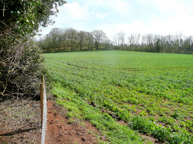
Ockington Coppice is a picturesque woodland located in Gloucestershire, England. Spread over an area of approximately 50 acres, the coppice is renowned for its natural beauty, diverse flora, and serene atmosphere. The woodland is situated within the Forest of Dean, a region famous for its ancient woodlands and rich wildlife.

The coppice consists primarily of broadleaf trees, including oak, beech, and ash, which create a dense canopy overhead, providing shade and shelter for the diverse range of plants and animals that call the woodland home. In spring, the forest floor is adorned with a vibrant carpet of bluebells, creating a truly enchanting sight.

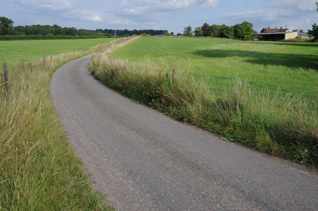
The woodland is crisscrossed by a network of well-maintained footpaths and trails, allowing visitors to explore its beauty at their own pace. These pathways lead walkers through a variety of habitats, from sun-dappled glades to moss-covered streams, providing ample opportunities to observe the local wildlife. Birdwatchers will be delighted to spot species such as woodpeckers, nuthatches, and tawny owls in the canopy.

Ockington Coppice is also a haven for wildlife enthusiasts, as it is home to a range of animals, including deer, badgers, and foxes. In addition to the resident mammals, the woodland attracts a multitude of insects, making it a prime location for butterfly and dragonfly spotting.

Overall, Ockington Coppice offers a serene retreat for nature lovers, with its tranquil ambiance, stunning scenery, and abundance of flora and fauna. Whether one is seeking a peaceful walk, a spot of birdwatching, or simply a moment of solitude in nature, this woodland provides the perfect escape.

If you have any feedback on the listing, please let us know in the comments section below.

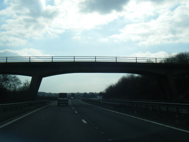
Ockington Coppice Images

Images are sourced within 2km of 51.990814/-2.4146103 or Grid Reference SO7132. Thanks to Geograph Open Source API. All images are credited.

M50 westbound at Bromsberrow Heath
M50 near Ryton
M50 near Ryton
M50 about to pass under a farm access road
Bridleway to Ever Hill Coppice Deeply indented green lane popular with dog-walkers.
Bridleway to Ever Hill Coppice
Deeply indented green lane popular with dog-walkers.
Ryton Coppice View from the bridleway east of Ryton.
Ryton Coppice
View from the bridleway east of Ryton.
Wild daffodils by the M50 On this last day of March 2011, the flowers are starting to senesce.
Wild daffodils by the M50
On this last day of March 2011, the flowers are starting to senesce.
Country road at Donnington Country road near Donnington Court Farm and Donnington church.
Country road at Donnington
Country road near Donnington Court Farm and Donnington church.
Lane near Knight's Green A bit of February Fill-Dyke going on to the right of the road.
Lane near Knight's Green
A bit of February Fill-Dyke going on to the right of the road.
Old cider orchard A remnant of much larger plantations of orchards in West Gloucestershire.
Old cider orchard
A remnant of much larger plantations of orchards in West Gloucestershire.
Dymock Cricket Club home ground Off Crowfield Lane, east of the village.
Dymock Cricket Club home ground
Off Crowfield Lane, east of the village.
Lane towards Greenway Bridge The bridge over the River Leadon is in the distance where the lane rises slightly.
Lane towards Greenway Bridge
The bridge over the River Leadon is in the distance where the lane rises slightly.
St Mary's Church, Donnington Although dating from 1300, it was much restored and extended around 1870.
St Mary's Church, Donnington
Although dating from 1300, it was much restored and extended around 1870.
Copse of Trees in field near Donnington
Cows in Field near Smallends Farm
Oast at Smallends Farm Unconverted Oast House, with "Herefordshire style" cowl.
Oast at Smallends Farm
Unconverted Oast House, with "Herefordshire style" cowl.
Oast at Smallends Farm Single square kiln oast house. Unusually narrow kiln.
Oast at Smallends Farm
Single square kiln oast house. Unusually narrow kiln.
Lane Junction near Broom's Green
Main Road at Broom's Green
Show me another place!

Ockington Coppice is located at Grid Ref: SO7132 (Lat: 51.990814, Lng: -2.4146103)

Administrative County: Gloucestershire

District: Forest of Dean

Police Authority: Gloucestershire

What 3 Words

///flips.chuckling.investor. Near Donnington, Herefordshire

Related Wikis

Vell Mill Daffodil Meadow

Vell Mill Daffodil Meadow (grid reference SO710314) is a 2.1-hectare (5.2-acre) nature reserve in Gloucestershire.The site is owned and managed by the...

Three Counties (Gloucestershire, Herefordshire and Worcestershire)

The Three Counties of England are traditionally the three agrarian counties of Gloucestershire, Herefordshire and Worcestershire.Including towns and cities...

Donnington, Herefordshire

Donnington is a village and civil parish near Ledbury. == Parish church == The parish church is dedicated to Saint Mary. Donnington Hall is located here...

Ketford Bank

Ketford Bank (grid reference SO723308) is a 0.69-hectare (1.7-acre) nature reserve in Gloucestershire.The site is owned and managed by the Gloucestershire...

Nearby Amenities

Located within 500m of 51.990814,-2.4146103
Natural: spring
Source: OS 1:25k
Lat/Long: 51.9909164/-2.4101466
Brooms Green
Place: hamlet
Source: OS 1:25k
Lat/Long: 51.9942923/-2.4162299
Barrier: stile
Lat/Long: 51.9914322/-2.4189616
Barrier: stile
Lat/Long: 51.9915595/-2.4189716
Barrier: stile
Lat/Long: 51.992731/-2.4187027
Barrier: stile
Lat/Long: 51.9933609/-2.4185451
Barrier: stile
Lat/Long: 51.9933971/-2.4185681
Post Box
Collection Times: Mo-Fr 16:30; Sa 08:15
Post Box Type: lamp
Ref: GL18 333
Royal Cypher: EIIR
Royal Cypher Wikidata: Q33102113
Lat/Long: 51.9941957/-2.4190766
Barrier: stile
Source: survey+gps
Lat/Long: 51.9941748/-2.4164532
Barrier: stile
Source: survey+gps
Lat/Long: 51.9943433/-2.4162976
Barrier: stile
Source: survey+gps
Lat/Long: 51.9944883/-2.4161218
Generator Method: photovoltaic
Generator Output Electricity: yes
Generator Source: solar
Generator Type: solar_photovoltaic_panel
Location: roof
Power: generator
Lat/Long: 51.9933981/-2.416276
Power: pole
Lat/Long: 51.9877465/-2.4165456
Hill Farm Dymcock
Power: pole
Transformer: distribution
Voltage Primary: 11000
Lat/Long: 51.9875012/-2.4156792
Power: pole
Lat/Long: 51.987381/-2.4181911
Power: pole
Lat/Long: 51.9880707/-2.4177016
Power: pole
Lat/Long: 51.9884134/-2.4189328
Power: pole
Lat/Long: 51.9887491/-2.4201357
Power: pole
Lat/Long: 51.9890914/-2.4213595
Power: pole
Lat/Long: 51.989838/-2.4208707
Power: pole
Lat/Long: 51.990597/-2.4203832
Power: pole
Lat/Long: 51.9913026/-2.4199171
Power: pole
Lat/Long: 51.9920215/-2.4194524
Power: pole
Lat/Long: 51.9930472/-2.418633
Power: pole
Lat/Long: 51.9927296/-2.4189965
Broom's Green West
Power: pole
Transformer: distribution
Voltage Primary: 11000
Lat/Long: 51.9939064/-2.4193472
Power: pole
Lat/Long: 51.9935559/-2.4186008
Whites Farm
Power: pole
Transformer: distribution
Voltage Primary: 11000
Lat/Long: 51.9933775/-2.4179504
Power: pole
Lat/Long: 51.9933874/-2.4182408
Power: pole
Lat/Long: 51.9938106/-2.4177325
Power: pole
Lat/Long: 51.9941157/-2.4174173
Broom's Green
Power: pole
Transformer: distribution
Voltage Primary: 11000
Lat/Long: 51.9944729/-2.4172416
The data included in this document is from www.openstreetmap.org. The data is made available under ODbL.

Have you been to Ockington Coppice?

Leave your review of Ockington Coppice below (or comments, questions and feedback).