Hammerley Wood

Wood, Forest in Gloucestershire

England

Hammerley Wood

Tortworth lodges
Tortworth lodges Credit: don cload

Hammerley Wood is a picturesque forest located in the county of Gloucestershire, England. Spread across an expansive area of land, this woodland is a haven for nature enthusiasts and those seeking tranquility away from the hustle and bustle of urban life.

The forest is predominantly composed of native broadleaf trees, including oak, beech, and birch. These towering giants provide a dense canopy, creating a cool and shaded atmosphere even on the hottest summer days. The woodland floor is carpeted with lush green vegetation, consisting of ferns, mosses, and wildflowers, adding to the enchanting beauty of the area.

Hammerley Wood is home to a diverse range of wildlife, including numerous bird species such as woodpeckers, owls, and warblers. The forest also provides a habitat for mammals such as deer, foxes, and badgers, making it a popular spot for wildlife enthusiasts and photographers.

The wood is crisscrossed with a network of well-maintained footpaths and trails, making it easily accessible to visitors. These paths meander through the forest, offering stunning views and opportunities for exploration. There are also designated picnic areas and benches, allowing visitors to relax and immerse themselves in the peaceful surroundings.

Hammerley Wood is particularly beautiful in the autumn when the foliage transforms into a vibrant display of reds, oranges, and yellows. This makes it a popular destination for photographers and nature lovers seeking to capture the essence of the season.

Overall, Hammerley Wood is a captivating and tranquil woodland that offers a sanctuary for both wildlife and visitors alike. Its natural splendor and serenity make it a cherished gem in the heart of Gloucestershire.

If you have any feedback on the listing, please let us know in the comments section below.

Hammerley Wood Images

Images are sourced within 2km of 51.621499/-2.4218939 or Grid Reference ST7091. Thanks to Geograph Open Source API. All images are credited.

Tortworth lodges
Tortworth lodges
Charfield railway station (site), Gloucestershire Opened in 1844 on what became the Midland Railway's line from Gloucester to Bristol, this station closed in 1965. 
View south towards Wickwar and Bristol. The two parallel platforms have been removed but the station buildings to the left of the line in the middle distance were still extant when this image was taken.
Charfield railway station (site), Gloucestershire
Opened in 1844 on what became the Midland Railway's line from Gloucester to Bristol, this station closed in 1965. View south towards Wickwar and Bristol. The two parallel platforms have been removed but the station buildings to the left of the line in the middle distance were still extant when this image was taken.
Entrance drive to Tortworth Court Hotel
Church tower, Tortworth, South Gloucestershire On the west side of Grade II (Star) Listed St Leonard's Church
in the Church of England Diocese of Gloucester.
Church tower, Tortworth, South Gloucestershire
On the west side of Grade II (Star) Listed St Leonard's Church in the Church of England Diocese of Gloucester.
Charfield - please drive carefully At the western edge of Charfield in South Gloucestershire, the 40mph speed limit drops to 30mph.
Charfield - please drive carefully
At the western edge of Charfield in South Gloucestershire, the 40mph speed limit drops to 30mph.
South side of Charfield Primary School, South Gloucestershire Distinctive building set back from Wotton Road.
<a title="https://www.geograph.org.uk/photo/7554968" href="https://www.geograph.org.uk/photo/7554968">Link</a> to a closer view of the nameboard.
South side of Charfield Primary School, South Gloucestershire
Distinctive building set back from Wotton Road. Link to a closer view of the nameboard.
Charfield Primary School nameboard, South Gloucestershire In July 2023 the board located here <a title="https://www.geograph.org.uk/photo/7554963" href="https://www.geograph.org.uk/photo/7554963">Link</a> shows that the school's motto is "Working Together .. Learning for Life"
Charfield Primary School nameboard, South Gloucestershire
In July 2023 the board located here Link shows that the school's motto is "Working Together .. Learning for Life"
North side of St John the Evangelist, Charfield, South Gloucestershire Grade II Listed Parish Church in the Church of England Diocese of Gloucester.
A cockerel weathervane is on top of the spire.
North side of St John the Evangelist, Charfield, South Gloucestershire
Grade II Listed Parish Church in the Church of England Diocese of Gloucester. A cockerel weathervane is on top of the spire.
Parish Church nameboard, Charfield, South Gloucestershire Located here <a title="https://www.geograph.org.uk/photo/7555043" href="https://www.geograph.org.uk/photo/7555043">Link</a> outside  St John the Evangelist church.
Parish Church nameboard, Charfield, South Gloucestershire
Located here Link outside St John the Evangelist church.
Pelican crossing, Wotton Road, Charfield, South Gloucestershire Chambers Dictionary states that pelican in this context is adapted from "pedestrian light controlled crossing".
Pelican crossing, Wotton Road, Charfield, South Gloucestershire
Chambers Dictionary states that pelican in this context is adapted from "pedestrian light controlled crossing".
Charfield War Memorial, South Gloucestershire  Viewed across Wotton Road. The Grade II Listed Portland stone War Memorial dates from 1920.
Charfield War Memorial, South Gloucestershire
Viewed across Wotton Road. The Grade II Listed Portland stone War Memorial dates from 1920.
Noticeboards under a weeping willow, Manor Lane, Charfield Near the corner of Wotton Road in Charfield, South Gloucestershire.
Noticeboards under a weeping willow, Manor Lane, Charfield
Near the corner of Wotton Road in Charfield, South Gloucestershire.
Dark green cabinets on a Charfield corner Two telecoms cabinets on the corner of Manor Lane 
and Wotton Road in Charfield, South Gloucestershire.
Dark green cabinets on a Charfield corner
Two telecoms cabinets on the corner of Manor Lane and Wotton Road in Charfield, South Gloucestershire.
Pear Tree Micro Pub name sign, Charfield, South Gloucestershire Viewed in July 2023. The sign has replaced this one <a title="https://www.geograph.org.uk/photo/3202182" href="https://www.geograph.org.uk/photo/3202182">Link</a> photographed in 2012 before the Pear Tree was a micro pub.
Pear Tree Micro Pub name sign, Charfield, South Gloucestershire
Viewed in July 2023. The sign has replaced this one Link photographed in 2012 before the Pear Tree was a micro pub.
SERVING ALE SINCE 1715, Charfield, South Gloucestershire On the wall of the Pear Tree Micro Pub in 2023.
SERVING ALE SINCE 1715, Charfield, South Gloucestershire
On the wall of the Pear Tree Micro Pub in 2023.
Welcome to CROMHALL -  Please drive carefully The 50mph speed limit on the B4058 Bristol Road in South Gloucestershire here drops to 30mph.
Welcome to CROMHALL - Please drive carefully
The 50mph speed limit on the B4058 Bristol Road in South Gloucestershire here drops to 30mph.
The Plough name sign, Wotton Road, Charfield, South Gloucestershire In July 2023 the sign shows that the Plough is a micro pub.
The Plough name sign, Wotton Road, Charfield, South Gloucestershire
In July 2023 the sign shows that the Plough is a micro pub.
Old tractor outside the Plough, Charfield, South Gloucestershire Outside the Plough micro pub in July 2023.
Old tractor outside the Plough, Charfield, South Gloucestershire
Outside the Plough micro pub in July 2023.
Show me another place!

Hammerley Wood is located at Grid Ref: ST7091 (Lat: 51.621499, Lng: -2.4218939)

Unitary Authority: South Gloucestershire

Police Authority: Avon and Somerset

What 3 Words

///cove.changing.shred. Near Charfield, Gloucestershire

Related Wikis

Slickstones Quarry, Cromhall

Slickstones Quarry, Cromhall (grid reference ST704916) is a 2.7 hectare geological Site of Special Scientific Interest near the village of Cromhall, South...
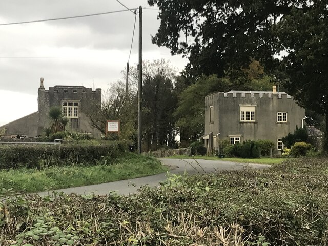
Cromhall

Cromhall is a village in South Gloucestershire, England. It is located between Bagstone and Charfield on the B4058, and also borders Leyhill. The parish...

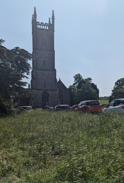
St James' Church, Charfield

St James' Church is a historic Anglican church at Churchend in the village of Charfield, Gloucestershire, England and is under the care of The Churches...
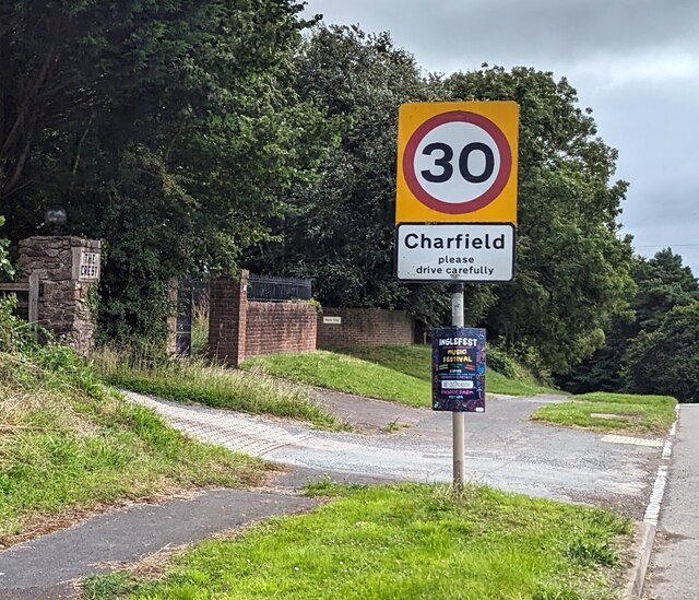
Charfield

Charfield is a village and civil parish in Gloucestershire, England, south-west of Wotton-under-Edge near the Little Avon River and the villages of Falfield...

HM Prison Leyhill

HM Prison Leyhill is a Category D men's prison located in the parish of Tortworth in Gloucestershire, England. His Majesty's Prison Service operates Leyhill...

Bibstone

Bibstone is a village in Gloucestershire, England. == External links == Media related to Bibstone at Wikimedia Commons

Tortworth

Tortworth is a small village and civil parish, near Thornbury in Gloucestershire, England. It has a population of 147 as of 2011. It lies on the B4509...

Tortworth Court

Tortworth Court is a Victorian mansion in Tortworth near Thornbury, South Gloucestershire. England. It was built in Tudor style for the 2nd Earl of Ducie...

Nearby Amenities

Located within 500m of 51.621499,-2.4218939
Dive Centre
Cromhall Diving Centre
Addr City: Cromhall
Addr Housename: Cromhall Quarry
Addr Postcode: GL12 8AA
Phone: +44 7901 832 862
Shop: scuba_diving
Tourism: attraction
Website: http://www.cromhalldiving.co.uk/
Lat/Long: 51.6240011/-2.4256804
Hammerley Down
Place: locality
Lat/Long: 51.6227686/-2.4217265
Design: h-frame
Location Transition: yes
Note: double wooden power line poles
Power: tower
Source: Bing
Lat/Long: 51.6189261/-2.4236236
Design: h-frame
Material: wood
Power: tower
Source: Bing
Lat/Long: 51.6252142/-2.4200016
Design: h-frame
Material: wood
Power: tower
Source: Bing
Lat/Long: 51.6253503/-2.4197495
Power: pole
Source: Bing
Lat/Long: 51.6257614/-2.4202608
Power: pole
Source: Bing
Lat/Long: 51.6257219/-2.4200723
Note: double wooden power line poles
Power: pole
Source: Bing
Lat/Long: 51.6247023/-2.4171861
Design: h-frame
Material: wood
Note: double wooden power line poles
Power: tower
Source: Bing
Lat/Long: 51.6250732/-2.4188716
Power: tower
Source: Bing
Lat/Long: 51.625299/-2.420271
Telephone: pole
Lat/Long: 51.6208573/-2.4285808
Telephone: pole
Lat/Long: 51.6209558/-2.4286686
Power: pole
Lat/Long: 51.62574/-2.4203718
Power: pole
Lat/Long: 51.6189603/-2.4233899
Power: pole
Lat/Long: 51.6185394/-2.4228615
Power: pole
Lat/Long: 51.6182161/-2.422441
Power: pole
Lat/Long: 51.6191073/-2.4262463
Power: pole
Lat/Long: 51.6195995/-2.4253686
Power: pole
Lat/Long: 51.6200796/-2.4245156
Location Transition: yes
Power: pole
Lat/Long: 51.6203367/-2.4240608
Power: pole
Lat/Long: 51.6182931/-2.4249067
Design: h-frame
Location Transition: yes
Power: tower
Lat/Long: 51.6200236/-2.423107
Power: pole
Lat/Long: 51.619372/-2.424236
Power: pole
Lat/Long: 51.6187315/-2.4253509
Power: pole
Lat/Long: 51.6183085/-2.4260746
The data included in this document is from www.openstreetmap.org. The data is made available under ODbL.

Have you been to Hammerley Wood?

Leave your review of Hammerley Wood below (or comments, questions and feedback).