Thistley Lawn

Wood, Forest in Northumberland

England

Thistley Lawn

Bolts Law View of Bolts Law <a href="https://www.geograph.org.uk/photo/507840">NY6981 : Bolts Law Mast</a> seen from Gowany Knowe.
Bolts Law Credit: Peter McDermott

Thistley Lawn is a captivating woodland located in Northumberland, an idyllic county in the northeastern part of England. Nestled amidst the picturesque landscapes of the region, Thistley Lawn is a haven for nature enthusiasts and a sanctuary for a diverse range of flora and fauna.

Covering an expansive area, Thistley Lawn is characterized by its dense forest and towering woodland trees. The woodland is predominantly composed of native species such as oak, beech, and birch, which create a rich and vibrant tapestry of greenery throughout the year. The forest floor is adorned with an array of wildflowers, adding a burst of color to the serene surroundings.

Thistley Lawn is not only visually appealing but is also home to a diverse ecosystem. Various species of birds, including woodpeckers and owls, can be spotted among the treetops, while small mammals like squirrels and rabbits scuttle through the undergrowth. The woodland also provides a habitat for a variety of insects, contributing to the overall biodiversity of the area.

Visitors to Thistley Lawn can explore the woodland through a network of well-maintained trails, allowing them to immerse themselves in the tranquility of nature. The paths wind their way through the forest, providing ample opportunities for leisurely walks, jogging, and even birdwatching. The woodland is a popular destination for nature lovers and provides a peaceful escape from the hustle and bustle of everyday life.

In conclusion, Thistley Lawn is a captivating woodland in Northumberland, offering visitors the opportunity to experience the beauty and serenity of nature. With its diverse flora and fauna, it is a haven for biodiversity and a cherished natural treasure in the region.

If you have any feedback on the listing, please let us know in the comments section below.

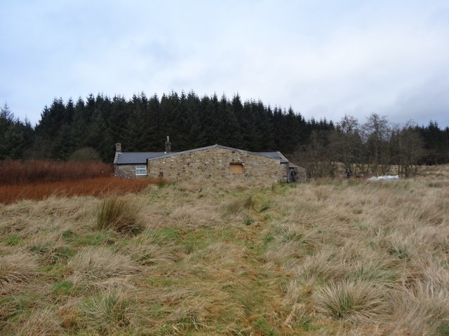
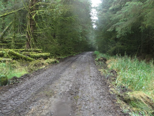
Thistley Lawn Images

Images are sourced within 2km of 55.123536/-2.4580447 or Grid Reference NY7081. Thanks to Geograph Open Source API. All images are credited.

Bolts Law View of Bolts Law <a href="https://www.geograph.org.uk/photo/507840">NY6981 : Bolts Law Mast</a> seen from Gowany Knowe.
Bolts Law
View of Bolts Law NY6981 : Bolts Law Mast seen from Gowany Knowe.
Forestry road near Chirdonhead
Forest Track above Chirdon Head
Forest Track and Ride
Rowantree Cleugh
Rowantree Cleugh
Chirdon Head Outdoor Centre On a previous visit in August 2008 we wondered if this was an outdoor centre but couldn't find any information about.  Since then a large extension has been built but not quite finished.  It belongs to the Cramlington Volunteer Youth Project.
<span class="nowrap"><a title="http://cvyp-ltd.com/activities/289/chirdon-head-ooutdoor-centre-retreat/" rel="nofollow ugc noopener" href="http://cvyp-ltd.com/activities/289/chirdon-head-ooutdoor-centre-retreat/">Link</a><img style="margin-left:2px;" alt="External link" title="External link - shift click to open in new window" src="https://s1.geograph.org.uk/img/external.png" width="10" height="10"/></span>
Chirdon Head Outdoor Centre
On a previous visit in August 2008 we wondered if this was an outdoor centre but couldn't find any information about. Since then a large extension has been built but not quite finished. It belongs to the Cramlington Volunteer Youth Project. LinkExternal link
Gate into young plantation A rather curious sloping gate admits the footpath to Chirdon Head into a young plantation.
Gate into young plantation
A rather curious sloping gate admits the footpath to Chirdon Head into a young plantation.
Waymark for the Alternative Pennine Way The marker indicates a public footpath, and also the logo of the Alternative Pennine Way. The APW is a strictly unofficial long distance walk from Ashbourne to Jedburgh, the subject of a Cicerone Guide published in 1992. It avoids much of the higher, boggier parts of the Pennine Way proper, but is little known and little walked. This and the one seen in <a href="https://www.geograph.org.uk/photo/5248386">NY7273 : Waymark in Wark Forest</a> are the only waymarks for the APW that I have ever seen.
Waymark for the Alternative Pennine Way
The marker indicates a public footpath, and also the logo of the Alternative Pennine Way. The APW is a strictly unofficial long distance walk from Ashbourne to Jedburgh, the subject of a Cicerone Guide published in 1992. It avoids much of the higher, boggier parts of the Pennine Way proper, but is little known and little walked. This and the one seen in NY7273 : Waymark in Wark Forest are the only waymarks for the APW that I have ever seen.
Track junction at Allerybank The junction of tracks at Allerybank within Wark Forest.
Track junction at Allerybank
The junction of tracks at Allerybank within Wark Forest.
Forest track and public footpath A forest track and public footpath in amongst the immeasurable number of trees of Wark Forest, which itself is part of Kielder Forest.
Forest track and public footpath
A forest track and public footpath in amongst the immeasurable number of trees of Wark Forest, which itself is part of Kielder Forest.
Track maintenance vehicles in Wark Forest A tractor and a grading machine are parked for the weekend whilst they are used repairing a section of track in Wark Forest.
Track maintenance vehicles in Wark Forest
A tractor and a grading machine are parked for the weekend whilst they are used repairing a section of track in Wark Forest.
Forest track and footpath, Wark Forest A forest track and public footpath in Wark Forest. The track is in the process of being repaired with machinery parked nearby.
Forest track and footpath, Wark Forest
A forest track and public footpath in Wark Forest. The track is in the process of being repaired with machinery parked nearby.
Fallen trees in Wark Forest Fallen trees beside a forest track in Wark Forest. The dead trees are covered in moss and lichen.
Fallen trees in Wark Forest
Fallen trees beside a forest track in Wark Forest. The dead trees are covered in moss and lichen.
Sheepfold close to the Chirdon Burn A round sheepfold on rough ground beside the Chirdon Burn.
Sheepfold close to the Chirdon Burn
A round sheepfold on rough ground beside the Chirdon Burn.
Forest track near Chirdonhead A forest track near the isolated building at Chirdonhead.
Forest track near Chirdonhead
A forest track near the isolated building at Chirdonhead.
Building at Chirdonhead The isolated building in the forest at Chirdon Head is owned by Cramlington Voluntary Youth Project and appears to slowly being developed into an outdoor centre with accommodation to host parties of young people on activity breaks.
Building at Chirdonhead
The isolated building in the forest at Chirdon Head is owned by Cramlington Voluntary Youth Project and appears to slowly being developed into an outdoor centre with accommodation to host parties of young people on activity breaks.
Goatstone Sike A small stream flowing between newly planted trees in Wark Forest.
Goatstone Sike
A small stream flowing between newly planted trees in Wark Forest.
Track junction at Allerybank A junction of forestry tracks at Allerybank in the large plantations of Wark Forest.
Track junction at Allerybank
A junction of forestry tracks at Allerybank in the large plantations of Wark Forest.
Show me another place!

Thistley Lawn is located at Grid Ref: NY7081 (Lat: 55.123536, Lng: -2.4580447)

Unitary Authority: Northumberland

Police Authority: Northumbria

What 3 Words

///commander.quit.bumping. Near Bellingham, Northumberland

Nearby Locations

Benty Hill Thistley Lawn

Related Wikis

Wark Forest

Wark Forest is the southern part of Kielder Forest in Northumberland, England. Wark Forest is found within the south-west tip of Northumberland National...

Churnsike Lodge

Churnsike Lodge is an early Victorian hunting lodge situated in the parish of Greystead, West Northumberland, England. Constructed in 1850 by the Charlton...

Falstone Bridge

Falstone Bridge is a stone bridge across the River North Tyne at Falstone in Northumberland. == History == The bridge, which has three stone arches, was...

Falstone railway station

Falstone railway station is a former railway station that served the hamlet of Falstone, in Northumberland, England. == History == The station was on the...

Nearby Amenities

Located within 500m of 55.123536,-2.4580447
Chirdonhead Moor
Place: locality
Lat/Long: 55.1262562/-2.4609783
Thistley Lawn
Place: locality
Lat/Long: 55.1232636/-2.4574778
The data included in this document is from www.openstreetmap.org. The data is made available under ODbL.

Have you been to Thistley Lawn?

Leave your review of Thistley Lawn below (or comments, questions and feedback).