Appletree Grove

Wood, Forest in Gloucestershire Forest of Dean

England

Appletree Grove

Farm drive to Knappers Farm The winding farm drive leading to Knappers Farm near Newent.  A public footpath follows this drive.
Farm drive to Knappers Farm Credit: Philip Halling

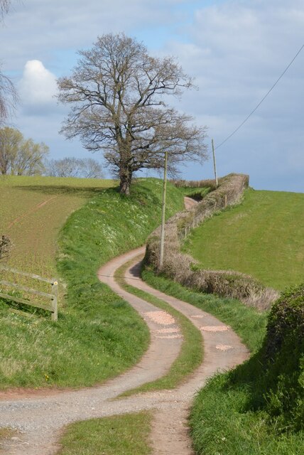
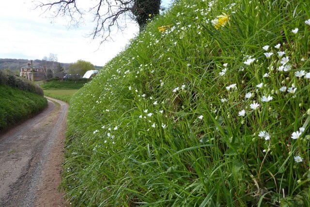
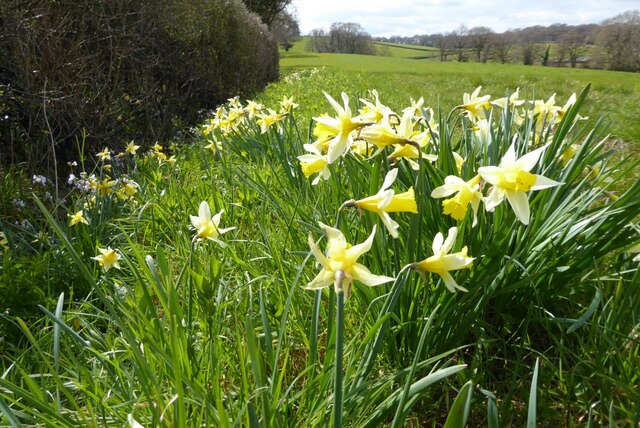
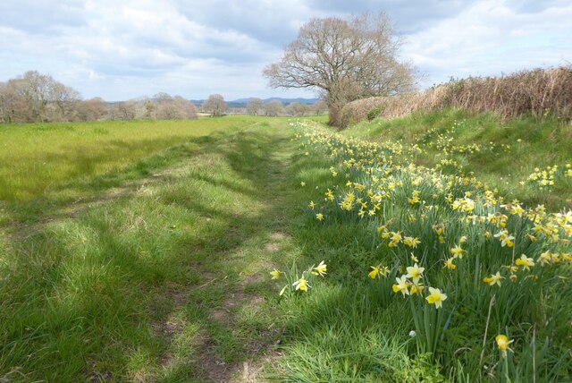
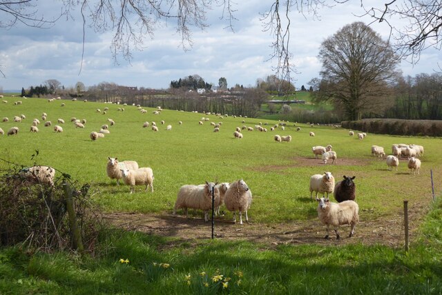
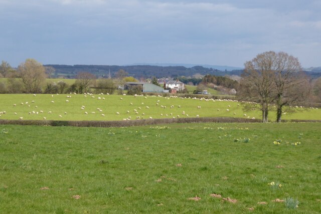
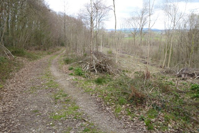
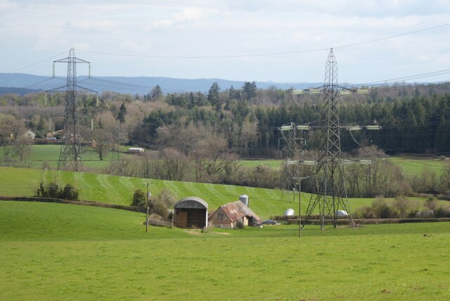
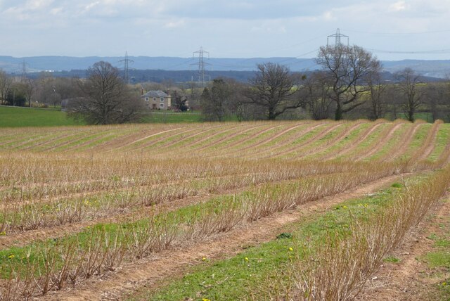
Appletree Grove is a picturesque woodland located in Gloucestershire, England. Situated within the heart of the Forest of Dean, this enchanting grove is renowned for its stunning natural beauty and tranquil atmosphere. Covering an area of approximately 50 acres, it is a popular destination for nature lovers, hikers, and photographers alike.

The grove gets its name from the abundance of apple trees that dot the landscape, providing a breathtaking sight especially during the spring when they burst into a riot of colorful blossoms. The foliage is predominantly composed of native tree species such as oak, beech, and birch, creating a diverse and thriving ecosystem.

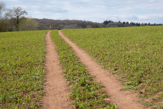
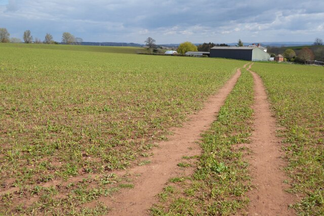
Visitors to Appletree Grove can take advantage of the well-maintained walking trails that meander through the woodland, allowing them to fully immerse themselves in its serene ambiance. The paths are suitable for all ages and abilities, making it accessible to families and individuals of varying fitness levels.

Aside from its natural beauty, the grove is also home to a rich variety of wildlife. Birdwatchers will be delighted by the presence of numerous avian species, including woodpeckers, owls, and thrushes. Squirrels and rabbits can often be spotted darting through the undergrowth, adding to the sense of a thriving and vibrant ecosystem.

In summary, Appletree Grove in Gloucestershire is a captivating woodland that offers visitors a chance to escape the hustle and bustle of everyday life and reconnect with nature. With its picturesque vistas, diverse flora and fauna, and well-maintained trails, it is truly a gem within the Forest of Dean.

If you have any feedback on the listing, please let us know in the comments section below.

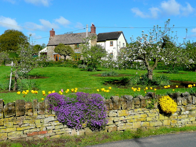
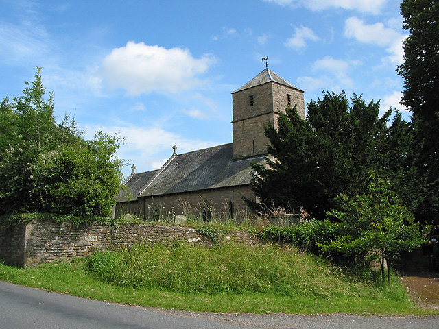
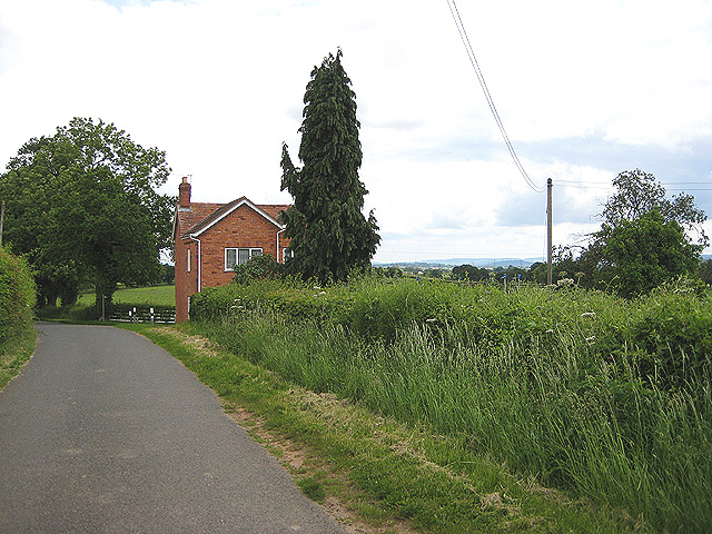
Appletree Grove Images

Images are sourced within 2km of 51.916851/-2.4358389 or Grid Reference SO7024. Thanks to Geograph Open Source API. All images are credited.

Farm drive to Knappers Farm The winding farm drive leading to Knappers Farm near Newent.  A public footpath follows this drive.
Farm drive to Knappers Farm
The winding farm drive leading to Knappers Farm near Newent. A public footpath follows this drive.
Spring blooms on the roadside The farm drive to Knappers Farm has become sunken, no doubt from centuries of use.  Spring bloom as colour to the grass bank.  The farmhouse can be seen in the background.
Spring blooms on the roadside
The farm drive to Knappers Farm has become sunken, no doubt from centuries of use. Spring bloom as colour to the grass bank. The farmhouse can be seen in the background.
Wild daffodils Wild daffodils beside a field hedgerow near Knappers Farm.
Wild daffodils
Wild daffodils beside a field hedgerow near Knappers Farm.
Daffodils and a footpath This footpath near Knappers Farm is the route of the Geopark Way.  Wild daffodils are a feature of this corner of Gloucestershire.
Daffodils and a footpath
This footpath near Knappers Farm is the route of the Geopark Way. Wild daffodils are a feature of this corner of Gloucestershire.
Sheep near Knappers Farm Sheep in a field beside the Geopark Way to the south-west of Knappers Farm.
Sheep near Knappers Farm
Sheep in a field beside the Geopark Way to the south-west of Knappers Farm.
Farmland around Knappers Farm View to the north-east from the Geopark Way where it enters Acorn Wood.  Sheep graze a field in the middle distance with Knappers Farm beyond.  The spire of Newent Church can be seen to the left of centre.
Farmland around Knappers Farm
View to the north-east from the Geopark Way where it enters Acorn Wood. Sheep graze a field in the middle distance with Knappers Farm beyond. The spire of Newent Church can be seen to the left of centre.
Bradfords Cottage An early 17th century timber-framed thatched cottage just outside Newent.  The cottage is Grade II listed, see: <span class="nowrap"><a title="https://historicengland.org.uk/listing/the-list/list-entry/1172282?section=official-list-entry" rel="nofollow ugc noopener" href="https://historicengland.org.uk/listing/the-list/list-entry/1172282?section=official-list-entry">Link</a><img style="margin-left:2px;" alt="External link" title="External link - shift click to open in new window" src="https://s1.geograph.org.uk/img/external.png" width="10" height="10"/></span>
Bradfords Cottage
An early 17th century timber-framed thatched cottage just outside Newent. The cottage is Grade II listed, see: LinkExternal link
Footpath through Acorn Word The Geopark Way follows this footpath through Acorn Wood to the south of Newent.  Here the wood is partially felled.
Footpath through Acorn Word
The Geopark Way follows this footpath through Acorn Wood to the south of Newent. Here the wood is partially felled.
Farm buildings Farm buildings and electricity pylons near Clifford Mesne.
Farm buildings
Farm buildings and electricity pylons near Clifford Mesne.
Footpath crossing an arable field The Geopark Way follows this footpath across this field near Knappers Farm.
Footpath crossing an arable field
The Geopark Way follows this footpath across this field near Knappers Farm.
Footpath approaching Knappers Farm The Geopark Way follows this footpath approaching Knappers Farm.
Footpath approaching Knappers Farm
The Geopark Way follows this footpath approaching Knappers Farm.
Footpath and track Footpath and track near Clifford's Mesne.
Footpath and track
Footpath and track near Clifford's Mesne.
Farmland near Clifford's Mesne I am not sure what the bushes are in this field, possibly currents.
Farmland near Clifford's Mesne
I am not sure what the bushes are in this field, possibly currents.
Former Newent Falconry centre Sadly this falconry centre is no longer open.
Former Newent Falconry centre
Sadly this falconry centre is no longer open.
A field of broad beans Broad beans beside a footpath in a field to the south of Newent.
A field of broad beans
Broad beans beside a footpath in a field to the south of Newent.
Footpath approaching Brook Farm Footpath approaching Brook Farm to the south of Newent.
Footpath approaching Brook Farm
Footpath approaching Brook Farm to the south of Newent.
Gated Track in Newent Woods
St Peter's Church - Clifford's Mesne
Show me another place!

Appletree Grove is located at Grid Ref: SO7024 (Lat: 51.916851, Lng: -2.4358389)

Administrative County: Gloucestershire

District: Forest of Dean

Police Authority: Gloucestershire

What 3 Words

///hopes.stylists.youths. Near Newent, Gloucestershire

Related Wikis

Boulsdon

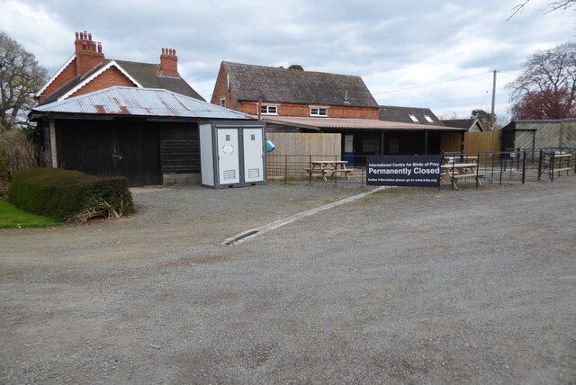
Boulsdon is a village in Gloucestershire, England. It is the location of the International Centre for Birds of Prey.A low mound in the village may have...

Aston Ingham

Aston Ingham is a village in south-eastern Herefordshire, England, near Newent and about 7 miles (11 km) east of Ross-on-Wye. The population of the village...

Gorsley and Kilcot

Gorsley and Kilcot is a civil parish forming part of the district of the Forest of Dean in the English county of Gloucestershire. The single parish of...

Cliffords Mesne

Cliffords Mesne is an English village in Gloucestershire, two miles (3.2 km) south-west of the town of Newent. It became the home of the autobiographical...

Newent Community School

Newent Community School is a secondary school in Newent, Gloucestershire, England. It is an Academy of 1,340 students, serving the town and the rural...

Anthony's Cross

Anthony's Cross is a hamlet in Gloucestershire, England. == External links == Media related to Anthony's Cross at Wikimedia Commons

Beavan's Hill

Beavan's Hill is a village in south east Herefordshire, England. The village is situated on the edge of Withymoor Wood, an area of ancient woodland, and...

Gorsley

Gorsley is a small village in the Forest of Dean district of Gloucestershire, forming part of the civil parish of Gorsley and Kilcot in the South West...

Nearby Amenities

Located within 500m of 51.916851,-2.4358389
Ravenhill
Is In: Gloucestershire, England, UK
Place: hamlet
Source: NPE
Lat/Long: 51.9164116/-2.4385618
Barrier: kissing_gate
Lat/Long: 51.9192038/-2.4379924
Barrier: cattle_grid
Lat/Long: 51.9207687/-2.4375301
Barrier: kissing_gate
Lat/Long: 51.9178305/-2.438875
Barrier: stile
Lat/Long: 51.9149371/-2.4411433
Barrier: kissing_gate
Lat/Long: 51.9149531/-2.4412635
Ravenhill
Power: pole
Transformer: distribution
Voltage Primary: 11000
Lat/Long: 51.9170344/-2.4392653
Power: pole
Lat/Long: 51.9173806/-2.438985
Power: pole
Lat/Long: 51.9177284/-2.4387348
Power: pole
Lat/Long: 51.918513/-2.4381924
Power: pole
Lat/Long: 51.9194709/-2.4375252
Briery Hill
Power: pole
Transformer: distribution
Voltage Primary: 11000
Lat/Long: 51.9199601/-2.4371859
Power: pole
Lat/Long: 51.9206086/-2.4367198
Power: pole
Lat/Long: 51.9211752/-2.4361271
The data included in this document is from www.openstreetmap.org. The data is made available under ODbL.

Have you been to Appletree Grove?

Leave your review of Appletree Grove below (or comments, questions and feedback).