Warry's Plantations

Wood, Forest in Dorset

England

Warry's Plantations

Former chapel at Holwell
Former chapel at Holwell Credit: David Martin

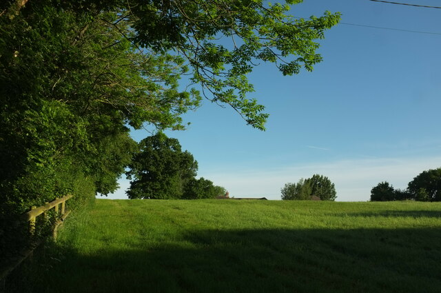
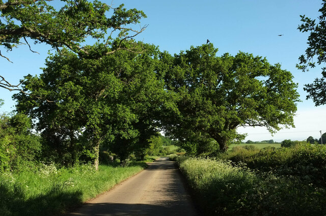
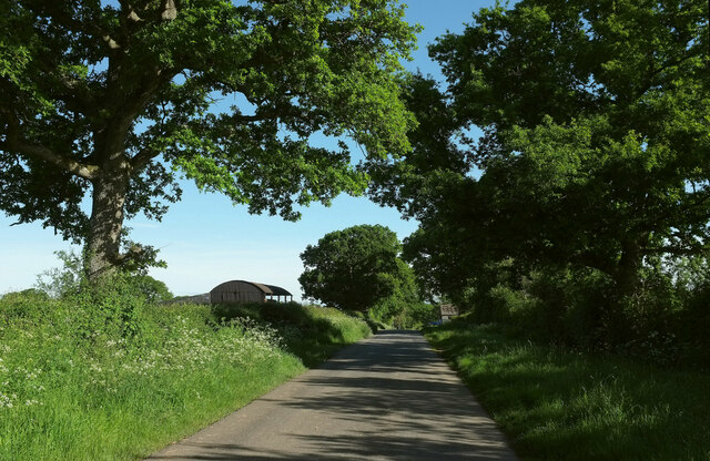
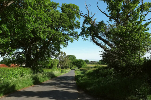
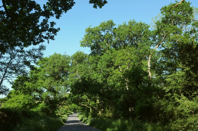
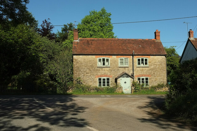
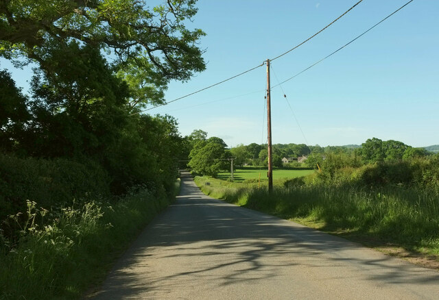
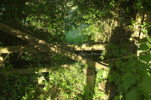
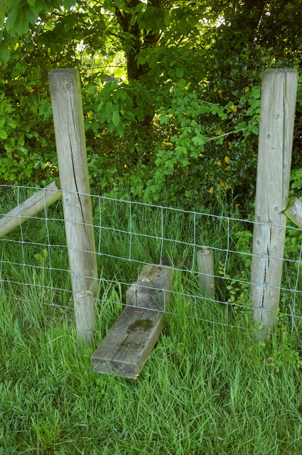
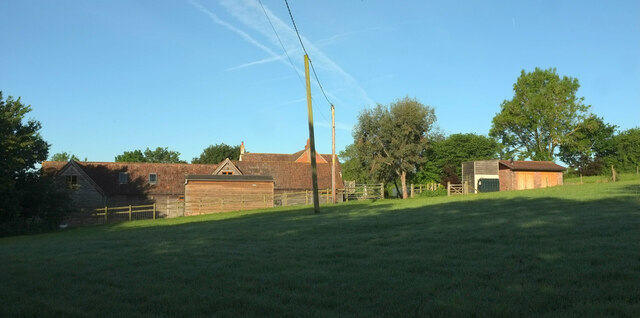
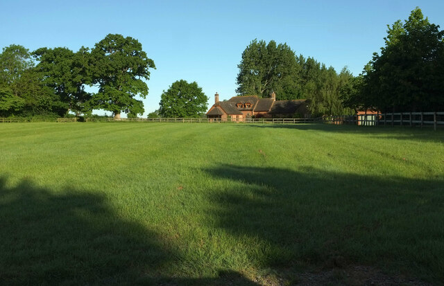
Warry's Plantations, located in Dorset, England, is a picturesque woodland area renowned for its natural beauty and rich history. This forested landscape covers a vast expanse of approximately 200 acres, making it a popular destination for nature enthusiasts and outdoor adventurers.

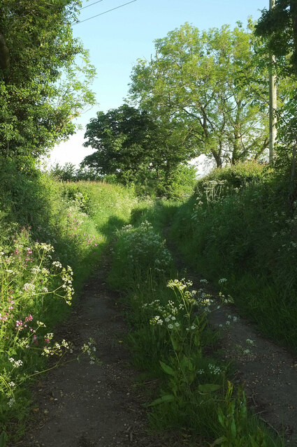
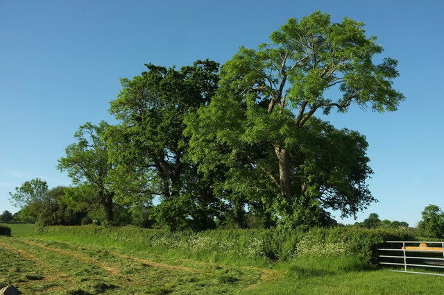
The woodland is predominantly composed of various species of trees, including oak, beech, and birch, creating a diverse and vibrant ecosystem. The lush undergrowth is home to a plethora of native flora, such as bluebells, primroses, and ferns, which add a vibrant splash of color to the forest floor during the spring and summer months.

Warry's Plantations has a long-standing history that dates back several centuries. It was originally established as a source of timber for the local community, providing essential resources for construction and fuel. Today, the woodland is managed by local authorities, who strive to maintain its ecological balance and protect its biodiversity.

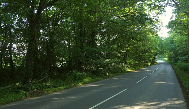
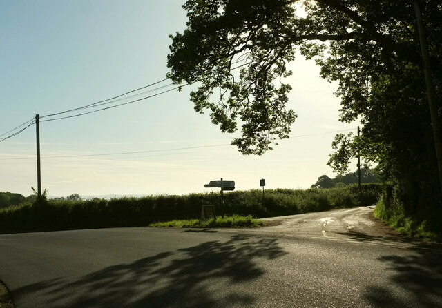
Visitors to Warry's Plantations can enjoy a range of activities, including hiking, cycling, and wildlife spotting. The forest boasts a network of well-maintained trails that cater to all levels of fitness and offer stunning views of the surrounding countryside. Additionally, the area is home to a variety of wildlife, such as deer, foxes, and a wide array of bird species, making it a haven for wildlife enthusiasts and birdwatchers.

Overall, Warry's Plantations in Dorset is a picturesque woodland that offers visitors a chance to connect with nature, explore its rich history, and immerse themselves in the tranquility of the forested landscape.

If you have any feedback on the listing, please let us know in the comments section below.

Warry's Plantations Images

Images are sourced within 2km of 50.888009/-2.4349339 or Grid Reference ST6909. Thanks to Geograph Open Source API. All images are credited.

Former chapel at Holwell
Field, West Pulham The nightmare that is footpath N49 20 is drawing to a close. Currently my nomination for Dorset's worst right of way (of those I've completed), and there's tough competition. Visible in the centre is the roof of Chaselands.
Field, West Pulham
The nightmare that is footpath N49 20 is drawing to a close. Currently my nomination for Dorset's worst right of way (of those I've completed), and there's tough competition. Visible in the centre is the roof of Chaselands.
B3143 northeast of Pulham The B road runs between two narrow belts of trees towards King's Stag.
B3143 northeast of Pulham
The B road runs between two narrow belts of trees towards King's Stag.
Footpath, Furze Hill Footpath N49 14 runs along this track between hedges from the B3143 before turning left to cross fields.
Footpath, Furze Hill
Footpath N49 14 runs along this track between hedges from the B3143 before turning left to cross fields.
Lane to Holwell Roadside trees on a straight lane passing Oakwood View.
Lane to Holwell
Roadside trees on a straight lane passing Oakwood View.
Grass triangle near Pulham Part of a staggered crossroads on the B3143, bearing left here. The turning on the right is Cannings Court Lane, a no through road.
Grass triangle near Pulham
Part of a staggered crossroads on the B3143, bearing left here. The turning on the right is Cannings Court Lane, a no through road.
Trees near Hartmoor Farm Along the lane from Holwell to Pulham.
Trees near Hartmoor Farm
Along the lane from Holwell to Pulham.
Passing Holwell Hill Farm On the lane from Pulham to Holwell.
Passing Holwell Hill Farm
On the lane from Pulham to Holwell.
Lane to Holwell A little further north from <a href="https://www.geograph.org.uk/photo/7184565">ST7010 : Passing Holwell Hill Farm</a>. A little of the village of Holwell is visible ahead right of centre.
Lane to Holwell
A little further north from ST7010 : Passing Holwell Hill Farm. A little of the village of Holwell is visible ahead right of centre.
Crouch Hill Farm The thatched farmhouse on Holwell Drove is "possibly of C17 origin ..." <span class="nowrap"><a title="https://historicengland.org.uk/listing/the-list/list-entry/1304895?section=official-list-entry" rel="nofollow ugc noopener" href="https://historicengland.org.uk/listing/the-list/list-entry/1304895?section=official-list-entry">Link</a><img style="margin-left:2px;" alt="External link" title="External link - shift click to open in new window" src="https://s1.geograph.org.uk/img/external.png" width="10" height="10"/></span> .
Crouch Hill Farm
The thatched farmhouse on Holwell Drove is "possibly of C17 origin ..." LinkExternal link .
Holwell Drove Approaching a slight right bend, the only bend in the one and a half kilometres road between Holwell and Sandhills. Its drove-like quality is more pronounced towards the western end.
Holwell Drove
Approaching a slight right bend, the only bend in the one and a half kilometres road between Holwell and Sandhills. Its drove-like quality is more pronounced towards the western end.
Holwell Manor House Grade II* listed. "Country House, C16 with much rebuilding of 1889" <span class="nowrap"><a title="https://historicengland.org.uk/listing/the-list/list-entry/1118845?section=official-list-entry" rel="nofollow ugc noopener" href="https://historicengland.org.uk/listing/the-list/list-entry/1118845?section=official-list-entry">Link</a><img style="margin-left:2px;" alt="External link" title="External link - shift click to open in new window" src="https://s1.geograph.org.uk/img/external.png" width="10" height="10"/></span> . Seen past the entrance gate on Holwell Drove <a href="https://www.geograph.org.uk/photo/7564503">ST6810 : Holwell Drove</a>.
Holwell Manor House
Grade II* listed. "Country House, C16 with much rebuilding of 1889" LinkExternal link . Seen past the entrance gate on Holwell Drove ST6810 : Holwell Drove.
Cottage, Sandhills Tess Cottage is opposite the junction of Holwell Drove (foreground) with Stock Hill Lane. Presumably named as a whimsical reference to Hardy's famous character who spent time in the Blackmore Vale, which we are in.
Cottage, Sandhills
Tess Cottage is opposite the junction of Holwell Drove (foreground) with Stock Hill Lane. Presumably named as a whimsical reference to Hardy's famous character who spent time in the Blackmore Vale, which we are in.
Stock Hill Lane Passing Rails Farm. To the right of the telegraph pole is Magog Farm.
Stock Hill Lane
Passing Rails Farm. To the right of the telegraph pole is Magog Farm.
Damaged stile near Pulham The stile on footpath N49 20 glimpsed from the other side at <a href="https://www.geograph.org.uk/photo/7560802">ST6908 : Overgrown stile near Pulham</a>. A time-consuming stretch of footpath.
Damaged stile near Pulham
The stile on footpath N49 20 glimpsed from the other side at ST6908 : Overgrown stile near Pulham. A time-consuming stretch of footpath.
Stile near Pulham Compared to the last stile <a href="https://www.geograph.org.uk/photo/7560806">ST7008 : Damaged stile near Pulham</a>, this looks fine, but beyond it the course of footpath N49 20 is through absolutely impenetrable woodland, even if daylight can be seen on the far side of the field boundary. I've no intention of retracing my steps given the difficulty of doing so, so will have to look for another route.
Stile near Pulham
Compared to the last stile ST7008 : Damaged stile near Pulham, this looks fine, but beyond it the course of footpath N49 20 is through absolutely impenetrable woodland, even if daylight can be seen on the far side of the field boundary. I've no intention of retracing my steps given the difficulty of doing so, so will have to look for another route.
Farm, Pulham Taken while trying to find alternative route for footpath N49 20 after the impossibility of using <a href="https://www.geograph.org.uk/photo/7560808">ST7008 : Stile near Pulham</a>. The farm is unnamed on maps.
Farm, Pulham
Taken while trying to find alternative route for footpath N49 20 after the impossibility of using ST7008 : Stile near Pulham. The farm is unnamed on maps.
House at Pulham Chaselands also appears in <a href="https://www.geograph.org.uk/photo/7180955">ST7008 : Field, West Pulham</a>. Needless to say the footpath I was trying to follow has no exit onto the road where mapped; I took the trouble to search diligently on both sides of the hedge. So I have to leave this meadow via the entrance driveway to the house. Footpath N49 20 is 478 metres long (<span class="nowrap"><a title="http://www.rowmaps.com/showmap.php?place=West%20Pulham&map=BingOS&lat=50.8723&lon=2.4236&lonew=W" rel="nofollow ugc noopener" href="http://www.rowmaps.com/showmap.php?place=West%20Pulham&map=BingOS&lat=50.8723&lon=2.4236&lonew=W">Link</a><img style="margin-left:2px;" alt="External link" title="External link - shift click to open in new window" src="https://s1.geograph.org.uk/img/external.png" width="10" height="10"/></span> ) and has around four impassable stiles or crossing places, which could easily be a record, at around 1 per 120 metres. It took me 18 minutes to get from one end to the other.
House at Pulham
Chaselands also appears in ST7008 : Field, West Pulham. Needless to say the footpath I was trying to follow has no exit onto the road where mapped; I took the trouble to search diligently on both sides of the hedge. So I have to leave this meadow via the entrance driveway to the house. Footpath N49 20 is 478 metres long (LinkExternal link ) and has around four impassable stiles or crossing places, which could easily be a record, at around 1 per 120 metres. It took me 18 minutes to get from one end to the other.
Show me another place!

Warry's Plantations is located at Grid Ref: ST6909 (Lat: 50.888009, Lng: -2.4349339)

Unitary Authority: Dorset

Police Authority: Dorset

What 3 Words

///jeering.restore.unwraps. Near Sherborne, Dorset

Related Wikis

Holwell, Dorset

Holwell is a village and civil parish in the county of Dorset in southern England, situated approximately 5 miles (8.0 km) south-east of Sherborne. It...

Pulham

Pulham is a village and civil parish in the county of Dorset in south-west England. It is situated in the Blackmore Vale, 7 miles (11 kilometres) southeast...

Glanvilles Wootton

Glanvilles Wootton, or Wootton Glanville, is a village and civil parish in the county of Dorset in southern England. It is situated in the Blackmore Vale...

Dungeon Hill

Dungeon Hill is an Iron Age hillfort, about 1+1⁄4 miles (2 kilometres) north of the village of Buckland Newton in Dorset, England. It is a scheduled monument...

Nearby Amenities

Located within 500m of 50.888009,-2.4349339
Colour: gray
Design: portal
Line Attachment: suspension
Material: metal
Power: tower
Source: bing
Structure: lattice
Lat/Long: 50.8838506/-2.4324974
Colour: gray
Design: portal
Line Attachment: suspension
Material: metal
Power: tower
Source: bing
Structure: lattice
Lat/Long: 50.8841222/-2.4345615
Colour: gray
Design: portal
Line Attachment: suspension
Material: metal
Power: tower
Source: bing
Structure: lattice
Lat/Long: 50.8846603/-2.4386537
Material: wood
Power: pole
Source: bing
Lat/Long: 50.8844859/-2.432379
Material: wood
Power: pole
Source: bing
Lat/Long: 50.8846691/-2.4342546
Material: wood
Power: pole
Source: bing
Lat/Long: 50.884853/-2.4363858
Material: wood
Power: pole
Source: bing
Lat/Long: 50.8850871/-2.4390917
The data included in this document is from www.openstreetmap.org. The data is made available under ODbL.

Have you been to Warry's Plantations?

Leave your review of Warry's Plantations below (or comments, questions and feedback).