Low Pasture Wood

Wood, Forest in Yorkshire South Lakeland

England

Low Pasture Wood

Old milestone The Hawes 13 milestone on the A684 has its back to a drystone wall near Nether House on the south side of the road.   615 of these milestones were set up for the West Riding County Council in 1893/94 not long after the formation of County Councils.   Gill and Frank Stead, stonemasons, of Mirfield won the contract which stated that the work had to be done in 12 months or they would incur a penalty.   Considering the size of the West Riding that was a tremendous feat but they succeeded.   The WRCC didn't always have stones erected on old tollroads.   They wanted to promote new trade routes.   It is Grade II listed 1384039.
Old milestone Credit: Chris Minto

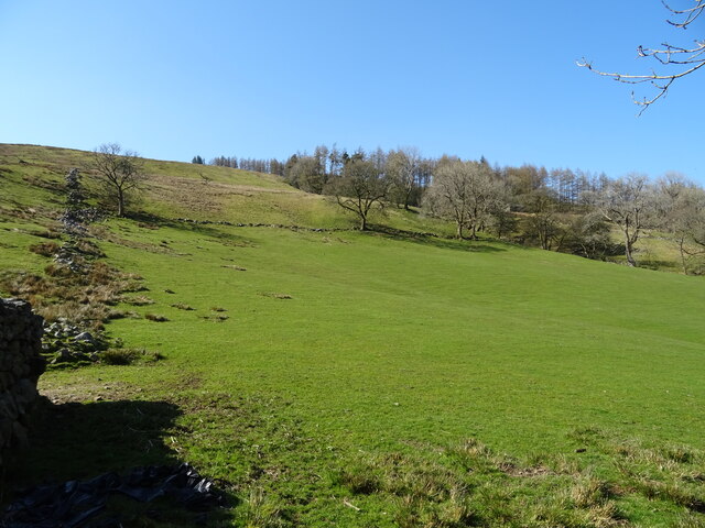
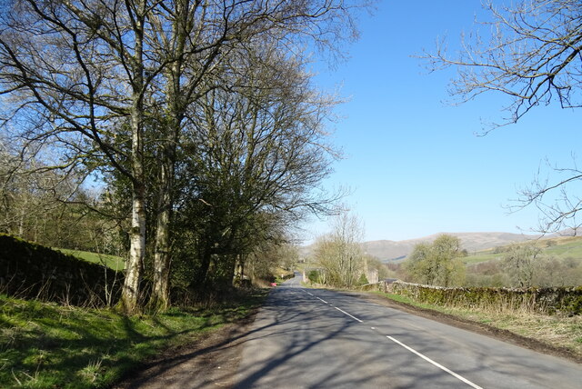
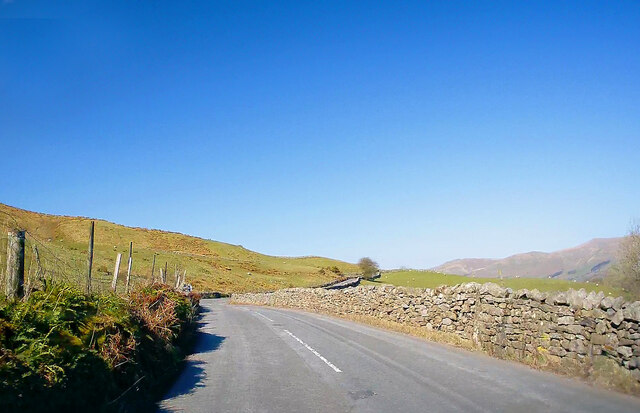
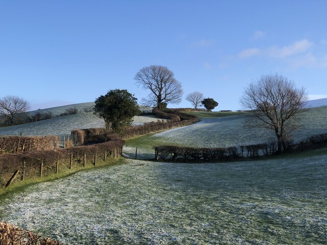
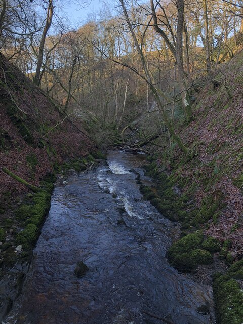
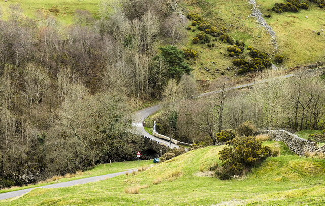
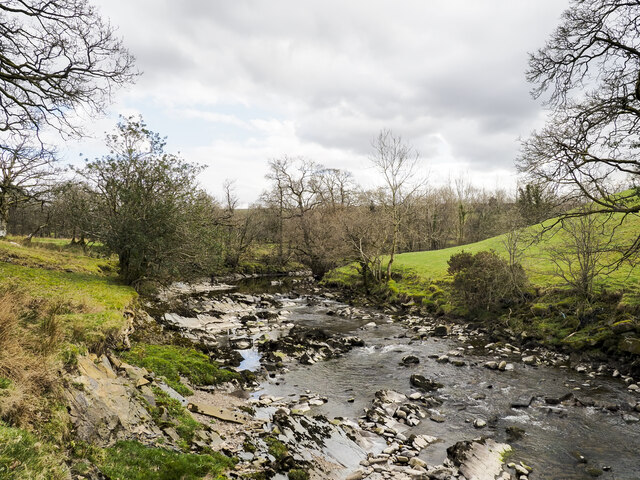
Low Pasture Wood is a picturesque woodland located in the county of Yorkshire, England. Spread across an area of approximately 50 acres, this charming forest is nestled in the heart of the Yorkshire Dales National Park. The wood is characterized by its diverse range of flora and fauna, making it a haven for nature enthusiasts and wildlife lovers.

The wood is primarily composed of native tree species such as oak, beech, and birch, which create a dense and vibrant canopy overhead. The forest floor is adorned with a carpet of wildflowers, adding to the beauty and serenity of the surroundings. The wood is crisscrossed by several well-maintained trails, allowing visitors to explore its enchanting corners and discover hidden gems.

Wildlife thrives in Low Pasture Wood, with a variety of species calling it home. Visitors may be lucky enough to spot deer, foxes, badgers, and a vast array of birdlife, including woodpeckers and owls. The wood provides a rich habitat for these creatures, ensuring their protection and preservation.

Low Pasture Wood offers a tranquil escape from the hustle and bustle of everyday life. It is a popular destination for hikers, nature photographers, and families seeking a peaceful retreat in nature. The wood is conveniently located near several charming villages and market towns, offering easy access and ample amenities for visitors.

Whether it's a leisurely stroll, a picnic amidst the trees, or simply soaking in the natural beauty, Low Pasture Wood is a destination that promises a memorable experience for all who venture into its leafy depths.

If you have any feedback on the listing, please let us know in the comments section below.

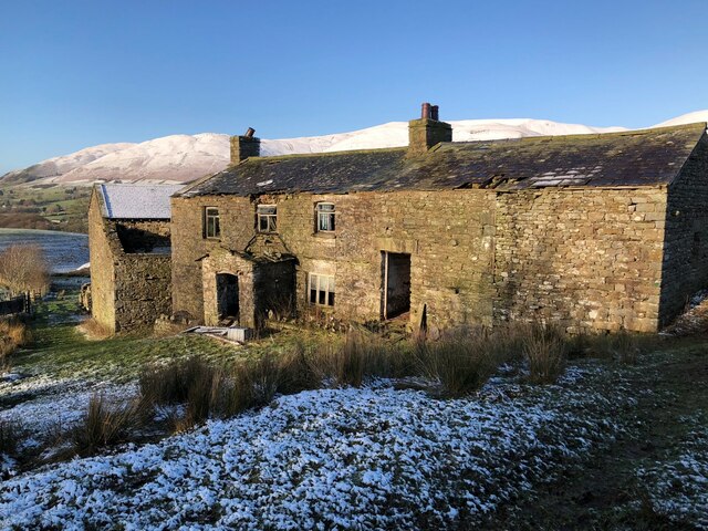
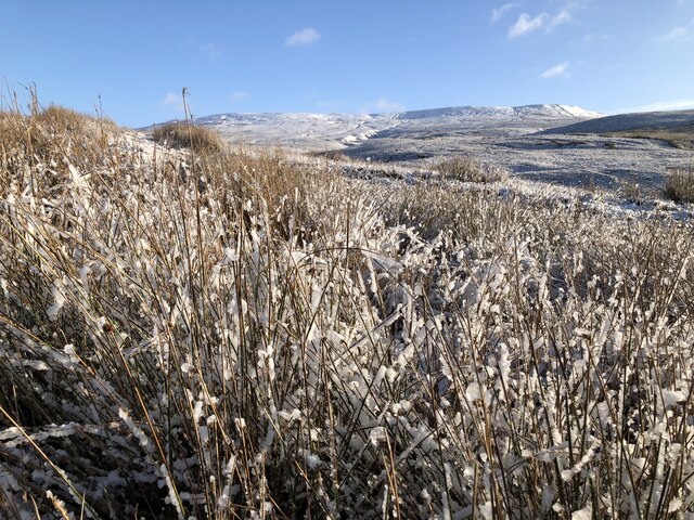
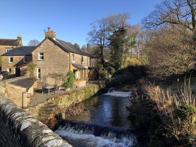
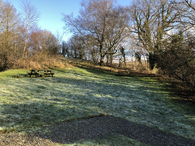
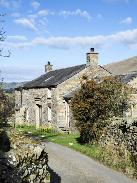
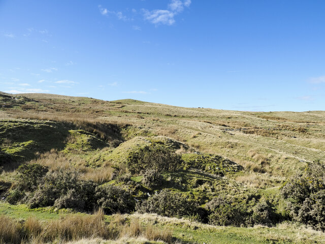
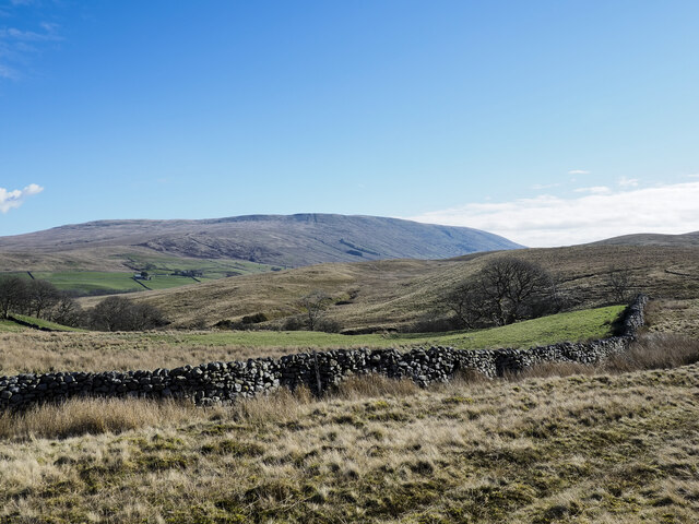
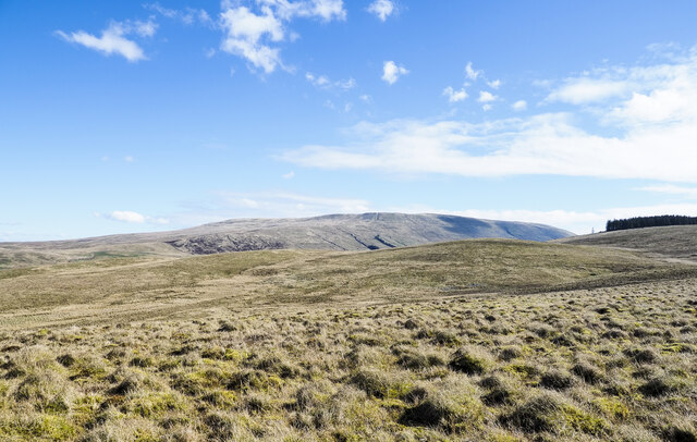
Low Pasture Wood Images

Images are sourced within 2km of 54.320613/-2.4791461 or Grid Reference SD6891. Thanks to Geograph Open Source API. All images are credited.

Old milestone The Hawes 13 milestone on the A684 has its back to a drystone wall near Nether House on the south side of the road.   615 of these milestones were set up for the West Riding County Council in 1893/94 not long after the formation of County Councils.   Gill and Frank Stead, stonemasons, of Mirfield won the contract which stated that the work had to be done in 12 months or they would incur a penalty.   Considering the size of the West Riding that was a tremendous feat but they succeeded.   The WRCC didn't always have stones erected on old tollroads.   They wanted to promote new trade routes.   It is Grade II listed 1384039.
Old milestone
The Hawes 13 milestone on the A684 has its back to a drystone wall near Nether House on the south side of the road. 615 of these milestones were set up for the West Riding County Council in 1893/94 not long after the formation of County Councils. Gill and Frank Stead, stonemasons, of Mirfield won the contract which stated that the work had to be done in 12 months or they would incur a penalty. Considering the size of the West Riding that was a tremendous feat but they succeeded. The WRCC didn't always have stones erected on old tollroads. They wanted to promote new trade routes. It is Grade II listed 1384039.
Valley of Holebeck Gill The shallow, upper valley of Holebeck Gill heading north to where it will meet the Clough River which drains Garsdale.
The Howgill Fells are in the distance beyond both the Clough River and the River Rawthey.
Valley of Holebeck Gill
The shallow, upper valley of Holebeck Gill heading north to where it will meet the Clough River which drains Garsdale. The Howgill Fells are in the distance beyond both the Clough River and the River Rawthey.
Old Milestone by the A684, Garsdale Milestone by the A684, in parish of Garsdale (Eden District), Ex. Yorkshire West Riding, near Nether House, back to drystone wall.

Inscription reads:-
: SEDBERGH / 3 MILES : : SEDBERGH & HAWES / ROAD / GARSDALE : : HAWES / 13 MILES :

Grade II listed.
List Entry Number: 1384039 <span class="nowrap"><a title="https://historicengland.org.uk/listing/the-list/list-entry/1384039" rel="nofollow ugc noopener" href="https://historicengland.org.uk/listing/the-list/list-entry/1384039">Link</a><img style="margin-left:2px;" alt="External link" title="External link - shift click to open in new window" src="https://s1.geograph.org.uk/img/external.png" width="10" height="10"/></span>

Milestone Society National ID: YW_HWSB13
Old Milestone by the A684, Garsdale
Milestone by the A684, in parish of Garsdale (Eden District), Ex. Yorkshire West Riding, near Nether House, back to drystone wall. Inscription reads:- : SEDBERGH / 3 MILES : : SEDBERGH & HAWES / ROAD / GARSDALE : : HAWES / 13 MILES : Grade II listed. List Entry Number: 1384039 LinkExternal link Milestone Society National ID: YW_HWSB13
Hillside grazing, Whit Beck
A684, Whit Beck Towards Sedbergh.
A684, Whit Beck
Towards Sedbergh.
A684, Potgill Holme Towards Sedbergh.
A684, Potgill Holme
Towards Sedbergh.
Fields Beside Road To Hebblethwaite Hall
Hebblethwaite Hall Gill
Abandoned Farmhouse at Sarthwaite
Icy Moorland Above Sarthwaite
Weirs on Hebblethwaite Hall Gill at Burntmill Bridge
Picnic Area Beside A 683
Low Hollins A cottage or cottages at Low Hollins near to Sedbergh. The narrow road here is the route of the long distance path, Dales High Way. The road ends not far behind the camera position the route then becoming a bridleway.
Low Hollins
A cottage or cottages at Low Hollins near to Sedbergh. The narrow road here is the route of the long distance path, Dales High Way. The road ends not far behind the camera position the route then becoming a bridleway.
Frostrow Frostrow, and an area of moorland named on OS maps as Frostrow Fells which is an area of low, rolling moorland.
Frostrow
Frostrow, and an area of moorland named on OS maps as Frostrow Fells which is an area of low, rolling moorland.
Dry stone wall at foot of Frostrow Fells The area known as Frostrow Fells is close to Sedbergh. It's part of the ground which eventually resolves itself into the broad ridge rising to Aye Gill Pike on the south side of Garsdale.
The large, distant hill is Baugh Fell, on the other side of Garsdale.
Dry stone wall at foot of Frostrow Fells
The area known as Frostrow Fells is close to Sedbergh. It's part of the ground which eventually resolves itself into the broad ridge rising to Aye Gill Pike on the south side of Garsdale. The large, distant hill is Baugh Fell, on the other side of Garsdale.
Moorland straddling Holebeck Gill Holebeck Gill drains the bowl of moorland in front of the camera beyond the near tussocks. Baugh Fell lies beyond.
Moorland straddling Holebeck Gill
Holebeck Gill drains the bowl of moorland in front of the camera beyond the near tussocks. Baugh Fell lies beyond.
Danny Bridge Danny Bridge carries the minor road, Danny Wheel, over the Clough River, which drains Garsdale.
Danny Bridge
Danny Bridge carries the minor road, Danny Wheel, over the Clough River, which drains Garsdale.
Ribs of rock in Clough River The river looking upstream, (to the south at the location), near to Hallbank, where a succession of low rock ribs extend out from the east bank, left in the image.
Ribs of rock in Clough River
The river looking upstream, (to the south at the location), near to Hallbank, where a succession of low rock ribs extend out from the east bank, left in the image.
Show me another place!

Low Pasture Wood is located at Grid Ref: SD6891 (Lat: 54.320613, Lng: -2.4791461)

Division: West Riding

Administrative County: Cumbria

District: South Lakeland

Police Authority: Cumbria

What 3 Words

///advancing.dream.caller. Near Sedbergh, Cumbria

Nearby Locations

Low Pasture Wood

Related Wikis

Clough River

The Clough River is a river in Cumbria, England. A tributary of the River Rawthey, it flows for 21.8 kilometres (13.5 mi) primarily through the Garsdale...

Settlebeck School

Settlebeck School is a small coeducational secondary school with academy status. It is located in Sedbergh in the English county of Cumbria, drawing pupils...

Millthrop

Millthrop is a hamlet in the South Lakeland district of Cumbria, Northern England and the Yorkshire Dales. Millthrop lies on the south bank of the River...

Sedbergh

Sedbergh ( SED-bər or locally SEB-ər) is a town and civil parish in the ceremonial county of Cumbria. It falls within the historic boundaries of the West...

Sedbergh School Chapel

Sedbergh School Chapel is located to the southeast of Sedbergh School, Sedbergh, Cumbria, England. It is considered to be of architectural importance...

The Bull Hotel, Sedbergh

The Bull Hotel, formerly The Black Bull Hotel, is a 17th-century coaching inn in Sedbergh, Cumbria. It is located in a narrow passage parallel with the...

St Andrew's Church, Sedbergh

St Andrew's Church is in Main Street, Sedbergh, Cumbria, England. It is an active Anglican parish church in the deanery of Kendal, and the diocese of Carlisle...

Sedbergh People's Hall

Sedbergh People's Hall is a village hall in Sedbergh, unique because it was built by the people, for the people. == Land and lease == The land on which...

Nearby Amenities

Located within 500m of 54.320613,-2.4791461
Hiking: yes
Information: guidepost
Source: GPS survey
Tourism: information
Lat/Long: 54.3210015/-2.4731107
Source: GPS survey
Lat/Long: 54.3201224/-2.4761108
Barrier: stile
Material: stone
Source: GPS survey
Stile: stepover
Lat/Long: 54.321289/-2.47736
Hiking: yes
Information: guidepost
Source: GPS survey
Tourism: information
Lat/Long: 54.3211982/-2.4771387
Hiking: yes
Information: guidepost
Source: GPS survey
Tourism: information
Lat/Long: 54.3212796/-2.4773392
Hiking: yes
Information: guidepost
Source: GPS survey
Tourism: information
Lat/Long: 54.3210117/-2.4835593
Barrier: kissing_gate
Lat/Long: 54.3213058/-2.4820867
Barrier: stile
Lat/Long: 54.3210383/-2.4835673
Barrier: kissing_gate
Lat/Long: 54.3208115/-2.4848011
Power: pole
Lat/Long: 54.3232119/-2.478455
Power: pole
Lat/Long: 54.3246816/-2.4823469
Power: pole
Lat/Long: 54.3247817/-2.481785
Power: pole
Lat/Long: 54.324996/-2.4802065
Power: pole
Lat/Long: 54.3240715/-2.4792945
Power: pole
Lat/Long: 54.3223602/-2.4776155
Power: pole
Lat/Long: 54.3216617/-2.4769248
Power: pole
Lat/Long: 54.3209257/-2.4761993
Power: pole
Lat/Long: 54.3203148/-2.4747053
Power: pole
Lat/Long: 54.3198673/-2.4735439
Power: pole
Lat/Long: 54.3191657/-2.4718581
Barrier: stile
Material: wood
Source: survey;gps
Stile: stepover
Lat/Long: 54.3213168/-2.4753112
Historic: milestone
Image: https://www.geograph.org.uk/photo/6044028
Wikidata: Q26663971
Lat/Long: 54.3167258/-2.4828532
Power: pole
Lat/Long: 54.3178144/-2.4801299
Power: pole
Lat/Long: 54.3176914/-2.4807455
Power: pole
Lat/Long: 54.3171591/-2.4816247
Power: pole
Lat/Long: 54.3182559/-2.4798328
Power: pole
Lat/Long: 54.3183579/-2.4784961
Power: pole
Lat/Long: 54.3184585/-2.4773127
Power: pole
Lat/Long: 54.3185801/-2.4757964
Power: pole
Lat/Long: 54.3193975/-2.4743159
The data included in this document is from www.openstreetmap.org. The data is made available under ODbL.

Have you been to Low Pasture Wood?

Leave your review of Low Pasture Wood below (or comments, questions and feedback).