Southcombe Plantation

Wood, Forest in Dorset

England

Southcombe Plantation

Ford by Morning Well Plantation Bridleway S36 25 crosses a tributary of the Piddle just downstream of a watercress bed by the wood.
Ford by Morning Well Plantation Credit: Derek Harper

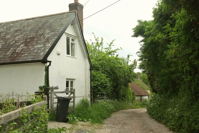
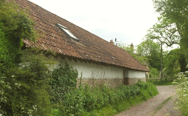
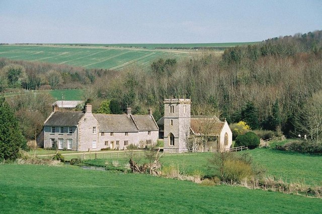
Southcombe Plantation is a picturesque woodland area located in the county of Dorset, England. Situated in the heart of the Dorset countryside, this plantation is known for its lush greenery, diverse flora and fauna, and serene atmosphere.

Covering an area of approximately 100 acres, Southcombe Plantation is predominantly made up of deciduous trees, including oak, beech, and ash. These trees provide a dense canopy, creating a cool and shady environment even during the hot summer months. The woodland floor is adorned with a variety of wildflowers, such as bluebells and primroses, adding bursts of color to the landscape.

The plantation is home to a diverse range of wildlife. Visitors can spot various bird species, including woodpeckers, owls, and thrushes, as well as small mammals like squirrels and rabbits. Deer can occasionally be seen grazing in the more secluded areas of the plantation.

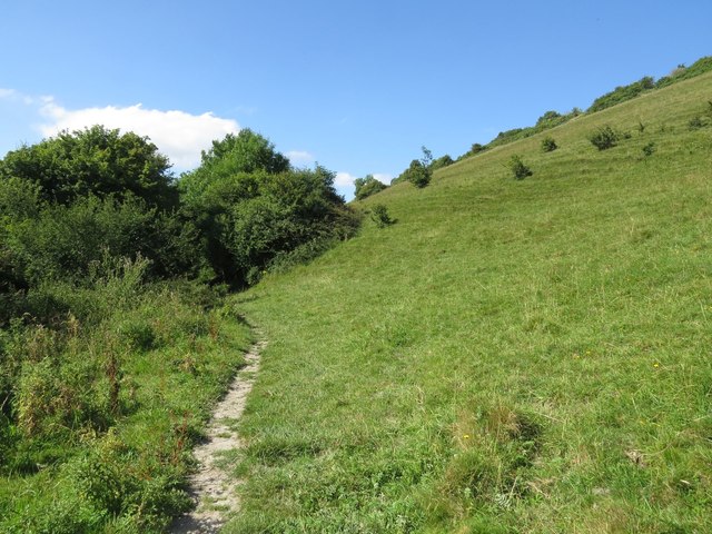
Southcombe Plantation offers several walking trails that wind through the woodland, allowing visitors to explore its natural beauty and enjoy the tranquility it offers. The paths are well-maintained and suitable for all ages and fitness levels. Along the trails, there are designated picnic areas, providing the perfect opportunity for visitors to relax and enjoy a meal amidst nature.

Overall, Southcombe Plantation is a haven for nature enthusiasts and those seeking a peaceful escape from the hustle and bustle of everyday life. Its scenic beauty, diverse wildlife, and well-maintained trails make it a popular destination for locals and tourists alike.

If you have any feedback on the listing, please let us know in the comments section below.

Southcombe Plantation Images

Images are sourced within 2km of 50.802629/-2.4527586 or Grid Reference ST6800. Thanks to Geograph Open Source API. All images are credited.

Ford by Morning Well Plantation Bridleway S36 25 crosses a tributary of the Piddle just downstream of a watercress bed by the wood.
Ford by Morning Well Plantation
Bridleway S36 25 crosses a tributary of the Piddle just downstream of a watercress bed by the wood.
Field north of Piddletrenthide Looking left from <a href="https://www.geograph.org.uk/photo/7598041">ST7000 : Ford by Morning Well Plantation</a>. A chalk scar can be seen beside the footpath shown in <a href="https://www.geograph.org.uk/photo/7596827">ST7001 : Path to Piddletrenthide</a>.
Field north of Piddletrenthide
Looking left from ST7000 : Ford by Morning Well Plantation. A chalk scar can be seen beside the footpath shown in ST7001 : Path to Piddletrenthide.
Ford by Morning Well Plantation A reverse view of  <a href="https://www.geograph.org.uk/photo/7598041">ST7000 : Ford by Morning Well Plantation</a>, along bridleway S36 25, with Morning Well Plantation on the left beyond the crossing.
Ford by Morning Well Plantation
A reverse view of ST7000 : Ford by Morning Well Plantation, along bridleway S36 25, with Morning Well Plantation on the left beyond the crossing.
Lower Southcombe Houses along bridleway S36 25 at the north edge of Piddletrenthide.
Lower Southcombe
Houses along bridleway S36 25 at the north edge of Piddletrenthide.
Southcombe, Piddletrenthide Bridleway S36 25 follows a back lane through the village.
Southcombe, Piddletrenthide
Bridleway S36 25 follows a back lane through the village.
Barn by the bridleway, Piddletrenthide There is a crossroads of byway, bridleway (S36 25) and lane just beyond the barn.
Barn by the bridleway, Piddletrenthide
There is a crossroads of byway, bridleway (S36 25) and lane just beyond the barn.
Listed house, Piddletrenthide The C17 Kiddles House is listed as " House, approximately 110 m south of All Saints Church" <span class="nowrap"><a title="https://historicengland.org.uk/listing/the-list/list-entry/1324152?section=official-list-entry" rel="nofollow ugc noopener" href="https://historicengland.org.uk/listing/the-list/list-entry/1324152?section=official-list-entry">Link</a><img style="margin-left:2px;" alt="External link" title="External link - shift click to open in new window" src="https://s1.geograph.org.uk/img/external.png" width="10" height="10"/></span> .
Listed house, Piddletrenthide
The C17 Kiddles House is listed as " House, approximately 110 m south of All Saints Church" LinkExternal link .
Ford at Piddletrenthide This ford is found on the track leading down to Southcombe Farm.
Ford at Piddletrenthide
This ford is found on the track leading down to Southcombe Farm.
The Cerne Abbas Giant Looking east from the viewing area toward the hill figure.
The Cerne Abbas Giant
Looking east from the viewing area toward the hill figure.
The Cerne Abbas Giant Chalk figure with an unknown past: is it a prehistoric fertility symbol, a Roman depiction of Hercules, or a parody of Oliver Cromwell?
The Cerne Abbas Giant
Chalk figure with an unknown past: is it a prehistoric fertility symbol, a Roman depiction of Hercules, or a parody of Oliver Cromwell?
Cerne Abbas, The Cerne Giant Unfortunately, a higher viewpoint is needed to do justice to the figure.
Cerne Abbas, The Cerne Giant
Unfortunately, a higher viewpoint is needed to do justice to the figure.
Rear garden at the Royal Oak, Cerne Abbas A well-appointed beer garden behind the Royal Oak pub on the main street in Cerne Abbas. The Badger Brewery (advertised on the umbrellas) is a local brewery in Blandford St Mary.
Rear garden at the Royal Oak, Cerne Abbas
A well-appointed beer garden behind the Royal Oak pub on the main street in Cerne Abbas. The Badger Brewery (advertised on the umbrellas) is a local brewery in Blandford St Mary.
Giant feet on Giant Hill, Cerne Abbas Looking across the feet of the much-photographed Cerne Abbas Giant (a hillside chalk figure, famous for his big club). The chalk-cut figure and the Trendle earthwork above it are surrounded by a barbed-wire fence, an effort by the National Trust to protect the hillside from erosion by visitors. During the summer the fenced-off part of the hillside becomes rather hairy with wildflowers and grasses as it is not grazed by sheep like the rest of the hill.
Giant feet on Giant Hill, Cerne Abbas
Looking across the feet of the much-photographed Cerne Abbas Giant (a hillside chalk figure, famous for his big club). The chalk-cut figure and the Trendle earthwork above it are surrounded by a barbed-wire fence, an effort by the National Trust to protect the hillside from erosion by visitors. During the summer the fenced-off part of the hillside becomes rather hairy with wildflowers and grasses as it is not grazed by sheep like the rest of the hill.
The Cerne Abbas Giant
Abbey Street, Cerne Abbas Looking south along Abbey Street, with the parish church of St Mary on the left flying the flag on Christmas Day. Photograph taken at exactly noon, when the church bell was tolling the hour and parishioners were leaving the church's Christmas morning service. In the distance, almost lost in the mist, is Black Hill.
Abbey Street, Cerne Abbas
Looking south along Abbey Street, with the parish church of St Mary on the left flying the flag on Christmas Day. Photograph taken at exactly noon, when the church bell was tolling the hour and parishioners were leaving the church's Christmas morning service. In the distance, almost lost in the mist, is Black Hill.
The Duck Pond, Abbey Street, Cerne Abbas The ducks have their own floating island for their protection. This pond is fed by the spring at St Augustine's Well, below the tall beech trees in the background.
The Duck Pond, Abbey Street, Cerne Abbas
The ducks have their own floating island for their protection. This pond is fed by the spring at St Augustine's Well, below the tall beech trees in the background.
Signpost in Cerne Abbas burial ground To the right is a path to St Augustine's Well, located within the cemetery. The path to the gate leads to the field containing the earthwork remains of Cerne Abbas abbey and on to Giant Hill (looming in the distance).
Signpost in Cerne Abbas burial ground
To the right is a path to St Augustine's Well, located within the cemetery. The path to the gate leads to the field containing the earthwork remains of Cerne Abbas abbey and on to Giant Hill (looming in the distance).
Preaching cross at Cerne Abbas burial ground These are the remains of a 15th century preaching cross, made of hamstone - a golden coloured limestone that is quarried at Ham Hill near Montacute.
Preaching cross at Cerne Abbas burial ground
These are the remains of a 15th century preaching cross, made of hamstone - a golden coloured limestone that is quarried at Ham Hill near Montacute.
Show me another place!

Southcombe Plantation is located at Grid Ref: ST6800 (Lat: 50.802629, Lng: -2.4527586)

Unitary Authority: Dorset

Police Authority: Dorset

What 3 Words

///forgives.firepower.vets. Near Charminster, Dorset

Related Wikis

Black Hill Down

Black Hill Down (grid reference ST668005) is a 71.84 hectare biological Site of Special Scientific Interest in Dorset, notified in 1989. == Sources... ==

Cerne Abbey

Cerne Abbey was a Benedictine monastery founded in 987 in the town now called Cerne Abbas, Dorset, by Æthelmær the Stout. == History == The abbey was founded...

Cerne Abbas Giant

The Cerne Abbas Giant is a hill figure near the village of Cerne Abbas in Dorset, England. 55 metres (180 ft) high, it depicts a standing nude male with...

Piddletrenthide Hoard

The Piddletrenthide Hoard is a Roman coin hoard dating from the 3rd century AD, found near Piddletrenthide, Dorset. It consisted of 2,114 base silver radiates...

Cerne Abbas

Cerne Abbas () is a village and civil parish in the county of Dorset in southern England. It lies in the Dorset Council administrative area in the Cerne...

Piddletrenthide

Piddletrenthide ( ) is a village and civil parish in the English county of Dorset. It is sited by the small River Piddle in a valley on the dip slope of...

Nether Cerne

Nether Cerne is a hamlet and civil parish in the English county of Dorset. It lies within the Dorset unitary authority administrative area, about 5 miles...

Piddletrenthide (liberty)

Piddletrenthide Liberty was a liberty in the county of Dorset, England, containing the following parishes: Gorewood (from 1858) Minterne Magna (part)...

Have you been to Southcombe Plantation?

Leave your review of Southcombe Plantation below (or comments, questions and feedback).