Ardchullarie More
Settlement in Perthshire
Scotland
Ardchullarie More

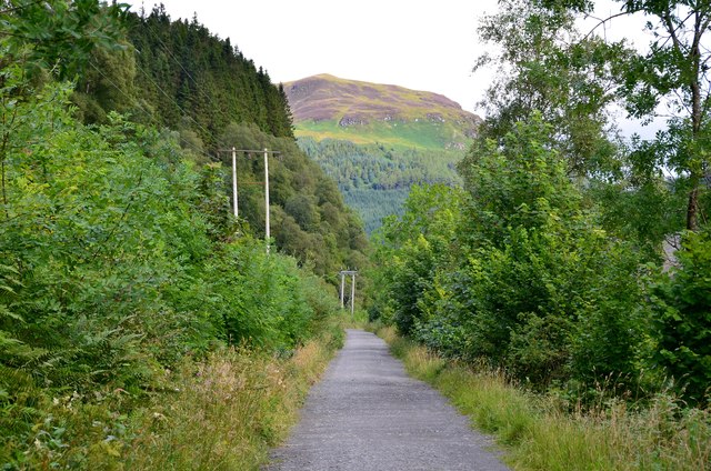
Ardchullarie More is a picturesque village situated in the county of Perthshire, Scotland. Nestled amidst the breathtaking scenery of the Scottish Highlands, this small village is located just a few miles north of the town of Callander. Known for its idyllic setting, Ardchullarie More offers visitors a tranquil retreat from the hustle and bustle of city life.
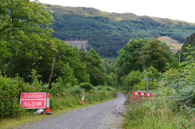
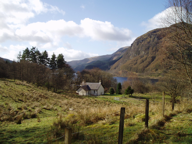
The village is surrounded by rolling hills and lush green landscapes, making it a popular destination for nature enthusiasts and hikers. The nearby Loch Lubnaig provides ample opportunities for fishing and boating, while the surrounding forests are perfect for leisurely walks and picnics.
Ardchullarie More is also home to a number of historic sites and landmarks. The ruins of Ardchullarie Castle, a 17th-century tower house, stand as a testament to the village's rich history. Visitors can explore the remains of the castle and imagine what life was like during its heyday.
Despite its small size, Ardchullarie More has a close-knit community and a friendly atmosphere. The village is home to a handful of local shops and amenities, including a post office and a small grocery store. There are also a few charming bed and breakfasts in the area, offering comfortable accommodations for those wishing to stay a bit longer.
Overall, Ardchullarie More is a hidden gem in Perthshire, offering visitors a chance to enjoy the natural beauty of the Scottish Highlands and experience the warmth of a small, welcoming community.
If you have any feedback on the listing, please let us know in the comments section below.
Ardchullarie More Images
Images are sourced within 2km of 56.288131/-4.2956713 or Grid Reference NN5813. Thanks to Geograph Open Source API. All images are credited.


Ardchullarie More is located at Grid Ref: NN5813 (Lat: 56.288131, Lng: -4.2956713)
Unitary Authority: Stirling
Police Authority: Forth Valley
What 3 Words
///giggle.snippets.pictures. Near Callander, Stirling
Nearby Locations
Related Wikis

Loch Lubnaig
Loch Lubnaig (Loch Lùbnaig in Gaelic) is a small freshwater loch near Callander in the Stirling council area, Scottish Highlands. It lies in the former...
Ardchullarie More
Ardchullarie More is a small hamlet in the Stirling council area, Scotland and is situated on the eastern side of Loch Lubnaig. == External links == Scottish...

Beinn Each
Beinn Each (813 m) is a mountain in the southern Grampian Mountains of Scotland. It is located in Stirlingshire, north of the town of Callander. Rising...

Ben Ledi
Ben Ledi (Beinn Leitir in Scottish Gaelic) is a mountain in Stirling, Scotland. It is 879 metres (2,884 feet) high, and is therefore classified as a Corbett...

Falls of Leny
The Falls of Leny are a series of waterfalls in the Trossachs of Scotland on the course of the Garbh Uisge, otherwise known as the River Leny, where the...

Strathyre railway station
Strathyre was a railway station located at the head of Loch Lubnaig, Stirling, in Strathyre. == History == This station opened on 1 June 1870 along with...

Strathyre
Strathyre (; from Scottish Gaelic: Srath Eadhair) is a district and settlement in the Stirling local government district of Scotland. It forms the south...

Benvane
Benvane (Scottish Gaelic: Beinn Bhàn) is a mountain in the Trossachs, in Stirling council area, Scotland. It lies within Loch Lomond and The Trossachs...
Nearby Amenities
Located within 500m of 56.288131,-4.2956713Have you been to Ardchullarie More?
Leave your review of Ardchullarie More below (or comments, questions and feedback).