Edford Wood

Wood, Forest in Somerset Mendip

England

Edford Wood

Walk steadily over the stream No railings for this wooden (and somewhat slippery) footbridge. It crosses the tributary that runs down from Kilmersdon Common to meet the Mells Stream.
Walk steadily over the stream Credit: Neil Owen

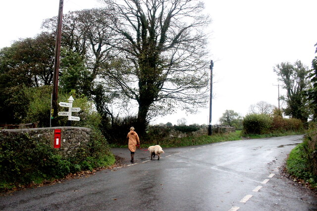
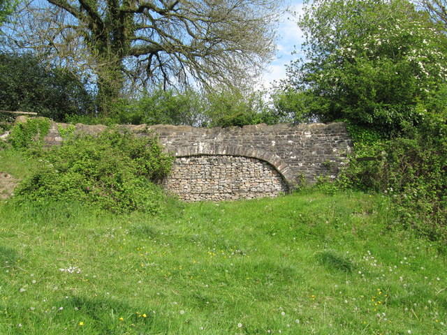
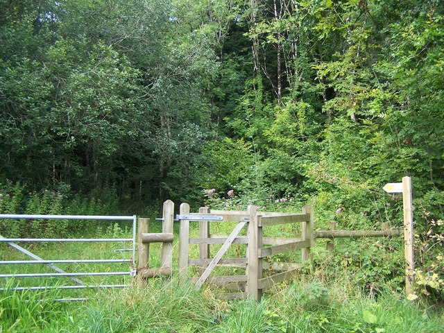
Edford Wood, located in Somerset, England, is a picturesque woodland area known for its natural beauty and rich biodiversity. Spanning over 200 acres, the wood is a popular destination for nature enthusiasts, hikers, and birdwatchers alike.

The woodland is primarily composed of broadleaf and coniferous trees, creating a diverse habitat for a wide range of flora and fauna. Ancient oaks, beech, and ash trees dominate the landscape, providing a haven for various woodland species. Bluebells, wild garlic, and primroses carpet the forest floor during spring, creating a stunning display of colors.

Edford Wood offers numerous walking trails, allowing visitors to explore the serene surroundings and immerse themselves in nature. The paths wind through the wood, meandering alongside tranquil streams and small ponds. The wood is also home to a variety of wildlife, including deer, badgers, foxes, and a multitude of bird species, such as woodpeckers, thrushes, and owls.

The wood has a rich cultural and historical significance, with evidence of human activity dating back to the Bronze Age. Ancient earthworks, burial mounds, and remnants of old settlements can still be found throughout the area, adding an air of mystery to the wood's ambiance.

Furthermore, Edford Wood is managed by a local conservation organization, ensuring the preservation of its natural resources and the protection of its ecosystem. The wood is open to the public year-round, providing an opportunity for visitors to connect with nature and appreciate the tranquility of this enchanting woodland.

If you have any feedback on the listing, please let us know in the comments section below.
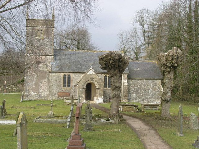
Edford Wood Images

Images are sourced within 2km of 51.235238/-2.4798685 or Grid Reference ST6648. Thanks to Geograph Open Source API. All images are credited.

Walk steadily over the stream No railings for this wooden (and somewhat slippery) footbridge. It crosses the tributary that runs down from Kilmersdon Common to meet the Mells Stream.
Walk steadily over the stream
No railings for this wooden (and somewhat slippery) footbridge. It crosses the tributary that runs down from Kilmersdon Common to meet the Mells Stream.
A dream that ran dry This is the Coleford aqueduct - part of the grand scheme to build the Dorset and Somerset Canal in the late eighteenth century. The plan was to link the Kennet and Avon Canal to Poole in Dorset, with some work being completed before the money dried up. It was never finished and the parts near here that did open were known locally as the Hucky Duck. Here a twin-arch section near Coleford spans private property.
A dream that ran dry
This is the Coleford aqueduct - part of the grand scheme to build the Dorset and Somerset Canal in the late eighteenth century. The plan was to link the Kennet and Avon Canal to Poole in Dorset, with some work being completed before the money dried up. It was never finished and the parts near here that did open were known locally as the Hucky Duck. Here a twin-arch section near Coleford spans private property.
Hucky Duck aqueduct Despite never being completed fully, the old Dorset and Somerset Canal aqueduct (known as the Hucky Duck) stands as a testament to the dream.
Hucky Duck aqueduct
Despite never being completed fully, the old Dorset and Somerset Canal aqueduct (known as the Hucky Duck) stands as a testament to the dream.
A little water in the stream near Kilmersdon Common The valley has a few small sources that gather and head to the Mells Stream.
A little water in the stream near Kilmersdon Common
The valley has a few small sources that gather and head to the Mells Stream.
Up to Mendip Vale Take the footpath up the hill to the modern housing of Highbury. Along the way is a rougher patch of brambles. Further down the hill is an old shaft, part of the coal mining history that used to dominate the village's industry.
Up to Mendip Vale
Take the footpath up the hill to the modern housing of Highbury. Along the way is a rougher patch of brambles. Further down the hill is an old shaft, part of the coal mining history that used to dominate the village's industry.
Wet Saturday Dog Walking near Withybrook The dog walker passing the box-in-the-wall post box is turning off the Fosse Road into the minor road that runs down to Stoke Bottom. The Fosse Rd carries on to Stoke St Michael. The road she is heading down is signposted to Nettlebridge.
Wet Saturday Dog Walking near Withybrook
The dog walker passing the box-in-the-wall post box is turning off the Fosse Road into the minor road that runs down to Stoke Bottom. The Fosse Rd carries on to Stoke St Michael. The road she is heading down is signposted to Nettlebridge.
Industrial Buildings at Stoke Bottom These buildings are heavily protected with large metal fences and razor wire but have no signage to indicate their use.
Industrial Buildings at Stoke Bottom
These buildings are heavily protected with large metal fences and razor wire but have no signage to indicate their use.
Old Milestone by A367, just South of Stratton on the Fosse Way The Milestone is located on grass verge on the East of the road.  Parish of Stratton On The Fosse (Mendip District). Cast iron post, plated iron casting design, erected by the Shepton Mallet turnpike trust in the 19th century. An earlier photograph can be found here: <a title="https://www.geograph.org.uk/photo/6095973" href="https://www.geograph.org.uk/photo/6095973">Link</a> 

Inscription reads:-
SHEPTON / MALLET / 5 : : BATH / 12 : : CHELT.M / 49 

Grade II listed. List Entry Number: 1058636 <span class="nowrap"><a title="https://historicengland.org.uk/listing/the-list/list-entry/1058636" rel="nofollow ugc noopener" href="https://historicengland.org.uk/listing/the-list/list-entry/1058636">Link</a><img style="margin-left:2px;" alt="External link" title="External link - shift click to open in new window" src="https://s1.geograph.org.uk/img/external.png" width="10" height="10"/></span> 

Milestone Society National ID: SO_CMSM49
Old Milestone by A367, just South of Stratton on the Fosse Way
The Milestone is located on grass verge on the East of the road.  Parish of Stratton On The Fosse (Mendip District). Cast iron post, plated iron casting design, erected by the Shepton Mallet turnpike trust in the 19th century. An earlier photograph can be found here: Link  Inscription reads:- SHEPTON / MALLET / 5 : : BATH / 12 : : CHELT.M / 49 Grade II listed. List Entry Number: 1058636 LinkExternal link Milestone Society National ID: SO_CMSM49
Old Milestone by A367, Fosse Way, outside front of "The George at Nettlebridge" PH The Milestone is located against front wall of inn on the East of the road.  Parish of Stratton On The Fosse (Mendip District). Cast iron post, plated iron casting design, erected by the Shepton Mallet turnpike trust in the 19th century. An earlier photograph can be found here: <a title="https://www.geograph.org.uk/photo/6037563" href="https://www.geograph.org.uk/photo/6037563">Link</a> 

Inscription reads:- 
SHEPTON / MALLET / 4 : : BATH / 13 : : CHELT.M / 50  

Grade II listed. List Entry Number: 1178363 <span class="nowrap"><a title="https://historicengland.org.uk/listing/the-list/list-entry/1178363" rel="nofollow ugc noopener" href="https://historicengland.org.uk/listing/the-list/list-entry/1178363">Link</a><img style="margin-left:2px;" alt="External link" title="External link - shift click to open in new window" src="https://s1.geograph.org.uk/img/external.png" width="10" height="10"/></span> 

Milestone Society National ID: SO_CMSM50
Old Milestone by A367, Fosse Way, outside front of "The George at Nettlebridge" PH
The Milestone is located against front wall of inn on the East of the road.  Parish of Stratton On The Fosse (Mendip District). Cast iron post, plated iron casting design, erected by the Shepton Mallet turnpike trust in the 19th century. An earlier photograph can be found here: Link  Inscription reads:- SHEPTON / MALLET / 4 : : BATH / 13 : : CHELT.M / 50 Grade II listed. List Entry Number: 1178363 LinkExternal link Milestone Society National ID: SO_CMSM50
Fernhill Cave The fabulous curtains.
Fernhill Cave
The fabulous curtains.
Fernhill Cave Stalagmite curtain.
Fernhill Cave
Stalagmite curtain.
WL Cave, Fairy Cave Quarry Pink Pool Chamber.
WL Cave, Fairy Cave Quarry
Pink Pool Chamber.
WL Cave, Fairy Cave Quarry Pink Pool Chamber.
WL Cave, Fairy Cave Quarry
Pink Pool Chamber.
Former canal bridge near Edford Infilled arch of a bridge over the course of the abandoned Dorset and Somerset Canal.
Former canal bridge near Edford
Infilled arch of a bridge over the course of the abandoned Dorset and Somerset Canal.
St Cuthbert's Roman Catholic Church, Holcombe
Footpath Near Ham
Footpath Near Ham
Path Through Harridge Wood
Show me another place!

Edford Wood is located at Grid Ref: ST6648 (Lat: 51.235238, Lng: -2.4798685)

Administrative County: Somerset

District: Mendip

Police Authority: Avon and Somerset

What 3 Words

///notes.movement.instructs. Near Chilcompton, Somerset

Nearby Locations

Edford Wood Stoke Bottom

Related Wikis

Edford Woods and Meadows

Edford Woods and Meadows (grid reference ST665485) is a 54.3 hectare (134.1 acre) biological Site of Special Scientific Interest, between Nettlebridge...

Cook's Wood Quarry

Cook's Wood Quarry also known as Holcombe Quarry (grid reference ST669479) is a 0.8-hectare (2.0-acre) geological Site of Special Scientific Interest near...

St Dunstan's Well Catchment

St. Dunstan's Well Catchment (grid reference ST668475) is a Site of Special Scientific Interest, covering 39.8 hectares (98.3 acres) near Stoke St Michael...
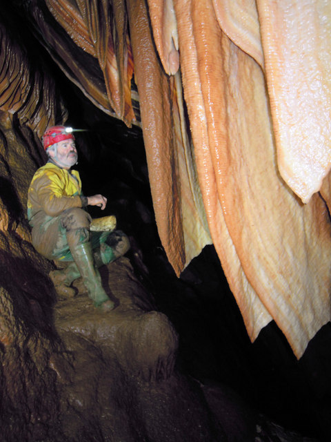
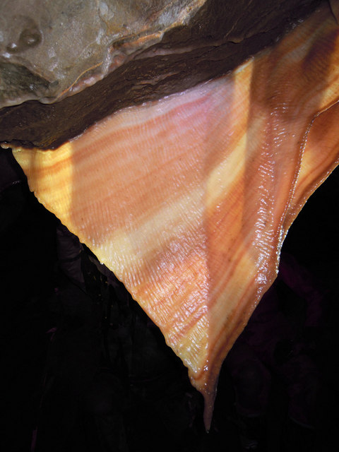
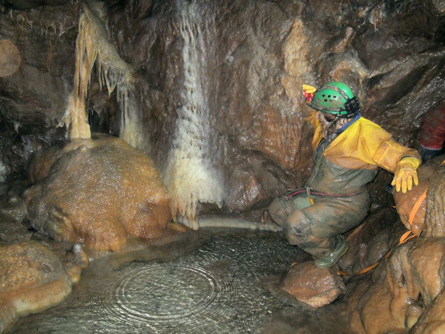
Stoke Lane Slocker

Stoke Lane Slocker (grid reference ST66874745) is a cave near Stoke St Michael, in the Carboniferous Limestone of the Mendip Hills, in the English county...

Holcombe, Somerset

Holcombe is a small village and civil parish (population 936) in the Mendip local government district of Somerset, England. The parish contains the hamlets...

W/L Cave

W/L Cave is part of the Fairy Cave Quarry group of caves between Stoke St Michael and Oakhill in the limestone of the Mendip Hills, in Somerset, England...
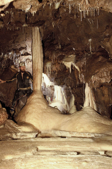
Shatter Cave

Shatter Cave is a cave in Fairy Cave Quarry, near Stoke St Michael in the limestone of the Mendip Hills, in Somerset, England. It falls within the St....

Fairy Cave Quarry

Fairy Cave Quarry (grid reference ST65734753) is between Stoke St Michael and Oakhill in the limestone of the Mendip Hills, in Somerset, England. Quarrying...

Nearby Amenities

Located within 500m of 51.235238,-2.4798685
Barrier: stile
Lat/Long: 51.2376175/-2.4746612
Ford: yes
Lat/Long: 51.2335234/-2.4849303
Barrier: stile
Lat/Long: 51.2330328/-2.4840204
Barrier: stile
Lat/Long: 51.2340134/-2.4750976
The data included in this document is from www.openstreetmap.org. The data is made available under ODbL.

Have you been to Edford Wood?

Leave your review of Edford Wood below (or comments, questions and feedback).