Folly Wood

Wood, Forest in Somerset

England

Folly Wood

View from Clapton Road, Midsomer Norton View across the valley of the Wellow Brook, taken looking south from Clapton Road in Midsomer Norton.  
Old Mills Colliery tip is the distance.
View from Clapton Road, Midsomer Norton Credit: Kevin Pearson

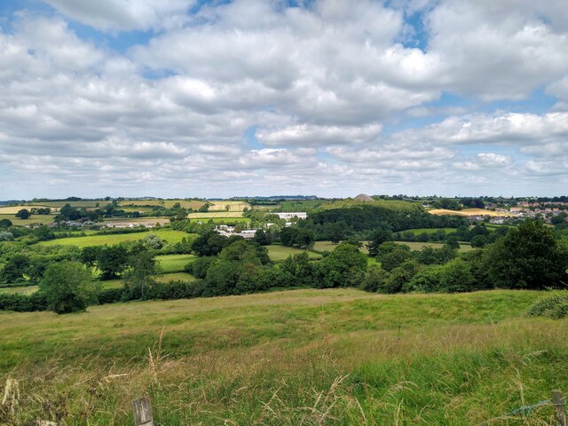
Folly Wood is a serene and enchanting forest located in Somerset, England. Spanning over a vast area, it is a natural haven teeming with diverse flora and fauna. The wood is situated in close proximity to the picturesque village of Folly, which adds to its charm and allure.

This ancient woodland is primarily composed of oak and beech trees, creating a dense and verdant canopy that provides shade and shelter to a multitude of wildlife. The forest floor is adorned with a rich carpet of moss and ferns, further enhancing the ethereal beauty of the surroundings. Folly Wood is also home to a variety of rare and endangered species, including the lesser spotted woodpecker and the silver-washed fritillary butterfly.

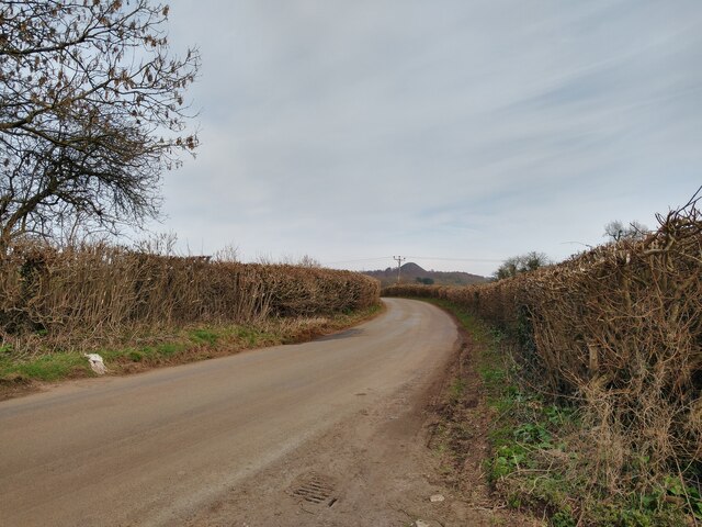
Tranquility permeates the air as visitors explore the winding paths and meandering streams that crisscross the wood. These pathways are well-maintained, allowing for easy navigation and ensuring a pleasant walking experience for nature enthusiasts. The serene atmosphere and breathtaking natural scenery make Folly Wood a popular destination for hikers, birdwatchers, and photographers.

In addition to its natural splendor, Folly Wood also boasts a rich historical significance. It is said to have inspired many local legends and folktales, with stories of mythical creatures and hidden treasures being passed down through generations. The wood offers a sense of mystery and intrigue, captivating visitors with its ancient charm.

Folly Wood, Somerset, is a true gem of natural beauty and a testament to the importance of preserving and appreciating our natural heritage. It is a place where one can escape the hustle and bustle of everyday life and immerse oneself in the wonders of the natural world.

If you have any feedback on the listing, please let us know in the comments section below.
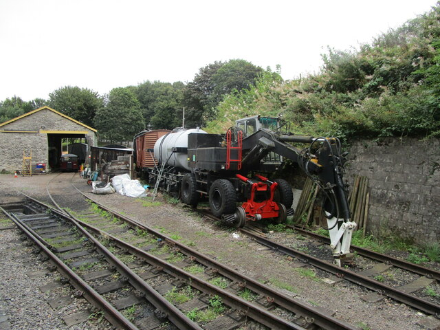
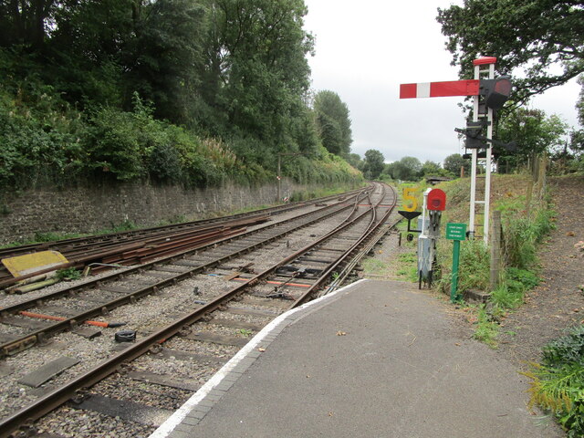
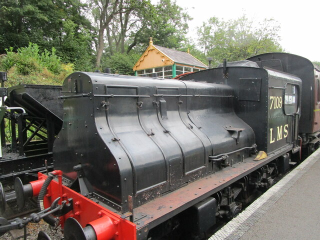
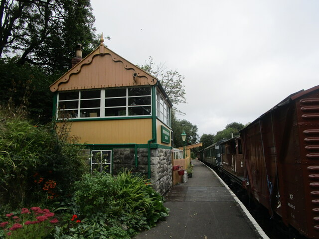
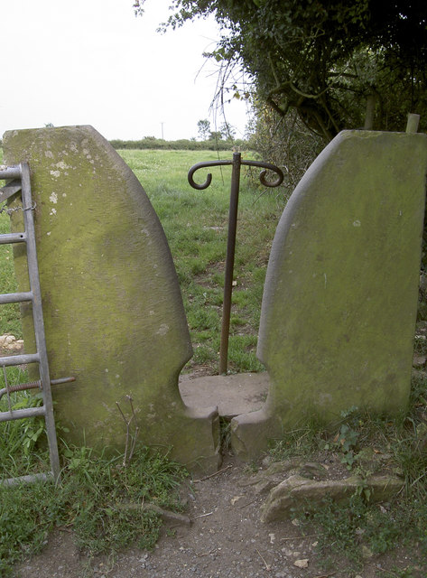
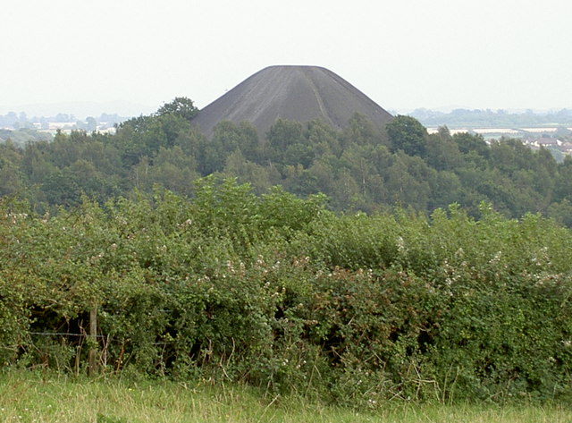
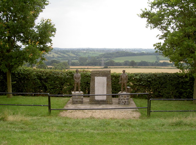
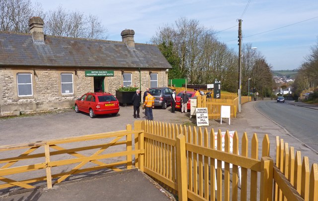
Folly Wood Images

Images are sourced within 2km of 51.284896/-2.4981232 or Grid Reference ST6554. Thanks to Geograph Open Source API. All images are credited.

View from Clapton Road, Midsomer Norton View across the valley of the Wellow Brook, taken looking south from Clapton Road in Midsomer Norton.  
Old Mills Colliery tip is the distance.
View from Clapton Road, Midsomer Norton
View across the valley of the Wellow Brook, taken looking south from Clapton Road in Midsomer Norton. Old Mills Colliery tip is the distance.
Langley's Lane near Clapton Langley's Lane, which runs from the small village of Clapton to the A362 near Midsomer Norton, crossing the trackbed of the former Bristol & North Somerset Railway just past where the photograph was taken.
The colliery heap of Old Mills Colliery is in the background.
Langley's Lane near Clapton
Langley's Lane, which runs from the small village of Clapton to the A362 near Midsomer Norton, crossing the trackbed of the former Bristol & North Somerset Railway just past where the photograph was taken. The colliery heap of Old Mills Colliery is in the background.
Restored station building, Midsomer Norton Once on the Somerset and Dorset Joint Railway <span class="nowrap"><a title="https://en.wikipedia.org/wiki/Somerset_and_Dorset_Joint_Railway" rel="nofollow ugc noopener" href="https://en.wikipedia.org/wiki/Somerset_and_Dorset_Joint_Railway">Link</a><img style="margin-left:2px;" alt="External link" title="External link - shift click to open in new window" src="https://s1.geograph.org.uk/img/external.png" width="10" height="10"/></span> between Bath and Bournemouth.
Restored station building, Midsomer Norton
Once on the Somerset and Dorset Joint Railway LinkExternal link between Bath and Bournemouth.
D2128 at Midsomer Norton A re-engined Class O3 locomotive <span class="nowrap"><a title="https://sdjr.co.uk/locomotives-stock/d2128-03901" rel="nofollow ugc noopener" href="https://sdjr.co.uk/locomotives-stock/d2128-03901">Link</a><img style="margin-left:2px;" alt="External link" title="External link - shift click to open in new window" src="https://s1.geograph.org.uk/img/external.png" width="10" height="10"/></span>
D2128 at Midsomer Norton
A re-engined Class O3 locomotive LinkExternal link
Rail mounted vehicle at Midsomer Norton
The end of the platform, Midsomer Norton A restored section of the Somerset and Dorset Joint Railway <span class="nowrap"><a title="https://en.wikipedia.org/wiki/Somerset_and_Dorset_Joint_Railway" rel="nofollow ugc noopener" href="https://en.wikipedia.org/wiki/Somerset_and_Dorset_Joint_Railway">Link</a><img style="margin-left:2px;" alt="External link" title="External link - shift click to open in new window" src="https://s1.geograph.org.uk/img/external.png" width="10" height="10"/></span>
The end of the platform, Midsomer Norton
A restored section of the Somerset and Dorset Joint Railway LinkExternal link
Sentinel steam locomotive 7109 At Midsomer Norton. Built by the Sentinel Waggon Works in 1927 <span class="nowrap"><a title="https://preservedbritishsteamlocomotives.com/sentinel-works-no-7109-joyce-0-4-0-vbgt/" rel="nofollow ugc noopener" href="https://preservedbritishsteamlocomotives.com/sentinel-works-no-7109-joyce-0-4-0-vbgt/">Link</a><img style="margin-left:2px;" alt="External link" title="External link - shift click to open in new window" src="https://s1.geograph.org.uk/img/external.png" width="10" height="10"/></span>
Sentinel steam locomotive 7109
At Midsomer Norton. Built by the Sentinel Waggon Works in 1927 LinkExternal link
Restored signal box at Midsomer Norton
Arnhem Memorial A poignant tribute to be found in an unremarkable field on the outskirts of Paulton, Somerset. The legend details how two gliders that were on the way to Arnhem came down here in 1944, claiming all aboard.

Also see <a href="https://www.geograph.org.uk/photo/2526731">ST6455 : Arnhem Memorial</a>, <a href="https://www.geograph.org.uk/photo/2526725">ST6455 : Trig point near a war-time crash site</a> and <a href="https://www.geograph.org.uk/photo/2526712">ST6455 : Arnhem Memorial inscription</a> for more views of the inscriptions.
Arnhem Memorial
A poignant tribute to be found in an unremarkable field on the outskirts of Paulton, Somerset. The legend details how two gliders that were on the way to Arnhem came down here in 1944, claiming all aboard. Also see ST6455 : Arnhem Memorial, ST6455 : Trig point near a war-time crash site and ST6455 : Arnhem Memorial inscription for more views of the inscriptions.
Arnhem Memorial inscription The legend gives details of the terrible loss over home soil, shortly after taking off from RAF Keevil, only a few miles away. See <a href="https://www.geograph.org.uk/photo/2526710">ST6455 : Arnhem Memorial</a> and <a href="https://www.geograph.org.uk/photo/2526725">ST6455 : Trig point near a war-time crash site</a>  for more views.
Arnhem Memorial inscription
The legend gives details of the terrible loss over home soil, shortly after taking off from RAF Keevil, only a few miles away. See ST6455 : Arnhem Memorial and ST6455 : Trig point near a war-time crash site for more views.
Flush bracket, Paulton The identifying bracket on the pillar, which is still in good condition. See <a href="https://www.geograph.org.uk/photo/2526722">ST6455 : Paulton trig pillar</a>.
Flush bracket, Paulton
The identifying bracket on the pillar, which is still in good condition. See ST6455 : Paulton trig pillar.
Paulton trig pillar Placed near the summit of the field, it overlooks some great views of the surrounding countryside (see <a href="https://www.geograph.org.uk/photo/2526725">ST6455 : Trig point near a war-time crash site</a>) and also the Arnhem Memorial (seen in distance). The flush bracket can be found here: <a href="https://www.geograph.org.uk/photo/2526721">ST6455 : Flush bracket, Paulton</a>.
Paulton trig pillar
Placed near the summit of the field, it overlooks some great views of the surrounding countryside (see ST6455 : Trig point near a war-time crash site) and also the Arnhem Memorial (seen in distance). The flush bracket can be found here: ST6455 : Flush bracket, Paulton.
Trig point near a war-time crash site In the field just over the crest, two Horsa gliders carrying 23 men of the Royal Engineers came down in 1944. All were lost in the crash. A memorial was established nearby in 1979 - see <a href="https://www.geograph.org.uk/photo/2526710">ST6455 : Arnhem Memorial</a> and <a href="https://www.geograph.org.uk/photo/2526712">ST6455 : Arnhem Memorial inscription</a> for more views.
Trig point near a war-time crash site
In the field just over the crest, two Horsa gliders carrying 23 men of the Royal Engineers came down in 1944. All were lost in the crash. A memorial was established nearby in 1979 - see ST6455 : Arnhem Memorial and ST6455 : Arnhem Memorial inscription for more views.
That'll stop the unwanted A striking variation on the methods of preventing cattle and motorised traffic through a field.
That'll stop the unwanted
A striking variation on the methods of preventing cattle and motorised traffic through a field.
Not volcanic A coal spoil heap rises above the greenery. Midsomer Norton and Radstock  were important coalmining areas from the late 18th century, and production gradually increased with time up to 1900. However, the complicated local geology and nationalisation eventually led to the closure of all mining in September 1973.

The heap is actually a SSSI and contains some interesting fossils, including the world's earliest known damselfly!
Not volcanic
A coal spoil heap rises above the greenery. Midsomer Norton and Radstock were important coalmining areas from the late 18th century, and production gradually increased with time up to 1900. However, the complicated local geology and nationalisation eventually led to the closure of all mining in September 1973. The heap is actually a SSSI and contains some interesting fossils, including the world's earliest known damselfly!
Arnhem Memorial A memorial to the loss of 23 men of the Royal Engineers, whose gliders came down in this field in 1944. It was unveiled by Major General R.E. Urquhart C.B. D.S.O. on 23rd September, 1979, but has been improved more than once since.

Compare the picture by Damon Knight in 2006 <a href="https://www.geograph.org.uk/photo/530902">ST6455 : Paulton Arnhem Memorial with View Beyond</a>. The two new statues were created by SPR Roy Cleeves and installed in 2008.

See <a href="https://www.geograph.org.uk/photo/2526712">ST6455 : Arnhem Memorial inscription</a>, <a href="https://www.geograph.org.uk/photo/2526725">ST6455 : Trig point near a war-time crash site</a> and <a href="https://www.geograph.org.uk/photo/2526710">ST6455 : Arnhem Memorial</a> for more images.
Arnhem Memorial
A memorial to the loss of 23 men of the Royal Engineers, whose gliders came down in this field in 1944. It was unveiled by Major General R.E. Urquhart C.B. D.S.O. on 23rd September, 1979, but has been improved more than once since. Compare the picture by Damon Knight in 2006 ST6455 : Paulton Arnhem Memorial with View Beyond. The two new statues were created by SPR Roy Cleeves and installed in 2008. See ST6455 : Arnhem Memorial inscription, ST6455 : Trig point near a war-time crash site and ST6455 : Arnhem Memorial for more images.
Bradford - Bournemouth express pounding through Midsomer Norton South station View northward, towards Bath: ex-Somerset & Dorset (Midland & LSW Joint) line, Bath (Green Park) - Templecombe - Bournemouth West. It is a Summer Saturday and the heavy 07.40 from Bradford (Forster Square) has reversed at Bath (dep. 14.50) and is due at Bournemouth West at 17.35. It needs two large locomotives to tackle the heavy gradients, here the long climb from Radstock up to Masbury. SR rebuilt Bulleid Light Pacific No. 34048 'Crediton' (built 11/46 as 21C148, rebuilt 3/59, withdrawn 3/66) is piloting BR Standard 5MT 4-6-0 No. 73019 (built 11/51, withdrawn 1/67). The station was closed with the line on 7/3/66, but the premises and a short length of track now belong to the Somerset & Dorset Railway Heritage Trust. (See also <a href="https://www.geograph.org.uk/photo/2122053">ST6653 : Midsomer Norton South Station, with Down express</a>).
Bradford - Bournemouth express pounding through Midsomer Norton South station
View northward, towards Bath: ex-Somerset & Dorset (Midland & LSW Joint) line, Bath (Green Park) - Templecombe - Bournemouth West. It is a Summer Saturday and the heavy 07.40 from Bradford (Forster Square) has reversed at Bath (dep. 14.50) and is due at Bournemouth West at 17.35. It needs two large locomotives to tackle the heavy gradients, here the long climb from Radstock up to Masbury. SR rebuilt Bulleid Light Pacific No. 34048 'Crediton' (built 11/46 as 21C148, rebuilt 3/59, withdrawn 3/66) is piloting BR Standard 5MT 4-6-0 No. 73019 (built 11/51, withdrawn 1/67). The station was closed with the line on 7/3/66, but the premises and a short length of track now belong to the Somerset & Dorset Railway Heritage Trust. (See also ST6653 : Midsomer Norton South Station, with Down express).
Midsomer Norton South Station This station was opened on 20 July 1874 as part of the Somerset & Dorset Railway's extension from Evercreech Junction to Bath.  It closed in 1966 along with the rest of the line between Bath and Bournemouth.  The Somerset & Dorset Heritage Trust was established in 1992, and has restored the Midsomer Norton South station. Future plans include relaying tracks to Chilcompton, the next station south, via the Chilcompton Tunnel.
Midsomer Norton South Station
This station was opened on 20 July 1874 as part of the Somerset & Dorset Railway's extension from Evercreech Junction to Bath. It closed in 1966 along with the rest of the line between Bath and Bournemouth. The Somerset & Dorset Heritage Trust was established in 1992, and has restored the Midsomer Norton South station. Future plans include relaying tracks to Chilcompton, the next station south, via the Chilcompton Tunnel.
Show me another place!

Folly Wood is located at Grid Ref: ST6554 (Lat: 51.284896, Lng: -2.4981232)

Unitary Authority: Bath and North East Somerset

Police Authority: Avon and Somerset

What 3 Words

///decently.sprinting.finds. Near Midsomer Norton, Somerset

Related Wikis

Somervale School

Somervale School is situated in Midsomer Norton in Bath and North East Somerset in South West England. The school, which has academy status, is a specialist...

The Priory, Midsomer Norton

The Priory in Church Square, Midsomer Norton, within the English county of Somerset was rebuilt in the early or mid 17th century. It is a Grade II* listed...

Church of St John the Baptist, Midsomer Norton

The Anglican Church of St John the Baptist in Midsomer Norton, Somerset, England, is a Grade II* listed building. St. John's is part of the Diocese of...

Church of the Holy Ghost, Midsomer Norton

The Church of the Holy Ghost, Midsomer Norton, Somerset, England is a Roman Catholic parish church housed in a converted tithe barn. It is served by monks...

Midsomer Norton Town Hall

Midsomer Norton Town Hall is a municipal structure at The Island, Midsomer Norton, Somerset, England. The structure, which serves as the meeting place...

Norton House, Somerset

Norton House was a mansion in Midsomer Norton, Somerset. It was built around 1789 by the Savage family, investors in mines in the Somerset Coalfield...

Midsomer Norton

Midsomer Norton is a town near the Mendip Hills in Bath and North East Somerset, England, 10 miles (16 km) south-west of Bath, 10 miles (16 km) north...

Norton Hill School

Norton Hill School is a state school with academy status in Midsomer Norton, Somerset, England. It is part of the Midsomer Norton Schools Partnership academy...

Nearby Amenities

Located within 500m of 51.284896,-2.4981232
Bus Stop
Bus: yes
Public Transport: platform
Lat/Long: 51.2869192/-2.4919545
Folly Hill
Ele: 156
Natural: peak
Source: NPE
Lat/Long: 51.2830199/-2.5033827
Bus Stop
Bus: yes
Public Transport: platform
Lat/Long: 51.2835269/-2.4923346
Bus Stop
Paulton Road
Bus: yes
Naptan AtcoCode: 0180BAC30863
Naptan Bearing: E
Naptan CommonName: Paulton Road
Naptan Crossing: Paulton Road
Naptan NaptanCode: bthapwt
Naptan Street: Redfield Road
Naptan Verified: no
Public Transport: platform
Source: naptan_import
Lat/Long: 51.2836139/-2.4919068
Bus Stop
Paulton Road
Bus: yes
Naptan AtcoCode: 0180BAC30864
Naptan Bearing: W
Naptan BusStopType: CUS
Naptan CommonName: Paulton Road
Naptan Crossing: Paulton Road
Naptan NaptanCode: bthataj
Naptan Street: Redfield Road
Naptan Verified: no
Public Transport: platform
Source: naptan_import
Lat/Long: 51.283524/-2.4919059
Bus Stop
Kings Arms
Bus: yes
Naptan AtcoCode: 0180BAC30877
Naptan Bearing: N
Naptan CommonName: Kings Arms
Naptan Crossing: Hillside Road
Naptan NaptanCode: bthapmg
Naptan Street: Chilcompton Road
Naptan Verified: no
Public Transport: platform
Source: naptan_import
Lat/Long: 51.2814828/-2.4940348
Bus Stop
Kings Arms
Bus: yes
Naptan AtcoCode: 0180BAC30878
Naptan Bearing: S
Naptan BusStopType: CUS
Naptan CommonName: Kings Arms
Naptan Crossing: Hillside Road
Naptan NaptanCode: bthapmp
Naptan Street: Chilcompton Road
Naptan Verified: no
Public Transport: platform
Source: naptan_import
Lat/Long: 51.2814924/-2.4938915
Bus Stop
Redfield Rd Top
Bus: yes
Naptan AtcoCode: 0180BAC30879
Naptan Bearing: N
Naptan CommonName: Redfield Rd Top
Naptan Crossing: Redfield Road
Naptan NaptanCode: bthapwg
Naptan Street: Paulton Road
Naptan Verified: no
Public Transport: platform
Source: naptan_import
Lat/Long: 51.2842954/-2.492373
Bus Stop
Pinewood Road
Bus: yes
Naptan AtcoCode: 0180BAC30880
Naptan Bearing: N
Naptan CommonName: Pinewood Road
Naptan Crossing: Pinewood Road
Naptan NaptanCode: bthapwm
Naptan Street: Paulton Road
Naptan Verified: no
Public Transport: platform
Source: naptan_import
Lat/Long: 51.2854117/-2.4920694
Bus Stop
Pinewood Road
Bus: yes
Naptan AtcoCode: 0180BAC30881
Naptan Bearing: S
Naptan BusStopType: CUS
Naptan CommonName: Pinewood Road
Naptan Crossing: Pinewood Road
Naptan NaptanCode: bthatad
Naptan Street: Paulton Road
Naptan Verified: no
Public Transport: platform
Source: naptan_import
Lat/Long: 51.2854302/-2.4919406
Bus Stop
Orchard Avenue
Bus: yes
Naptan AtcoCode: 0180BAC30882
Naptan Bearing: N
Naptan BusStopType: CUS
Naptan CommonName: Orchard Avenue
Naptan Crossing: Orchard Avenue
Naptan NaptanCode: bthatag
Naptan Street: Paulton Road
Naptan Verified: no
Public Transport: platform
Source: naptan_import
Lat/Long: 51.2869588/-2.4919569
Bus Stop
Orchard Avenue
Bus: yes
Naptan AtcoCode: 0180BAC30883
Naptan Bearing: S
Naptan CommonName: Orchard Avenue
Naptan Crossing: Orchard Avenue
Naptan NaptanCode: bthatam
Naptan Street: Paulton Road
Naptan Verified: no
Public Transport: platform
Source: naptan_import
Lat/Long: 51.2869685/-2.4917849
Bicycle Parking
Capacity: 20
Lat/Long: 51.2856634/-2.4962181
Hillside
Place: suburb
Source: OS OpenData StreetView
Lat/Long: 51.2810725/-2.4969418
Fast Food
Salt And Batter
Addr Housenumber: 76
Addr Postcode: BA3 2JP
Addr Street: Redfield Road
Cuisine: fish_and_chips
Fhrs Id: 1639329
Lat/Long: 51.2836887/-2.4919423
Kindergarten
Longvernal Nursery School
Addr Postcode: BA3 2LP
Facebook: https://www.facebook.com/Longvernalnursery/
Fhrs Id: 204202
Lat/Long: 51.2849212/-2.4945705
Power: pole
Lat/Long: 51.2819588/-2.5031766
Power: pole
Lat/Long: 51.2828587/-2.5034498
Power: pole
Lat/Long: 51.2838222/-2.5037294
Power: pole
Lat/Long: 51.2844327/-2.5039112
Power: pole
Lat/Long: 51.2854478/-2.5042048
Power: pole
Lat/Long: 51.2860392/-2.5043725
Brookes News
Addr Postcode: BA3 2JP
Fhrs Id: 205737
Shop: newsagent
Lat/Long: 51.283689/-2.4918234
Power: pole
Lat/Long: 51.2842224/-2.5051591
Post Box
Operator: Royal Mail
Operator Wikidata: Q638098
Post Box Type: wall
Royal Cypher: GR
Royal Cypher Wikidata: Q33102273
Lat/Long: 51.2835471/-2.492727
The data included in this document is from www.openstreetmap.org. The data is made available under ODbL.

Have you been to Folly Wood?

Leave your review of Folly Wood below (or comments, questions and feedback).