New Hey Wood

Wood, Forest in Lancashire Ribble Valley

England

New Hey Wood

The road to Dunsop Bridge Approaching Burholme Bridge.
The road to Dunsop Bridge Credit: Phil and Juliette Platt

The requested URL returned error: 429 Too Many Requests

If you have any feedback on the listing, please let us know in the comments section below.
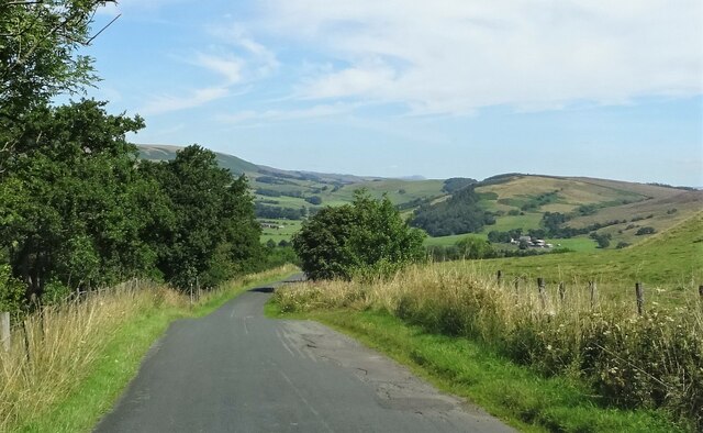
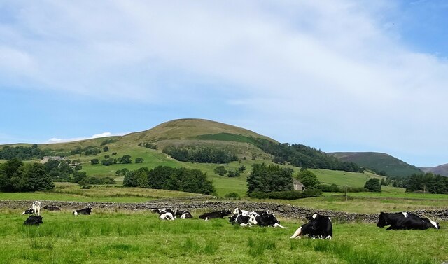
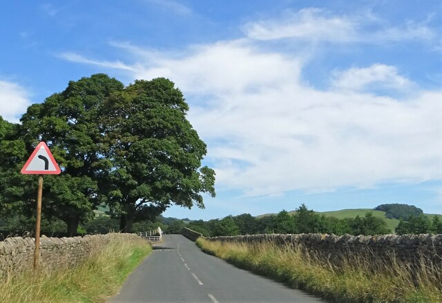
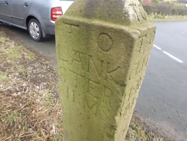
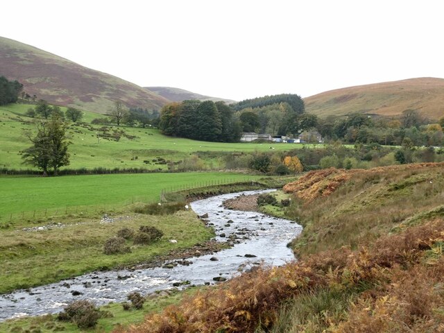
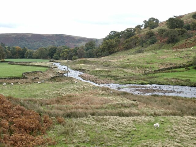
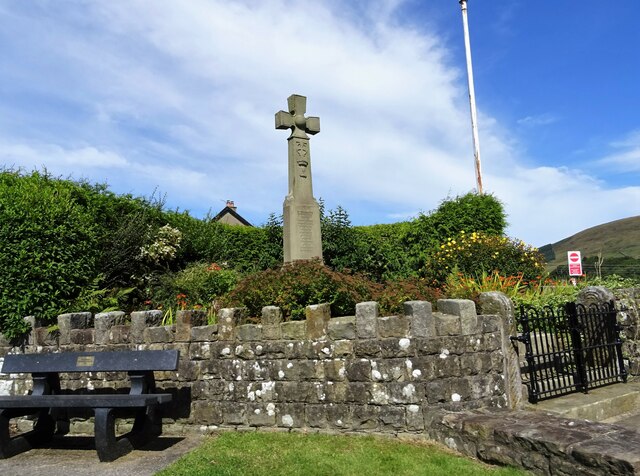
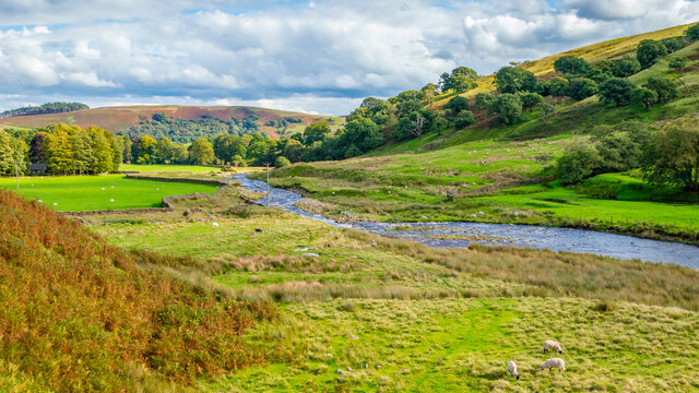
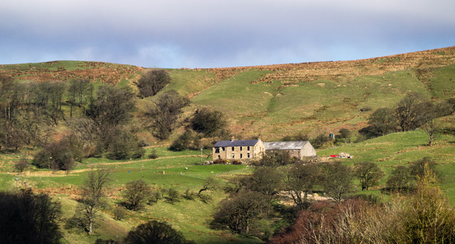
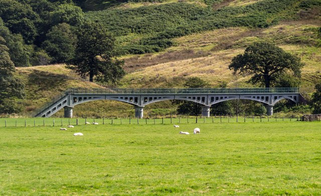
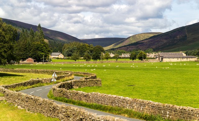
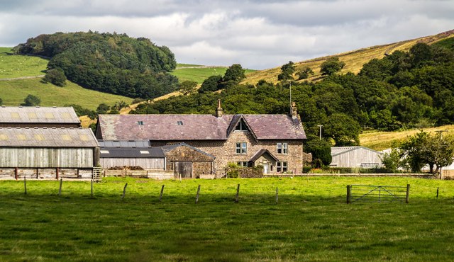
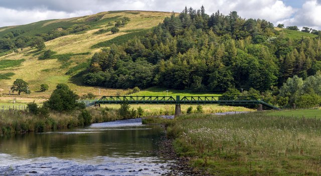
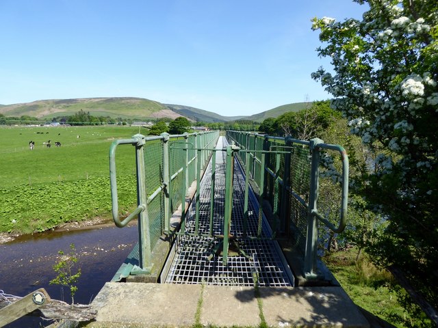
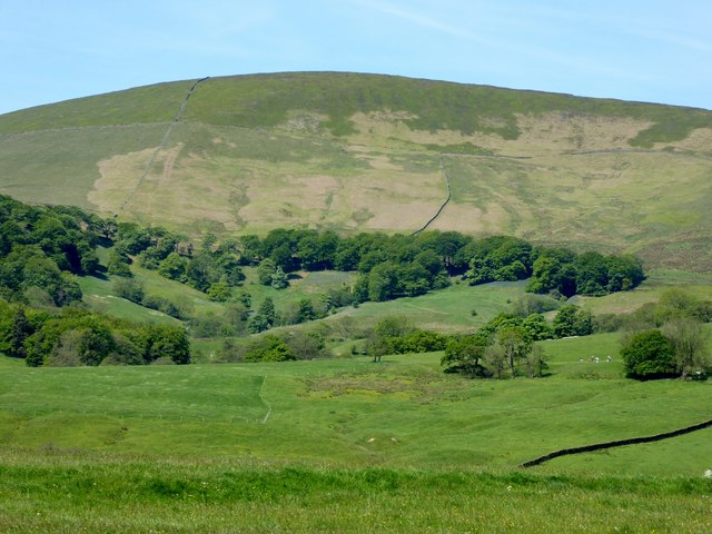
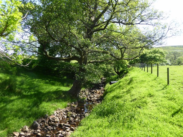
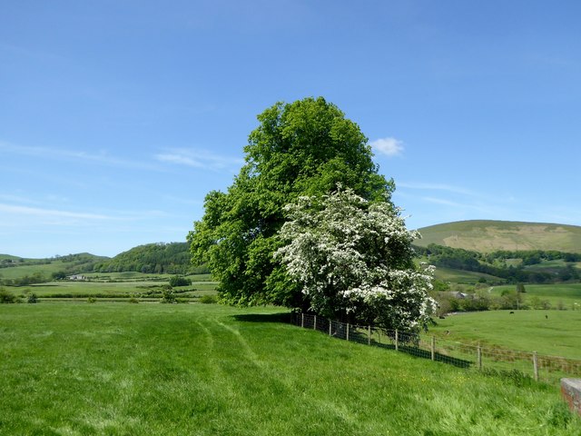
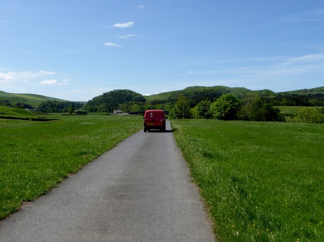
New Hey Wood Images

Images are sourced within 2km of 53.931969/-2.5413751 or Grid Reference SD6448. Thanks to Geograph Open Source API. All images are credited.

The road to Dunsop Bridge Approaching Burholme Bridge.
The road to Dunsop Bridge
Approaching Burholme Bridge.
Cows taking it easy Near Burholme Bridge.
Cows taking it easy
Near Burholme Bridge.
Approaching Langden Bridge Carrying the road over Langden Brook outside Dunsop Bridge.
Approaching Langden Bridge
Carrying the road over Langden Brook outside Dunsop Bridge.
Old Milestone by Dunsop Bridge By the UC road, in Bowland Forest High parish (Ribble Valley District), formerly Yorkshire West Riding but now Lancashire. Dunsop Bridge, junction with road to Slaidburn.

Grade II listed. List Entry Number: 1362243
<span class="nowrap"><a title="https://historicengland.org.uk/listing/the-list/list-entry/1362243" rel="nofollow ugc noopener" href="https://historicengland.org.uk/listing/the-list/list-entry/1362243">Link</a><img style="margin-left:2px;" alt="External link" title="External link - shift click to open in new window" src="https://s1.geograph.org.uk/img/external.png" width="10" height="10"/></span>

Surveyed

Milestone Society National ID: YW_XBOWa
Old Milestone by Dunsop Bridge
By the UC road, in Bowland Forest High parish (Ribble Valley District), formerly Yorkshire West Riding but now Lancashire. Dunsop Bridge, junction with road to Slaidburn. Grade II listed. List Entry Number: 1362243 LinkExternal link Surveyed Milestone Society National ID: YW_XBOWa
Langden Brook Hareden Farm can be seen in the mouth of the side valley.
Langden Brook
Hareden Farm can be seen in the mouth of the side valley.
Langden Brook
Langden Brook
War memorial at Dunsop Bridge Remembering the local men who died in the Great War.
War memorial at Dunsop Bridge
Remembering the local men who died in the Great War.
Looking east along Langden Brook
New Hey Farm View of New Hey Farm.
New Hey Farm
View of New Hey Farm.
New Bridge Aqueduct and footbridge over the River Hodder.
New Bridge
Aqueduct and footbridge over the River Hodder.
Root Hill Root Hill with Dunsop Bridge and the valley of the River Dunsop behind.
Root Hill
Root Hill with Dunsop Bridge and the valley of the River Dunsop behind.
Langden Holme Farm View of Langden Holme Farm.
Langden Holme Farm
View of Langden Holme Farm.
River Hodder Aqueduct over the River Hodder.
River Hodder
Aqueduct over the River Hodder.
Footbridge over the Hodder A turnstile type barrier prevents sheep from accessing the bridge.
Footbridge over the Hodder
A turnstile type barrier prevents sheep from accessing the bridge.
Mellor Knoll From a footpath near Burholme Farm.
Mellor Knoll
From a footpath near Burholme Farm.
Stream at Burholme Farm A footbridge carries the footpath over the brook and into the farmyard.
Stream at Burholme Farm
A footbridge carries the footpath over the brook and into the farmyard.
Farmland at Burholme The hawthorn is flowering.
Farmland at Burholme
The hawthorn is flowering.
The Royal Mail delivers Another rural delivery completed, this time to Burholme Farm.
The Royal Mail delivers
Another rural delivery completed, this time to Burholme Farm.
Show me another place!

New Hey Wood is located at Grid Ref: SD6448 (Lat: 53.931969, Lng: -2.5413751)

Administrative County: Lancashire

District: Ribble Valley

Police Authority: Lancashire

What 3 Words

///cove.burn.headlight. Near Waddington, Lancashire

Nearby Locations

New Hey Wood

Related Wikis

Langden Brook

Langden Brook is a watercourse in the Trough of Bowland, Lancashire, England. A tributary of the River Hodder, its source is near the summit of Hawthornthwaite...

Bowland Forest High milestone

The Bowland Forest High milestone is an historic milestone marker in the English parish of Bowland Forest High, in the Trough of Bowland, Lancashire. A...

Dunsop Bridge (structure)

Dunsop Bridge is a bridge in the English village of the same name. The structure, which dates to the early 19th century, crosses the River Dunsop. A Grade...

Bowland Forest High

Bowland Forest High is a civil parish in the Ribble Valley district of Lancashire, England, covering some 20,000 acres (80 km2) of the Forest of Bowland...

Nearby Amenities

Located within 500m of 53.931969,-2.5413751
The data included in this document is from www.openstreetmap.org. The data is made available under ODbL.

Have you been to New Hey Wood?

Leave your review of New Hey Wood below (or comments, questions and feedback).