Frog's Folly Plantation

Wood, Forest in Dorset

England

Frog's Folly Plantation

Benchmark on Remedy House, near Hermitage Ordnance Survey benchmark, described on database at <span class="nowrap"><a title="http://www.bench-marks.org.uk/bm71318" rel="nofollow ugc noopener" href="http://www.bench-marks.org.uk/bm71318">Link</a><img style="margin-left:2px;" alt="External link" title="External link - shift click to open in new window" src="https://s1.geograph.org.uk/img/external.png" width="10" height="10"/></span>. See also <a href="https://www.geograph.org.uk/photo/4723466">ST6405 : Remedy House gate, near Hermitage</a>.
Benchmark on Remedy House, near Hermitage Credit: Becky Williamson

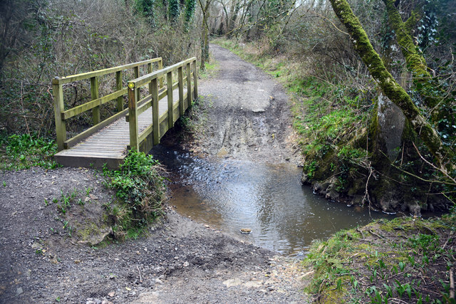
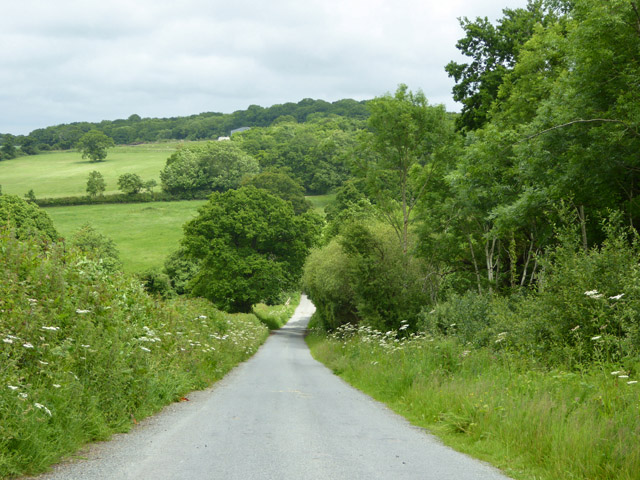
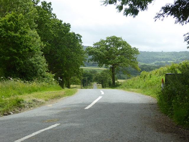
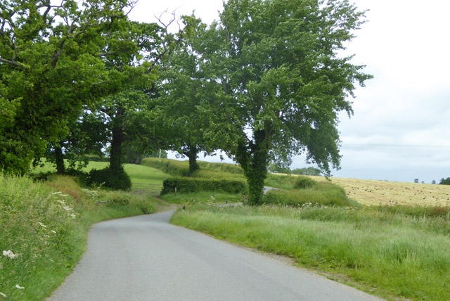
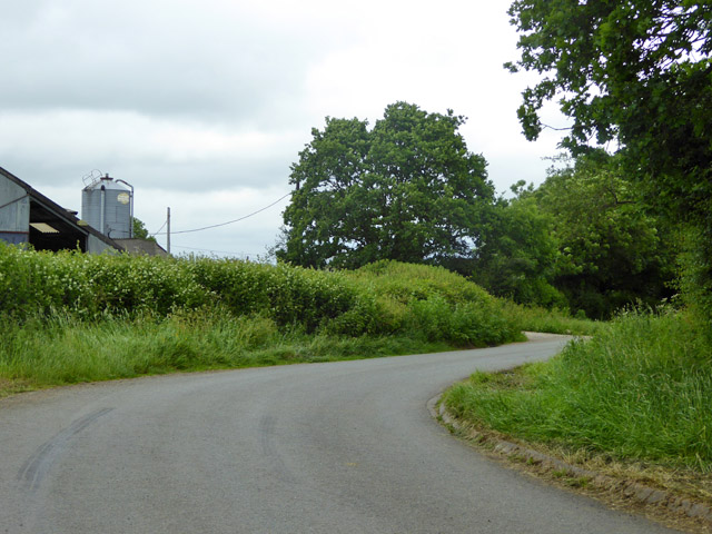
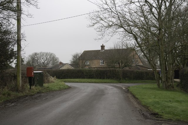
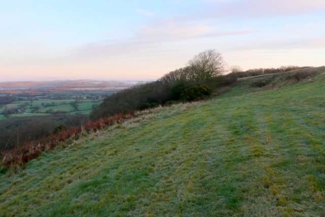
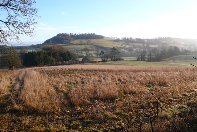
Frog's Folly Plantation is a picturesque woodland area located in Dorset, England. This sprawling plantation covers a vast expanse of land, consisting mainly of dense forests and woodlands. It is a popular destination for nature enthusiasts and those seeking tranquility amidst nature's beauty.

The plantation is home to a diverse range of flora and fauna, making it a haven for wildlife. Visitors can expect to encounter various species of birds, mammals, and insects while exploring the area. The lush greenery and towering trees create a peaceful and serene atmosphere, providing ample opportunities for nature walks, birdwatching, and photography.

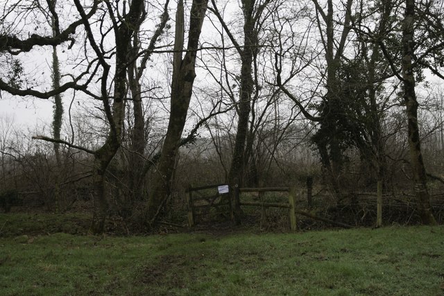
The woodlands in Frog's Folly Plantation are characterized by a mix of deciduous and coniferous trees. Oak, beech, and birch trees dominate the landscape, creating a vibrant display of colors during the autumn months. The plantation also features several well-maintained walking trails, allowing visitors to immerse themselves in the natural surroundings and enjoy the tranquility of the woodland.

Aside from its natural beauty, Frog's Folly Plantation also has historical significance. The plantation's name is believed to have originated from an old folklore tale, adding an element of mystery and intrigue to the area. It is said that a mischievous frog once played pranks on the plantation owner, leading to the naming of the estate.

Overall, Frog's Folly Plantation offers a serene escape from the hustle and bustle of everyday life, allowing visitors to reconnect with nature and experience the beauty of Dorset's woodlands.

If you have any feedback on the listing, please let us know in the comments section below.

Frog's Folly Plantation Images

Images are sourced within 2km of 50.863776/-2.5058969 or Grid Reference ST6407. Thanks to Geograph Open Source API. All images are credited.

Benchmark on Remedy House, near Hermitage Ordnance Survey benchmark, described on database at <span class="nowrap"><a title="http://www.bench-marks.org.uk/bm71318" rel="nofollow ugc noopener" href="http://www.bench-marks.org.uk/bm71318">Link</a><img style="margin-left:2px;" alt="External link" title="External link - shift click to open in new window" src="https://s1.geograph.org.uk/img/external.png" width="10" height="10"/></span>. See also <a href="https://www.geograph.org.uk/photo/4723466">ST6405 : Remedy House gate, near Hermitage</a>.
Benchmark on Remedy House, near Hermitage
Ordnance Survey benchmark, described on database at LinkExternal link. See also ST6405 : Remedy House gate, near Hermitage.
Remedy House gate, near Hermitage There is an Ordnance Survey benchmark on the right-hand side of the gable end of this house. See <a href="https://www.geograph.org.uk/photo/4723461">ST6405 : Benchmark on Remedy House, near Hermitage</a>
Ordnance Survey benchmark, described on database at <span class="nowrap"><a title="http://www.bench-marks.org.uk/bm71318" rel="nofollow ugc noopener" href="http://www.bench-marks.org.uk/bm71318">Link</a><img style="margin-left:2px;" alt="External link" title="External link - shift click to open in new window" src="https://s1.geograph.org.uk/img/external.png" width="10" height="10"/></span>.
Remedy House gate, near Hermitage
There is an Ordnance Survey benchmark on the right-hand side of the gable end of this house. See ST6405 : Benchmark on Remedy House, near Hermitage Ordnance Survey benchmark, described on database at LinkExternal link.
Leigh Ford This ford is found on Long Bridge Drove near Leigh.
Leigh Ford
This ford is found on Long Bridge Drove near Leigh.
Hilfield Lane There's the 'hil', and there's the fields...
Hilfield Lane
There's the 'hil', and there's the fields...
Road towards Hilfield church Looking from the junction by Hilfield Manor.
Road towards Hilfield church
Looking from the junction by Hilfield Manor.
Hermitage Lane Heading towards Hermitage.
Hermitage Lane
Heading towards Hermitage.
Lane north from Hermitage A field cut for silage on the right has attracted a great many rooks.
Lane north from Hermitage
A field cut for silage on the right has attracted a great many rooks.
Lane bend, Higher Holnest
Hedgerow trees and Common Wood Near, or possibly formerly part of, Holnest Park.
Hedgerow trees and Common Wood
Near, or possibly formerly part of, Holnest Park.
Hartley Manor Farm
Hartley Manor Farm
Pond Farm From the footpath to Hermitage.
Pond Farm
From the footpath to Hermitage.
Bartlett's Corner, Hermitage
Library in Phone Box, Hermitage
Entrance to Prince's Wood, Hermitage
Old Mission Hall, Hermitage There is an Ordnance Survey benchmark on this building. See <a href="https://www.geograph.org.uk/photo/5650996">ST6406 : Benchmark on old Mission Hall, Hermitage</a>.
Old Mission Hall, Hermitage
There is an Ordnance Survey benchmark on this building. See ST6406 : Benchmark on old Mission Hall, Hermitage.
Benchmark on old Mission Hall, Hermitage Ordnance Survey benchmark described on database at <span class="nowrap"><a title="http://www.bench-marks.org.uk/bm91954" rel="nofollow ugc noopener" href="http://www.bench-marks.org.uk/bm91954">Link</a><img style="margin-left:2px;" alt="External link" title="External link - shift click to open in new window" src="https://s1.geograph.org.uk/img/external.png" width="10" height="10"/></span>. See also <a href="https://www.geograph.org.uk/photo/5650994">ST6406 : Old Mission Hall, Hermitage</a>.
Benchmark on old Mission Hall, Hermitage
Ordnance Survey benchmark described on database at LinkExternal link. See also ST6406 : Old Mission Hall, Hermitage.
Woodland bounding Sandy Lane
Sandy Lane blocked by fallen tree Workmen on the scene to clear the road after a windy, wet night brought a tree across the road
Sandy Lane blocked by fallen tree
Workmen on the scene to clear the road after a windy, wet night brought a tree across the road
Show me another place!

Frog's Folly Plantation is located at Grid Ref: ST6407 (Lat: 50.863776, Lng: -2.5058969)

Unitary Authority: Dorset

Police Authority: Dorset

What 3 Words

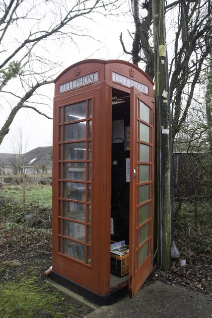
///household.satin.feasts. Near Yetminster, Dorset

Related Wikis

Hermitage, Dorset

Hermitage is a small village and civil parish in the county of Dorset in southern England. It is situated in the Blackmore Vale under the scarp of the...

Telegraph Hill, Dorset

Telegraph Hill (267 metres, 876 feet high) is a hill about 1 mile northwest of Minterne Magna and about 10 miles north of Dorchester in the county of Dorset...

Cerne, Totcombe and Modbury Hundred

Cerne, Totcombe and Modbury Hundred was a hundred in the county of Dorset, England. Some of its tithings and parishes were exclaves which indicates that...

Hilfield

Hilfield is a small, scattered village and civil parish in west Dorset, England, situated under the scarp face of the Dorset Downs 7 miles (11 km) south...

Dogbury Hill

At 248 metres (814 ft), Dogbury Hill is one of the highest hills in the county of Dorset, England. It is the site of a prehistoric hill fort. == Location... ==

Holnest

Holnest is a village and civil parish in the county of Dorset in southern England. It lies in the Blackmore Vale 4 miles (6.4 km) south of Sherborne. It...

Leigh, Dorset

Leigh ( ) is a village and civil parish in the county of Dorset in southern England, situated approximately 5 miles (8.0 km) south-southwest of Sherborne...

River Cerne

The River Cerne is a ten mile long river in Dorset, England, which rises in the Chalk hills of the Dorset Downs at Minterne Magna, between High Stoy and...

Nearby Amenities

Located within 500m of 50.863776,-2.5058969
Material: wood
Power: pole
Source: bing
Lat/Long: 50.8594178/-2.5075524
Material: wood
Power: pole
Source: bing
Lat/Long: 50.8597621/-2.505981
Material: wood
Power: pole
Source: bing
Lat/Long: 50.8601017/-2.5045198
Material: wood
Power: pole
Source: bing
Lat/Long: 50.8602279/-2.5039751
Material: wood
Power: pole
Source: bing
Lat/Long: 50.8606546/-2.5021006
Material: wood
Power: pole
Source: bing
Lat/Long: 50.861218/-2.5011034
Material: wood
Power: pole
Source: bing
Lat/Long: 50.8617798/-2.5000912
Material: wood
Power: pole
Source: bing
Lat/Long: 50.8620684/-2.5003611
Material: wood
Power: pole
Source: bing
Lat/Long: 50.862773/-2.5010318
Material: wood
Power: pole
Source: bing
Lat/Long: 50.8632791/-2.5011528
Public Bookcase
Booth: K6
Man Made: telephone_box
Public Bookcase Type: phone_box
Lat/Long: 50.8596749/-2.5079915
Defibrillator
Defibrillator Location: Hermitage Village Hall
Emergency: defibrillator
Lat/Long: 50.8596122/-2.5080183
Post Box
Operator: Royal Mail
Post Box Type: lamp
Ref: DT2 198
Ref GB Uprn: 10015283608
Royal Cypher: EIIR
Royal Cypher Wikidata: Q33102113
Lat/Long: 50.8623803/-2.500091
Direction: 170
Generator Method: photovoltaic
Generator Output Electricity: yes
Generator Solar Modules: 9
Generator Source: solar
Generator Type: solar_photovoltaic_panel
Location: roof
Power: generator
Lat/Long: 50.8595612/-2.5080734
Direction: 165
Generator Method: photovoltaic
Generator Output Electricity: yes
Generator Solar Modules: 16
Generator Source: solar
Generator Type: solar_photovoltaic_panel
Location: roof
Power: generator
Lat/Long: 50.8601229/-2.505435
Direction: 175
Generator Method: photovoltaic
Generator Output Electricity: yes
Generator Solar Modules: 20
Generator Source: solar
Generator Type: solar_photovoltaic_panel
Location: roof
Power: generator
Lat/Long: 50.8602204/-2.5036326
Direction: 100
Generator Method: photovoltaic
Generator Output Electricity: yes
Generator Solar Modules: 16
Generator Source: solar
Generator Type: solar_photovoltaic_panel
Location: roof
Power: generator
Lat/Long: 50.8647445/-2.4990571
Direction: 100
Generator Method: photovoltaic
Generator Output Electricity: yes
Generator Solar Modules: 16
Generator Source: solar
Generator Type: solar_photovoltaic_panel
Location: roof
Power: generator
Lat/Long: 50.864714/-2.4994218
The data included in this document is from www.openstreetmap.org. The data is made available under ODbL.

Have you been to Frog's Folly Plantation?

Leave your review of Frog's Folly Plantation below (or comments, questions and feedback).