Beacon Wood

Wood, Forest in Somerset Mendip

England

Beacon Wood

Farm Buildings at Higher Farm Higher Farm is the most northerly of the farms located at the hamlet of Bodden just north east of Shepton Mallet.
Farm Buildings at Higher Farm Credit: Nigel Mykura

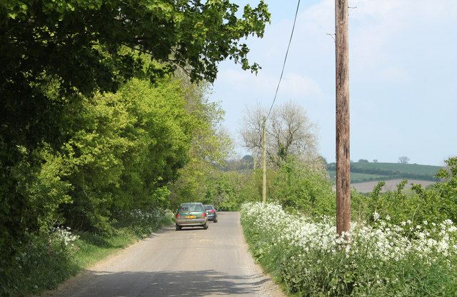
Beacon Wood is a picturesque forest located in Somerset, England. Covering an area of approximately 300 acres, it is a popular destination for nature lovers and outdoor enthusiasts. The wood is situated on the southern slopes of the Quantock Hills, offering stunning views of the surrounding countryside.

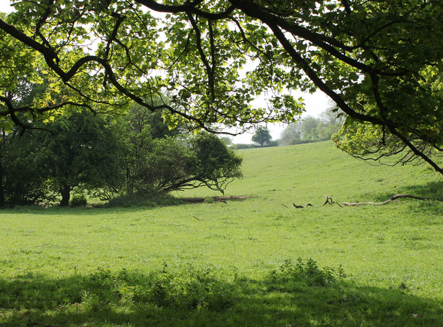
The forest is primarily composed of deciduous trees, including oak, beech, and ash, which create a dense canopy overhead. This provides a cool and shady refuge during the summer months, making it an ideal spot for picnics and leisurely walks. The forest floor is blanketed with a variety of wildflowers, adding bursts of color to the landscape.

Beacon Wood is known for its diverse wildlife, attracting birdwatchers and nature photographers alike. Visitors may catch a glimpse of elusive species such as buzzards, tawny owls, and woodpeckers. The wood is also home to a range of mammals, including deer, foxes, and badgers. Additionally, the forest is teeming with smaller creatures such as squirrels, hedgehogs, and a wide array of insects.

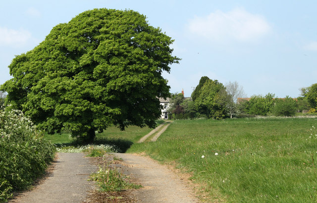
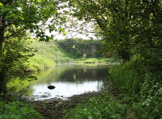
There are several well-maintained trails that meander through the wood, offering visitors the chance to explore its natural beauty. These paths are suitable for all abilities and provide opportunities for both leisurely strolls and more challenging hikes. Along the way, visitors can discover ancient trees, hidden ponds, and cascading streams, adding to the enchanting atmosphere of the wood.

Overall, Beacon Wood is a captivating destination that showcases the natural splendor of Somerset. Its tranquil ambiance and abundant wildlife make it a perfect retreat for those seeking a peaceful escape into nature.

If you have any feedback on the listing, please let us know in the comments section below.
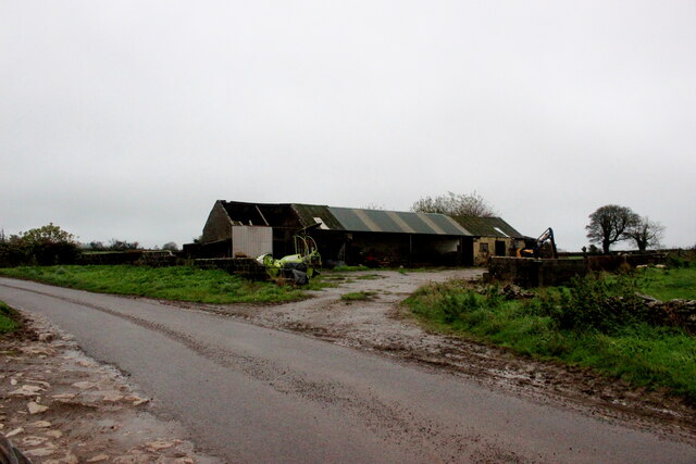
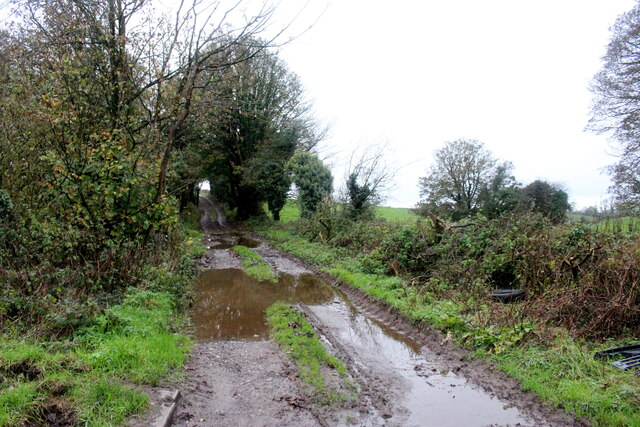
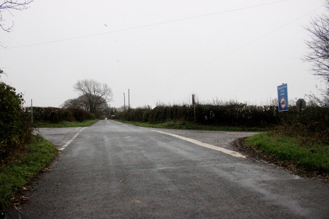
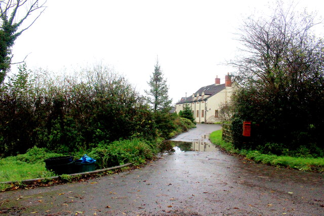
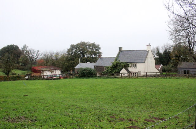
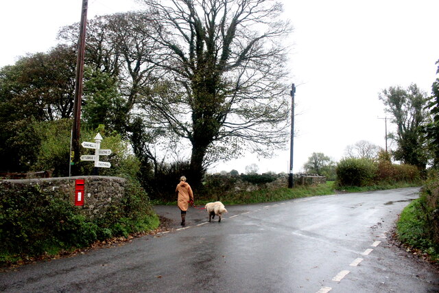
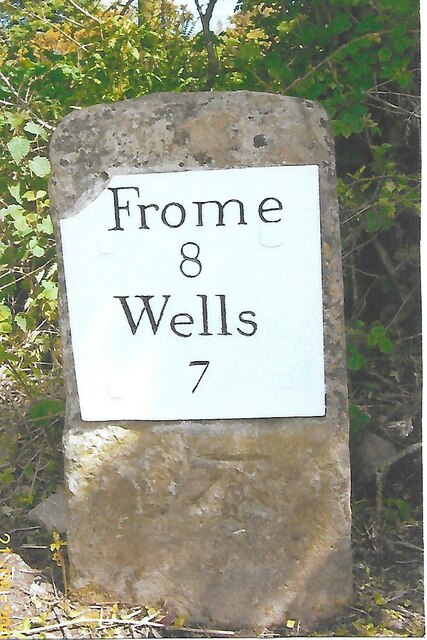
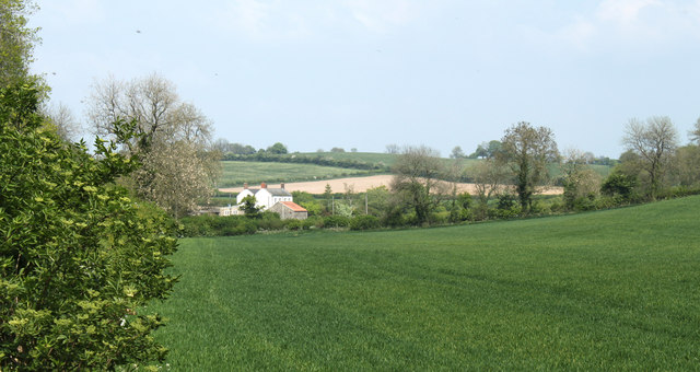
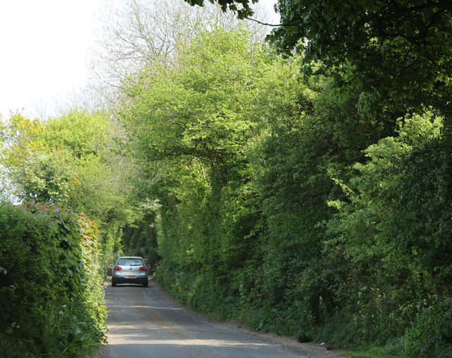
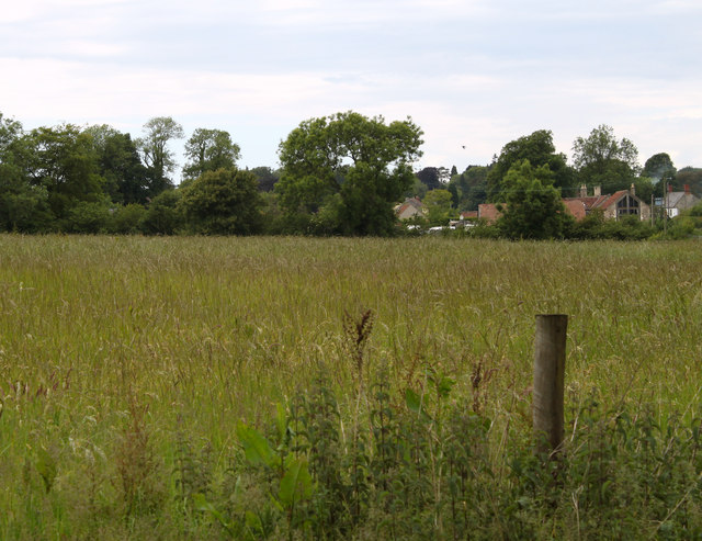
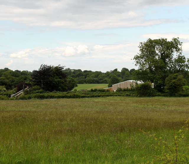
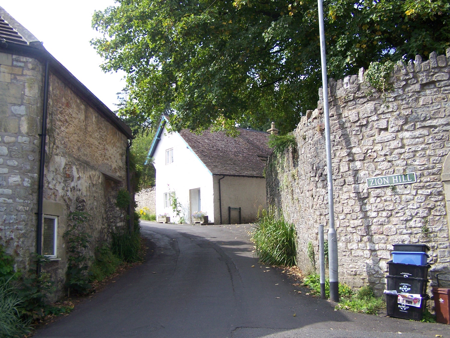
Beacon Wood Images

Images are sourced within 2km of 51.215049/-2.5162388 or Grid Reference ST6446. Thanks to Geograph Open Source API. All images are credited.

Farm Buildings at Higher Farm Higher Farm is the most northerly of the farms located at the hamlet of Bodden just north east of Shepton Mallet.
Farm Buildings at Higher Farm
Higher Farm is the most northerly of the farms located at the hamlet of Bodden just north east of Shepton Mallet.
A  Wet Day on the Fosse Way The route of the old Roman road can be clearly seen at this point and the track that now runs on this route is an ORPA. Other route with public access.
A Wet Day on the Fosse Way
The route of the old Roman road can be clearly seen at this point and the track that now runs on this route is an ORPA. Other route with public access.
Overgrown Roman Road This small footpath marks the line of what used to be the Fosse Way. It runs north straight up to and over the summit of Beacon Hill showing Roman road building engineers had little regard for physical obstructions
Overgrown Roman Road
This small footpath marks the line of what used to be the Fosse Way. It runs north straight up to and over the summit of Beacon Hill showing Roman road building engineers had little regard for physical obstructions
Crossroads on Waggon and Horses Hill This is the crossroads where King's Road running up Waggon and Horses Hill crosses Bolters Lane.
Crossroads on Waggon and Horses Hill
This is the crossroads where King's Road running up Waggon and Horses Hill crosses Bolters Lane.
Entrance to Knapps Farm Knapps Farm is no longer a working farm but is a residential establishment with paddocks that could be used as an equestrian facility.
Entrance to Knapps Farm
Knapps Farm is no longer a working farm but is a residential establishment with paddocks that could be used as an equestrian facility.
House at Three Ashes Three Ashes was probably once a large working farm but today it seems to consist of several large houses and no working farms although some of the houses have adjacent paddocks.
House at Three Ashes
Three Ashes was probably once a large working farm but today it seems to consist of several large houses and no working farms although some of the houses have adjacent paddocks.
Wet Saturday Dog Walking near Withybrook The dog walker passing the box-in-the-wall post box is turning off the Fosse Road into the minor road that runs down to Stoke Bottom. The Fosse Rd carries on to Stoke St Michael. The road she is heading down is signposted to Nettlebridge.
Wet Saturday Dog Walking near Withybrook
The dog walker passing the box-in-the-wall post box is turning off the Fosse Road into the minor road that runs down to Stoke Bottom. The Fosse Rd carries on to Stoke St Michael. The road she is heading down is signposted to Nettlebridge.
Path and Sign at Beacon Hill Wood
Old Milestone near Long Cross crossroads The Milestone is located on grass verge among undergrowth on the North of the road.  Parish of Doulting (Mendip District). Metal plate attached to stone post, Frome square iron plate design, erected by the Frome turnpike trust in the 19th Century, broken top left corner of plate. An earlier photograph can be found here:  <a title="https://www.geograph.org.uk/photo/6099211" href="https://www.geograph.org.uk/photo/6099211">Link</a> 

Inscription reads:-  
FROME / 8 / WELLS / 7  

Grade II listed. List Entry Number: 1221602 <span class="nowrap"><a title="https://historicengland.org.uk/listing/the-list/list-entry/1221602" rel="nofollow ugc noopener" href="https://historicengland.org.uk/listing/the-list/list-entry/1221602">Link</a><img style="margin-left:2px;" alt="External link" title="External link - shift click to open in new window" src="https://s1.geograph.org.uk/img/external.png" width="10" height="10"/></span> 

Milestone Society National ID: SO_FRWL08
Old Milestone near Long Cross crossroads
The Milestone is located on grass verge among undergrowth on the North of the road.  Parish of Doulting (Mendip District). Metal plate attached to stone post, Frome square iron plate design, erected by the Frome turnpike trust in the 19th Century, broken top left corner of plate. An earlier photograph can be found here:  Link Inscription reads:- FROME / 8 / WELLS / 7 Grade II listed. List Entry Number: 1221602 LinkExternal link Milestone Society National ID: SO_FRWL08
Old Milepost by A37, Bristol Road, near junction of A37 and A367 The Milepost is located on grass verge on the East of the road.  Parish of Ashwick (Mendip District). Cast iron post, plated iron casting design, erected by the Shepton Mallet turnpike trust in the 19th Century. An earlier photograph can be found here: <a title="https://www.geograph.org.uk/photo/6061448" href="https://www.geograph.org.uk/photo/6061448">Link</a> 

Inscription reads:- 
SHEPTON / MALLET / 2  : : BRISTOL / 18 : : BATH / 15  

Grade II listed. List Entry Number: 1058479 <span class="nowrap"><a title="https://historicengland.org.uk/listing/the-list/list-entry/1058479" rel="nofollow ugc noopener" href="https://historicengland.org.uk/listing/the-list/list-entry/1058479">Link</a><img style="margin-left:2px;" alt="External link" title="External link - shift click to open in new window" src="https://s1.geograph.org.uk/img/external.png" width="10" height="10"/></span> 

Milestone Society National ID: SO_SMBR02
Old Milepost by A37, Bristol Road, near junction of A37 and A367
The Milepost is located on grass verge on the East of the road.  Parish of Ashwick (Mendip District). Cast iron post, plated iron casting design, erected by the Shepton Mallet turnpike trust in the 19th Century. An earlier photograph can be found here: Link  Inscription reads:- SHEPTON / MALLET / 2 : : BRISTOL / 18 : : BATH / 15 Grade II listed. List Entry Number: 1058479 LinkExternal link Milestone Society National ID: SO_SMBR02
2011 : Winter wheat seen from Bolter's Lane On the way to Downside.
An elder tree is about to come into flower. The flowers make a pleasant light wine but the berries are better.
2011 : Winter wheat seen from Bolter's Lane
On the way to Downside. An elder tree is about to come into flower. The flowers make a pleasant light wine but the berries are better.
2011 : Farm track north of Bolter's Lane Entrance to Yew Tree farm.
Passing a fine oak tree on the way.
2011 : Farm track north of Bolter's Lane
Entrance to Yew Tree farm. Passing a fine oak tree on the way.
2011 : Bolter's Lane looking west Toward Downside. The Fosse Way crosses at this point.
2011 : Bolter's Lane looking west
Toward Downside. The Fosse Way crosses at this point.
2011 : Pasture with trees north of Shepton Mallet Seen from Bolter's Lane.
2011 : Pasture with trees north of Shepton Mallet
Seen from Bolter's Lane.
2011 : A disused quarry, flooded The Fosse Way passes on the right.
2011 : A disused quarry, flooded
The Fosse Way passes on the right.
2011 : Bolter's Lane looking east Makes a link between Downside on the A37 and the Old Frome Road west of Long Cross.
2011 : Bolter's Lane looking east
Makes a link between Downside on the A37 and the Old Frome Road west of Long Cross.
2011 : Hay field near Blakes Farm Looking toward Oakhill.
Tanyard Farm can be seen.
Or it could be for silage.
2011 : Hay field near Blakes Farm
Looking toward Oakhill. Tanyard Farm can be seen. Or it could be for silage.
2011 : Mowing grass near Tanyard Farm, Oakhill From the same spot as <a href="https://www.geograph.org.uk/photo/2457517">ST6446 : 2011 : Hay field near Blakes Farm</a> a little to the right.
2011 : Mowing grass near Tanyard Farm, Oakhill
From the same spot as ST6446 : 2011 : Hay field near Blakes Farm a little to the right.
Show me another place!

Beacon Wood is located at Grid Ref: ST6446 (Lat: 51.215049, Lng: -2.5162388)

Administrative County: Somerset

District: Mendip

Police Authority: Avon and Somerset

What 3 Words

///corkscrew.pricing.sedative. Near Shepton Mallet, Somerset

Nearby Locations

Beacon Wood Beacon Pond

Related Wikis

Oakhill

Oakhill is a village in the Mendip district of Somerset, England, in Ashwick parish approximately 2.5 miles (4 km) north of Shepton Mallet. It lies between...

Ashwick

Ashwick is a village in Somerset, England, about three miles north of Shepton Mallet and seven miles east from Wells. It has also been a civil parish since...

Hillier's Cave

Hillier's Cave (grid reference ST65734753) is a cave in Fairy Cave Quarry, near Stoke St Michael in the limestone of the Mendip Hills, in Somerset, England...

Balch Cave

Balch Cave (grid reference ST65734753) is a cave in Fairy Cave Quarry, near Stoke St Michael in the limestone of the Mendip Hills, in Somerset, England...

Shatter Cave

Shatter Cave is a cave in Fairy Cave Quarry, near Stoke St Michael in the limestone of the Mendip Hills, in Somerset, England. It falls within the St....

Fairy Cave Quarry

Fairy Cave Quarry (grid reference ST65734753) is between Stoke St Michael and Oakhill in the limestone of the Mendip Hills, in Somerset, England. Quarrying...

Harridge Wood

Harridge Wood is an area of woodland in Somerset, England. From about 1300 AD part of the wood was the scene of coal mining, which continued until around...

W/L Cave

W/L Cave is part of the Fairy Cave Quarry group of caves between Stoke St Michael and Oakhill in the limestone of the Mendip Hills, in Somerset, England...

Nearby Amenities

Located within 500m of 51.215049,-2.5162388
Parking
Beacon Hill Woods (Woodland Trust)
Fee: yes
Parking: surface
Lat/Long: 51.2129668/-2.5210662
Beacon Hill
Ele: 288
Place: locality
Source: NPE
Lat/Long: 51.2111307/-2.5152948
Woodland Trust
Board Type: nature
Description: Map, History, Nature in the woods
Information: board
Tourism: information
Lat/Long: 51.2128133/-2.5210807
The data included in this document is from www.openstreetmap.org. The data is made available under ODbL.

Have you been to Beacon Wood?

Leave your review of Beacon Wood below (or comments, questions and feedback).