Brown's Wood

Wood, Forest in Somerset Mendip

England

Brown's Wood

Pond at the end of Tellis Lane A small feature close to the junction with the A37.
Pond at the end of Tellis Lane Credit: Neil Owen

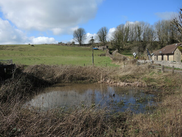
Brown's Wood is a picturesque woodland located in the county of Somerset, England. Situated in the heart of the beautiful Somerset Levels, this enchanting forest covers an area of approximately 50 acres. The wood is owned and managed by the local council, who have taken great care to preserve its natural beauty and protect its diverse ecosystem.

The woodland is predominantly composed of native broadleaf trees, such as oak, beech, and ash, creating a rich and vibrant canopy that provides a habitat for a wide variety of flora and fauna. It is home to a multitude of bird species, including woodpeckers, warblers, and owls, making it a popular spot for birdwatchers and nature enthusiasts.

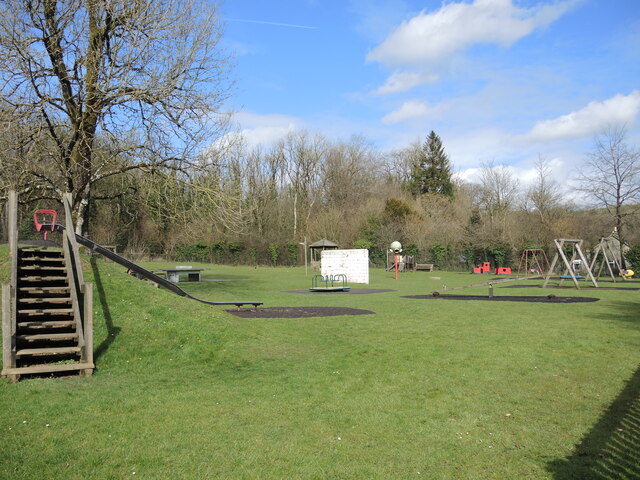
Brown's Wood offers an extensive network of walking trails, allowing visitors to explore its hidden treasures at their own pace. These trails wind through the forest, leading visitors past tranquil ponds, ancient trees, and carpeted woodland floors adorned with wildflowers in the springtime. The woodland also features several picnic areas, providing a perfect spot to relax and enjoy the peaceful surroundings.

Not only is Brown's Wood a haven for wildlife, but it also holds historical significance. It is believed that the wood has been present since ancient times, with evidence of human activity dating back thousands of years. Archaeological finds suggest that it was once used as a source of timber and fuel, highlighting its importance in the local community throughout history.

Overall, Brown's Wood offers a serene and captivating retreat for those seeking solace in nature. Its stunning landscapes, diverse wildlife, and rich history make it a cherished natural treasure within Somerset.

If you have any feedback on the listing, please let us know in the comments section below.

Brown's Wood Images

Images are sourced within 2km of 51.235664/-2.5190335 or Grid Reference ST6348. Thanks to Geograph Open Source API. All images are credited.

Pond at the end of Tellis Lane A small feature close to the junction with the A37.
Pond at the end of Tellis Lane
A small feature close to the junction with the A37.
Gurney Slade play area Located beside the village hall, the open space is well stocked with equipment and fresh air. The site is just on the fringe of the old quarry, now landscaped; indeed, in the past a tramline would have ended just at the steps to the left.
Gurney Slade play area
Located beside the village hall, the open space is well stocked with equipment and fresh air. The site is just on the fringe of the old quarry, now landscaped; indeed, in the past a tramline would have ended just at the steps to the left.
George Inn, Gurney Slade Public house on the Aa37
George Inn, Gurney Slade
Public house on the Aa37
The Mendip Inn Public house on the A37
The Mendip Inn
Public house on the A37
Wet Saturday Dog Walking near Withybrook The dog walker passing the box-in-the-wall post box is turning off the Fosse Road into the minor road that runs down to Stoke Bottom. The Fosse Rd carries on to Stoke St Michael. The road she is heading down is signposted to Nettlebridge.
Wet Saturday Dog Walking near Withybrook
The dog walker passing the box-in-the-wall post box is turning off the Fosse Road into the minor road that runs down to Stoke Bottom. The Fosse Rd carries on to Stoke St Michael. The road she is heading down is signposted to Nettlebridge.
Industrial Buildings at Stoke Bottom These buildings are heavily protected with large metal fences and razor wire but have no signage to indicate their use.
Industrial Buildings at Stoke Bottom
These buildings are heavily protected with large metal fences and razor wire but have no signage to indicate their use.
Old Milestone by A367, just South of Stratton on the Fosse Way The Milestone is located on grass verge on the East of the road.  Parish of Stratton On The Fosse (Mendip District). Cast iron post, plated iron casting design, erected by the Shepton Mallet turnpike trust in the 19th century. An earlier photograph can be found here: <a title="https://www.geograph.org.uk/photo/6095973" href="https://www.geograph.org.uk/photo/6095973">Link</a> 

Inscription reads:-
SHEPTON / MALLET / 5 : : BATH / 12 : : CHELT.M / 49 

Grade II listed. List Entry Number: 1058636 <span class="nowrap"><a title="https://historicengland.org.uk/listing/the-list/list-entry/1058636" rel="nofollow ugc noopener" href="https://historicengland.org.uk/listing/the-list/list-entry/1058636">Link</a><img style="margin-left:2px;" alt="External link" title="External link - shift click to open in new window" src="https://s1.geograph.org.uk/img/external.png" width="10" height="10"/></span> 

Milestone Society National ID: SO_CMSM49
Old Milestone by A367, just South of Stratton on the Fosse Way
The Milestone is located on grass verge on the East of the road.  Parish of Stratton On The Fosse (Mendip District). Cast iron post, plated iron casting design, erected by the Shepton Mallet turnpike trust in the 19th century. An earlier photograph can be found here: Link  Inscription reads:- SHEPTON / MALLET / 5 : : BATH / 12 : : CHELT.M / 49 Grade II listed. List Entry Number: 1058636 LinkExternal link Milestone Society National ID: SO_CMSM49
Old Milestone by A367, Fosse Way, outside front of "The George at Nettlebridge" PH The Milestone is located against front wall of inn on the East of the road.  Parish of Stratton On The Fosse (Mendip District). Cast iron post, plated iron casting design, erected by the Shepton Mallet turnpike trust in the 19th century. An earlier photograph can be found here: <a title="https://www.geograph.org.uk/photo/6037563" href="https://www.geograph.org.uk/photo/6037563">Link</a> 

Inscription reads:- 
SHEPTON / MALLET / 4 : : BATH / 13 : : CHELT.M / 50  

Grade II listed. List Entry Number: 1178363 <span class="nowrap"><a title="https://historicengland.org.uk/listing/the-list/list-entry/1178363" rel="nofollow ugc noopener" href="https://historicengland.org.uk/listing/the-list/list-entry/1178363">Link</a><img style="margin-left:2px;" alt="External link" title="External link - shift click to open in new window" src="https://s1.geograph.org.uk/img/external.png" width="10" height="10"/></span> 

Milestone Society National ID: SO_CMSM50
Old Milestone by A367, Fosse Way, outside front of "The George at Nettlebridge" PH
The Milestone is located against front wall of inn on the East of the road.  Parish of Stratton On The Fosse (Mendip District). Cast iron post, plated iron casting design, erected by the Shepton Mallet turnpike trust in the 19th century. An earlier photograph can be found here: Link  Inscription reads:- SHEPTON / MALLET / 4 : : BATH / 13 : : CHELT.M / 50 Grade II listed. List Entry Number: 1178363 LinkExternal link Milestone Society National ID: SO_CMSM50
2011 : Ashwick Court from Blackley Lane Blackley Lane follows the bottom of a small valley from Benter west to Badger's Cross. About half way along we see Ashwick Court at the top of the hill to the south.
2011 : Ashwick Court from Blackley Lane
Blackley Lane follows the bottom of a small valley from Benter west to Badger's Cross. About half way along we see Ashwick Court at the top of the hill to the south.
2011 : Crossroads with tractor at Badger's Cross A tractor with trailer waits to emerge carefully onto the minor road between Gurney Slade and Oakhill.
The signpost indicates Moorwood and Benter to the left and Shepton Mallet to the right.
2011 : Crossroads with tractor at Badger's Cross
A tractor with trailer waits to emerge carefully onto the minor road between Gurney Slade and Oakhill. The signpost indicates Moorwood and Benter to the left and Shepton Mallet to the right.
2011 : A37 heading north toward Gurney Slade On to Ston Easton, Farrington Gurney, Pensford and Bristol.
A few yards behind the camera position the B3135 begins its journey west over the high Mendips to Cheddar.
2011 : A37 heading north toward Gurney Slade
On to Ston Easton, Farrington Gurney, Pensford and Bristol. A few yards behind the camera position the B3135 begins its journey west over the high Mendips to Cheddar.
2011 : View north from Blackey Lane On the other side of Blackey Lane from <a href="https://www.geograph.org.uk/photo/2308116">ST6348 : 2011 : Ashwick Court from Blackley Lane</a> looking up the northern slope of the valley in the direction of West Farm which is out of shot to the right.
2011 : View north from Blackey Lane
On the other side of Blackey Lane from ST6348 : 2011 : Ashwick Court from Blackley Lane looking up the northern slope of the valley in the direction of West Farm which is out of shot to the right.
2011 : Blackey Lane heading east Down the valley toward Benter.
The footpath (see sign) to the right takes the walker to Ashwick, less than half a mile, another path to the left climbs the side of the valley to West Farm and T'other Side The Hill.
2011 : Blackey Lane heading east
Down the valley toward Benter. The footpath (see sign) to the right takes the walker to Ashwick, less than half a mile, another path to the left climbs the side of the valley to West Farm and T'other Side The Hill.
2011 : Up Blackley Lane toward Badger's Cross The lane follows the valley floor between Benter and Badger's Cross becoming steeper further on.
2011 : Up Blackley Lane toward Badger's Cross
The lane follows the valley floor between Benter and Badger's Cross becoming steeper further on.
2011 : Blackey Lane heading east from Badger's Cross Soon to drop into a small valley which it follows to Benter.
2011 : Blackey Lane heading east from Badger's Cross
Soon to drop into a small valley which it follows to Benter.
2011 : Bay's Lane or Simbriss Road Somewhere around here Bay's Lane, from the north, becomes Simbriss Road heading south, or it could be Blackey Lane from the east - who cares.
One thing is for sure, it is near Badger's Cross.
2011 : Bay's Lane or Simbriss Road
Somewhere around here Bay's Lane, from the north, becomes Simbriss Road heading south, or it could be Blackey Lane from the east - who cares. One thing is for sure, it is near Badger's Cross.
2011 : Minor road to Gurney Slade At Badger's Cross.
2011 : Minor road to Gurney Slade
At Badger's Cross.
Show me another place!

Brown's Wood is located at Grid Ref: ST6348 (Lat: 51.235664, Lng: -2.5190335)

Administrative County: Somerset

District: Mendip

Police Authority: Avon and Somerset

What 3 Words

///relief.mocked.viewer. Near Chilcompton, Somerset

Related Wikis

Ashwick Court

Ashwick Court is Grade II listed house on Heckley Lane northwest of Ashwick, in Mendip district, eastern Somerset, England, adjacent to the Church of St...

Ashwick

Ashwick is a village in Somerset, England, about three miles north of Shepton Mallet and seven miles east from Wells. It has also been a civil parish since...

Harridge Wood

Harridge Wood is an area of woodland in Somerset, England. From about 1300 AD part of the wood was the scene of coal mining, which continued until around...

Oakhill

Oakhill is a village in the Mendip district of Somerset, England, in Ashwick parish approximately 2.5 miles (4 km) north of Shepton Mallet. It lies between...

Blacker's Hill

Blacker's Hill is an Iron Age hill fort at Chilcompton, 4.5 kilometres (3 mi) south west of Radstock, Somerset, England. It has been designated as a Scheduled...

Gurney Slade quarry

Gurney Slade quarry, grid reference ST626497 is a limestone quarry near Gurney Slade between Binegar and Holcombe, on the Mendip Hills, Somerset, England...

Christ Church, Downside

Christ Church is a former Church of England church in Downside, Somerset, England. Designed by John Pinch the younger, it was built in 1837–38 and closed...

Hillier's Cave

Hillier's Cave (grid reference ST65734753) is a cave in Fairy Cave Quarry, near Stoke St Michael in the limestone of the Mendip Hills, in Somerset, England...

Related Videos

Enchanting Spring Evening in the English Countryside #virtualrun #englishcountryside #treadmill

Some highlights from a virtual run around woodlands covered in wild garlic and bluebells in Somerset, England on a beautiful, ...

A BIG ABBEY IN A SMALL VILLAGE - STRATTON-ON-THE-FOSSE │ ENGLAND

Sunday morning Temp. 3°C November 2021 This was a very short walk through Stratton-on-the-Fosse to Downside Abbey during ...

Oakhill Camping & Caravan Site, Oakhill, Somerset

Come with us as we get our first impression of Oakhill Campsite, 3 miles north of Shepton Mallet. #vanlife #vanlifeuk #travelling ...

Nearby Amenities

Located within 500m of 51.235664,-2.5190335
Ashwick
Is In: Somerset, England, UK
Place: hamlet
Wikidata: Q2215512
Wikipedia: en:Ashwick
Lat/Long: 51.2334253/-2.5208257
Barrier: stile
Foot: yes
Lat/Long: 51.2354782/-2.5129547
Barrier: stile
Foot: yes
Lat/Long: 51.2372117/-2.5143251
Barrier: stile
Foot: yes
Lat/Long: 51.2372938/-2.5144862
Barrier: stile
Foot: yes
Lat/Long: 51.2386559/-2.5150244
Barrier: stile
Foot: yes
Lat/Long: 51.2396718/-2.5161541
Power: pole
Lat/Long: 51.2380751/-2.5175428
Power: pole
Lat/Long: 51.2374907/-2.5187552
Power: pole
Lat/Long: 51.2369281/-2.5198817
Power: pole
Lat/Long: 51.2362345/-2.5213382
Power: pole
Lat/Long: 51.2356216/-2.522572
Power: pole
Lat/Long: 51.2350035/-2.5238943
Power: pole
Lat/Long: 51.2343402/-2.5252971
The data included in this document is from www.openstreetmap.org. The data is made available under ODbL.

Have you been to Brown's Wood?

Leave your review of Brown's Wood below (or comments, questions and feedback).